Who invented the GPS? People behind the Global Positioning System
 That Alexander Graham Bell did not invent the telephone could be proven in court 113 years after the original inventor Antonio Meucci died. Thomas Edison’s name comes to mind when someone says ‘light bulb,’ but it was Humphry Davy who showed for the first time how light can be cast by passing an electric current through a platinum strip. The history of science is riddled with inventions whose ownership is hotly disputed. The Global Positioning System (GPS) is one of them. Who invented the GPS then?
GPS has become such an indispensable part of modern life that we have almost become dependent on it. It has slowly and steadily crept into our cars, ships, aeroplanes, cameras, construction equipment, agricultural machinery, laptops, and of course, smartphones.
And yet, there is a lack of consensus over who should be credited with its creation. At least four different people have been acknowledged to be clearly associated with the invention of this revolutionary technology which was ultimately developed by the US Department of Defense to assist the military forces.
Also read: What would happen if GPS failed?
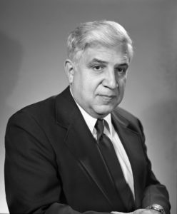
Roger L. Easton
This former head of Naval Research Laboratory’s space applications branch was the brain behind several engineering applications and technologies that enabled the development of the GPS. A Cold War scientist, Easton worked on technology to track satellites like the Soviet Union’s Sputnik before fathering a time-based navigational concept called TIMATION which utilized passive ranging, circular orbits, and space-borne high precision clocks synchronized to a master clock. Even today, these features are vital in any modern GPS.
In 2004, Easton received the United States National Medal of Technology and Innovation from then-President George W. Bush. The honor was bestowed in recognition of “extensive pioneering achievements in spacecraft tracking, navigation, and timing technology that led to the development of the NAVSTAR-Global Positioning System.”
However, it wasn’t until 2010 that National Inventors Hall of Fame recognized Easton’s efforts in the creation of the GPS. In fact, in 2004, two other people were inducted into the Hall of Fame for championing the development of GPS technology.
Who were they? Let’s find out…
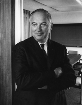
Ivan Getting and the concept of GPS
The Inventors Hall of Fame credits Dr. Getting for pressing forward “the concept of using an advanced system of satellites to allow the calculation of exquisitely precise positioning data for rapidly moving vehicles, ranging from cars to missiles.”
This founding president of The Aerospace Corporation is also recognized by the American National Academy of Engineering who awarded him the Charles Stark Draper Prize for Engineering in 2003 for the “concept and development of the GPS”. More specifically, the Academy credits Dr. Getting for his work on “the design of GPS, on its operational value, and on planning, negotiation, and reaching agreements with all the system’s stakeholders was critical to its becoming a reality.
Dr. Getting proposed a three-dimensional, time-difference-of-arrival position-finding system for navigation and by his own admission, “one of the proposals put forth by The Aerospace Corporation… was essentially what is now the GPS.” While acknowledging that the Navy had already developed a very good space navigation system when this proposal was put forward to the Department of Defense, Dr. Getting says, “The conclusion of the Director of Defense Research & Engineering (DDRE) was that a single system was required and that it should be based on the Air Force/Aerospace concept called GPS and developed by the Air Force with cooperation from all three services.”
Interesting read: Why is China messing with our GPS coordinates?
However, Easton’s son, Richard, has vehemently argued that Dr. Getting’s contributions, at best, are limited to supporting the GPS program, and as such, he shouldn’t be credited as being its inventor. Nonetheless, Richard is more accommodating toward sharing credit with the other Hall of Fame inductee who co-received the Charles Stark Draper Prize with Dr. Getting, Bradford Parkinson.
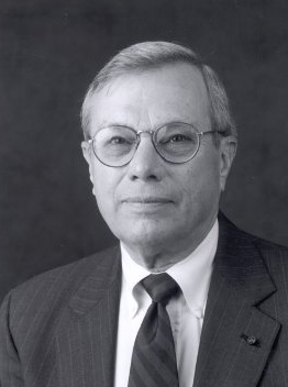
Bradford Parkinson – the architect of GPS
Parkinson was at the forefront of the NAVSTAR GPS Joint Program Office from 1972 to 1978. The Inventors Hall of Fame is clear that “as the program’s first manager, he has been the chief architect of GPS throughout the system’s conception, engineering development, and implementation.” This has also earned Parkinson the title the ‘Father of GPS’.
Parkinson, an Air Force colonel at the time, was tasked to revive a Space and Missile Systems Organization program called 621B that provided altitude, as well as latitude and longitude for navigation purposes. And once the Department of Defense decided that it wanted a joint program developed with the cooperation of all military services, Parkinson was put in charge to pull such a program together.
Parkinson says in a Stanford address that this new program pulled the clocks from Easton’s TIMATION, the signal structure of 621B, and the orbital prediction method from another Navy navigation system called TRANSIT which was developed at the Johns Hopkins University Applied Physics Laboratory. Together, these formed the NAVSTAR-Global Positioning System.
Dr. Gladys West – key female figure in GPS invention

Dr. Gladys West
For Dr West, the journey to be recognized as one of the key figures behind the invention of the GPS has been a long one. In 1956, Dr. West started working at the United States Naval Weapons Laboratory. This place was at the forefront of the post-Cold War era space race and home to the Naval Space Surveillance Center until 2004 when the Air Force took over the space reins. A mathematician by education, Dr West would churn numbers and process data from satellites to help determine their exact location.
In December 2018, Dr West was finally inducted into the Air Force Space and Missile Pioneers Hall of Fame – one of Air Force’s Space Commands Highest Honors. At the induction, the Air Force recognized Dr West’s contribution in programming an IBM 7030 ‘Stretch’ computer to deliver “increasingly refined calculations for an extremely accurate geodetic Earth model, a geoid, optimized for what ultimately became the Global Positioning System (GPS) orbit.”
Today, there are at least 31 operational GPS satellites orbing the Earth and impacting every aspect of our life.
[Note: The article was updated to recognize Dr Gladys West’s contribution. ]
Now see: How accurate is the altimeter in a GPS watch?
Did you like this article? Read more and subscribe to our monthly newsletter!


