Starting a space business: initiatives that can help you
Space is widely associated with science. Indeed, space and the technology around it imply a lot of research and testing. Public or international organizations such as ESA, NASA or many other national space organisations are important players in the space sector. They launch proper space programs and often have their own satellites. Funded by public they provide the benefits of the space technology to the society. However, the technology behind space highly involves the private sector too. Starting at the ground station and ranging from launch vehicles, satellite launchers to the satellites themselves the space subjetcs are manifold and so is the palette of companies that engage in the space sector. A respectable number of satellites, mostly high resolution satellites such as WorldView, Spot, Radarsat, etc. are even completely privately operated.
One important field of work in earth observation is the exploitation of data produced in space. While private satellite companies use their data themselves, the information of public satellites is accessible to everybody. The Copernicus program of ESA will provide an unprecedented amount of data from space that is free to all of us, once all satellites are launched. The palette of data will cover different radar and optical products generating around 1TB of information each day. The exploitation of this amount and variety of data is far not exhausted yet. In contrast, the ideas of data usages are beginning to be developed. The intention behind this open data policy from ESA is to stimulate new usages of earth observation data within non-space applications that will be beneficial to our everyday lives. In order to facilitate that process, ESA has founded the Business Incubation Centers.
ESA BICs
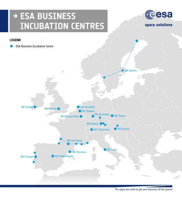
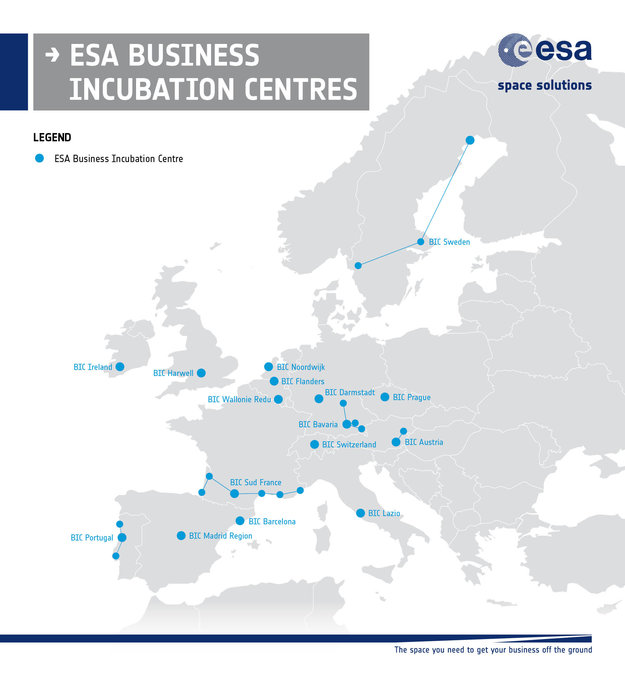
ESA’s Business Incubation Centers (BIC) were initiated by the Technology Transfer Programme Office (TTPO), which addresses to people that have innovative ideas for using space technologies and space systems in a non-space environment and thereby demonstrating the benefit of the European Space Program to (European) citizens. The scope of the BICs is to support entrepreneurs to turn space-connected business ideas into commercial companies by providing technical expertise and business related support. 12 BICs are spread over Europe (Germany, The Netherlands, Italy, Spain, Portugal, UK, Belgium, France and Sweden) providing selected entrepreneurs with comprehensive commercial and technical assistance in order to enter the market. – Four additional BICs are planned in Austria, Ireland, Czech Republic and Switzerland. Submissions of business ideas can be sent at any time. Each center has a specific procedure concerning the Call of Proposal and the required Proposal Template to be used. Please, find specific information upon each BIC here.
Act in Space
Beyond the ESA BICs there are other initiatives that aim to support space related business ideas in Europe. The Act in Space contest is a yearly workshop aiming to create business ideas around space technology and space systems. It is organised by the National Centre for Space Studies (CNES), ESA and ESA BIC Sud France and was held the second time this year. The setting of the Act in Space event is a weekend, where entrepreneurs, students, developers and any other creative users come together and develop solutions for space challenges proposed by the organizers. Within 24 hours the participants have to come up with commercial ideas for everyday uses of space technologies or space acquired data. In this year’s edition workshops were simultaneously held in 24 cities spread over 12 countries in Europe and Brazil. Over 1400 participants subscribed for the 86 challenges. The winning teams proceeded to the national and international finals that took place in Toulouse in June 2016. Besides the prizes for the winning teams, all realistic projects will receive support via the ESA BICs and partners incubators to foster the emergence of new start-ups. I was offered the possibility to participate at one of the workshops as technical supporter and was impressed by the motivation and spirit of the attendees. Surprisingly the participants not only came from a typical space related background, but were experts in other disciplines (business, law, natural sciences) with a strong interest in space technology. For more information upon Act in Space click here.

Map of ESA’s BICs in Europe. Source: ESA


