Maxar is offering 15cm HD satellite imagery products
Earlier this year, satellite imagery market leader Maxar laid bare the intentions to make its highest-quality imagery products even better. Introducing a proprietary technique, called High-Definition (HD) technology, Maxar detailed that it would refine satellite images to ensure precise edges and well-reconstructed details which would reduce clutter and pixilation, and deliver a superior visual experience.
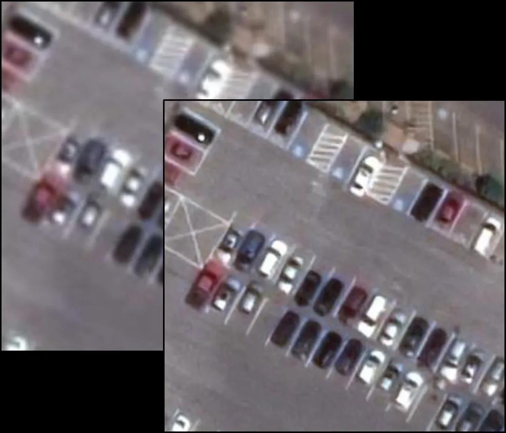
In the below example, an image originally collected at 50 cm resolution (left) has been converted into a 30 cm HD image on the right using HD technology. You can see how smaller features can be identified much more easily because of the enhanced clarity.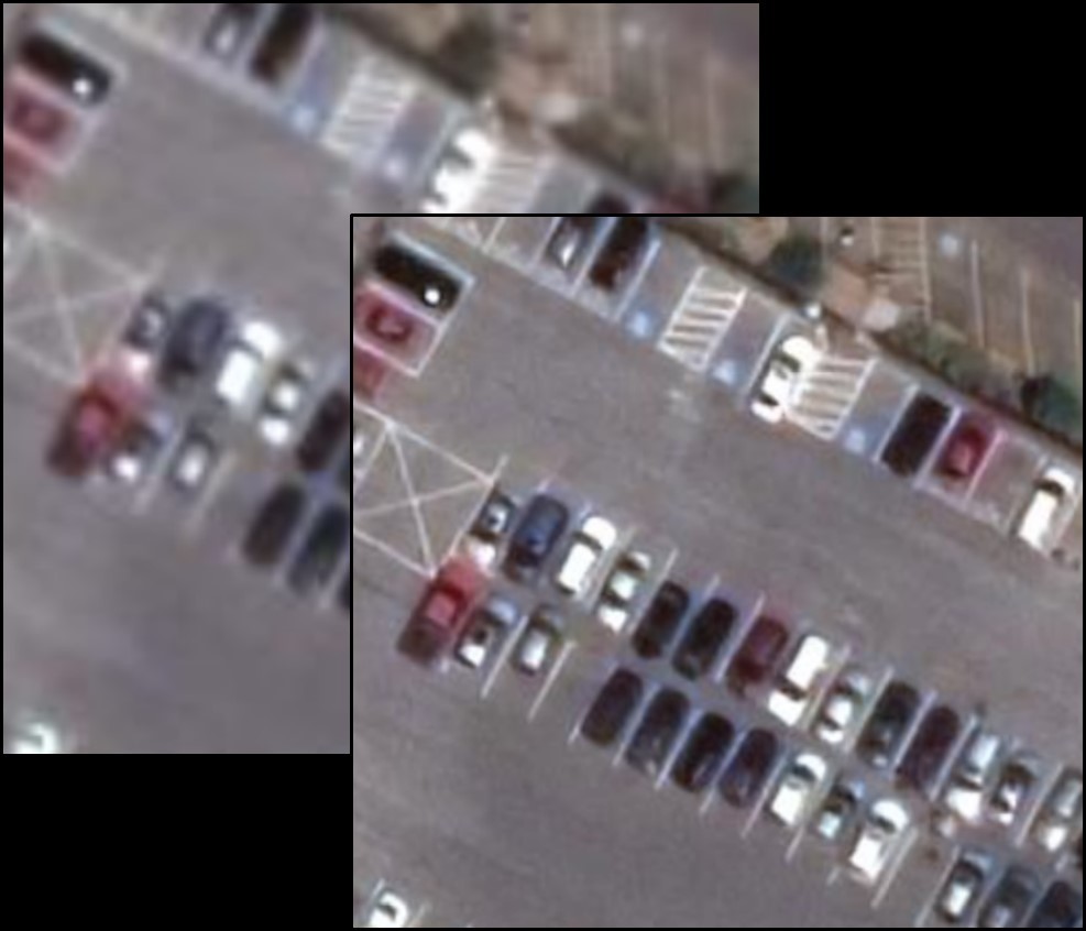
Maxar was quick to point out then that HD wouldn’t replace natively collected 30 cm imagery; it would only give one more way to acquire the quality and utility of 30 cm imagery. And now, by applying this technology to the native 30 cm imagery, the company has developed an unprecedented 15 cm HD product.
Today, 15 cm HD is available for Maxar’s View-Ready and Map-Ready satellite imagery products, and soon, it will be available for Vivid and Dynamic basemap products as well.
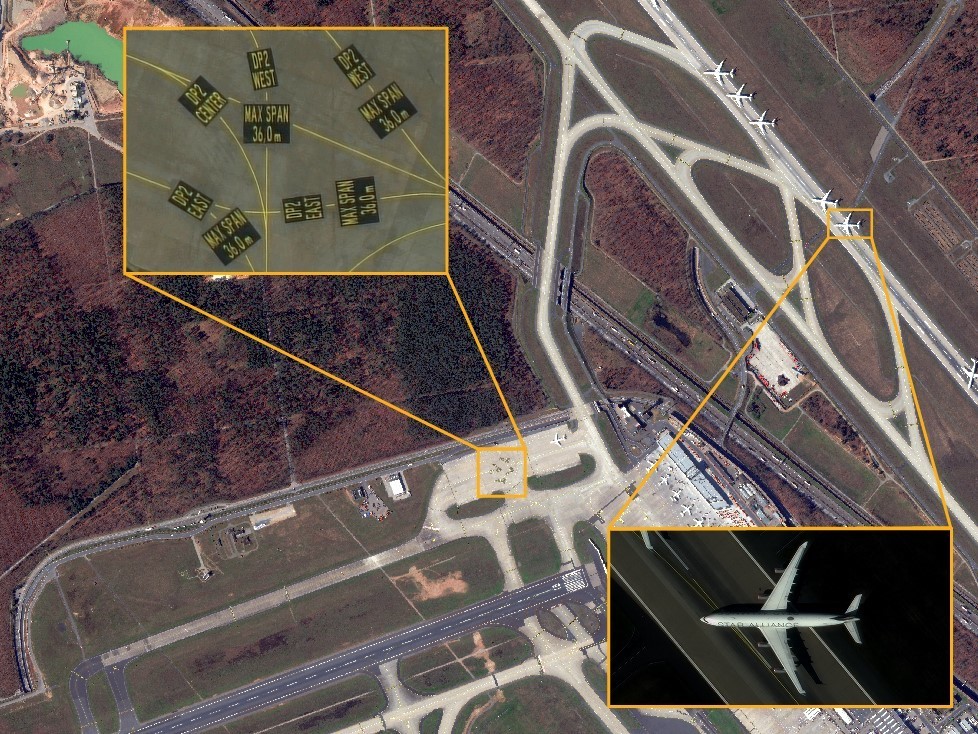
Here are some examples of the insights that 15 cm HD imagery will be able to uncover:
Monitoring: 15 cm HD maximizes the ability to see smaller features that can be gathered from satellite imagery, such as high-value assets, environment, agriculture, and change over time.
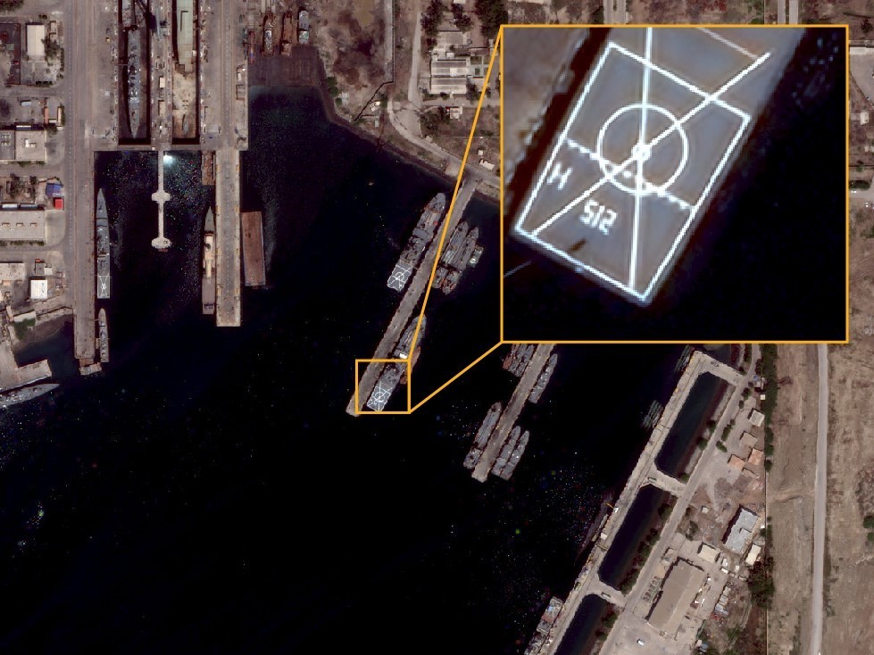 Mapping: In large-scale projects, 15 cm HD enables a level of detail that allows governments, organizations, and businesses to verify features, such as light poles, signs, and road and infrastructure conditions, without the inconvenience or cost of sending in-field inspection teams.
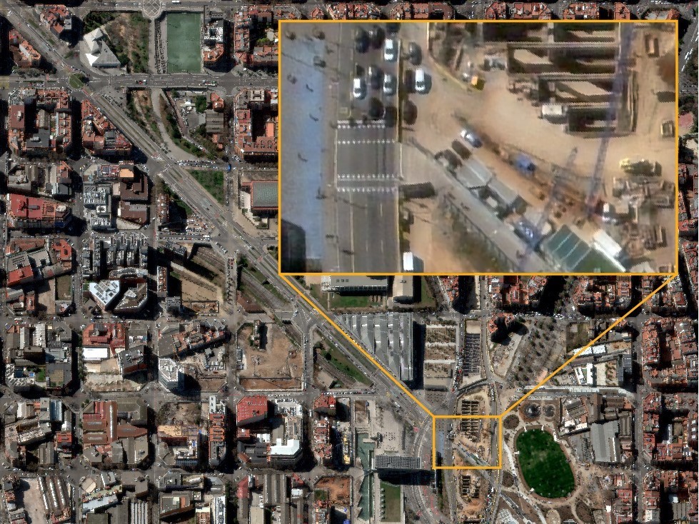
AI/ML Applications: Maxar’s in-house experiments have proven that HD technology can improve the average precision of the object detection of the ML algorithm. 15 cm HD provides additional detail for automated analysis and feature extraction, the experiments have shown.
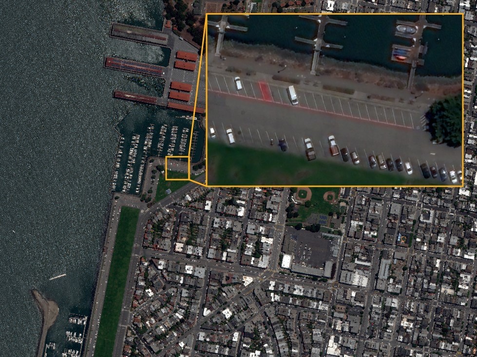
Supplementing Aerial Mapping: HD imagery can augment data collection in regions that are too remote to fly aircraft. A global 15 cm HD coverage can also support aerial mapping missions that have been affected by COVID-19.
Did you like the article? Read more and subscribe to our monthly newsletter!


 Around seventy percent of the world’s property is unregistered, causing land insecurity and poverty. Creating a system to document and formalize land ownership is the only way to ensure that the land is developed sustainably into the future.