First InSAR deformation maps of Sentinel-1A from the recent Napa Valley earthquake
The earthquake
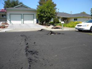
On 24 August 2014 North California was shaken by the most powerful earthquake of the past 25 years. The epicentre was located at a depth of around 11 kilometres in the middle of the Napa Valley, a wine growing area extending about 40km North of San Francisco. Fortunately, the 6.0 magnitude earthquake spared from fatal injuries but made houses collapse and roads mount up along lines, where the energy of tectonics directly released.
During earthquakes the earth’s surface is deformed. Radar technology from space has proofed to be an accurate method to measure this vertical movement of the crust. Synthetic aperture radar interferometry (InSAR) enables to calculate the distance between a satellite sensor (space borne in case of SAR) and the earth’s surface and thus to generate elevation models. Two images of the same area taken at different dates can be combined to detect small elevation changes over large areas.
Radar images
For the very recent Napa Valley earthquake radar images from ESA’s Sentinel-1A satellite were used to process a so called interferogram, which is the product of two interferometrically processed images: The first image was taken on 7 August 2014 on the same day when the satellite reached its operating orbit and the second one on 31 August after the earthquake had occurred. The technically and strategically pleasing news is that although Sentinel-1A, which was only launched on 3 April 2014 and is still being commissioned, ESA was able to specifically respond to the incident and provide data rapidly.
In the interferogram as shown below the topography is deducted in either image in order to only reveal the elevations changes that were caused by the earthquake. Coloured areas denote surfaces that were deformed during the earthquake, whereas one rainbow colour cycle (e.g. from red to red) refers to exactly 28mm vertical movement (wave length/2). Different colour lines lying tightly together indicate a greater deformation than plane fields of the same colouring. The direction of the deformation, if it was a lifting or sinking movement, has to be determined by a proper (separate) inspection. In the interferogram, the two circles with several rainbow sequences reveal the areas where most deformation occurred. The deformation within this zone is greater than 10 cm, whereas a territory of 30 x 30km was affected significantly. The figure reveals that the earthquake was caused by the Western Napa Fault system (very wide colour fields) pressing against the plate in the East and provoking its deformation.
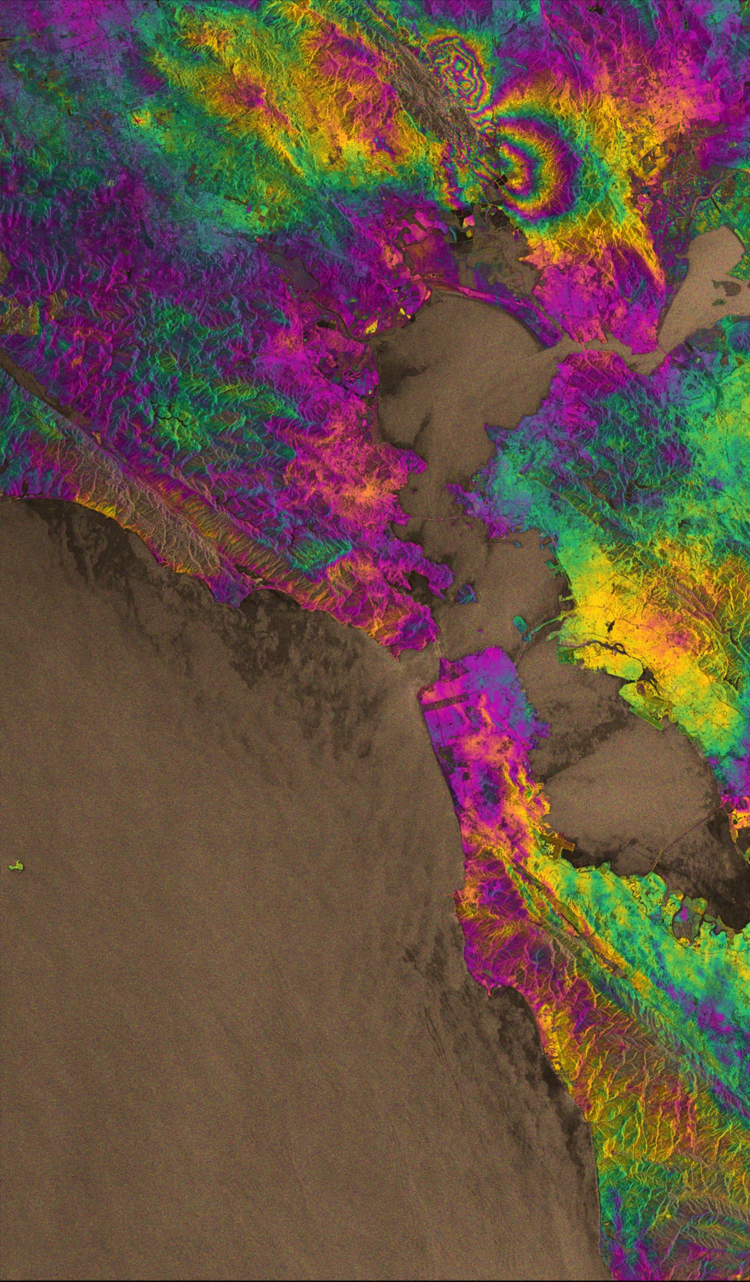
InSAR deformation maps, Sentinel-1A interferogram of the ground deformation due to the August 24th earthquake, Napa, California. Source: ESA
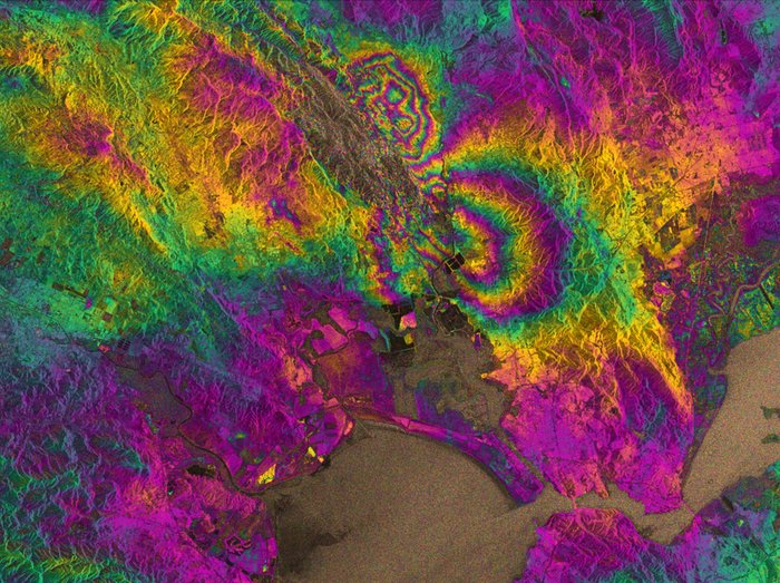
Interferogram in detail. Source: ESA
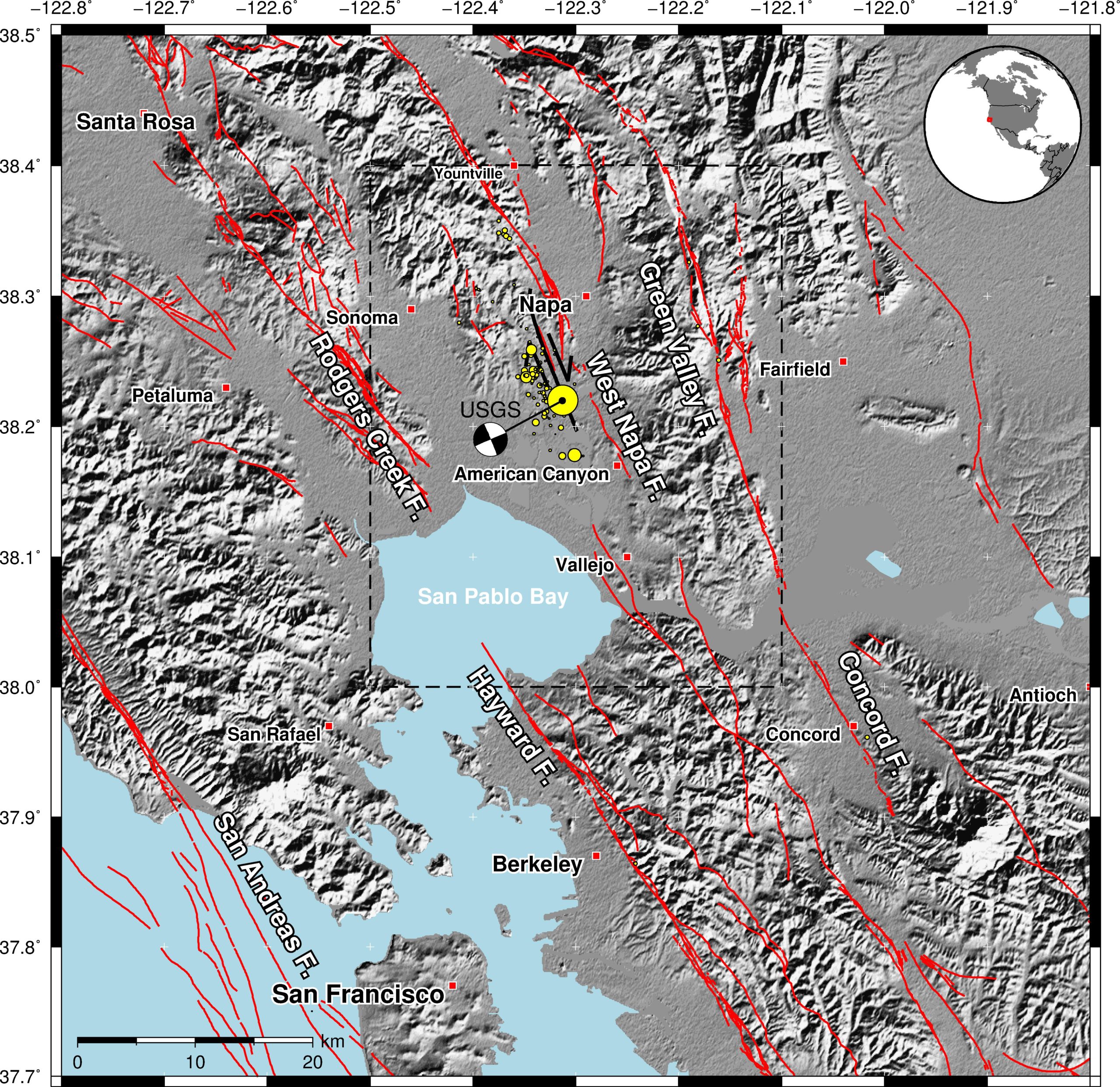
Fault map of the San Francisco Bay Area with faults in red colour. The fault rupture is shown by the black line, south-west of Napa (mapped by UC Davis scientists). The mainshock and smaller aftershocks are denoted by the yellow circles. Earthquake locations and existing fault locations sourced from USGS. Source: Earthquakes without frontiers.
Sentinel-1A
Sentinel-1A was launched on 3 April 2014 as the first in a fleet of satellite missions of Europe’s Copernicus environmental monitoring programme. Sentinel-1A passes over the same spot on the ground every 12 days. However, once its identical twin, Sentinel-1B, is launched in 2016, this will be cut to just six days, so that changes deriving from natural hazards can be mapped even faster.
According to Austin Elliott, a PhD student at the University of California Davis involved in mapping the earthquake rupture on the ground “the data from satellites are invaluable for completely identifying the surface break of the earthquake – deformation maps from satellite imagery guide us to places where rupture has not yet been mapped.”
Source: ESA
Did you like this post about InSAR deformation maps? Read more and subscribe to our monthly newsletter!


