Earth Observation in Banking and Finance: How Spatial Insights Drive Decision-Making and Support Communities – Meet UX Researcher, Cyhana Williams
Editor’s note: This article was written as part of EO Hub – a journalistic collaboration between UP42 and Geoawesome. Created for policymakers, decision-makers, geospatial experts and enthusiasts alike, EO Hub is a key resource for anyone trying to understand how Earth observation is transforming our world. Read more about EO Hub here.
While many financial institutions are beginning to adopt geospatial technologies, there are many areas of finance and banking, as well as other industries that stand to benefit from the spatial component. From informing location-based decisions to supporting the communities they serve, companies have much to gain from adopting geospatial technologies.
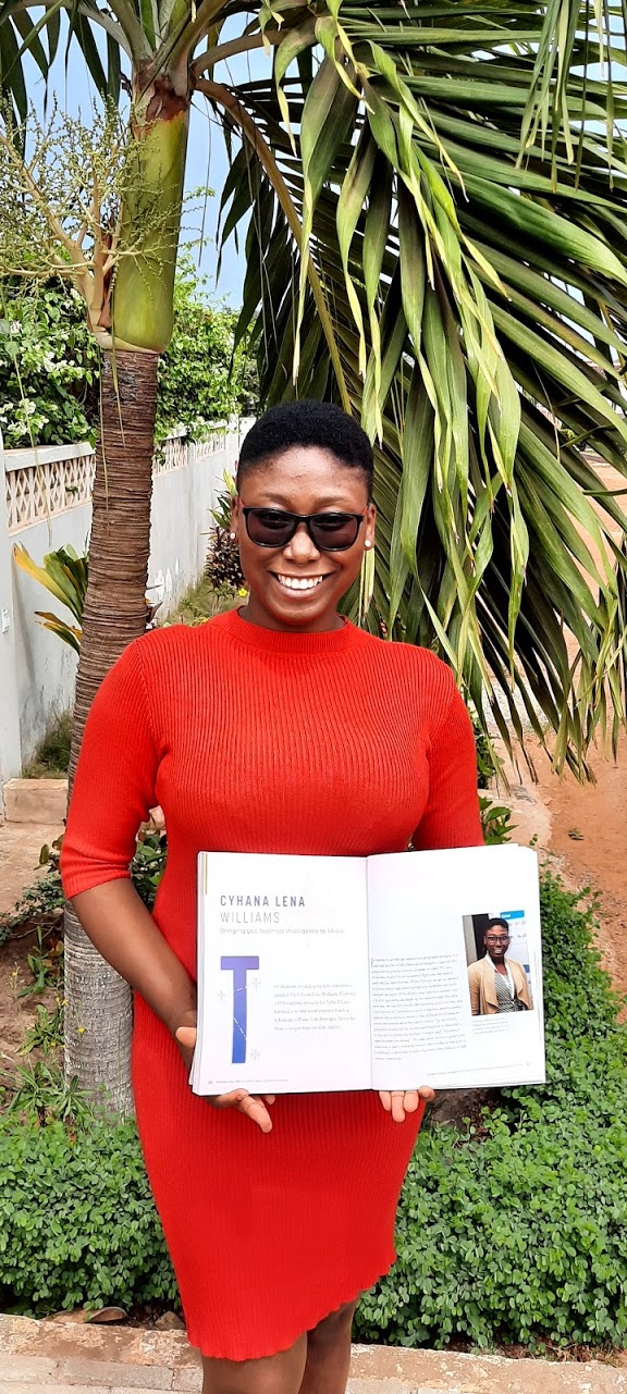
We spoke to Cyhana Williams on the topic. As a customer-centric, geographically-minded professional, her background in both GIS and UX research makes her perfectly placed at the intersection of location and people. Currently at Microsoft working in User Experience Research, Cyhana is also the Co-Founder of African Women in GIS—creating a community of African women in the geospatial industry across the world.
Q: Hi Cyhana, thank you for joining us! We loved your Looking Up With UP42 episode and learned that you studied geography and resource development at The University of Ghana, could you tell us more about your path to becoming a UX Researcher and how this intersects with your background in geospatial technologies?
A: Thank you for inviting me to share my thoughts on this important topic. My background is in geography and psychology. After school, I worked in a GIS and software company startup. Then I was in an FMCG company before I landed my current role as a UX researcher at Microsoft.
During my journey, I’d say that I did some research as I was working as a GIS technician at the startup since I took on multiple roles. One of the roles was research because I worked as a Project Manager on a pest and disease control system software that had a GIS component and needed research. Since we were a startup with few staff members, I had to take on the researcher’s role. That was how I entered the UX research field without knowing.
Currently, the research I do isn’t directly related to GIS in the sense that we don’t work with GIS tools. But the research that we do forms the base layer of multiple technologies out there.
I’d say it intersects with geospatial in the way we conduct the research. You need to consider the location component of where your data is coming from.
I do research concerning people. So where are the people I’m talking to located and what are their thoughts? How different is it? That is in terms of cultural, location, and even subcultural differences. All those things come together and give me the geographical aspect of UX research.
Q: In the episode, you mentioned there are many industries that stand to benefit from geospatial insights. Could you describe what the value of the spatial component is for companies that aren’t currently using geospatial technologies? Particularly, those in the banking and finance sectors.
A: I’d say a lot of it. There are a lot of values that the banking and financial sector is losing out on if they don’t incorporate location data. There are 3 things I’d mention:
- Geo Targeted marketing
- Resource allocation
- Risk management.
For geo targeted marketing, it is quite common in business development. Whenever you’re creating a product, you need to do targeted market research. For financial institutions, there is no difference.
For example, back home in my country Ghana, particularly in Accra, when I was a student I realized that a lot of the banks on our campus had products that targeted students. They knew students would be there for four years, they’d probably be working, some would have money from their parents, and they would want to save but some wouldn’t be able to save a lot. So as financial institutions, they created financial packages, little savings packages, and investment packages where the starting amount was low enough for students to benefit from—they were able to come in and open an account with a very low amount.
It worked for both parties. Students were able to save enough and banks were able to succeed in getting more customers. That’s geo-targeted marketing. You target a specific area, a specific demographic in that area and then you pivot your products to suit that particular market. It’s really niche and it’s more intentional and beneficial as you have more data to back your strategies. So, it makes more business sense. Banks need to first understand their customer, so they can satisfy them with the products that they are providing.
Resource allocation is one of the basic uses of geodata that I think a lot of banks are currently using. That’s how they choose a location for a particular product or asset. With this, it’s not about necessarily targeting a particular demographic but more in relation to large numbers.
For example, in some Western countries, there are not as many ATMs, but back home in Accra we have a lot of them in various locations.
The great thing is that no matter what bank you belong to, you can use whichever ATM. So it’s very helpful to have any bank’s ATMS located where most people are. Areas with more public amenities such as markets, hospitals, and schools are great locations. Banks pick places that have a high concentration of people, majority of the time. That’s how they allocate resources for economic benefits.
The second aspect of resource allocation is in relation to branches – when it comes to expanding banks or financial institutions. Financial institutions and others need to target areas that are growing. If a bank wants to be forward-thinking with projection in mind—they would target upcoming areas — using geodemographics and population data to inform their decisions.
One thing about urbanization is that people move to where resources are provided and vice versa. Banks should pay attention to forecasts – which areas are going to be more important and populated in 5-10 years’ time?
The final point is risk management. This ties into resource allocation because while trying to target the best places to situate a branch, banks need to pay attention not only to the population but also the geography of the area.
There are certain parts of the world, due to climate change and other reasons, that have natural disasters. Back home in Accra, we have floods since Accra is a plain. There are some areas where flooding can be very severe and those areas become waterlogged. Banks need to keep this in mind since banks are also real estate investments.Thus, their locations need to be geographically safe.
Looking at the geographic element- this isn’t just physical geography but also sociocultural, economic, and psychological – in relation to the society in that area. Will people feel safe in my bank to transact business? Will people want to come to this location to deposit money?
These values, if considered together, can help banks make informed decisions.
Q: A new study has found that Earth observation data can unlock value for the financial services sector. The report created in collaboration between the UK Space Agency’s Unlocking Space for Business programme and the Ordnance Survey shed light on how accurate and detailed location data can enable better investment decisions, particularly in sustainability and biodiversity net gain. What are your thoughts on this? Particularly, relating to the potential value EO data can unlock for the financial sector, the sheer volume of data out there, and the knowledge needed to use it effectively and appropriately.
A: What they’ve shared is very true. To be honest, I hardly see reports about EO data— especially in relation to investments and where to target markets or expansions.
Especially in this time of climate change, financial institutions and banks need to pay particular attention to EO data. Although vector data can be accurate for certain forms of analysis – I would say that EO data gives you a better picture of reality. Whether it’s forecasting an approaching tornado or heavy rain potentially triggering a landslide, your systems should be able to predict and alert you of such things.
This report definitely impacts people, i.e., the financial institutions and the people who have saved in those banks. One particular institution that can benefit from EO data is insurance companies. For example, let’s look at a company that handles reimbursement of insurance for farmers. With climate change and agricultural loss – a financial institution utilizing satellite imagery will be able to and have definitive proof that the land has been affected and compensation claimed can be given. There is the benefit of risk management and efficient resource allocation.

Q: Are there any people or companies that are revolutionizing the banking industry by bringing geospatial insights into domains like customer experience, customer behavior, risk assessment, and resource allocation? If so, what do you like about their approach and where do you see this going next?
A: One that came to mind is a company called Esoko in Ghana. This company provides geospatial insights for farmers by providing them with information about market changes, climate conditions, and weather changes—while sharing farming strategies and advice for weather-specific crop growth.
Esoko combines GIS data with financial services in addition to information provision. They’ve tried to bridge the gap between the financial services and the farmers in Ghana. That’s really important since back home in Ghana, depending on where you are, many agricultural issues occur and need financial institutions’ backing. For example, on cocoa farms.
Where do I see this going? I hope more financial institutions will open up to this idea and provide packages that will cater to people’s needs like that. This is where geo-understanding comes to mind. Understanding who lives in a particular area as well as what does and doesn’t work for them. In rural Ghana, most farmers don’t use smartphones, instead they use analog phones. If banks want to create a system for them, they need to take into account the user’s way of doing things, their circumstances, and their limitations. An app will not work if the right internet and device infrastructures are unavailable. Instead, SMS services with a short code and call services are the types of technologies that will be more beneficial to rural farmers.
That doesn’t mean a high-tech app solution shouldn’t be created either. It’s important to cater to and understand people before you introduce solutions to them – since they will be using those solutions, not you.
That’s why it’s very important to incorporate geospatial insights and have an understanding of the geospatial component in target markets. I’m hoping to see this approach being used by banks if they are not doing so already.
Q: Could you tell us what customer-centric means to you? And in what way does the crossover between customer pain points and GIS technologies lead to industries being truly customer-centric?
A: I’ll answer with a story. There was one instance at my first workplace where we created a really cool pest and disease management system, as I mentioned before. The smartphone app could scan larvae worms during an infestation and let farmers know what type it is. Since some look similar in their larvae stage – the system was trained with lots of images. The app worked by allowing a farmer to detect the worm, and then automatically suggest ways to mitigate the issue. It also sent an alert to the agricultural officer of that area to alert the other farmers about the larvae found – and to stock up on pesticides in preparation for the worst.
However, when we presented this app to an agricultural organization, while they were very impressed, they pointed out a crucial missing piece. We had forgotten to pay attention to our users. While creating it, we focused on urban farmers who had access to good infrastructure, yet the people who faced the infestation issue the most were rural farmers. They also formed the majority of those without smartphones thus, they wouldn’t have had access to our app.
This was our ‘aha’ moment. Rural farmers make up a huge percentage of farmers in Ghana. We made the mistake of building the product first, and then testing it on urban farmers, without a steady understanding of who the user really was.
That’s why it’s really important that whatever GIS technologies you want to introduce to particular user groups – you need to properly understand people in terms of infrastructure. Do they have the right infrastructure to use this? Is the app too heavy to load on the 2G network? Some areas in Ghana only have Edge, and wouldn’t get 4G or 5G. Ask yourself: can your app work on those network levels?
To be truly customer-centric is to have an understanding of people who will use your services or products so that you can tailor the solution accordingly, with geodata being front of mind. In the future, I think we’ll see a lot more localization and personalization from truly customer-centric products.
Q: There’s definitely a lot to gain from location data! Cost is something that often comes up in the discussion around geospatial data extending beyond the geospatial industry. How do you think financial institutions can use spatial insights to better understand and serve their customers while reducing costs and increasing revenue?
A: I think financial institutions need to see location data as a long-term investment. Those who start incorporating location data now will reap the benefits after a lengthy research period.
This research is the only way they can get better insights to make more informed decisions. Once they take these intentional steps—talking to the person who will use their products and learning about their challenges, how they live, and what they need—they’ll build a foundational understanding of their user.
As mentioned before, geospatial data can be utilized for risk management, geo-targeted marketing, and resource allocation. Using geospatial data for these processes reduces decision-making time and helps to monitor and evaluate risks. The overall efficiency of the company increases exponentially. Spatial insights are not only beneficial for customer relations and understanding but it is also beneficial to the company’s operations and management. This, in turn, can help to reduce costs and increase revenue.
Q: Could you share your experience of working in UX research and GIS – what areas of improvement are needed to make geospatial technologies more accessible for customer-centric roles? Is there enough of an understanding of how spatial insights drive decision-making and support communities?
A: The cost of some GIS tools is quite high. Usually, it’s Western businesses that incorporate GIS in their decision-making. However, in many regions including Ghana, some businesses often can’t afford premium GIS tools nor do they see the full value.
Balancing costs in data collection is crucial. In a previous role, we used a mix of expensive and free tools to optimize our investment while maintaining data quality. This approach helped increase revenue while managing costs.
It’s important to note that not everywhere is the same. Not every company can afford expensive tools and this is an accessibility challenge that should be improved. There should be affordable packages for good GIS tools.
Another key area of improvement is UX research tools. The UX research world, closely tied to design, considers location factors in tool usage and research methods. Incorporating GIS technologies into UX research tools, especially for survey and quantitative research, could greatly enhance data representation. For instance, adding location data at the city or country level to UX research tools would be valuable, as precise coordinates aren’t always necessary.
So if UX research tools can be combined with GIS tools that would be really impactful. Existing data analysis tools like Excel already have some geographic components. However, making more complex GIS functionalities accessible in these tools, alongside videos or tutorials, would help support people without extensive GIS backgrounds.
Also, I think it’s important to be vocal about changes we need to see in our tech tools, in order to make a difference.
In terms of how much understanding there is around how spatial insights drive decision-making and support communities—I don’t think there is much at the moment. It is still quite niched.
Many people are unaware of Geographic Information Systems as a field, particularly its technological aspects. Promoting GIS integration in various tools and industries could help bridge this knowledge gap and unlock valuable insights across sectors.
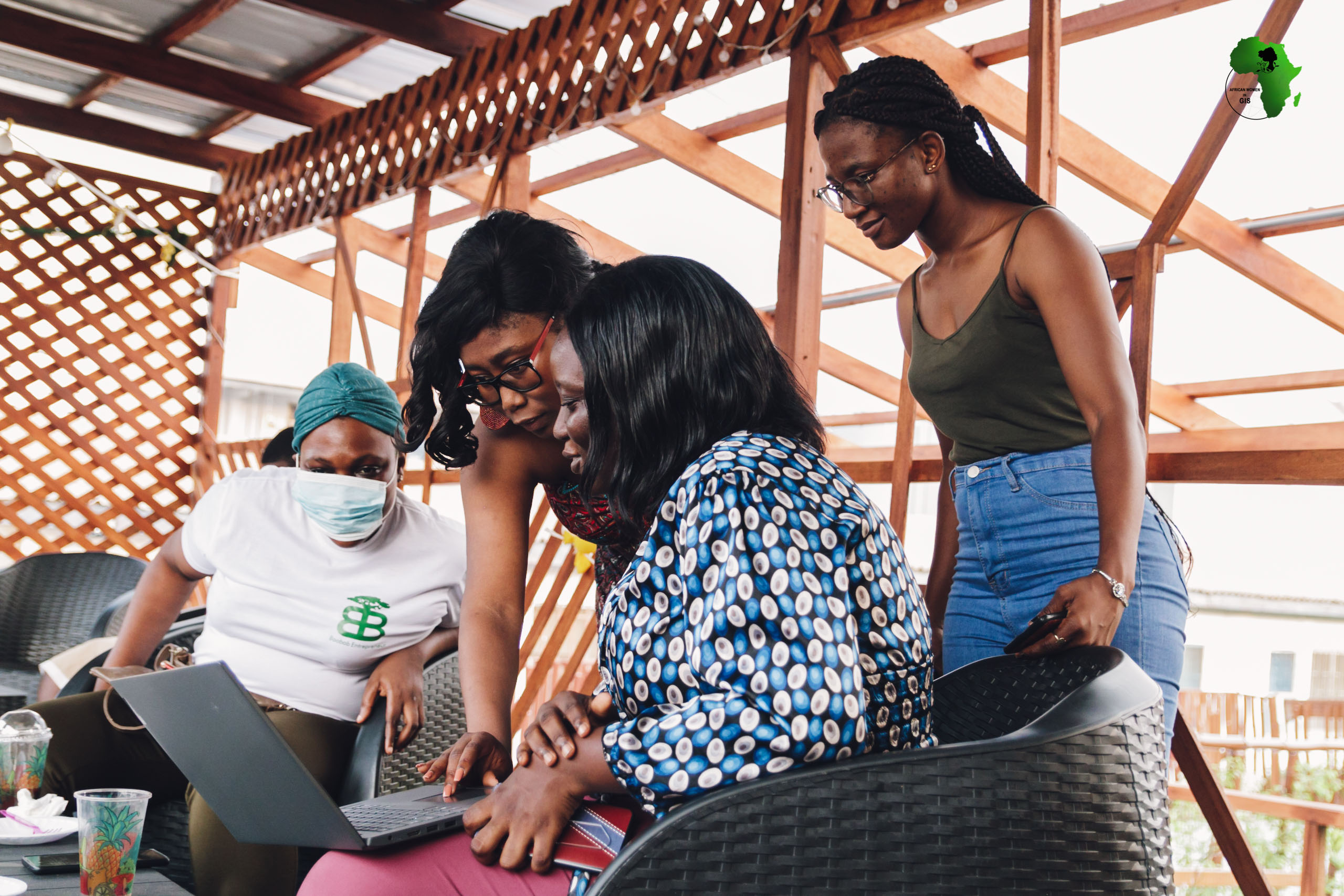
Q: Lastly, we love the work you’re doing to promote women in tech through African Women in GIS. Could you tell us more about this community and the impact you’ve seen it have in helping women across the world and across all industries?
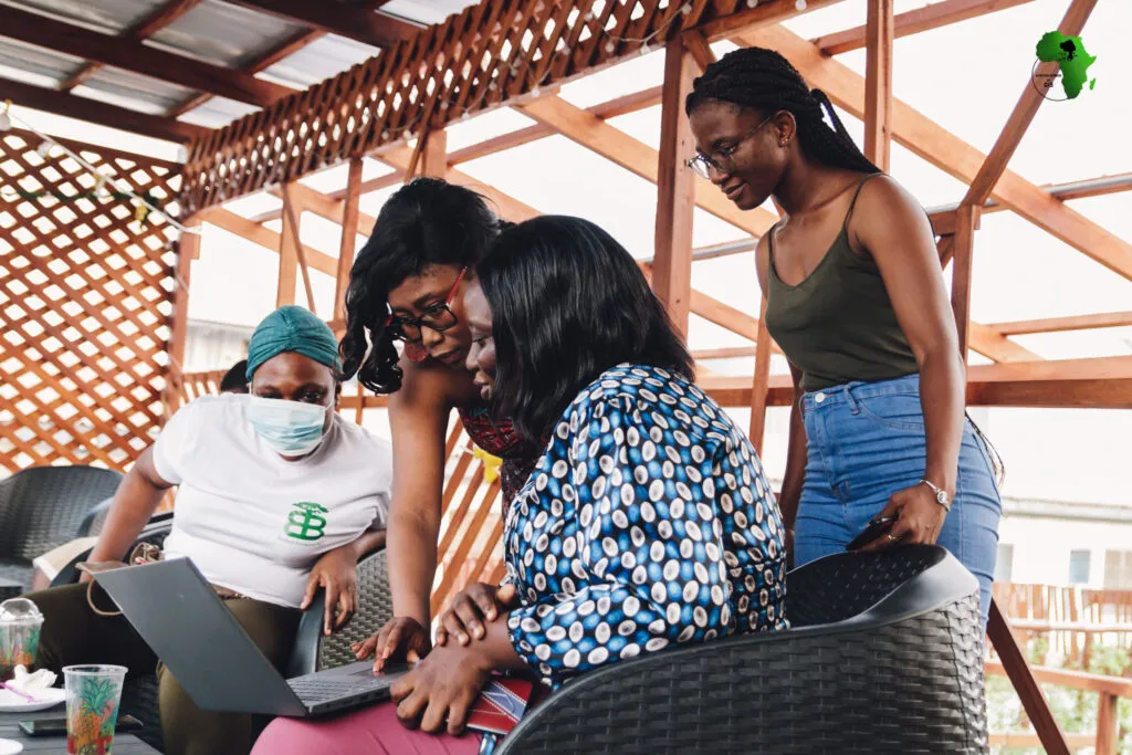
A: Thank you! The African Women in GIS community has been thriving for five years, thanks to the dedication of our volunteers and the contributions from our members, supporters, and collaborators. Our organization was created to provide a safe space for African women in the GIS industry worldwide. We offer a platform for access to opportunities, education, projects, news, mentorship, and guidance.
The idea originated from a conversation between my co-founder, Chidimma Umeogu, and I, where we realized we both struggled to find information about GIS jobs and connect with other women in the field. After I completed my studies, I wanted to explore the potential of a GIS career. This led me to establish a community, and after reaching out to Chidimma, who had started her own group, we decided to merge our efforts into what is now African Women in GIS.
Over the past five years, with the help of dedicated volunteers, we’ve organized numerous events and collaborated with various organizations. We’ve enabled our members to gain real-world experience by working on projects that enhance their portfolios. Also, our resource webinars cover topics like securing scholarships and writing proposals for research grants.
Mentorship has been a key component of our community. Many members have participated in mentorship programs that provide career guidance and networking opportunities—helping them gain clarity about their career paths.
Our mission is to bridge the gender gap in the African geospatial industry by encouraging more women to enter the field and creating opportunities for them to shine. We aim to inspire the next generation of African women by showcasing successful female role models in geospatial careers.
We welcome collaborations and new members! You can connect with us on LinkedIn, X, and our website: https://awigis.org.
Did you like the article? Read more and subscribe to our monthly newsletter!


