
People have been trying to control weather for a long time now. It is a difficult task on a large-scale but locally humans have already learnt how to influence some of the meteorological processes.
Silver iodide is a material commonly used to induce extra rainfall from clouds. It has a hexagonal crystalline structure that is very similar to ice. Similar enough to trigger a process of freezing nucleation where smaller particles gathers to form a block of ice, resulting in a rainfall.
Microscopic particles of silver iodide are shot into existing clouds to control where the rainfall happens. You can use it to clear the air before important events (like Olympic games in Beijing in 2008) or even to reduce a risk of some precipitation related natural disasters.
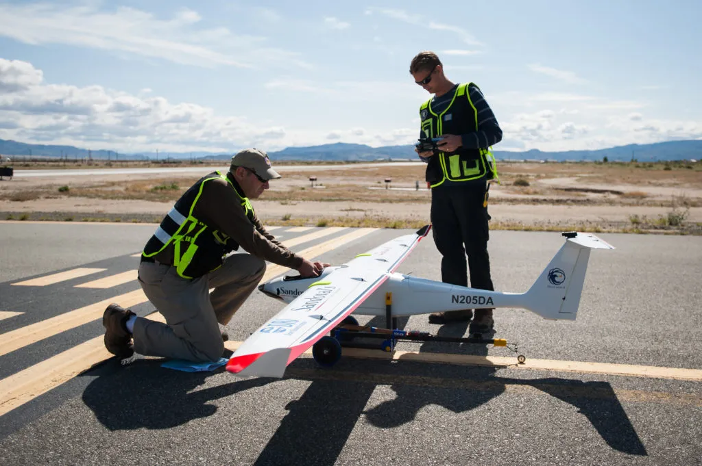
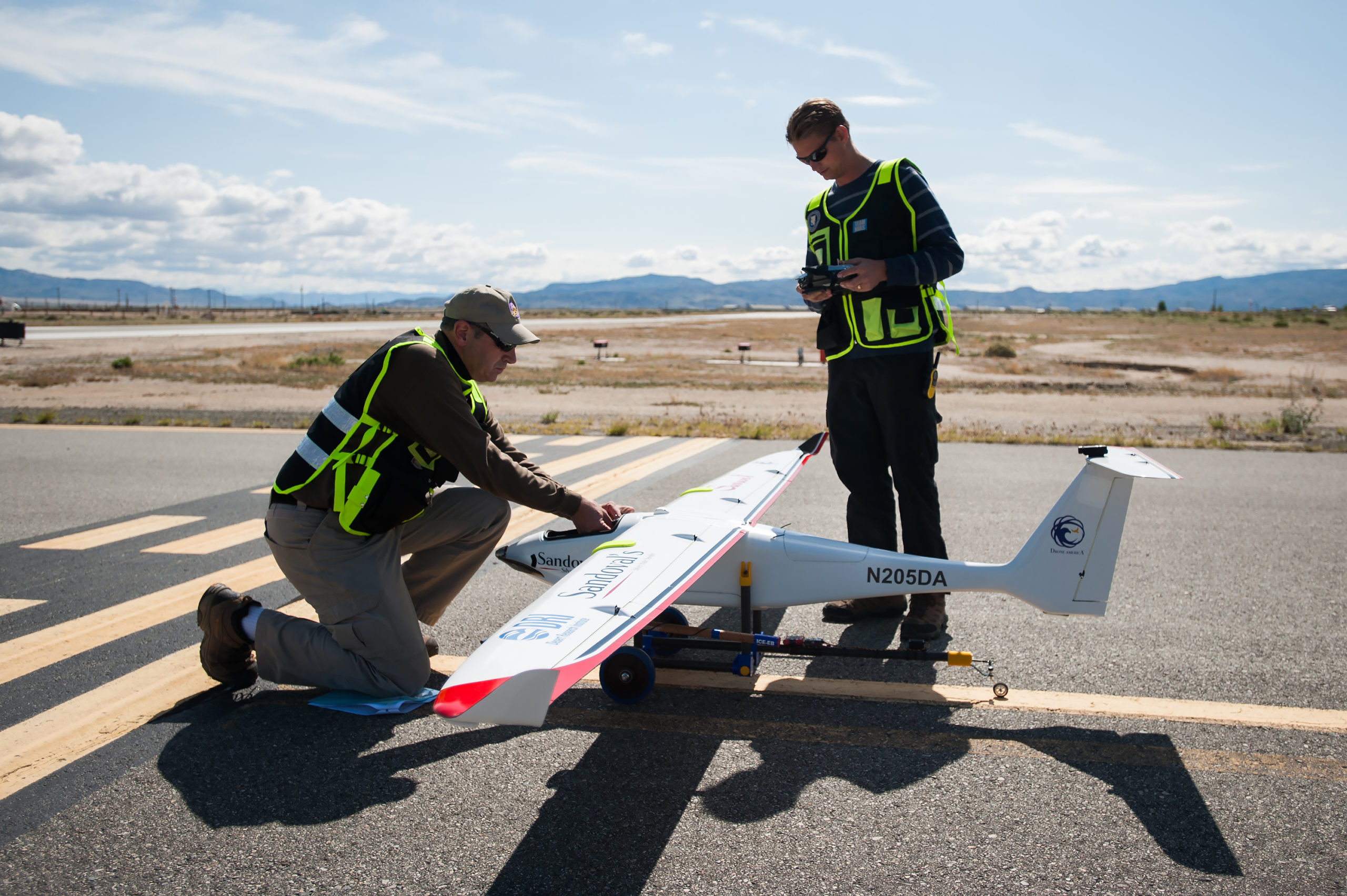
Now this technology is being tested with the use of drones. A new UAV has been built by the Desert Research Institute in cooperation with Drone America. Earlier this week the drone called the “Sandoval Silver State Seeder” has been tested in Nevada. It flew to an altitude of 400 ft (122 m) in an 18-minute flight, deploying two silver-iodide flares. Although it didn’t make any rain, DRI calls it a “major milestone.”
“We have reached another major milestone in our effort to reduce both the risks and the costs in the cloud seeding industry and help mitigate natural disasters caused by drought, hail and extreme fog,” says Mike Richards, President and CEO of Drone America. “With a wingspan of 11-feet, 10-inches (3.6 m) and its light weight design (less than 55 pounds (25 kg)) the Savant is the perfect vehicle to conduct this type of operation due to its superior flight profile, long flight times and its resistance to wind and adverse weather conditions.”
Weather engineering is still a new field of science. Using drones will undoubtedly make it cheaper, better and more accessible. Although modifications of a climate have as many supporters as people against it, the truth is that using it to flight droughts and other natural disasters is very tempting.

#Insights


Next article
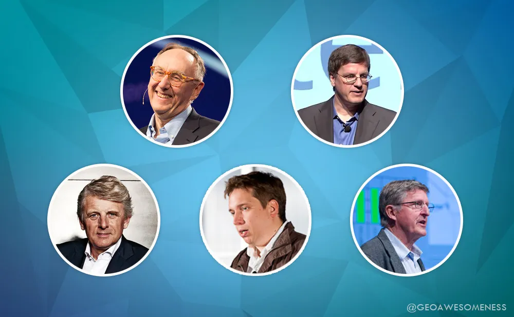

The great things are done by extraordinary people. Here is my list of top 5 people who I believe shaped the geo industry of the 21 century. It was not an easy choice… Please comment if you have other candidates.
Jack Dangermond – CEO of Esri
 Jack Dangermond founded Esri in 1969 with $1,100… Today his company is worth a few billion dollars and it’s one of the largest privately held software companies in the world. For over 4 decades Jack has been shaping the GIS industry, and today at the age of 70 he is still doing so.
Brian McClendon – VP of Google Maps
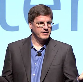 Brian McClendon is person behind everything that you love about Google Maps. He joined Google in 2004 when his company Keyhole, Inc., has been acquired by Google to create a foundation of Google Earth and Maps. He was leading Google’s mapping efforts between 2004 and 2015 when finally he was replaced by Jen Fitzpatrick and decided to join Uber.
Steve Coast – Founder of OSM
 Steve Coast is a legendary founder of OpenStreetMap, the project that started large-scale Open Source movement in the Geo industry. When Steve started OSM back in 2004, he had to build it from scratch. Today the crowd-sourced project offers the most accurate and open map of the entire planet.
Harold Goddijin – CEO TomTom
 TomTom is one of the largest mapping companies in the world and although it is not the biggest one, Harold is a person who continues to lead it through all these years. Your first PND, navigation app on your phone, real-time traffic service and now maps for autonomous car have been all influenced by his activities and decisions.
Michael F. Goodchild – Professor at University of California
 Michael Frank Goodchild is a Professor of Geography at the University of California, Santa Barbara. If you have ever read any GIS textbooks, there is a big chance that it was written, co-authored, reviewed by Professor Goodchild or at least his work is referenced there. He invented the term Volunteered Geographic Information and he brought up two generations of great geo experts.
[td_smart_list_end]

