

One of the most iconic geospatial tools of our time just reached a major milestone. Google Earth celebrated its 20th anniversary this June, marking two decades of helping people explore, understand, and connect with the world around them. Whether you’re a GIS professional or simply someone curious about the planet, Google Earth has made it possible to discover the world in new and powerful ways.
With its vast archive of satellite imagery, aerial photography, Street View, and 3D renderings, Google Earth has brought stunning visuals of our planet into homes, classrooms, offices, and research labs worldwide. It has inspired a ton of geography-based games, supported environmental education, and enabled visual storytelling.
Beyond exploration, this tool has played a key role in social impact. Through initiatives like the “Geo for Good” summit and the Google Earth Impact Awards, the platform has empowered researchers, nonprofits, and local communities to drive real-world change.
Its evolution from the early Keyhole days to the integration of advanced AI capabilities and links to Niantic Spatial highlights how the platform continues to grow in relevance. It remains one of the most accessible and powerful geospatial tools available today.
Some of the biggest tech websites out there including The Verge, TechCrunch, Yahoo and others have extensively covered the mileston. This global coverage is a testament to the tool’s enduring influence. Whether it’s through storytelling, analysis, or exploration, Google Earth continues to shape how we see and interact with our world.
As geo-curious minds, we can take pride in the fact that such a globally loved and widely used tool is rooted in the geospatial discipline. Google Earth has not only shaped our industry, it has brought it closer to people everywhere.

#Bez kategorii
Next article
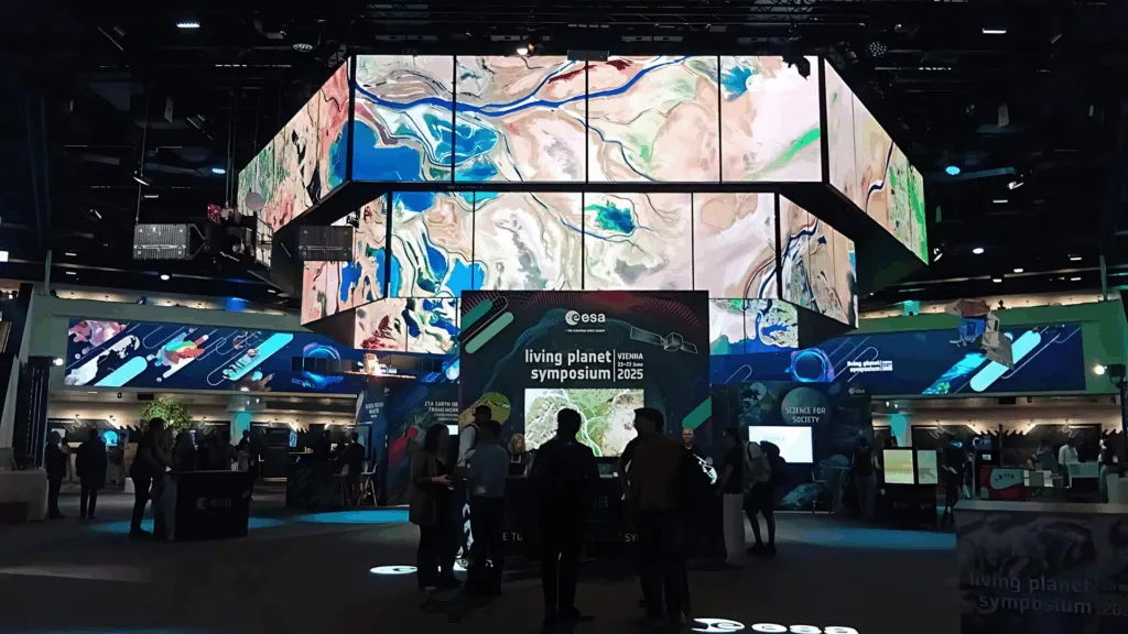

Over 6,500 participants gathered for this year’s Living Planet Symposium (LPS) — that’s more than double the number from the last edition! It’s a strong signal that Earth observation and space innovation are booming like never before.
The event brought together an incredible mix of researchers, industry leaders, and private sector pioneers from around the globe.
LPS 2025 Exhibitors
| ACRI-ST | Copernicus Data Space Ecosystem | EOX | Geodatalab |
| AI2Peat (CaDAR) | CS Group | Esri | Geoville |
| Airbus | Data Terra | EUSI | GMV |
| Beyond Gravity | DOMINO-E | Exprivia | Google Earth Engine |
| Brockmann Consult | EARSC | Flypix AI | Green Space Center |
| CEOS | Earthwave | Frontiers Media | HE Space |
| CGI | e-geos | GAF AG | IABG |
| CloudFerro S.A. | EODC | GeoBioRemediation | ICOS |
| IEEE GRSS | MEED Srl | PCP Wise | Swedish Space Corporation |
| Kayrros | MetaSensing | Planet | Teledyne Space Imaging |
| KSAT | MindEarth | Planetek Italia | Telespazio |
| Korea AeroSpace Administration | NASA | QFieldCloud | TerraDue |
| Kura Space | NV5 Geospatial | Recent Advances | Trade in Space |
| Leonardo | OHB | SatVu | VITO Remote Sensing |
| Magellium | OVHcloud | Serco | |
| MDA Space | PASCO Corporation | SITAEL |
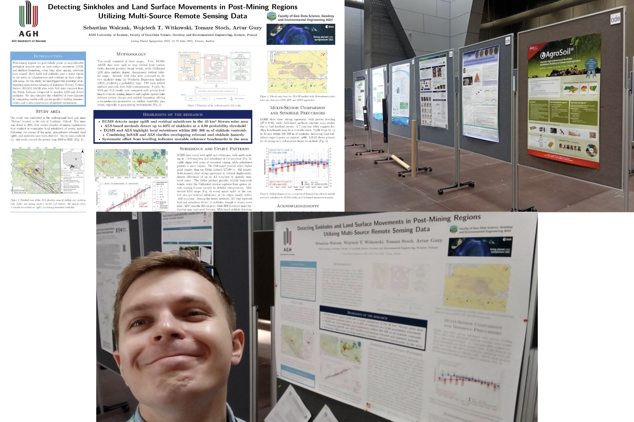
LPS offered a unique opportunity to present the latest discoveries and projects, with hundreds of poster sessions. Our team member, Sebastian, had the honor of presenting his research during one of these sessions.
One of the standout moments was the premiere of the first-ever satellite image from ESA’s BIOMASS mission — a stunning view of the Bolivian rainforest captured using long-wavelength P-band radar. This historic image showcases the mission’s potential to reveal Earth’s forest structure like never before.
Didn’t get the chance to see all the posters? No worries — they’ll soon be available on the official LPS website, so you can revisit your favorites or catch the ones you missed!
A significant highlight was the opportunity to reconnect with the Geoawesome community during the ThriveGeo meetup. It was great to see both long-time blog’s fans and newcomers who share a common passion for shaping the geospatial future.
Event info: ThriveGeo Meetup
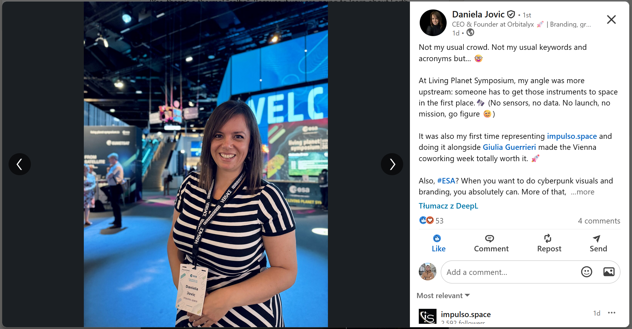
LPS enjoyed a huge amount of documentation in the form of posts on the LinkedIn platform (search by hashtag: #LPS2025). Big shoutout to our follower Daniela Jovic for spreading the enthusiasm and documenting the LPS energy so well!
View full post on LinkedIn
We would like to thank everyone for working together, for the ideas that were shared, and for thinking about the future of Earth observation.
If you have any personal impressions from the event and would like to feature them on the website, please let us know via email at sebastian@geoawesome.com.
Read more and subscribe to our monthly newsletter!

