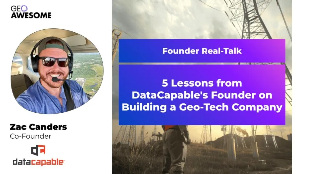

In a first installment of Geoawesome Founder Real Talk series, a platform dedicated to fostering peer-to-peer networking and sharing entrepreneurial journeys in the geospatial industry, I had the interviewing Zac Canders, the co-founder of DataCapable. Zac’s story is a powerful reminder that building a successful company isn’t just about having a great idea; it’s about a relentless focus on solving a problem, constant adaptation, and building the right team. The recording of the entire interview including audience Q&A is available here.
The Origin Story: A Problem-First Approach
The idea for DataCapable was sparked by the aftermath of Superstorm Sandy. Zac, a former utility operations professional, recognized the immense challenge of coordinating resources and understanding the scope of damage during large-scale emergencies. He envisioned a system where anyone could take a photo and get it onto a map, providing a real-time, ground-level view of an event. This problem-centric approach, rather than a technology-first one, became the foundation of DataCapable’s mission.
In the company’s early days, this vision manifested in using social media data, specifically from platforms like Twitter, to identify and map events like power outages. This was a novel application of technology at the time. Today, the company leverages advanced AI and machine learning to analyze a variety of data sources, from open-source platforms to real-time audio analytics, to detect and communicate threats like wildfires and active shooter events.
Technology and the Human-Augmented AI Model
Zac explained that while technology continues to evolve at a rapid pace, the goal remains the same: to provide actionable insights. The company’s progression from simple data scraping to sophisticated AI models was driven by both customer demand and the team’s desire to build a more robust platform.
A key takeaway from Zac’s experience is the concept of human-assisted AI. He believes that while AI algorithms are powerful for detecting events, a human element is still crucial for verification and adding context. This hybrid model ensures accuracy and reliability, preventing the kind of “noise” that machine learning models can produce, such as misinterpreting a photo of a drink for a mudslide.
Building the Team and Navigating Partnerships
According to Zac, a successful startup isn’t just about the product; it’s about the people. He emphasized that building a strong team and fostering a healthy company culture is paramount. His advice for aspiring entrepreneurs includes:
- Be passionate about the problem: Deep engagement with your industry’s community is essential for long-term success.
- Focus on getting paid: While building a great product is important, a business cannot survive without a strong focus on sales and timely payments.
- Don’t give your product away for free: Always attach a value to your product or service, even in pilot programs, to demonstrate its worth.
- Build a strong support system: Delegate non-core tasks like accounting and legal work to professionals. This frees up founders to focus on building the business.
- Don’t burn out: Set boundaries and maintain a healthy work-life balance to avoid becoming jaded.
DataCapable’s growth was also significantly aided by strategic partnerships with industry leaders like Esri and Amazon Web Services. Zac highlighted the value of these relationships, stating that they provided opportunities to expand their reach and gain credibility within the geo-tech space. He strongly recommends that new founders engage with these ecosystems to find mentors, pilot clients, and build a network of advocates.
The recording of the entire interview including audience Q&A is available here.
In the 2nd edition of Geoawesome Founder Real-Talk, we are interviewing Marco Bernasocchi, founder of OpenGIS.ch. You can register for the live interview and community networking event here.


#Startups


Next article
Background
Sometime back, I had the opportunity to reconnect with Fredrik Moger, founder of Atlas, a cloud GIS platform. Our conversation traced the origins of the company, its design philosophy, and the role of open standards in shaping a new kind of GIS experience.
As Fredrik explained, Atlas began as a university project at the Norwegian University of Science and Technology, where students from different disciplines—civil engineering, environmental sciences, robotics, and computer science—struggled with the steep learning curve of traditional GIS tools. The idea emerged to build something more accessible, collaborative, and cloud-native, designed for teams where not everyone is a GIS specialist.
Fredrik shared that Atlas has since grown to thousands of users across more than 170 countries, and has raised about $2 million in pre-seed funding—one of the largest at that stage in Norway. Their users include small and medium businesses, renewable energy startups, universities, and local governments. The goal is not to replace advanced GIS platforms, but to provide a lighter, easier entry point for organizations where one GIS expert works alongside many non-specialists.
What Sets Atlas Apart
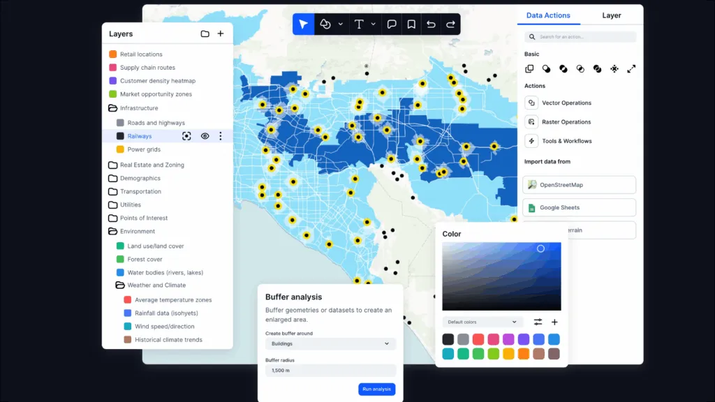
According to Fredrik, what distinguishes Atlas is the way it breaks GIS into approachable, browser-based modules that mirror everyday workflows. Its four main components include:
- Data – Upload and manage layers, connect external sources, edit attributes, and perform basic operations.
- Builder – Assemble dashboards and interfaces with maps, charts, and feature search tools.
- Workflows – A visual scripting environment to automate analyses such as buffers, boundaries, or clustering.
- Forms – Tools for collecting field data, similar to digital survey applications.
Under the hood, Atlas runs on Postgres/PostGIS and AWS, with MapLibre for rendering. But what matters most is that all of this happens in the browser, without downloads or complex installs. Collaboration is built in, allowing teams to share data and build applications together more easily.
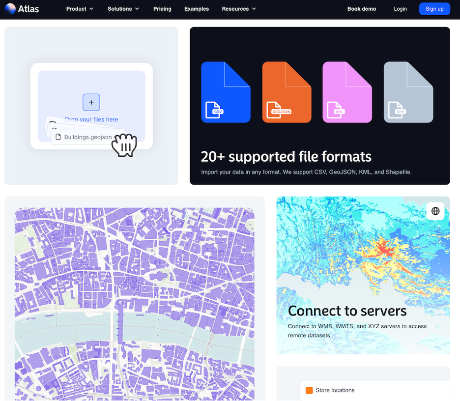
Atlas supports open data sources such as OSM and Overture, along with a wide range of open formats including OGC Standards, OGC web services, and widely used industry formats. (Credits: Atlas)
Open Data, Open Formats and Standards
Fredrik highlighted that Atlas is designed to make it easy to query open data sources such as OpenStreetMap and Overture Maps. This enables users to enrich their datasets with points of interest, roads, and building data—an important capability for teams that depend on openly available, standards-aligned content.
He also emphasized Atlas’s broad support for open data formats and OGC standards. This is not just a technical choice, but a deliberate step to ensure interoperability, reduce lock-in, and align with global practices for geospatial data exchange.
Atlas supports a wide spectrum of open formats including GeoJSON, GML, CityGML, KML, GeoPackage, AIXM (based on GML), JPEG 2000, PNG, GeoTIFF, Cloud Optimized GeoTIFF (COG), DEM, TopoJSON, and LAS for LiDAR data. It also works with CSV and DBF for databases. For services, Atlas connects with OGC Web Services including Web Coverage Service (WCS), Web Feature Service (WFS), and Web Map Service (WMS).
In addition to open formats, Atlas also supports a wide range of industry formats—such as AutoCAD DXF, Esri File and Personal Geodatabases, Esri Grid, Shapefiles, Erdas Imagine, KMZ, PostGIS, SWL Database formats, MapInfo Tab—and industry web map servers like XYZ Servers.
Formats on the Roadmap
Fredrik noted that several additional formats and services are on the Atlas roadmap. These include WFS, WMTS, and Esri ImageServer, along with emerging open formats such as GeoParquet, FlatGeobuf, and PMTiles.
Why It Matters
Platforms like Atlas highlight an important shift: geospatial tools are reaching new audiences. By lowering the entry barrier for non-specialists and supporting open standards, they expand who can participate in geospatial analysis and decision-making.
For the GIS community, this means thinking not just about advanced functionality, but also about accessibility, collaboration, and how well systems interconnect. The value of openness—through formats, services, and standards—becomes even clearer when smaller teams and new sectors begin adopting geospatial technology.
As Atlas and similar platforms grow, they remind us of the importance of building tools that are both powerful and approachable, rooted in the principles of openness that the OGC community continues to advance.
P.S. Let’s Collaborate
If you’re a startup or innovator working on emerging technologies, new product ideas, or evolving business models, I’d be glad to connect. I’m particularly interested in geospatial platforms where open standards play—or could play—a meaningful role.
Even if open standards aren’t currently part of your approach, a conversation could open new possibilities. Let’s explore how your work can be supported, amplified, and shared with a wider audience.
Transparency Note
This post is not a product review, promotion, or endorsement. I haven’t tested the platform myself and have no commercial interest in this product. This is a voluntary initiative to bring visibility to early-stage efforts in the geospatial space and foster more awareness and collaboration around open standards.

