#Business #Ideas

More than a crowdsourced map: How OpenStreetMap is becoming a mapping standard, and why you should care

Standardization can have a profound effect on industries and the people they interact with. Done right, standardization can shift innovation of entire industries. Whether we talk about a USB-C as a port standard for devices or containerization in the shipping industry, standards have allowed companies to focus on what they’re good at rather than how they play with others. A similar shift is taking place right now in how we create and consume digital maps.

Standardization in mapping shouldn’t come as a surprise. The demand for location-based services has shot through the roof in recent years. Designers and developers now consider location as a given in many of the services they’re building. This goes for more obvious cases, like Uber and Lyft, but also for platforms like Facebook and fitness apps like Strava. More than ever before, maps are in demand—both the raw data behind them and the visualizations they enable.

There’s also greater pressure in terms of what’s expected from a map. Until recently, all a new business cared about was to be listed in the Yellow Pages. Now the concern is whether or not they exist on major mapping platforms. The location, opening hours, contact information, and description of services are most easily retrieved via a map-based application. Navigation data like the direction of travel, speed-limit, surface-type, and transport networks are equally important elements of a modern map. The cost of acquiring and maintaining this data is huge, but the industry is pragmatic and channeling efforts towards a neutral platform and database which also serves as the foundation for the standardization we’re now seeing: OpenStreetMap.

What began as a crowdsourced map curated by volunteers has evolved into a diverse ecosystem of players with a shared interest in collecting and consuming map data. In fact, it seems that everyone uses OpenStreetMap. Corporate giants like Apple, Facebook, and Uber all use OpenStreetMap. Individual volunteers used the service to map villages in the Philippines before the typhoon season, while a Microsoft team used it to mapping bodies of water in Australia. In the past, such mapping took place independently on offline paper maps and closed databases. Not only has the cost of these approaches excluded many, but the advantages of using OpenStreetMap as a base map have also become more significant. A ride-sharing company launching in Tanzania tomorrow could take advantage of the incredible flood resilience mapping by the Ramani Huria project throughout Dar Es Salaam. The flood mapping included locations of businesses and health clinics, as well as tedious details of the road network. This data is just as relevant for a ride-sharing company as it is for flood resilience work, even without direct collaboration. When OpenStreetMap is lacking features, a key advantage is that the map is readily compatible with other services such as OpenTraffic, Mapillary, or TripAdvisor. At the end of the day, all of these players benefit from an improved OpenStreetMap.

On the engineering side of things, OpenStreetMap is becoming an obvious standard foundation when people and organizations want their location data to be displayed on top of a map. Because of OpenStreetMap’s open structure to storing data, companies and organizations are able to build other applications on top of it quite easily—keeping the bits they like, and simply removing the bits they don’t, while combining it with data they’ve gathered elsewhere. This approach is taken by giants like Microsoft, but also by much smaller organizations like the offline map platform maps.me.
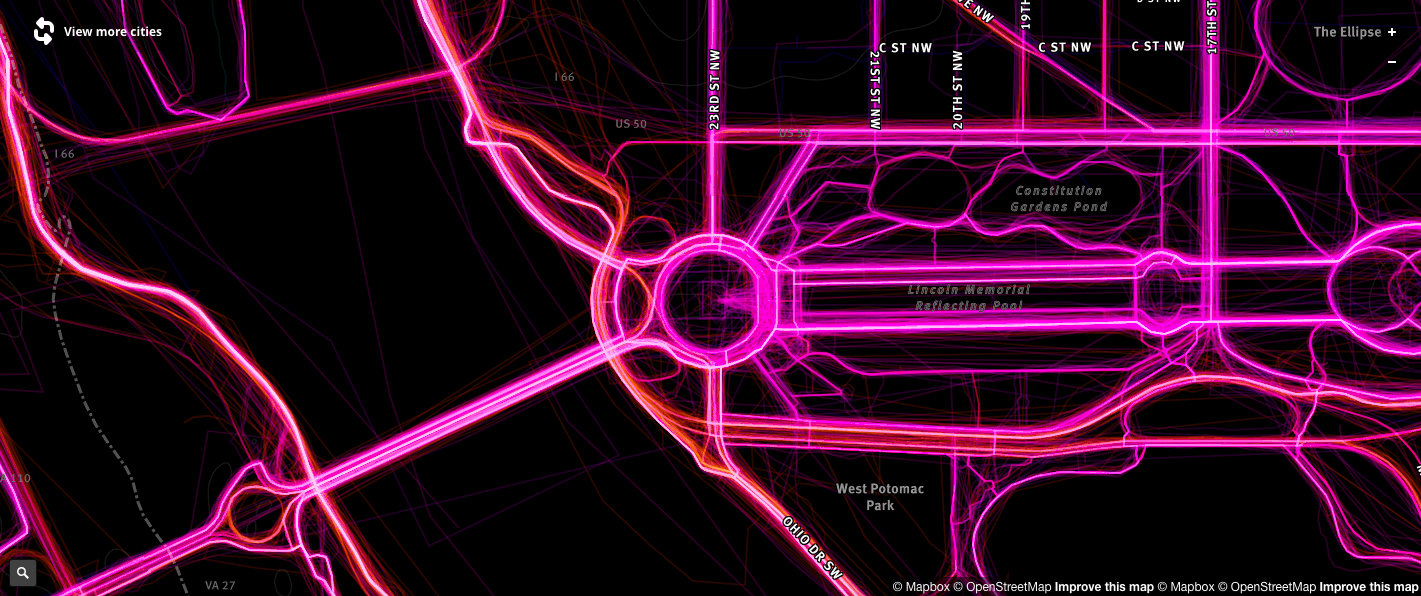
Driving patterns data as collected by Mapbox

Driving patterns data as collected by Mapbox

It isn’t just humans that are impacting the way the map changes. Companies like Mapbox are collecting over 400 million kilometers of data on driving patterns which are being analyzed with machine learning to estimate the speed limit of a road, direction of travel and where construction might be taking place. Existing OpenStreetMap data can then be validated and updated at a greater frequency than human volunteers can achieve alone. Similarly, Mapillary applies computer vision and machine learning to the 385 million images on our platform. This helps to identify over 33 billion map features—all of which we’ve committed to making freely available to the OpenStreetMap community. These automated methods are producing a flood of data that human mappers can use as sources, guides, and evidence, noting the fact that all OpenStreetMap data must be added and verified with a human touch as a final step.
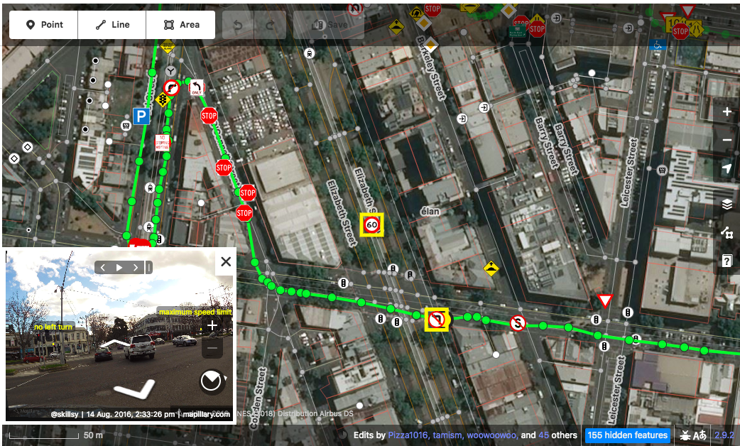
Mapillary detected traffic signs in OpenStreetMap's iD Editor

Mapillary detected traffic signs in OpenStreetMap’s iD Editor

This is where the community continues to play a defining role. OpenStreetMap volunteers make extraordinary additions to maps from perspectives that don’t always matter to commercial players. The fact that these divergent groups of individuals, companies, governments, and organizations can each contribute to the one platform is a powerful thing. It means that the value shifts towards the applications that can be built with the map data rather than who controls it. The result is better maps everywhere.

OpenStreetMap is more than a crowdsourced map—it’s turning into a mapping standard, and we’re all better off because of it.

Say thanks for this article (0)
The community is supported by:
Become a sponsor
#Business
#Business #Fun #Ideas #Science
Next Generation Map Navigation: Is It Based on AR Smart Glasses?
Nianhua Liu 07.19.2024
AWESOME 2
#Business #Contributing Writers #Fun #People
History of GIS | ESRI – A Pioneer in GIS Technology
Sebastian Walczak & Nikita Marwaha Kraetzig 07.26.2024
AWESOME 1
#Business #Featured
Global Top 100 Geospatial Companies 2025
GeoawesomeTeam 09.23.2024
AWESOME 5
Next article
#Business #Environment #Featured #Ideas

How giving away empty addresses is helping fight homelessness

How can an empty address help fight homelessness? By definition, a homeless person is someone without a permanent residence, unable to acquire and maintain regular, safe, secure and adequate housing. Unfortunately, being homeless doesn’t just mean that they are without a house, an address, but also end up losing their de facto means of identification. Without identification, it becomes difficult for them to access the basic services that they need to recover – social benefits, a bank account, employment all get either taken away or gets too complicated. Those who might have otherwise gotten back on their feet with a little early support are instead left to become entrenched in the situation and, ultimately, develop more complex and care-intensive needs over time. If only they had an address in the first place, we could have helped them get access to the social benefits that they deserve!
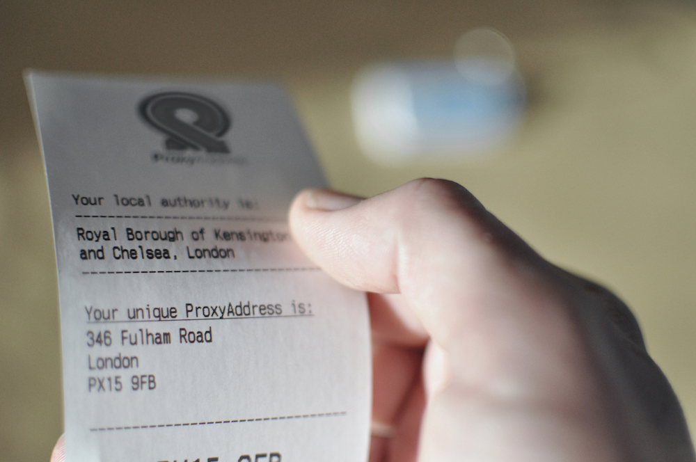

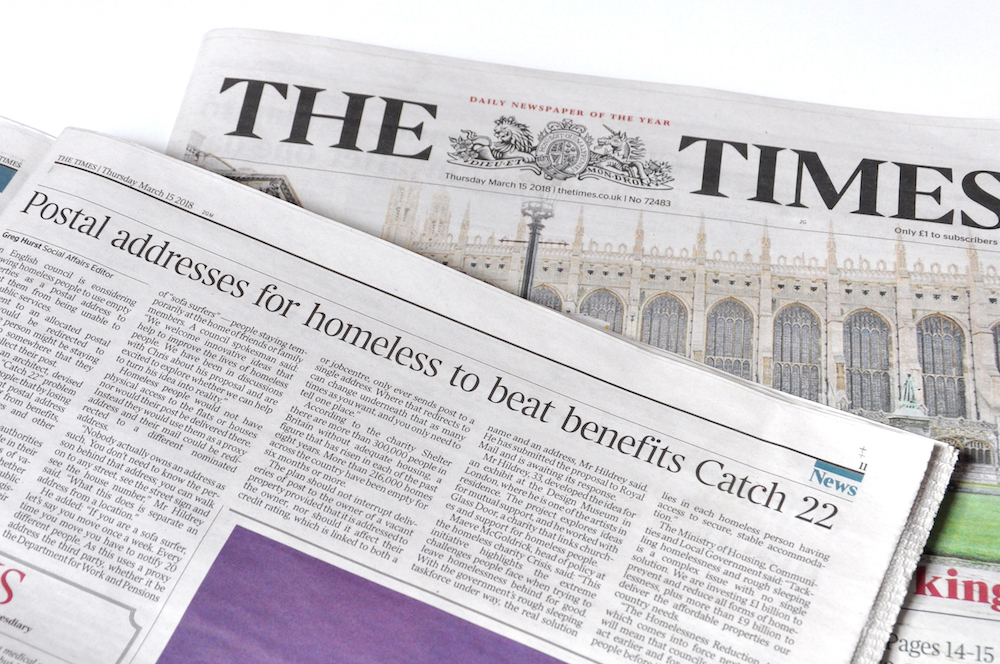
Homelessness creates unstable living arrangements. Without a stable address, people are cut off from the support they need. ProxyAddress uses empty address data to ensure that the most vulnerable can access the services they require and avoid enforcement before that happens.

I interviewed Chris Hildrey, the person behind ProxyAddress to learn more about his project and how it works. Read on!

Q: Chris, thanks for the taking the time! Before we start talking about ProxyAddress and the problem it is trying to solve; I am just curious to know what made an architect interested in understanding how the addressing system works and how it leaves the homeless at a disadvantage?

A: I was a little surprised to find myself here too! But, despite being an architect, my loyalty lies not with buildings, but with trying to make to make the built environment improve the lives of those who occupy it. Architecture is one of those rare design disciplines where most decisions are imposed upon those who use it: you can choose what phone to buy, what clothes to wear, but very few people are in a position to shape the environments in which they live most of their lives. For me, this fact carries with it an implicit duty for architects to act to improve and make these spaces more inclusive.

To turn away possible improvements because they’re not buildings seems to me to be a waste. Architects develop so many skills through their education and they can be applied to many different things and in many different ways. So, once I started to better understand the urgency of the issues for those most marginalized by the built environment – people facing homelessness – I soon came to realise that there are thousands of people out there who can’t wait for the necessary buildings to be built before facing the precipice. I wanted to find a solution that could help people tomorrow rather than in a decade’s time. Once the research started to point me in a new direction, I decided to widen my focus from buildings to also consider the systems that underpin the very way in which we use and understand our cities. Addressing is at the heart of that.

Q: In a nutshell what ProxyAddress is trying to achieve is use empty address data to ensure homeless people have access to social services, right? Could you perhaps throw more light into the problem that you are trying to solve and your approach?

A: The problem with addressing today is that, despite being introduced to the UK in the late 18th century to help categorize and organise the built environment, it’s now used as a de facto form of ID. With the number one cause of homelessness being the end of a tenancy, this means that the act of becoming homeless sees you not only lose your home but your address too – and, with it, the credentials required to access support. The very reason you need help becomes the reason it’s taken away.

This situation has largely come about from legacy logistics; an outdated mindset that says that all people have a consistent, fixed address. This isn’t the case for an increasingly large number of people and it causes great strain. The conceptual difference between the existing system and ProxyAddress is a little like that between a landline and a mobile phone. When you call landlines, the first thing the person on the other end says is who is speaking. When you call a mobile, the first thing they usually say is where they are. In the first case, you know the location but not the person; in the latter, it’s vice versa. ProxyAddress tries to deal with addresses being used to identify people by assigning them to people rather than to a place.

Today, addresses are used by many as a lynchpin for data. Remove it, and all the relevant information required to access these services falls away. By reinstating it, a huge range of services and benefits can be achieved: from accessing welfare to applying for jobs without stigma, to postal redirection, to opening bank accounts. This small change can make a huge difference in the early stages of homelessness.

Q: How do you actually identify these empty addresses? And even if you did assign an empty address to someone, wouldn’t they need to have access to the building in order to be able to collect their mail?

A: Records of empty addresses are already maintained by councils by law. In fact, a key component of the project was making the most of existing infrastructure. When I approach large organisations to partner on the project, asking them to make significant changes to their operations was never going to fly. Instead, the key design challenge was in creating a system that works without significant cost or change required by anyone; one that ’s greater than the sum of its parts.

Post is a good example of this: Royal Mail redirection already exists. In fact, every year over 80,000 children send a letter to Santa Clause using an address that doesn’t exist; the letters end up in a sorting office in Belfast. But the important point is that it could be anywhere – a postal address is simply a routing instruction and where it ultimately directs to does not need to correspond. This is the characteristic of addressing we use to ensure that no impact is felt on any addresses used: redirection is on the basis of a combination of name and address so no ProxyAddress mail ends up at the physical location, and no impact is felt on credit records of the owners either.

Q: So now we have an empty address assigned to someone in need and the postal service takes care of re-routing it. However, don’t you still have to somehow register yourself as an inhabitant of that address, in order to be able to get the social services? How does this work?

A: This comes back to the idea of the address being a lynchpin for data. When you buy a plane ticket, you provide your address. But where you live isn’t of importance – it’s not even on your passport – it’s just so that if two people of the same name arrive for the same flight there is some differentiating detail present to help identify each individual.

The same principle applies throughout the public and financial sectors; the database which connects the individual to the ProxyAddress can allow access – if granted and required – to provide each service. There are occasions where it isn’t transparent though – for instance when applying to a job while using the care of address of a homeless shelter. Here, ProxyAddress provides the outward appearance of a consistent address, helping ensure that people are judged on their own merit rather than the stigma associated with their living arrangements.

Q: Wow! I didn’t think about an address in this way before. You must have spent several weeks, probably months, reading the legal stuff, understanding the pain points before you came up with this idea. Now that Proxy address is out there, what comes next? How are the authorities taking to your proposal?

A: The reaction from local and central government has been wonderful. The recent introduction of the Homelessness Reduction Act placed a huge amount of duties on councils to prevent and relieve homelessness. But, with an average of 38% finding cuts in the last 8 years, councils are struggling to do more with less.

We’re currently moving towards a live trial in London. For this first step, we’re tackling the highest bar for identification and anti-fraud regulation compliance: opening a bank account. Without proof of address, this is difficult enough – but to try it when you’re at the most vulnerable time in your life just isn’t feasible. We hope that crossing this milestone from the outset will clear the path for the many other, less legally onerous, services to follow as part of a wider roll out.

Q: How can we help you in your crusade?

A: There’s always more I could be doing and learning so the usual needs apply at this stage: funding, publicity (such as this!), connections with local and central government, advice from startups, and advocating for the idea with those who might benefit from it. We’ve made some great progress on all areas but the more hands we can find to help smooth the road ahead, the faster we can make sure that becoming homeless doesn’t mean being cut off from support.

You can read more about ProxyAddress here.

Read on
Search