2024’s Best Offline Map Apps: Ultimate Guide for Travel and Navigation
In today’s world, where connectivity is a constant companion, offline map applications have become an integral tool for travelers and adventurers.
Whether navigating through a foreign city, hiking in remote areas, or preparing for emergencies, offline maps ensure you always know where you are, even without an internet connection.
We’ve compiled the best offline map applications of 2024, comparing their features, usability, and accuracy. We’ll equip you with the knowledge to choose the perfect digital navigator for your adventures, whether you’re behind the wheel, on two wheels, or on foot.
Why Are Offline Maps So Important?
Offline maps are crucial for several reasons, beyond mere convenience:
- Reliability: Offline maps are free from the constraints of cellular networks and Wi-Fi hotspots. They don’t rely on these and are essential when navigating in areas with poor connectivity.
- Cost-Effective: By eliminating the need for data roaming when traveling internationally, offline maps help to reduce charges traditionally associated with using data abroad.
- Battery Efficient: With reduced data fetching, offline maps significantly extend your device’s battery life—a crucial factor for long journeys or remote areas.
- Safety: In emergencies, offline maps provide a reliable fallback, ensuring you can always find your way to safety.
5. Enhanced Exploration: Free from connectivity concerns, with offline maps, you can venture off the beaten path with confidence. Discover hidden gems and forge new experiences.
The Best Offline Maps For Drivers
In a time when connectivity isn’t always guaranteed, offline maps have become essential tools for drivers. Let’s explore the top contenders:
Google Maps: The All-Rounder
Key Features:
- Comprehensive global map coverage
- Offline area downloads for specific regions
- Real-time traffic updates when online
- Intuitive route planning and navigation
Usability:
A household name, Google Maps offers an extremely user-friendly interface that’s familiar to most smartphone users Maps can be downloaded easily by selecting the area you wish to save for offline use.
Accuracy:
Thanks to Google’s extensive mapping data and frequent updates, Google Maps is highly accurate, even in offline mode.

Source: Google Support
Waze: The Crowd-Sourced Navigator
Key Features:
- Real-time, user-generated traffic and road condition updates
- Limited offline capabilities compared to Google Maps, requiring initial connection before driving offline, but still useful
- Community-driven alerts for traffic updates, road hazards, police presence, and more
Usability:
Waze is designed with drivers in mind, providing alternate routes quickly based on current traffic conditions. Its interface is intuitive and driver-friendly.
Accuracy:
While primarily an online tool, Waze’s accuracy shines through its real-time user input, providing up-to-the-minute traffic and road change information.
Source: Waze
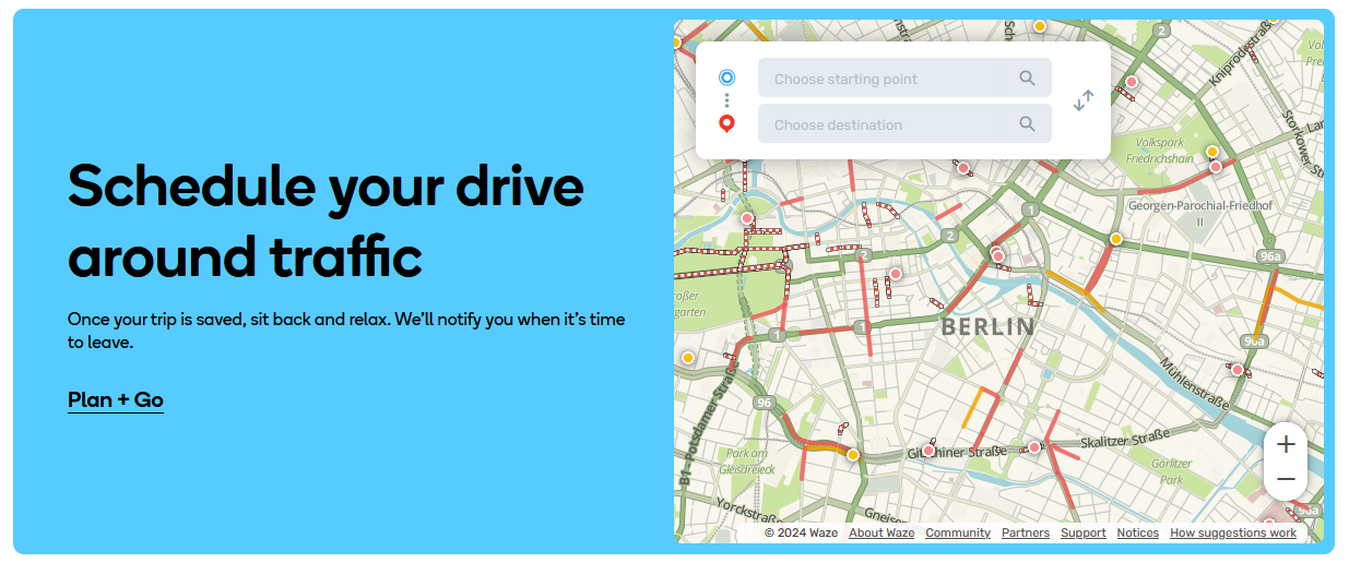
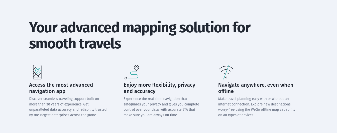
HERE WeGo: The Offline Champion
Key Features:
- Extensive offline functionality
- Ability to download entire countries or regions
- Turn-by-turn navigation in offline mode
- Public transport information included
Usability:
HERE WeGo boasts a clean, simple interface that’s easy to navigate. Its robust offline capabilities make it a great choice for international travelers or those venturing into areas with poor connectivity
Accuracy:
Known for its reliability, HERE WeGo offers accurate navigation and a wide range of offline features.
Source: HERE
The Best Offline Maps For Tourists
In today’s digital age, tourists need reliable navigation tools. Here’s a selection of top-tier map apps designed to help you explore during your travels:
Citymapper: Your Urban Exploration Companion
Key Features:
- Focused on urban transportation with detailed public transport information
- Offline maps available for major global cities
- Multimodal route planning (public transport, walking, cycling)
Usability:
Citymapper shines with its intuitive interface, tailored for effortless navigation in unfamiliar urban environments. Its focus on multimodal transport options makes it ideal for city tourists.
Accuracy:
With its covered cities, Citymapper offers highly accurate navigation, providing real-time updates where available online.
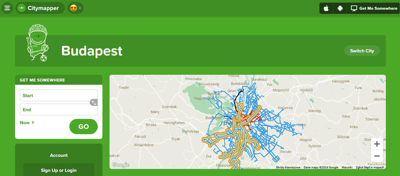
Source: Citymapper
Tripadvisor: More Than Just Reviews
Key Features:
- Offline access to city maps, reviews, and photos
- Information on attractions, restaurants, and hotels
- Downloadable content for 300+ cities globally
Usability:
Known for its travel planning features, TripAdvisor’s app seamlessly integrates its database of reviews and recommendations with offline mapping capabilities making it a handy tool for tourists.
Accuracy:
While primarily known for its user-generated content, TripAdvisor’s offline maps provide accurate location data for points of interest and general navigation.
YT video instruction: How to download offline Tripadvisor maps
MAPS.ME: Global Offline Navigation
Key Features:
- Detailed offline maps covering the entire world
- Rich point of interest (PO) database to discover attractions, restaurants, hotels, and more offline
- Multi-modal navigation providing turn-by-turn directions
- Regular map updates and community-driven improvements
Usability:
MAPS.ME’s intuitive interface caters to both urban explorers and off-the-beaten-path adventurers. The app’s focus on detailed offline functionality makes it exceptionally user-friendly.
Accuracy:
Known for its precision, MAPS.ME leverages OpenStreetMap data, which is updated daily by millions of contributors. This crowdsourced approach ensures that maps remain current and accurate, even for lesser-known locations.

Source: MAPS.ME
The Best Offline Maps For Cyclists
For cyclists, having reliable navigation tools is crucial, especially when venturing into unfamiliar areas or when on long-distance rides. Here are a few of the top-tier offline map apps designed to improve the cycling experience:
Komoot: The Outdoor Enthusiast’s Choice
Key Features:
- Detailed offline maps with elevation data and surface-type information
- Sport-specific route planning optimized for road cycling and mountain biking
- Turn-by-turn voice navigation
- Community-driven highlights and recommendations
Usability:
Komoot offers an intuitive interface focused on route planning, discovery, and sharing. Its offline functionality is robust, allowing cyclists to download entire regions for offline use.
Accuracy:
Highly accurate, particularly for outdoor trails and cycling-specific routes. Komoot’s maps are regularly updated with community input, ensuring up-to-date information
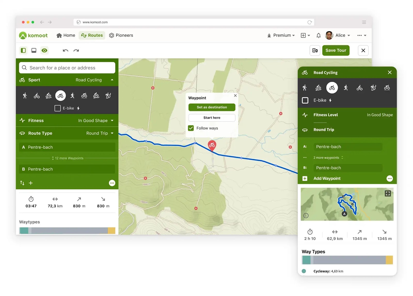
Source: Komoot
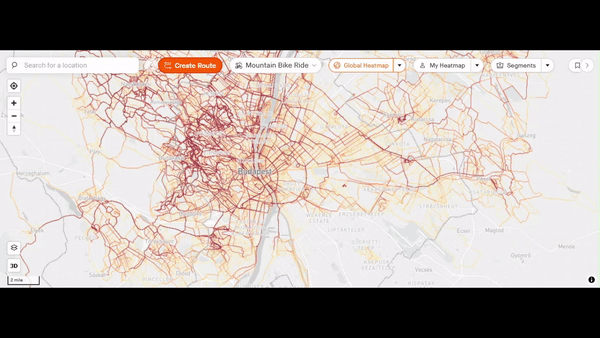
Strava: The Athlete’s Guide
Key Features:
- Offline maps integrated with fitness tracking
- Segment challenges and performance analysis
- Route creation and discovery
- Social features for sharing rides and achievements
Popular among athletes, Strava offers route tracking and offline maps for cycling. It integrates with fitness tracking.
Usability:
Popular among athletes, Strava’s Intuitive interface has a strong focus on performance tracking and social sharing of routes and achievements. Offline maps are easily accessible for route navigation.
Accuracy:
Known for its precise route tracking and elevation data, Strava provides accurate and reliable navigation and performance metrics for cyclists.
Source: Strava
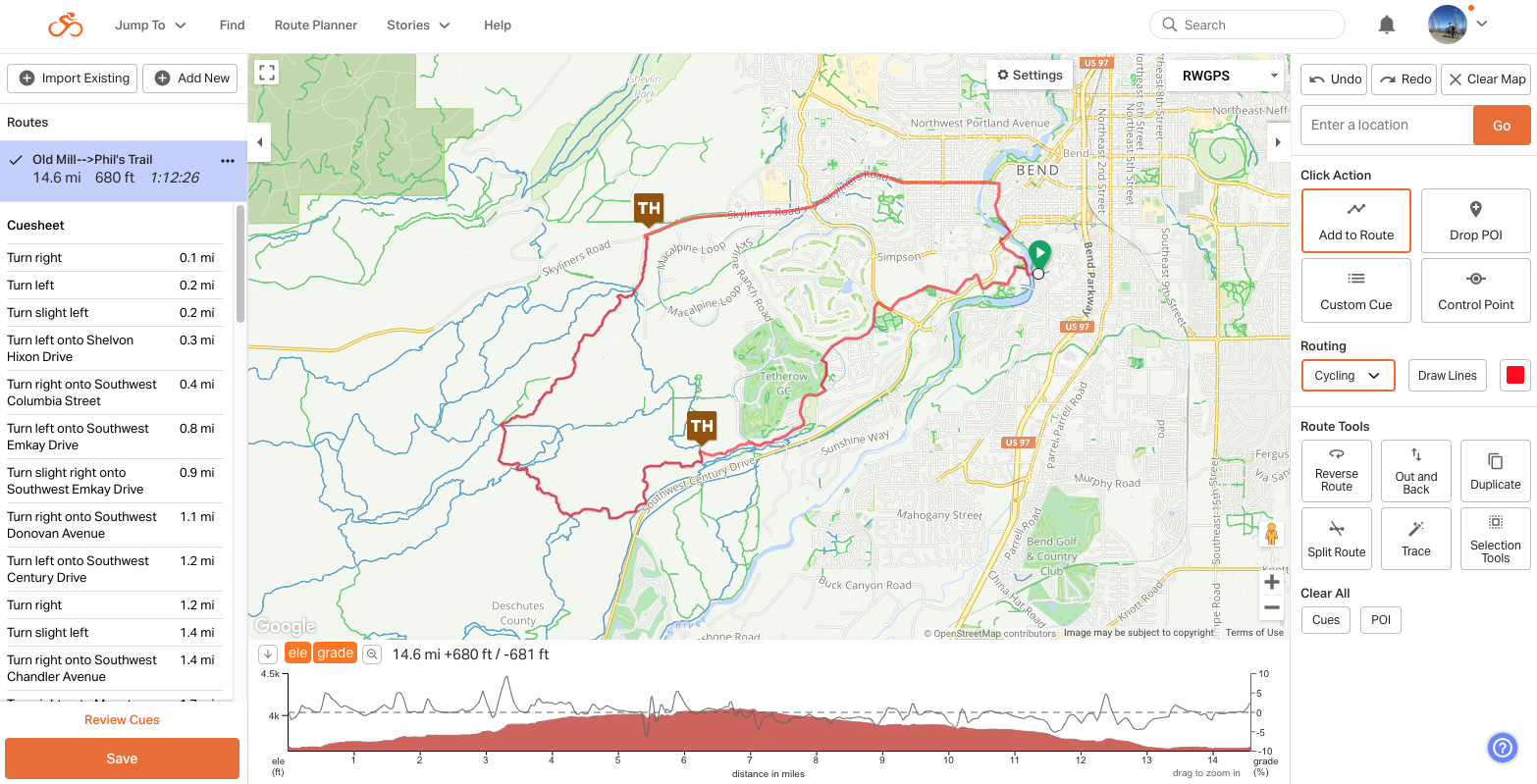
Ride with GPS: The Cyclist’s Navigator
Key Features:
- Detailed offline maps with cycling-specific route information
- Turn-by-turn navigation with voice prompts
- Comprehensive elevation profiles
- Custom cue sheets and route planning
Usability:
Designed with cyclists in mind, Ride with GPS offers straightforward route planning and navigation. Its offline capabilities are extensive, catering to long-distance riders.
Accuracy:
Highly accurate, providing detailed elevation data and route information.
Source: Ride with GPS
The Best Offline Maps For Motorcyclists
For bikers who love to explore the open road, here are a few of the best apps for your off-the-grid adventures:
REVER: Route Planning Made Easy
Key Features:
- Detailed offline maps with motorcycle-specific route planning
- Community-shared routes and ride discoveries
- Comprehensive ride tracking and performance metrics
- Weather overlay for intelligent route planning
Usability:
REVER has an intuitive, user-friendly with a focus on scenic routes and ride tracking.
Accuracy:
Highly accurate for road conditions and route planning, benefitting from regular updates and community input
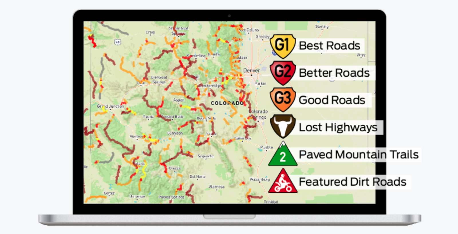
Source: Rever
Scenic: Discover the Road Less Traveled
Key Features:
- Curated scenic routes optimized for motorcycles
- Robust offline map access for remote areas
- Points of interest specific to bikers (e.g motorcycle-friendly stops, viewpoints)
- Route sharing and community recommendations
Usability:
Scenic’s user-friendly design focuses on helping bikers discover and navigate picturesque routes with ease, even without an internet connection.
Accuracy:
Highly accurate with a focus on scenic and enjoyable routes, with regular updates to ensure accuracy
Source: Scenic
The Best Offline Maps For Walkers
Whether you’re exploring urban trails or venturing into remote wilderness, these apps will help you stay on track without an internet connection:
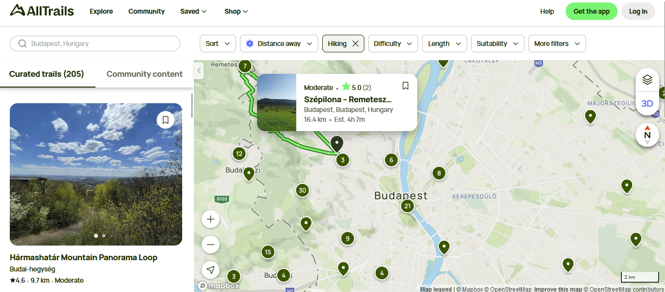
AllTrails: For the Trail Explorer
Key Features:
- Vast library of 400,000 trail maps worldwide
- Detailed offline maps with elevation profiles
- User-generated reviews and condition updates
- Custom route creation and recording capabilities
AllTrails is perfect for hiking and walking, offering detailed offline maps with trail information and user reviews.
Usability:
Perfect for hiking and walking, AllTrails is user-friendly with a focus on trail details, difficulty levels, and reviews. The app is made for both daily walkers and regular hikers.
Accuracy:
Highly precise trail trail maps, enhanced by user-submitted data and regular updates.
Source: AllTrails
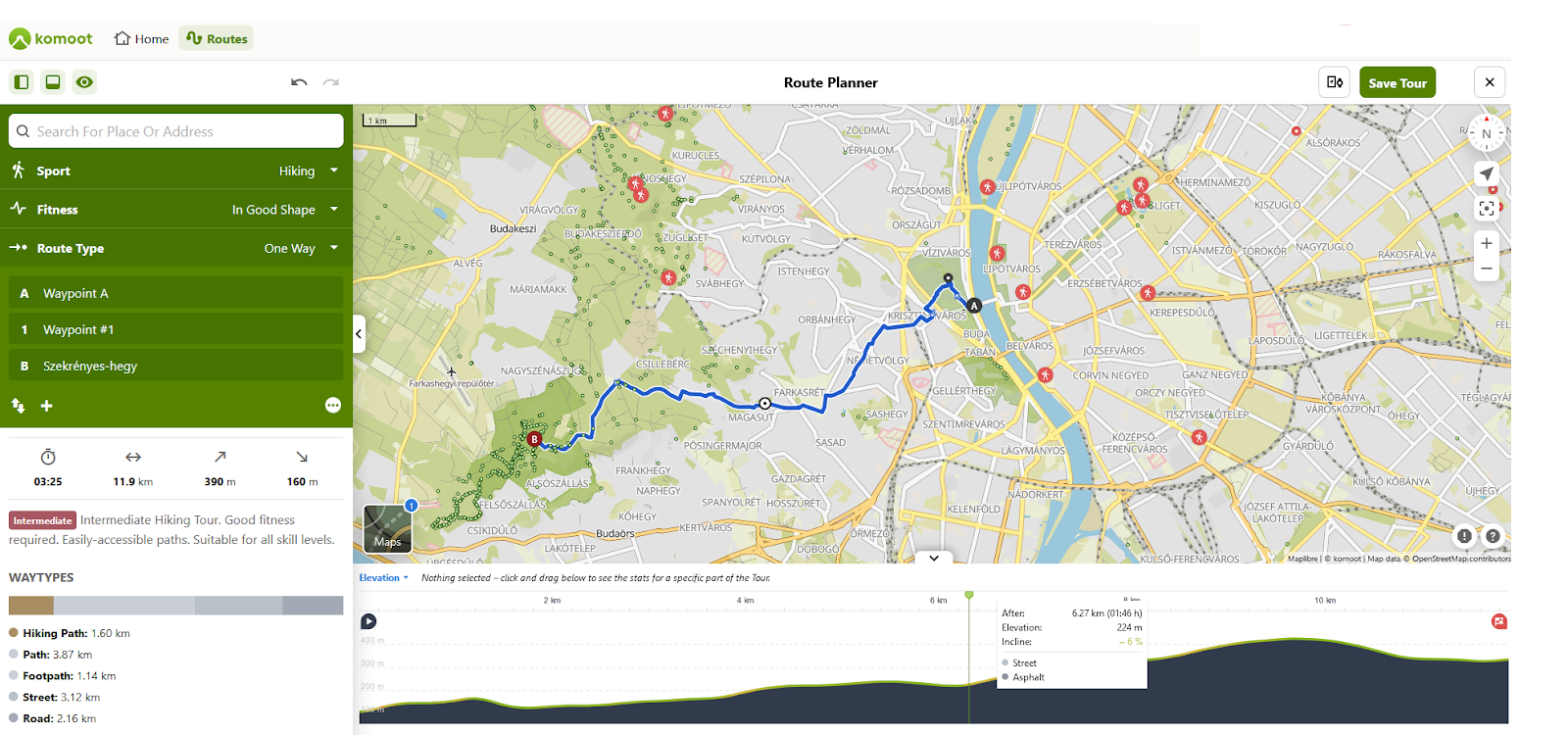
Komoot: The All-Terrain Navigator
Key Features:
- Detailed offline maps for hiking and walking with terrain and surface information
- Sport-specific route planning with turn-by-turn voice navigation
- Personalized route suggestions based on fitness level and preferences
- Community tips, highlights, and route sharing capabilities
Usability:
In addition to cyclists, Komoot is great for walkers and hikers. It’sasy to use with detailed route planning and offline capabilities for both beginners and experienced hikers.
Accuracy:
Accurate with detailed trail and walking route information thanks to OpenStreetMap data and community contributions Komoot’s sport-specific routing ensures accurate suggestions for walkers and hikers.
Source: Komoot
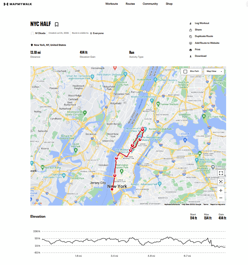
MapMyWalk: Fitness Meets Navigation
Key Features:
- Route tracking and offline maps for walking and hiking
- Integration with fitness tracking and goal setting
- Community-shared routes and challenges
- KML export for Google Earth visualization
Usability:
MapMyWalk offers an intuitive interface that combines navigation with comprehensive fitness tracking features. It’s particularly useful if you’re looking to monitor your progress and set fitness goals.
Accuracy:
Accurate for route tracking and distance measurement. The app’s GPS tracking ensures accurate stats for your walks and hikes.
Source: MapMyWalk
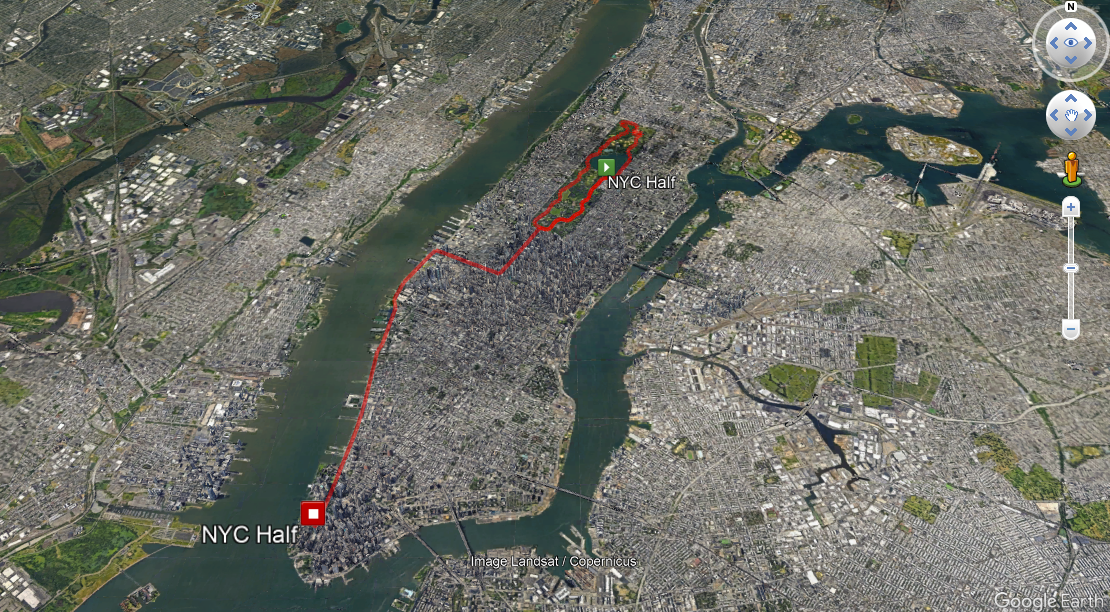
KML route in Google Earth
Navigating the Future: Offline Maps for Every Adventure
Offline map applications are essential tools for anyone needing reliable navigation without constant internet access.
Whether you’re a diver, a tourist wandering new streets, a cyclist exploring new trails, a motorcyclist cruising scenic routes, or a walker navigating nature’s paths, there’s an offline map app tailored to your needs.
These digital tools offer more than just directions, they provide peace of mind, enhance safety, and open up new possibilities for exploration.
We hope this guide has helped you to compare features, usability, and accuracy—so you can choose the best app for you.
What apps do you use in your daily life? And what features do you appreciate the most? Tell us in the comments
Read more about navigating apps in Top offline GPS navigation apps to download before your next road-trip.
Did you like the article on Offline Map Apps? Read more and subscribe to our monthly newsletter!


#Contributing Writers

Next article
Maps have long been more than just tools for navigation; they are windows into the world’s history, culture, and artistic expression. From the meticulously crafted maps of the Renaissance to contemporary digital masterpieces, maps offer a unique blend of utility and beauty. This article explores the aesthetic elements that make maps captivating, showcasing a curated selection of historical, artistic, and modern digital maps.
Historical Maps Considered as Works of Art
Historical maps are a testament to the craftsmanship and artistry of past cartographers. The David Rumsey Historical Map Collection is a treasure trove of over 132,000 maps, including rare and beautifully detailed works from the 16th to the 21st century. These maps not only chart geographical knowledge but also reflect their times’ artistic styles and cultural contexts.
Browsing through collections of Old World maps reveals the extraordinary craftsmanship of early cartographers. Additionally, interactive globes featuring old-style maps offer a glimpse into historical geography in a dynamic way.
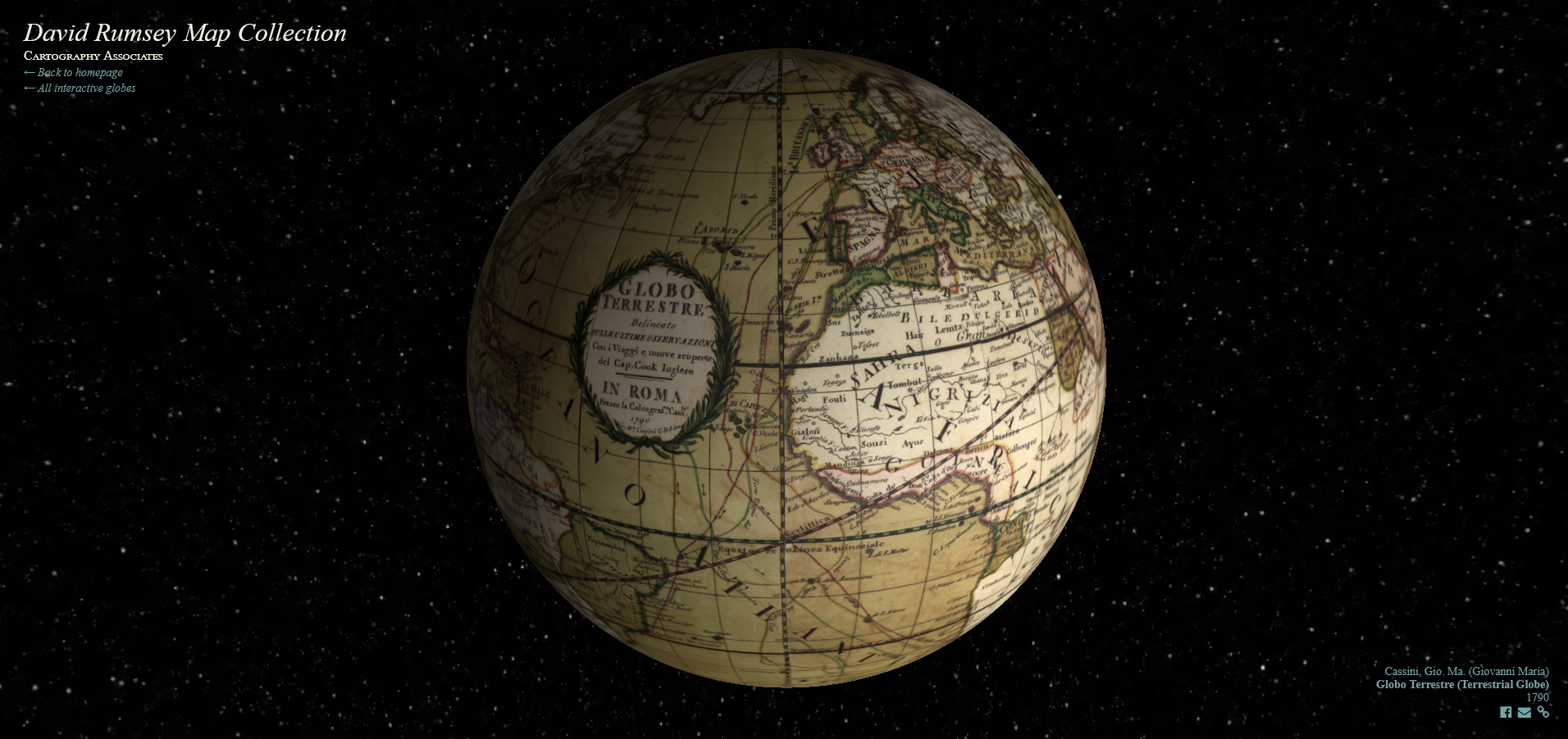
Source: David Rumsey Map Collection
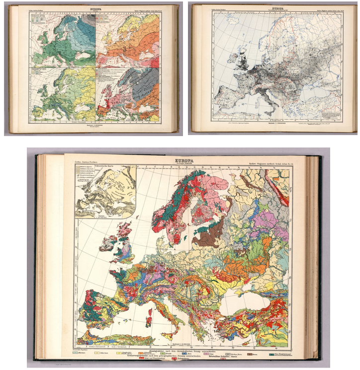
Atlas Map of Europe, 1940. Source: David Rumsey Map Collection
The mozaic of labels. Source: David Rumsey Map Collection
Map of the canton of Zurich completed in 1667. Source: David Rumsey Map Collection
The Timeless Artistry of Historical Cartography
Cartographic designs in the past were often considered works of art, celebrated for their intricate details, aesthetic beauty, and the skilled craftsmanship of the cartographers.
The advent of digital technology has ushered in a new era for these cartographic treasures. Today, these masterpieces can be preserved in digital form, ensuring their longevity and accessibility for future generations. This digital conservation effort safeguards not only the physical integrity of these maps but also the rich historical and cultural heritage they embody.
Thanks to the internet, anyone can now browse through these stunning historical maps, appreciating their artistic value from anywhere in the world. From the comfort of their homes, enthusiasts and scholars alike can explore intricate details and peer through a window into the geography of bygone eras.
Map of Algérie, Cap de Fer, 1928. Source: http://igrek.amzp.pl/
Lativian map of Daugavpils, 1924. Source: http://igrek.amzp.pl/
The Evolution of Cartography: Works of Art to Modern Precision
The art of mapmaking has undergone a remarkable transformation, transitioning from ornate works of art to accurate digital representations. This evolution reflects the changing needs of society and the advancements in technology that have revolutionized the field of cartography.
In centuries past, mapmakers were as much artists as they were geographers. Historical cartographers like Blaeu and de Wit were not only skilled craftsmen but also artists who infused their work with creativity and attention to detail.
The creation of beautiful maps requires a blend of technical skill, artistic talent, and a deep understanding of geography. Mapmakers, or cartographers, are often driven by a passion for exploration and a desire to convey complex information in a visually appealing way.
As technology advanced, the focus of cartography shifted from artistic expression to precision and functionalism. Modern cartography embraces digital tools and techniques that prioritize accuracy and accessibility.
Geographic Information Systems (GIS), Global Positioning Systems (GPS), and satellite imaging have become integral to the mapmaking process, allowing for unprecedented levels of digital and real-time updates.
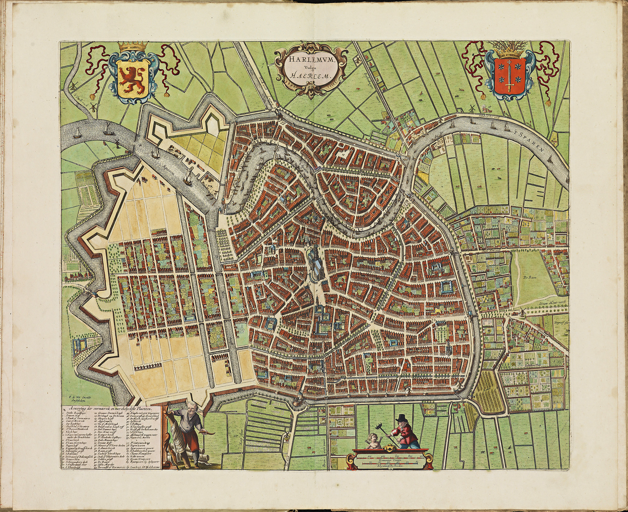
City Atlas De Wit Haarlem, 1698. Source: kb.nl
Today, cartographers continue to push the boundaries of the field, using digital tools to create maps that are both functional and beautiful.
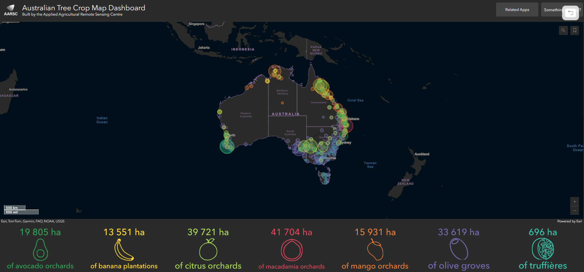
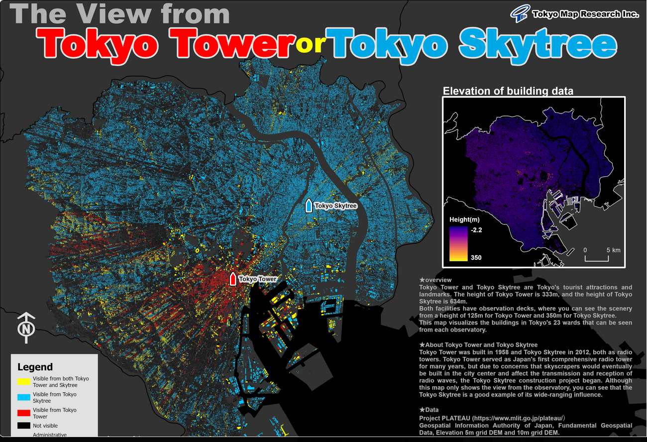
The Esri Map Gallery stands as a testament to this evolution, showcasing innovative maps created by a global community of GIS professionals. These maps leverage advanced technology to produce visually stunning and informative data representations, making complex information accessible and engaging.
The gallery features a diverse array of thematic maps covering topics such as climate change, urban development, and population demographics. Each map not only conveys essential data but does so with a high degree of aesthetic appeal, demonstrating that modern cartography can be both informative and visually captivating.
The dedication to preserving and advancing the art of mapmaking is evident in collections, where cartographers and historians work together to digitize and share rare maps with the public. This passion ensures that maps remain a vital part of our cultural heritage and a source of inspiration for future generations.
Source: Esri Map Gallery
Source: Esri Map Gallery
Maps are going viral!
Maps are gaining significant popularity on social media platforms, particularly Instagram.
The visual nature of cartography lends itself well to Instragram’s image-centric platform, allowing map enthusiasts and creators to share visuals with a wide audience.
We had a browse and discovered beautifully designed maps and cartographic designs. Here are the most active Instagram profiles that are worth following if you’re interested in the beauty of maps.
Most active Instagram profiles focused on cartography
Modern cartography
Maps are more than just tools for navigation; they are artistic expressions that capture the imagination and convey rich stories about our world.
From the details of historical maps to the innovative designs of modern digital creations, maps continue to fascinate and inspire. Historical maps offer a window into the past. Each map tells a story of exploration, discovery, and artistic expression.
These cartographic designs, once solely available in paper form, have transformed into digital formats, allowing for broader accessibility and preservation.
Today, thanks to digital technology, these maps can be recorded and browsed online, ensuring their beauty and historical significance are appreciated by future generations. As we move further into the digital age, the art of mapmaking will continue to adapt and thrive, promising new ways to visualize and understand our world.
Did you like the article? Read more and subscribe to our monthly newsletter!

