
Geoawesomeness celebrated its 10th anniversary earlier this year and we believe it’s time to (re)envision the future of the Geospatial community! We are thrilled you’re considering working/volunteering with us. You’ll be joining a friendly, fun, innovative, and inspiring global community.
Over the past decade over 150 authors with diverse educational, cultural and linguistic backgrounds have volunteered their time and shaped the blog to what it is today – an open and global platform that connects the geospatial community and aims to tell the story of geospatial data and tools are transforming the world. This shared passion for all things location is what unites this diverse group of people.
Contract work
- Web developer and Digital designer: Help redesign the website and our logo. A creative brief with estimated budget is available for review. If you are interested, please reach out to us via email (info@geoawesomeness.com) by 25th November.
Join the team
Not a web developer? Here are other ways in which you can contribute to our global community.
- Blogging and content writer
- Local meetup organiser (1st chapter already up and running in Munich, Germany)
- Video content creator and editor
- Community forum moderator
- Advisory and Steering Committee
- Geospatial for good Outreach Coordinator
What does Geoawesomeness offer?
- A global platform to showcase your personal expertise and passion for geospatial.
- Opportunity to network and connect with members of the geospatial community.
- Take Geospatial to the world – help tell the story of how geospatial data and tools are transforming the world for the better.
- A partnership for change – Do some real good by support organisations such as MapAction and Humanitarian OpenStreetMap.
- A Diverse, inclusive and open platform: geospatial cannot transform the world without all members of our community being a part of it.
If you are interested in joining the team or need more information, please do send us an email at info@geoawesomeness.com.
P.S: If you are a student looking to do a paid internship, please do mention that in the email.


#Featured


Next article
GIS helping with significant emissions reductions at the Oil and Gas Authority

Sounds counterintuitive right? How can the Oil and Gas Authority make any significant impact toward Net Zero 2050?
The UK is currently reliant on oil and gas for the majority of our heating and electricity needs and will retain some of that reliance for years to come while we transition to greener technologies. The OGA is working in a tripartite partnership with industry and government to improve production efficiency and reduce flaring and venting. Flaring volumes have decreased by 22% in 2020[1] from the previous year. Production efficiency is at a 16-year high of 80%[2]. A lot of the skills needed to explore and implement new technologies such as hydrogen and CCUS require not only the same skills that have enabled petroleum extraction, but also a lot of the same data.
The OGA became a government company in October 2016, its role is to work with industry and government on the economic recovery of UK oil and gas and support the UK government in its drive to reach net zero greenhouse gas emissions by 2050. It does this by a combination of influencing and regulating.
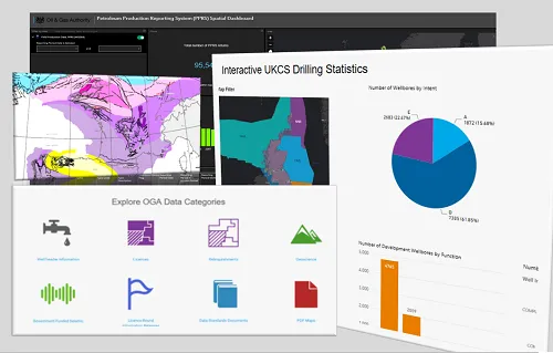
The GIS team at the OGA work on two fronts: they provide vast and varied amounts of data to the wider world through their Open Data site and they help internal users make better decisions, often around emissions reduction or CCUS siting.

The OGA make GIS data available through the OGA Open Data site
Recently the OGA worked with The Crown Estate and Crown Estate Scotland to build an application that collated an up-to-date picture of all energy leases on the UK Continental Shelf. Though simple in technical terms, this app had a major impact, bringing together data in a way that was previously out of reach to many of its users. This app allows for the planning of, for example, reuse of infrastructure for green technologies and the electrification of oil and gas platforms (which reduces their emissions) by sourcing energy from windfarms.
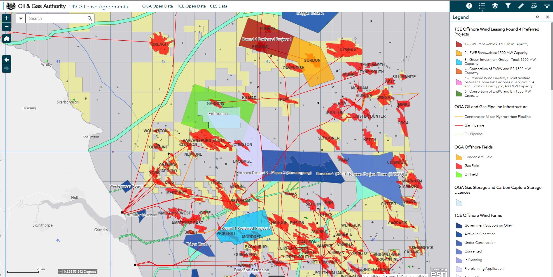
The OGA have collaborated with The Crown Estate and Crown Estate Scotland to produce the lease agreement application
The OGA also make available detailed historical daily production data for oil and gas reservoirs that have ceased production, providing experts with information needed to assess the suitability of a reservoir for carbon storage.
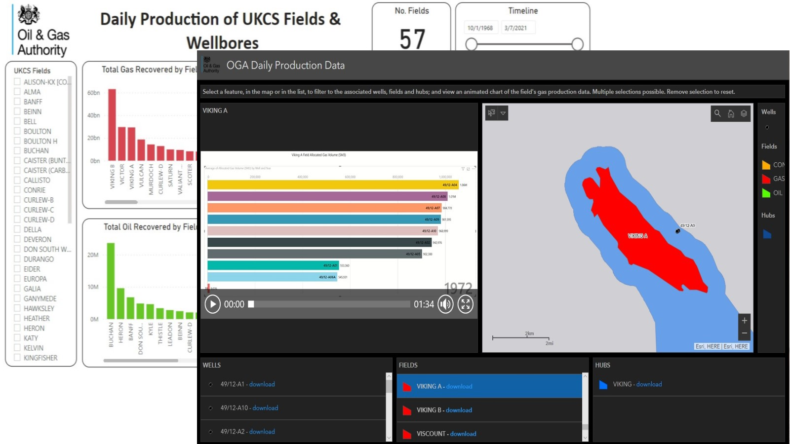
Daily well production data can assist in the identification of potential carbon capture and storage (CCS) sites
Most importantly, the OGA GIS team work to collaborate with other organisations, finding efficient ways to share information, such as through APIs to provide the joined-up picture required for decision makers to find opportunities that drive efficiencies and revolutionise the energy supply for the UK.
[2] https://web.archive.org/web/20220101190524/http://www.ogauthority.co.uk/media/7141/ukcs-a5-overview-final_web.pdf

