#Business #Featured

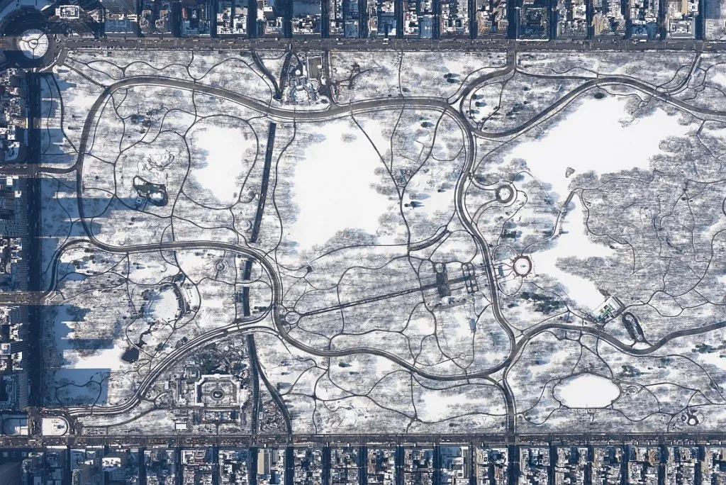
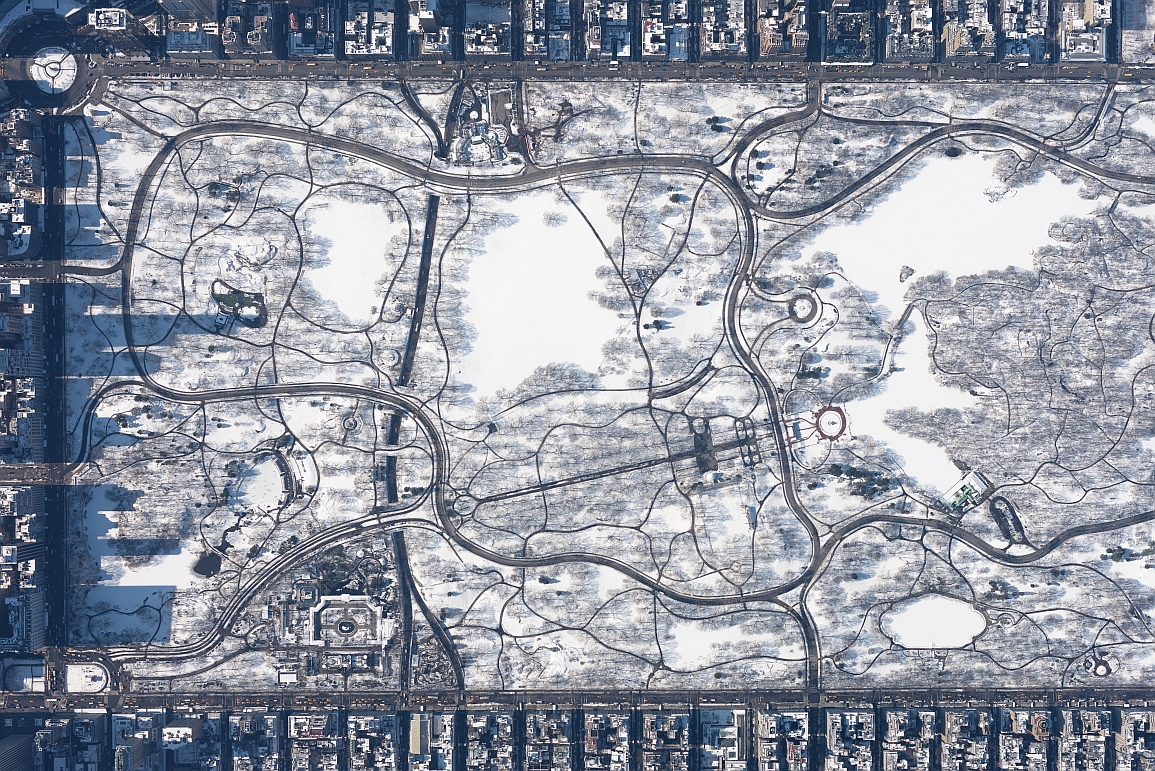
This amazing aerial footage of snowy Central Park won 2016 Sony World Photography Awards

© Filip Wolak

© Filip Wolak

This amazing aerial footage of Central Park covered in snow won 2016 Sony World Photography Awards in the architecture category. The photo has been taken by a Polish photographer Filip Wolak from 10,000 feet above the New York city.

It was one of those brisk wintery days in March 2015. Everyone was already tired of the long and tough winter here in the north east. Amazed by how clear the day was I took my Cessna above New York’s restricted airspace, which gave me a full freedom to roam. The winds were quite strong that day with no haze and unlimited visibility. With a bit of planning (and luck) I was able to capture perfect shadow alignment along the avenues – I had only one chance to capture – they were shifting fast.

The bar for drone photographers is now set high. Literally.

Say thanks for this article (0)
The community is supported by:
Become a sponsor
#Business
#Business #Environment #Ideas #Satellites
China’s Smart Agriculture Boom Has Tech Potential but Requires Affordable Solutions
Nianhua Liu 05.9.2024
AWESOME 3
#Business #Featured
The Earth Observation Hub Report: 2024 Industry Trends and Analysis
Avatar for Muthukumar Kumar
Muthukumar Kumar 03.13.2024
AWESOME 4
#Business #Featured #GeoDev
Geo Addressing Decoded, Part 3: Diving into the Key Features of Precisely’s Geo Addressing System
Aleks Buczkowski 06.29.2024
AWESOME 4
Next article
#Ideas

Sound and the city. How can you map sounds?

Chatty map of sounds - Geoawesomeness

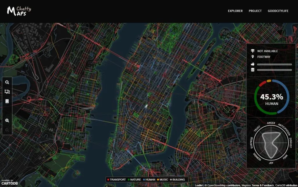
Visualizing geotagged data can reveal a unique spatial pattern that might allow you and/or decision makers to make choices based on knowledge. We’ve seen maps of different phenomena like diplomacy networks, human activity, the age of buildings, adultery, or even sights of Virgin Mary. But how can one map sounds of a city?

The most straightforward approach would include listening to urban sounds, measuring and interpreting it but the scale of that kind of project would make it hardly doable. Another approach that has been implemented a few months back by Trulia, includes mapping noise complaints.

SoundWheel-582x437

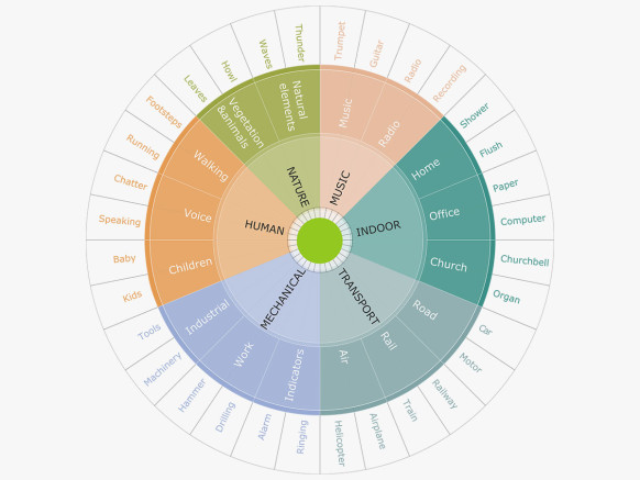
The new project called Chatty Maps looks at the same topic from a different angle. The maps were created by mining Flickr for geo-tagged images containing sound-related words. The researchers started with creating a library of sound-related words which they were looking in the description of photos. These words are taken from Freesound, the largest crowdsourced online repository of audio samples and then categorized into six types: transport, nature, human, music, mechanical, and indoor sounds.

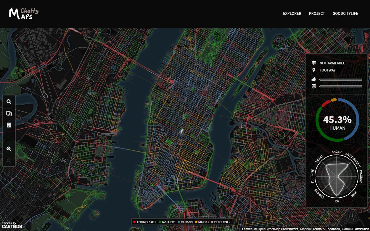
Chatty map of sounds 2 - GeoawesomenessEach of the street on the maps is colored according to what kind of noise is mostly associated with it. Blue means human-related sounds, red stands for transportation, green for nature, yellow for music, and gray for construction. When you click on a particular street, you get its sound profile. Everything is nicely done in CartoDB.

For now, the maps are available for New York, San Francisco, Chicago, Boston, Washington, Miami, Seattle, London, Barcelona, Madrid, Milan, and Rome.

Cool project.

Read on
Search