#Ideas

This stunning map shows the world’s shipping routes

Shipmap.org is an amazing mapping project that visualizes the movements of the global merchant fleet over the course of 2012, overlaid on a bathymetric map.
Once you hit the play button the journey begins. The animation and audio guide will take you to an interesting tour explaining some of the patterns that can be observed on the map. Try it out:

The map is based on the exactEarth for AIS data (location/speed) and Clarksons Research UK World Fleet Register (static vessel information) that features information like engine type and hull measurements. With this information it was possible to compute the exact CO2 emissions.
Really interesting project.
Say thanks for this article (0)
The community is supported by:
Become a sponsor
#Ideas
#Fun #Ideas
The Geo Geek Gift Guide: 10 Unique Ideas for Every Geospatial Enthusiast
Sebastian Walczak 12.9.2024
AWESOME 2
#Ideas #People #Satellites #Science
AI Assistance in Creating 3D City Visualizations
Sebastian Walczak 04.12.2024
AWESOME 1
#Contributing Writers #Fun #Ideas
From Digital Footprints to Urban Intelligence: Leveraging Public GPS Traces
Sebastian Walczak & Nikita Marwaha Kraetzig 07.25.2024
AWESOME 1
Next article
#Business #Featured #Ideas

The good news of Open data and OpenStreetMap Evangelization


The Greek word εὐαγγέλιον (evangelion) originally meant a reward given to the messenger for good news (εὔ = “good”, ἀγγέλλω= “I bring a message”). In modern days, it actually refers to promoting ideas with actions, events and other socio digital schemes to spread the word about a new path breaking discovery, platform or app.
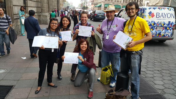
Volunteered (or participatory) Geographical Information is one of that good news. It is a recently coined term to define the use made of wikis, social networks and other platforms in order to create, gather and disseminate openly geographic information provided voluntarily by individuals. Many platforms, like Open Street Map (OSM), Crisis Mappers, gv SIG or Mapbox, allow users to create openly and discuss collaboratively to share their own contents and problems through the geolocation of features that are not initially shown in classical official maps or census cartography.

The most faithful community around a platform is that one from OSM, with more than one million users and 18 million edits. Their gospel goes beyond merely advocating against legal or technical restrictions to prevent others from using geo data openly. It commits to ground truth militancy, allowing us all to collect and use geo data for the common good of all in society. They usually demonstrate that sharing their faith with open mapping nonbelievers can be intimidating and difficult, but also incredibly rewarding.

There is a whole new generation of NGOs and initiatives evangelizing with innovative programs helping to promote OSM and teaching it to converted mappers. Programs like MapGive, Stats UP from GeoCensos community, Youth Mappers and School of Data show how well the contagion of evangelization is working for Open Street Map. The good news is here to stay.

As any kind of “announcement of the good news”, evangelizing on OSM needs to be carefully analysed, planned and launched to be effectively introduced to new enthusiastic users. A well thought and packed program can assure OSM – or any other platform for what it matters – attractiveness to the entire proprietary and open mapping ecosystem; i.e. official cartographers, statistical and cartographic offices, universities, humanitarian NGOs, local government and advocacy communities among many others.

Let’s see what each of these OSM evangelion promoters do, who they target their efforts to and how they do it:

Map Give @mapgive

It’s a U.S. State Dept initiative, with several (global) ways to involve initiated mappers in OSM for humanitarian aid and other crowd-sourced mapping initiatives. They invite to make contributions just using an internet connection and basic computer skills, even if not living in the mapped area. They introduce to the use of OSM through three simple steps: 1) Setting an account 2) Walking the user and making him practice throughout the complete open mapping process 3) Offering a suitable project to work on. They have roadtriped in several underdeveloped countries, setting challenges to attendants interested in collaborating with crowsourced projects.

Stats UP @geocensos

It’s a GeoCensos Foundation initiative from Colombia, aimed to National Statistics Offices in Latin America setting a program targeted to young social entrepreneurs offering support for the creation of geo start-ups in developing countries. The strategy proposes both to open and to use geo data currently available in public organizations and national statistical offices. Contents include a) Induction to GeoData Revolution and the role of the Data Scientist b) GeoData Management and Analysis tools, Cross Learning with demographers and statisticians c) Opening protocols and techniques for GeoData d) Ethical and Advocacy principles in Social StartUps.

Youth Mappers @ youthmappers

It’s an initiative founded by Texas Tech University and George Washington University targeted to students willing to map their own surrounding territories. It works by university chapters and provides advice about how to set one up. The academic institutions of approved groups automatically become part of the MappersU , a university level consortium. By joining the Youth Mappers network, members share ideas and results of mapping efforts learning from other linked communities. Not binded to Open Street Map but promoting it, they propose five increasingly visible steps: 1) Learning how to use geospatial data 2) Mapping the local environment 3) Organizing events and group activities and 4) Exchanging with other chapters in the world and finally, 5) Sharing the geo data solutions attained.

School of Data @schoolofdata

It’s an Open Knowledge initiative that works as a network of data literacy practitioners, both organisations and individuals, implementing training and other data literacy activities in their respective countries and regions. Lead among others by SocialTIC, members of the School of Data work to empower civil society organizations (CSOs), journalists, governments and citizens with the skills they need to use data effectively in their efforts to create better, more equitable and more sustainable societies. It hasn’t a OSM specific program, but it does promote its use.

GeoCensos Foundation is an officially registered NGO from Latin America and the Caribbean that promotes innovative projects in geospatial disciplines and Earth sciences. @geocensos info@geocensos.com fb / geocensos

Read on
Search