#Business

Satellite images turned into… carpet maps

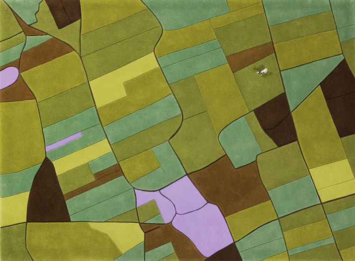
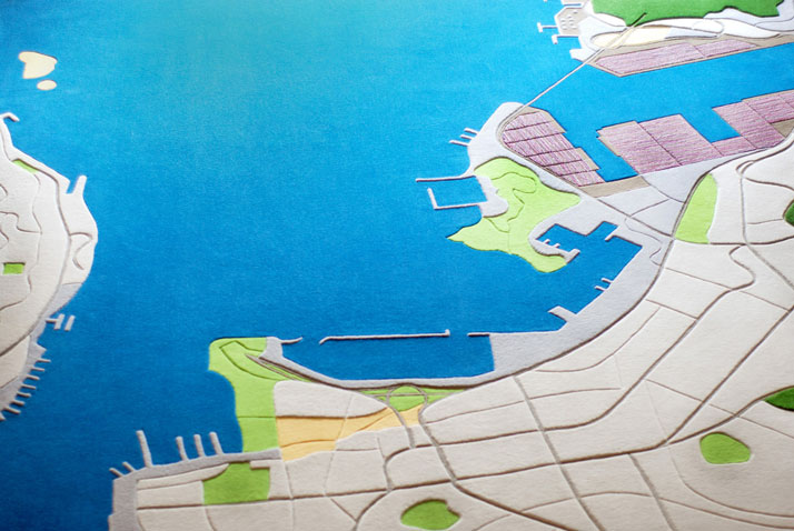
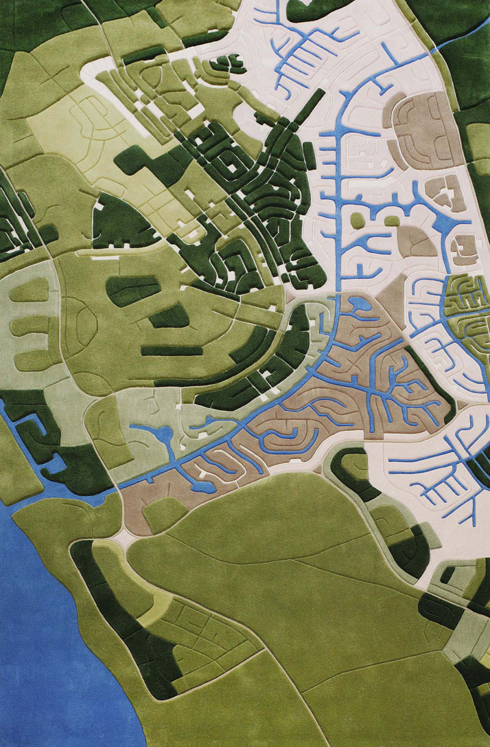
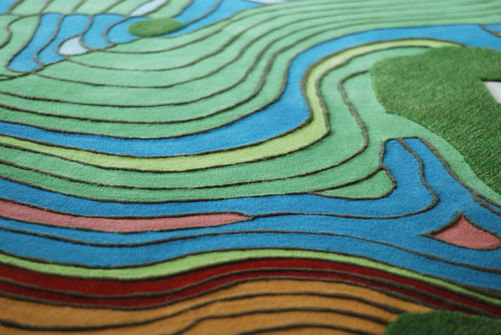
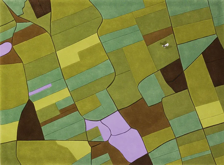
One of the most crazy but somehow inspiring projects I heard about. Austrian artists Florian Pucher (currently based in Shanghai) takes satellite images and uses them as model for a custom-made “Landcarpets”. Originally trained as an architect, the designer began making these carpets back in 2007 in collaboration with graphic designer and business partner Sophia Liu Bo.

To create a carpet they take aerial images and then redraw them, focusing on the typical characteristics of the area the image depicts. They use wool of different thicknesses to represent the lands of selected area to create a sculptural quality that recalls an actual landscape. The effect is wonderful but not cheap. The cost for their pre-made designs like the U.S. and Europe starts from $1,200 up-to $2,100 depending on size but if you’re willing to pay a bit more they’ll make an exclusive rug based on your favorite place.

USA

Shanghai

Shanghai

bahamas

Bahamas

China

China

source: Florian Pusher

Say thanks for this article (2)
The community is supported by:
Become a sponsor
#Business
#Business #Events #Featured
The Future of Navigation: How Satellite Data Shapes Map Innovation
Avatar for Muthukumar Kumar
Muthukumar Kumar 10.29.2024
AWESOME 1
#Business #Featured #GeoDev
Geo Addressing Decoded Part 2: Beyond Coordinates – Exploring the Depth and Impact of Geo Addressing
Aleks Buczkowski 05.2.2024
AWESOME 4
#Business #Featured #GeoDev
Geo Addressing Decoded, Part 4: Exploring the Applications of Geo Addressing Solutions
Aleks Buczkowski 06.25.2024
AWESOME 2
Next article
#Business

Russian Activists Used GPS Devices To Track…. Their Poop

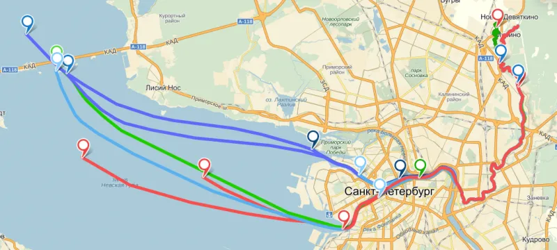
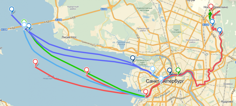
For some time citizens of St. Petersburg have sniffed with suspicion at the waterways. The smell of poop was coming from a river flowing from a little town called Novoye Devyatkino (a suburb about 15 km outside the city) and it flows into the Neva – main river of St. Petersburg. The local government did not seemed to be interested in the problem.

A group of St. Petersburg ecologists decided to conduct a test. They’ve bought ten miniaturized, waterproofed GPS-tracking units and dropped them down the toilet of a single apartment home in Novoye Devyatkino. They were very surprised when they found out that the trackers spilled out directly into the open-air waterways outside the building, without encountering even the most basic sewage filtration. From Novoye Devyatkino, five of the devices reached the open waters of Neva Bay, where the units’ batteries died.

Poop tracking Geoawesomeness

The group said that they used cheap Chinese-made GPS/GLONASS units, which they enclosed in small waterproof containers. The containers were each filled with a small air bubble, to make them float. Each unit was also covered in a salt mixture, which allowed the devices to sink initially. After that mixture dissolved, the trackers began floating again, making it possible to emit a signal. The ecologists say the units’ batteries are set to economize power, sending a single signal once an hour.

Interesting way to use location-based technologies to prove a point to authorities. Will it bring any results? We don’t know but we keep our fingers crossed.

source: Global Voice Online

Read on
Search