
We’re thrilled to announce the launch of our new brand identity, marking an exciting chapter in our journey!
Our name refresh
For years, we have dedicated ourselves to telling the stories of the people dreaming up geo-innovations to study and navigate our planet—fueled by a passion for all things location. Now, we’re embarking on a new chapter.
Introducing: Geoawesome. A small, yet mighty step for geo-awesome-kind.
Geoawesome is more than just a name change. It’s a renewal of our unwavering dedication to bringing ideas, stories, people, and projects together. Our vision has always been to foster an open community that everyone is able to join, contribute towards, and feel heard.
This rebrand has been a process. In the works for over a year, we released our refreshed logo in 2022, and are finally excited to officially announce our name change and much more.
Going forward, we want to build on our 13 years of storytelling by inviting our readers to take part.

Collaborative storytelling
Enter the era of collaborative storytelling: our ethos centers around both authors and audiences telling stories. From geospatial giants and savvy startups to data science students and Earth observation researchers— our vibrant community collectively crafts, shares, and consumes stories.
Right now, the industry is in a state of flux. There are so many challenges that need to be first, talked about, then solved.
We encourage this collaboration between the community and industries to address issues surrounding geospatial technologies. Whether through conversation at events or from questions in interviews, we pride ourselves on creating an environment that allows curiosity-driven discussions to take root, grow, and flourish.
This cross-pollination of ideas and perspectives drives conversations and collaborations and, in turn, leverages geospatial data, tools, and expertise.
Join our circle of industry partners
So, if you’re a geospatial company, we want to hear from you! We know it’s hard to inspire people about your brand when you’re the one telling them about it. That’s where we come in.
Brands both big and small rely on Geoawesome to get the message across to the right audience. We’re looking for geospatial organizations that want to amplify their own efforts while connecting with the geospatial community you’re looking for.
Be a part of the Geoawesome experience. Contribute your stories, insights, and expertise by pitching articles or partnering with Geoawesome to connect with the community on the geospatial topics that matter most.
Key elements of our rebranding include:
- A bold, modern logo released already, capturing the essence of Geoawesome
- Refreshed offerings and services for industry partnerships
- A renewed focus on fostering strong industry partnerships and collaborations to drive community and connection e.g. reports, events, featured articles, etc
- A rebrand video reintroducing Geoawesome to the world.
- A new editorial series called Geoawesome Maps of the World – a curated collection of the most awesome maps of the world from a geospatial perspective
- A new video series, You Are Geoawesome, showcases the innovative work and inspiring stories of companies and individuals in the geospatial industry through micro-interviews.
- Calls for contributing writers to pitch topics, spotlight changemakers, and express opinions
Here’s to the future
Thirteen years on, our enthusiasm for the future of geospatial technology is as vibrant as ever! Our recent rebranding has infused us with renewed energy and sharpened our focus on driving innovation in the geospatial field while deepening our commitment to our community. We’re excited to embark on this next chapter together, pushing the boundaries of what’s possible.
Don’t miss the latest news! Read more and subscribe to our monthly newsletter!


#Featured

Next article

Google Maps has long been a leader in digital navigation, offering directions and location insights to users worldwide. In 2023, Google introduced several new features that use geospatial technology and artificial intelligence to improve user experience. These updates not only support existing services but also introduce new abilities that promise to change how we interact with our environment.
Immersive View for Routes
One of the most notable introductions is the Immersive View for Routes. Developed in major cities, this feature allows users to visualize their entire journey in a dynamic, three-dimensional space. By combining AI with extensive Street View and aerial photography data, Google Maps can now provide a detailed, photorealistic preview of travel routes.
This 3D visualization is particularly useful for planning as it includes real-time elements like traffic conditions and weather forecasts. Users can simulate different departure times to see how conditions change, making it easier to plan trips efficiently. For cyclists and pedestrians, this feature enhances safety by allowing them to familiarize themselves with the route details, such as turns and landmarks, before heading out.
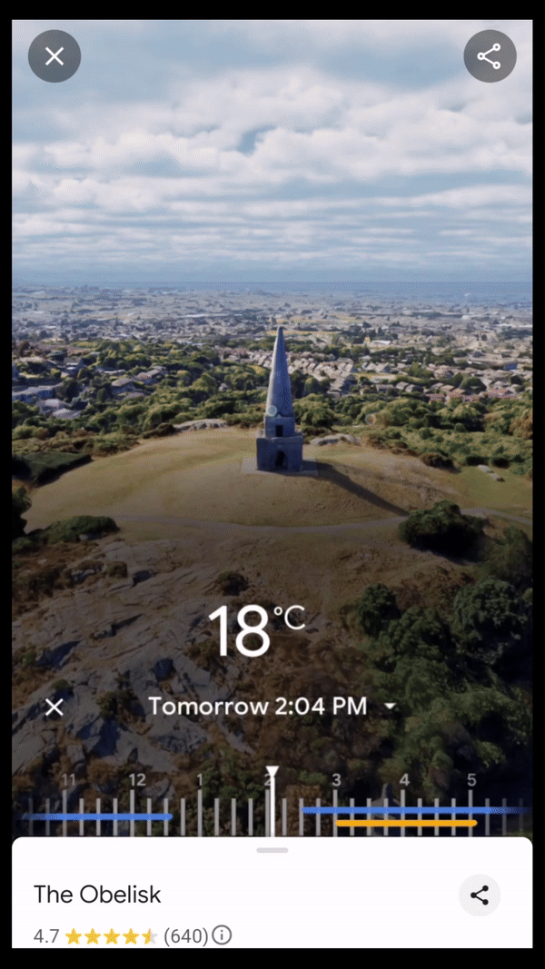
Immersive View, Dublin
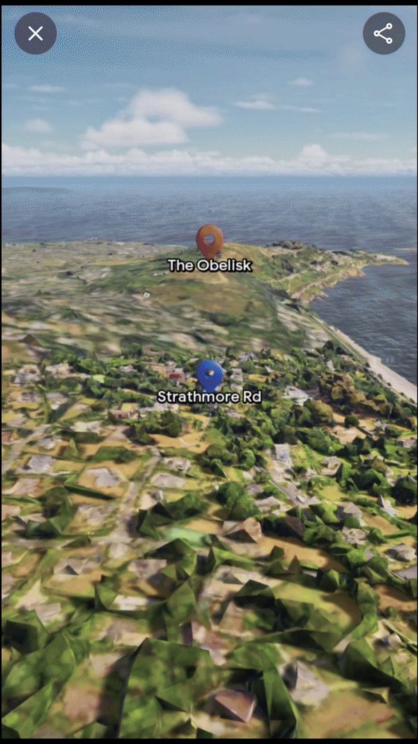
Immersive View for Routes, Dublin
Google Maps’ Immersive View for routes transforms navigation by stitching together billions of high-resolution images from aerial surveys and Street View captures. The photogrammetric technique aligns these images with existing map data, creating a precise digital visual.
AI and machine learning then label critical route details like street signs and building entrances from these images. The transformation from 2D to 3D is achieved using multi-perspective aerial cameras, which accurately model terrain and building heights. This detailed 3D map allows for dynamic route visualization with camera movements that show both overarching route plans and close-up navigational tips. Real-time data overlays such as traffic conditions and weather are added, enhancing route planning. This integration of detailed visuals and real-time information is now enhancing navigational confidence for users in cities like Amsterdam, Dublin, New York, and Tokyo.
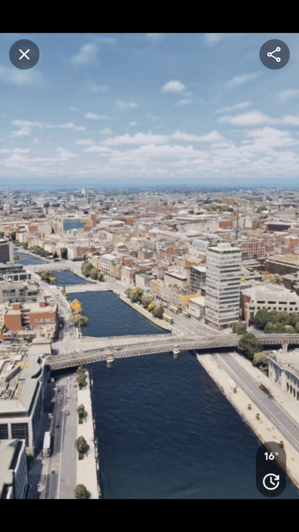
Immersive View for Routes, Dublin
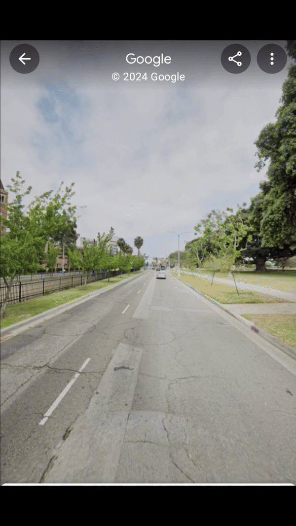
Fusion of StreetView and Immersive View, Los Angeles
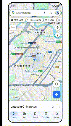
AR Possibilities with Lens in Maps
Lens in Maps, formerly known as Search with Live View, has expanded its functionality. Now available in over 50 new cities, this feature utilizes augmented reality and AI to help users quickly orient themselves in unfamiliar surroundings. By simply pointing their smartphone cameras, users can get real-time information about nearby places like restaurants, ATMs, and public transport stations. This instant data layer helps users navigate spaces more confidently and efficiently.
AR Lens, Tokio
Photorealistic 3D Tiles in Google Maps Platform
The launch of Photorealistic 3D Tiles marks a significant advancement in Google Maps’ possibilities. These tiles allow developers to create more engaging map experiences. For instance, real estate companies can use these tiles to show potential buyers detailed 3D models of properties and their surroundings, enhancing the buying experience by providing a more comprehensive view of the area.
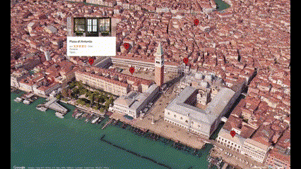
Source: 3d-tiles.web.app
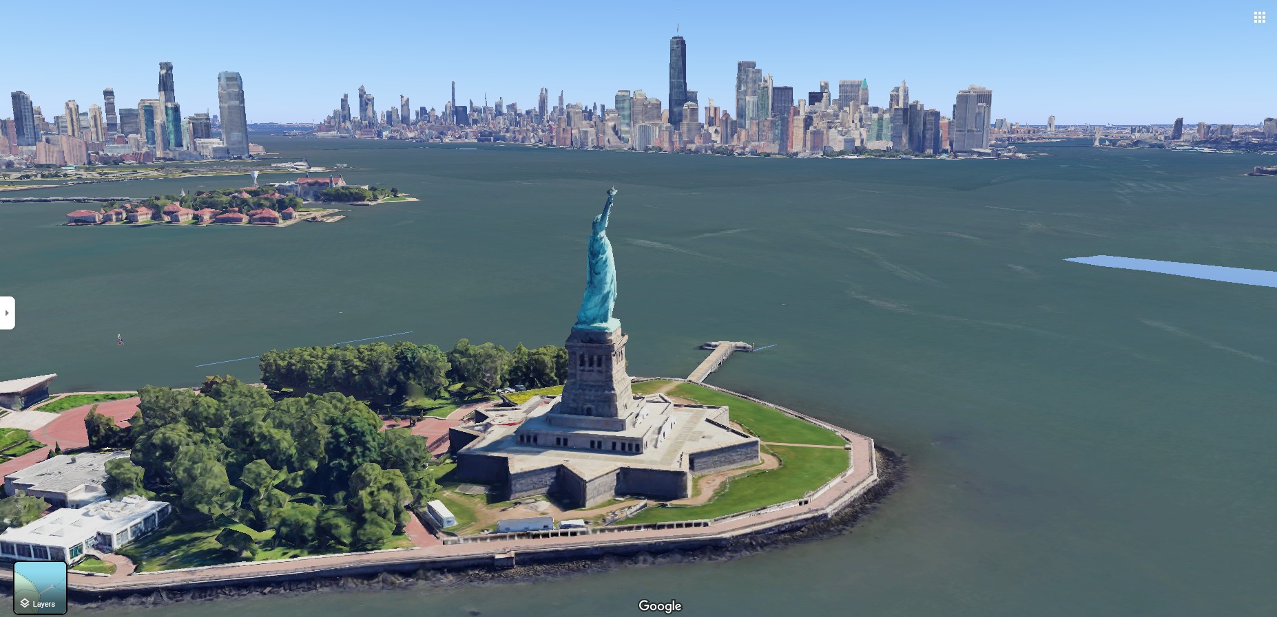
Example of 3D Tiles, New York
Example: The Importance of Vegetation in Prague, Czech Republic
Prague’s use of Google Maps’ 3D Tiles to study urban vegetation showcases the practical applications of these advanced geospatial tools. By analyzing 3D models of the city enhanced with data on existing vegetation, planners can assess the impact of green spaces on urban heat islands, air quality, and biodiversity. Such insights have a huge impact on developing strategies to integrate more green areas into urban planning, which can lead to healthier, more sustainable city environments.
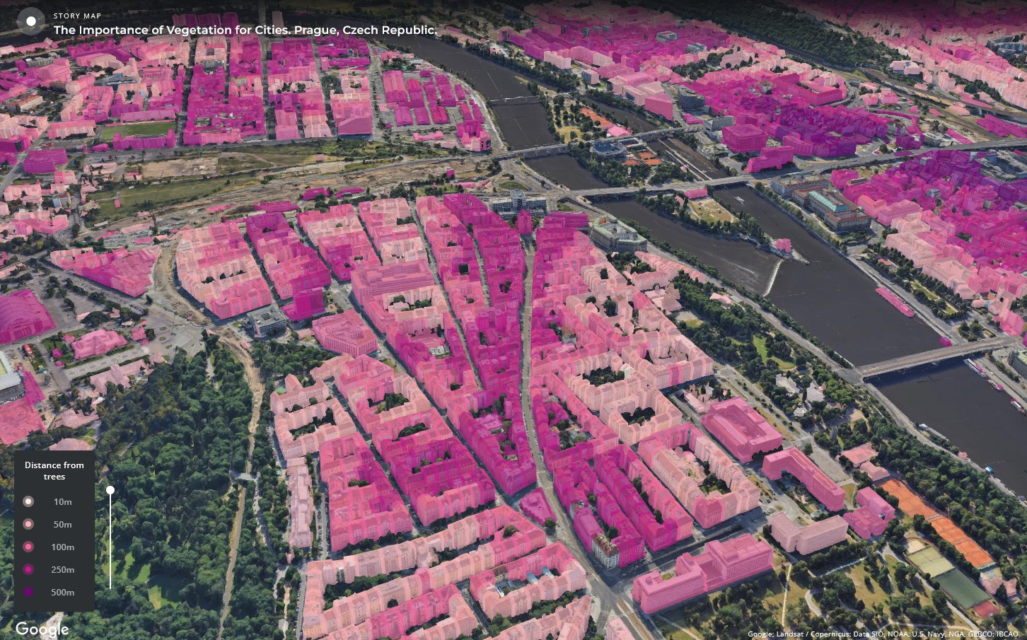
3D Tiles, Prague
Check out this project here: carto.com
Future Directions of Google Maps Features
These updates from Google Maps highlight the growing importance of geospatial technology in everyday applications. Google Maps continues to set the standard for digital mapping and navigation. Its latest updates, not only improve how we view and interact with our immediate environment but also offer tools that can help shape the future of urban landscapes worldwide. By integrating AI and 3D visualization, Google Maps is enabling more informed interaction with the places we live and visit.
Did you like this post? Read more and subscribe to our monthly newsletter!

