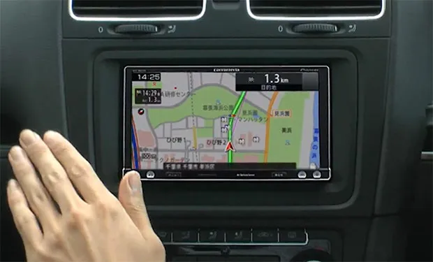


Pioneer has announced that its latest satellite navigation unit, called the Raku Navi sill include gesture-based control technology. The navigation system features an “Air Gesture Sensor” embedded in the seven-inch touch-screen. By simply holding your finger in front of the screen, the display is able to bring up a small overlay of the command buttons and location information. By moving your hand left or right, you’re also able to zoom in and out of the map. Although the gesture-controlled navigation provides quick access to essential information, it doesn’t entirely mean drivers can take their eyes off the road as a majority of commands still require to be accessed via the touch-screen. The price is expected to be around ¥125,000 (about $1,600). Pioneer really? Do you think it’s worth it?


#Ideas


Next article


Very nice app for Geo-Engineers and professionals on the move to quickly take a note, take a picture, all georeferenced, save and email it in Google KMZ format for later visualization on Google Map or Earth.
A cool smart dude Nike, studying environmental engineering at UC Berkeley developed this app with the help of his professor. An easy-to-use to use app that allows you take geo-located notes, attach photos and export in KMZ format.
Some other note-taking apps could offer some geolocation features, but they don’t have the capability to allow you visualize those notes on Google Earth. This app provides that capability, you take your notes, attach photos and export to KMZ for visualization on Google Earth.

Source: gearthblog.com, mediainstitute.edu

