#Business #GeoDev #Ideas

PathSense – new location API without GPS and battery drain

My-locationRecently I come around an interesting start-up called PathSense. It promises a precise positioning for location-based apps with 90% less battery drain compared to GPS technology. PathSense is a California-based start-up founded by Pete Tenereillo who is well know persona in location-based apps area. In 2007 he founded a Trapster –  navigation social networking app similar to Waze. In 2010 after growing to 10 million users the service has been acquired by NAVTEQ. Two years ago Pete gathered a team of engineers and PhD scientists out of Nokia/Here and Qualcomm Research and started to work on his project.

The idea was to develop a positioning technology which would solve the problem of battery draining by GPS-enabled apps (such as Trapster). After 2 years they developed and patented a technology which is based on inertial navigation, sensor fusion, predictive routing, and a proprietary learning engine. By eliminating GPS from the positioning engine it allows to significantly save smartphone’s battery. Pete Tenereillo commented:

GPS apps drain your battery. Anyone with a smartphone knows that. PathSense solves this issue by providing a GPS alternative. PathSense is a software developer kit for any iOS or Android app. It uses sensor fusion and inertial navigation to provide location accuracy comparable to, and often better than, GPS, with 90 percent less battery drain. Our customers are developers who need location in their apps, without battery drain — there are more than 500,000 of them. Starting today, developers can sign up for early access at our website.

Starting from this week the service is available as a beta SDK for iOS or Android apps. I believe that PathSense’s API is likely to raise interest of many app developers especially for precise background location which lacks the GPS accuracy. PathSense team presented their technology at DEMO conference last week. Check it out:

source:  Market Wired, GPS Business News

Say thanks for this article (0)
The community is supported by:
Become a sponsor
#Business
#Business #Environment #Ideas #Satellites
China’s Smart Agriculture Boom Has Tech Potential but Requires Affordable Solutions
Nianhua Liu 05.9.2024
AWESOME 2
#Business #Ideas
Urban Digital Twins in China: A Smart Gadget or a Decision Support Tool?
Nianhua Liu 03.28.2024
AWESOME 4
#Business #Featured #GeoDev
Geo Addressing Decoded, Part 3: Diving into the Key Features of Precisely’s Geo Addressing System
Aleks Buczkowski 06.29.2024
AWESOME 4
Next article
#Ideas #Science

HabitatMap & AirCasting: Internet of Things, Maps & Environmental Monitoring

One of the most famous applications of Geographic Information Science is the 1854 London Cholera Map by Dr. John Snow. A map that helped him figure out that Cholera spread through water. (How often does a map change the world). Interestingly, GI Science started off as an aid to a Doctor. GIS has come a long way since those days. Here is an interesting example of how GI Science in its version 2.0 is helping understand the impact of the environment on our health.

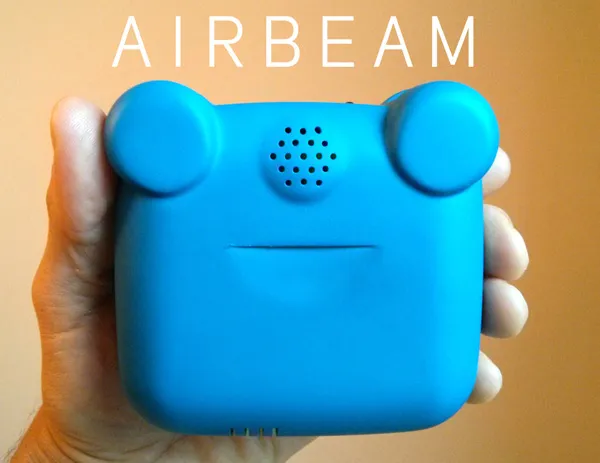
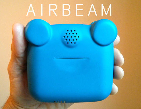
HabitatMap, a non-profit, environmental justice group based out of New York, utilizes online maps and social networks to raise awareness about the impact the environment has on human health. 3 days ago, they successfully crowd funded (via KickStarter) their new $200 wearable air quality monitoring device “AirBeam” that maps, graphs and shares your air pollution exposures in real time.

TheAirBeam_Geoawesomeness

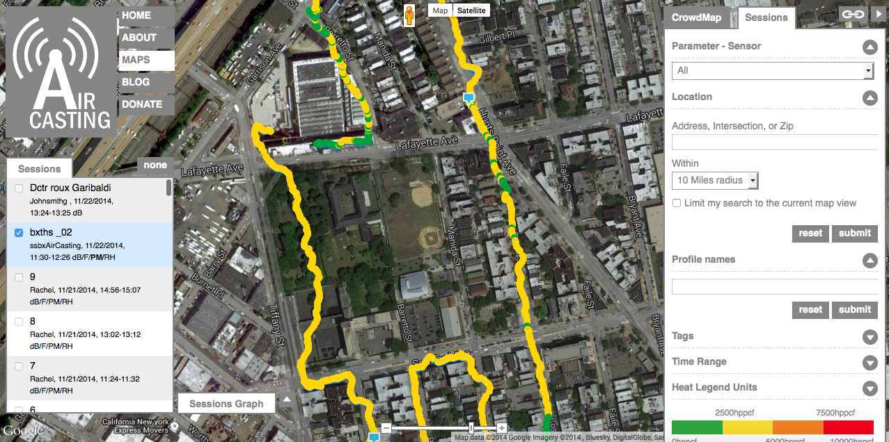
AirBeam draws air through a sensing chamber where light from an LED scatter off the particulate matter in the air. The scattered light is measured by a detector, which enables the estimation of PM 2.5 (particulate matter that is harmful to our health); The data is then shared via bluebooth to your Smartphone and to the community via the AirCasting platform, which is an open source platform for recording, mapping and sharing health and environmental data using your smartphone. You could also download their Android app – “AirCasting Android App“. Here’s everything the AirCasting app can do (information from the AirCasting)

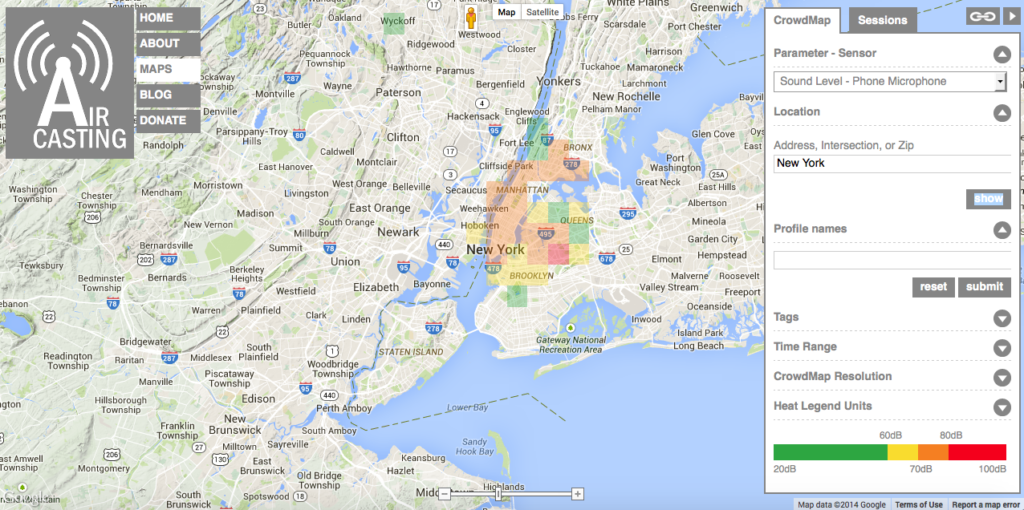
  • Sound levels recorded by their phone microphone;
  • Temperature, humidity, and fine particulate matter (PM2.5) concentrations recorded by the Arduino-powered AirBeam;
  • Temperature, humidity, carbon monoxide (CO) and nitrogen dioxide (NO2) gas concentrations recorded by the Arduino-powered AirCasting Air Monitor;
  • Heart rate, heart rate variability, R to R, breathing rate, activity level, peak acceleration and core temperature measurements recorded by the Zephyr BioHarness 3; and
  • Heart rate measurements recorded by the Zephyr HxM.

AirCasting global mapThe results of the AirBeam device recording will enable us to make better choices to improve our health by either deciding to travel when the pollution levels are lower or take an alternative route or in the worst case scenario, understand the risks that we are facing and take necessary precautions for a healthy life. Since the AirCasting platform is open source, it is possible for many of the current Noise monitoring applications to coexist and cooperate. Remember, the open source NoiseTube application. Might be an interesting idea to develop a method to combine these two great services together.

routemap_airbeam

Some of us might have our concerns about the Internet of Things and Sensors that collect data, but this is definitely not one of those cases. Considering that air pollution is one of the serious forms of pollution and often the one that we hardly notice, it is a great initiative.

Source: Gigaom

Read on
Search