#Ideas

“Media Map” Project By Bitly Shows Real-Time Media Coverage

Wouldn’t it be amazing to know which television, newspaper, magazne and radio covers most of the daily news in my area or the other. Wouldn’t it be fascinating to put such tabular information in an easily understandable form of a digital MAP? Wouldn’t it be much more value addition if the digital map shows Real-Time link-sharing data from various publications.

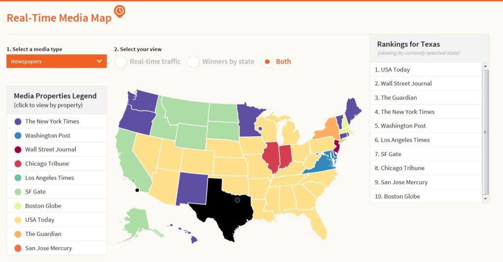
Bitly, a URL shortening and bookmarking service, unleashed a fascinating GIS mapping project called the “Media Map”, which delineates each state with its most widely consumed media source on a state-by-state basis and displays real-time shares from those publications on the map. It not only allows you to visualize static and real-time information on map, but also allows you to interactively filter the information/news by either by state or by media source.

Below is the intuitive map showing both real-time information of shares and winners by state, on other hand, you can filter the information by selecting particular state.

BothInfoOnMap

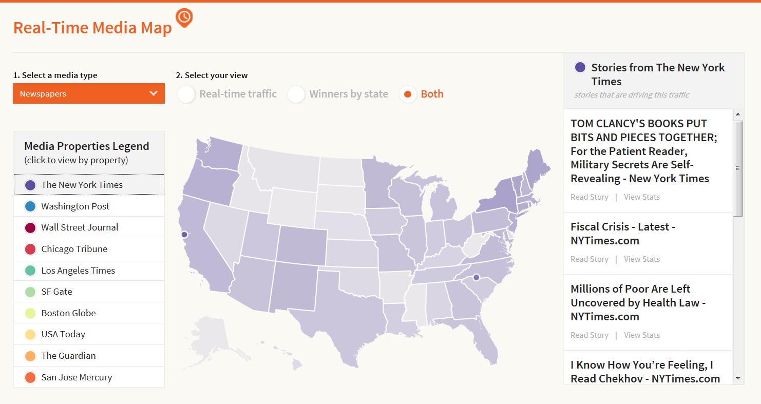
Below is another map which shows the map with the real time sharing of stories from New York Times media source.

FilterByMedia

Isn’t it so cool to visualize media information on a MAP with real time information?  For more information, you may follow this link.

source: Bitly

Say thanks for this article (0)
The community is supported by:
Become a sponsor
#Ideas
#Business #Featured #GeoDev #Ideas #News
Bee Maps: Creating a Buzz in the World of Fresh, Affordable, and Real-Time Mapping Solutions
Nikita Marwaha Kraetzig 11.5.2024
AWESOME 5
#Business #Featured #Ideas
Why Have Scientific Datasets Been So Widely Adopted in Earth Observation and What Role Does Data Quality Play?
GeoawesomeTeam 07.17.2024
AWESOME 4
#Contributing Writers #GeoDev #Ideas #News #Science
The New Standard in EO – STAC: The Application of STAC API Browser
Sebastian Walczak 12.6.2024
AWESOME 1
Next article
#Business #Featured #GeoDev #Ideas

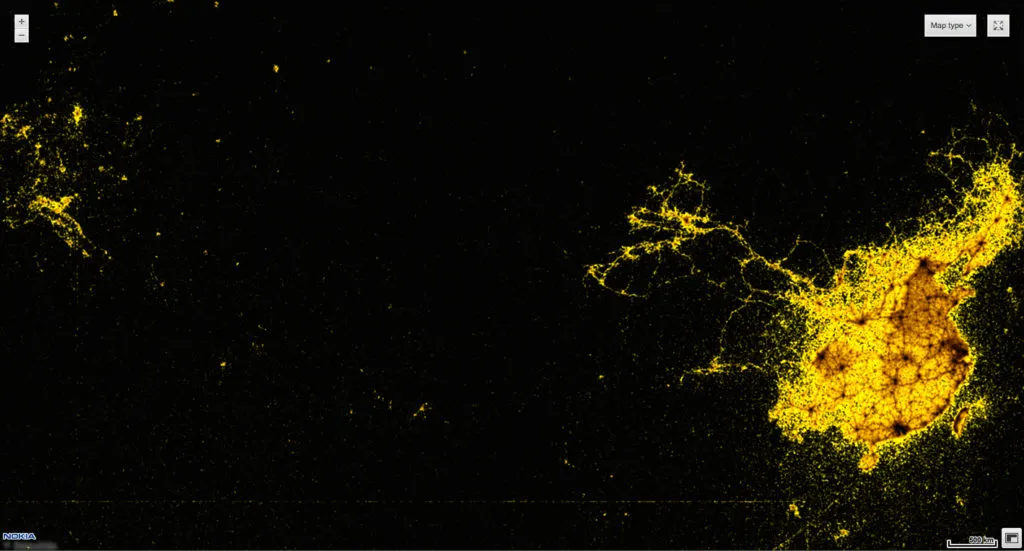
This Map By Nokia Shows All Windows Phones With Language Set To “Chinese” In Asia And Europe.

Geoawesomeness Nokia_Chinese

Companies owns a lot of Big Data about their business and their customers. More and more they start to realize that and use it in their advantage. This particular map made by Nokia HERE in Berlin shows spatial distribution of all Windows Phones with language set to “Chinese”. With market penetration close to 10% on average worldwide this map gives you good estimation on what is the density of Chinese people around Eurasia, which particularly interesting outside China. Any census data or migration office will not be able to show it and definitely not on such a scale.

From the perspective of Nokia such a tool can actually give them value of real market penetration and how it spatially changes over time. I bet that 1 year earlier this map looked totally different. This can be particularly interesting after the launch of a new Lumia with availability in different  countries at different time and can clearly answer whether marketing activities were appropriate. New customers would be simply lighting  up on the map. I’ve been working with location-based big data for some time already and I’m more and more fascinated by the possibilities it gives and how companies and governments could use it.

source: Nokia Conversations

Read on
Search