If you are a US citizen, you may want to recheck your home’s flood risk. A new national-level study has found that a total of 14.6 million properties across the United States are at risk of severe flooding. Of this, 5.9 million property owners are either not aware of or underestimating the risk they face because federal maps do not identify them as being within the Special Flood Hazard Areas (SFHA).
Non-profit research and technology group First Street Foundation has created a new high-precision, climate-adjusted flood model that assesses the risk of flooding at the individual property level – today and into the future – for all types of events, including fluvial (riverine), pluvial (rainfall), storm surge, and tidal sources. And now, the group has released flood risk data for over 142 million homes and properties across the US.
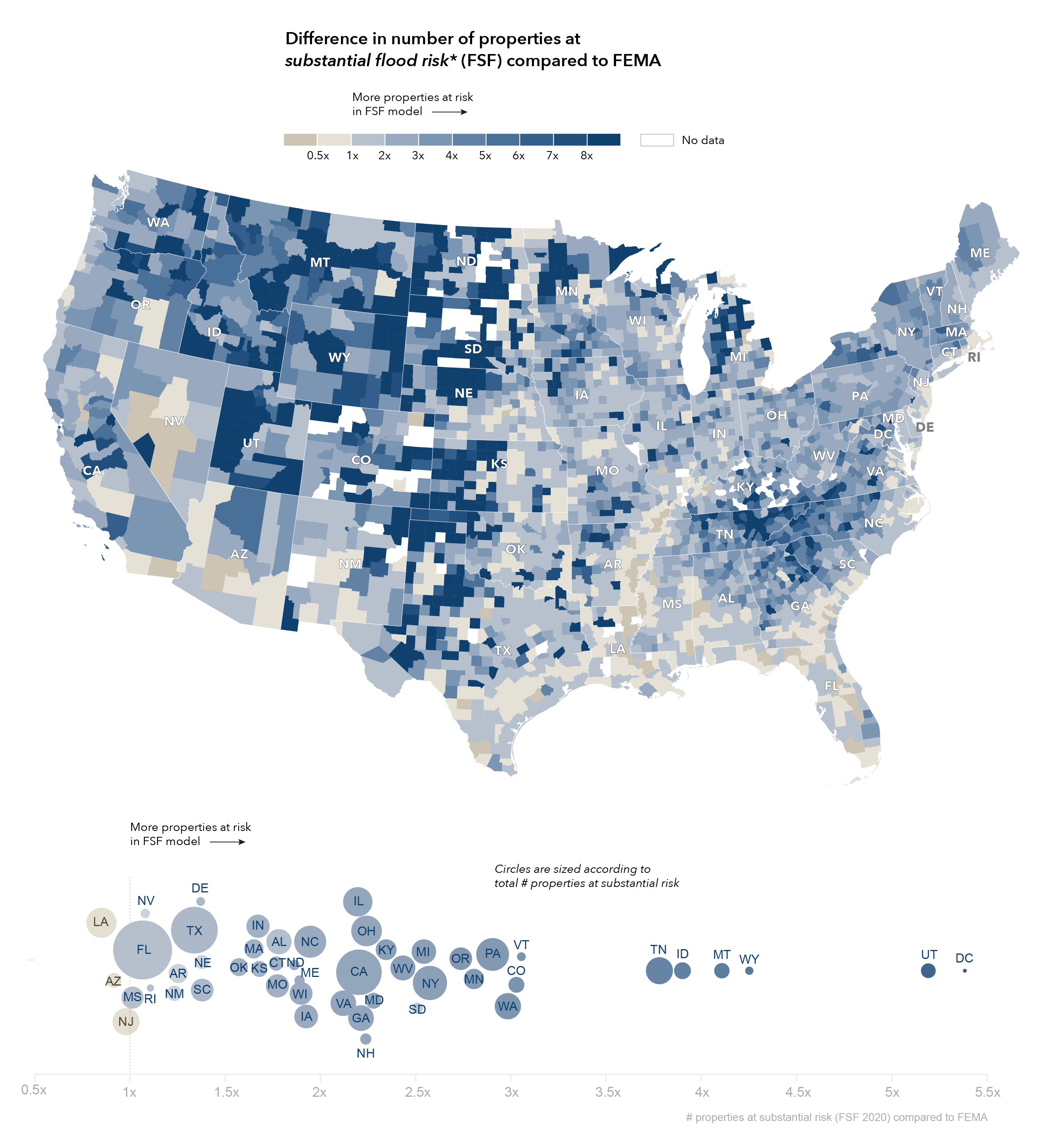
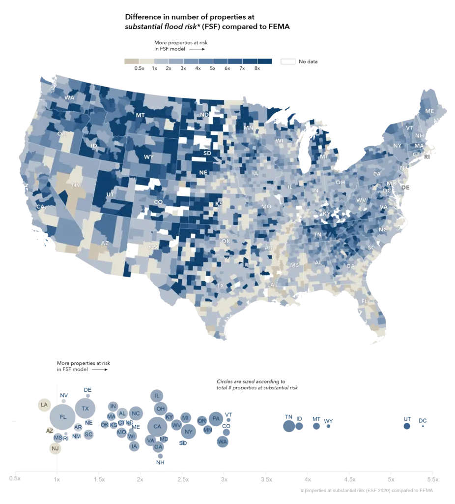
Difference from FEMA
The findings, published in a new national report, say that around 1.7 times more properties are at substantial flood risk compared to the FEMA 1-in-100 SFHA designation.
Also see: Map shows locations where building foundations may crumble in the US
The greatest differences between the First Street Flood Model estimates and FEMA SFHA designation have been observed in the states of Washington D.C. (438%), Utah (419%), Wyoming (325%), Montana (311%), and Idaho (290%). This is chiefly because FEMA’s mapping in some of these locations is not yet complete, while First Street is offering nationwide coverage.
Flood risk change over time
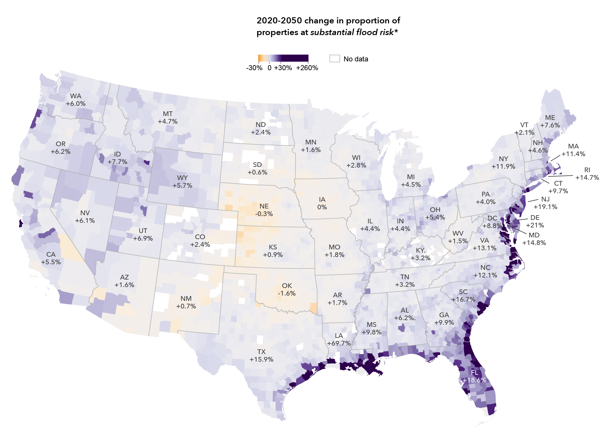
Interestingly, in Arizona, New Jersey, and Louisiana the First Street model shows a lower count of properties currently with substantial flood risk in comparison to the FEMA SFHA. However, when future environmental changes such as sea-level rise that approaches or exceeds protective levee heights are factored in, additional properties fall into the high-risk categorization.
For example, after adjusting for climate change in Louisiana, the First Street methods uncover an additional 332,700 properties with substantial risk by the year 2050 – which means 248,800 more properties with substantial risk than FEMA defines currently. Similarly, in New Jersey, First Street estimates 8,100 fewer properties to be at substantial risk currently. But in the next three decades, 73,600 more properties will be at substantial flood risk than current FEMA flood maps.
If you also want to check your home’s flood risk according to the new model, you can do so here.


