

source: Daily Mail
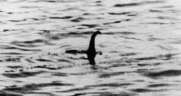
On the april 20th, 1934 the Daily Mail printed what is now the most famous photo of the Loch Ness Monster. To celebrate this day Google launched its Street View imagery of the famous lake. Viewers can explore above and below the surface of the 23 miles (37 kilometers) lake. In order to make such a project Google Trekker has been installed on a boat and was taken under water by divers collecting imagery along the way.
The story of Loch Ness monster goes back to the legend from A.D 565 when St. Columba repelled a water beast after it had killed a man swimming in the Ness River leading into the lake. Since than “Nessie” has been a part of Scottish folklore. There have been dozens of alleged photos, films and videos showing the monster but no concrete evidence has emerged. But that hasn’t stopped people from searching for it. In 2003, a research team funded by the BBC conducted one of the largest and most comprehensive searches of the lake, using sonar and satellite navigation, but found no signs of the creature.
Try Google Street View maybe you’ll spot something…

#Insights

Next article


GIS Cloud is happy to announce the release of the newest addition to their app family: Maplim – an application that delivers the fastest and most intuitive real-time collaboration on a map using any device.
IDEA BEHIND MAPLIM
While Maplim is simple on the outside and super easy to get started with and use, it consists of absolutely everything you would need to set up a perfect collaboration for your entire organization. A map is put in a context of an organization board where you are creating projects and cards, while engaging with your colleagues in discussions, making drawings (redlining and annotations), attaching documents or just leaving a comment. Such collaboration streams can be easily shared with anyone and accessed from any mobile, tablet or computer device. The possibilities of using Maplim are endless, because you can adjust it to your needs and setup the perfect workflow you have been looking for.
ORGANISE YOUR TEAM AND DATA WITH CARDS
Create real-time collaboration streams as cards to which you can add any content around a map and share it with your colleagues. Maplim adapts to your project, team, and workflow.
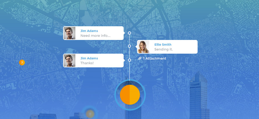
RED-LINE AND COMMENT
Seamlessly make drawings on a map, add notes, marks and comments and provide your team with everything they need to get things done in real-time.
ATTACH AND SHARE YOUR DOCUMENTS
Attach and access important media like photos, videos, PDFs, Excel and Word documents relevant to a card.
GET RESULTS INSTANTLY
Maplim stays perfectly in sync across all your devices, wherever you are. Post comments for instant feedback, follow your team’s activity in real time and share results with anyone, anywhere and on any device.
Maplim is here to provide you with the easiest way to collaborate on a map.
Sign-up for free and get early access.
Register for Maplim free webinar and get a live preview of the app’s features and possibilities.

