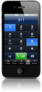
One of the fundamental application of LBS is utilizing the ability to locate an individual calling to emergency response agency (911 in US, 112 in EU) who is either unaware of his/her exact location or is not able to reveal it because of an emergency situation. Based on this spatial information emergency response agency (e.g. ambulance, police, firefighters) can provide help in a quick and efficient way.
In 1996 the US Congress passed the law issued by Federal Communication Commission requiring all US mobile operators to locate emergency caller dialing number 911. In the first phase of the project required all 911 calls to be routed to the nearest public safety answering point (PSAP) and provide the PSAP with the telephone number of the originator of a wireless call and the location of the cell site or base station transmitting the call. In the second phase (2001) the wireless carriers where obliged to increase the accuracy of the geographic position of the caller up to 50-300m.
European Union Commission has passed a similar regulation –“ Commission Recommendation of 25 July 2003 on the processing of caller location information in electronic communication networks for the purpose of location-enhanced emergency call services” based on Directive 2002/22/EC . This article asks EU states to develop national regulations for mobile operators enforcing the automatic positioning of emergency calls: “Member states shall ensure that undertakings which operator public telephone networks make a caller location information available to authorities handling emergencies, to the extent technically feasible, for all calls to the single European emergency call number 112’’. The difference between approaches in US and Europe is that EU in fact did not enforce mobile operators to increase the accuracy of caller’s location. Especially in
the USA initiative brought vast development of LBS technologies and infrastructure among mobile operators that allowed them to offer other services.
the USA initiative brought vast development of LBS technologies and infrastructure among mobile operators that allowed them to offer other services.
Data from Location Based Services can be used as well for disaster management. One of great examples is the Ushahidi platform – an open source project which allows users to crowdsource crisis information that was sent via location-enabled mobile devices, but as well published in the Internet, local media ect. and visualize it on the map to get the ‘real picture’ of the problem and manage rescue services in the most efficient way. The platform was found to be a great help during Haiti earthquake in 2010.
Another emergency application of LBS was released in the city of Portland in 2010. The city created open source platform where citizens are able to report problems with the city infrastructure via iPhone and Android devices using dedicated application – PDX Reporter. It enables users to select the type of issue to report, take a photo, geotag it with GPS or interactive map, add comments, and send their report to the responsible bureau. Afterwards users can view issues they have submitted and check the status of the issue.


