#Business #Ideas

Location-Based Gaming

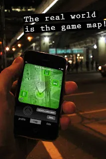
Traditional open-air (location-based) games like Hide-and-seek or Capture the flag brought hours of fun to many of us when we were kids. Then consoles and computer games came along and suddenly the only location you played in was the living room. Today integration of smartphones and geo-location is about to change it and combine the real and virtual worlds. Although Mobile Location-Based Gaming is an area where developers have just begun to scratch the surface in terms of what’s possible, it is one of the fastest growing and interesting trends among LBS.


What is it?

Mobile Location-Based Gaming  is linking elements of traditional open-air field games (e.g. Hide-and-seek, Paper Chase) with new technologies available on mobile devices including positioning technologies, wireless fast speed internet, image recognition and augmented reality among others. In the era of integrating everything with everything is hard to say which location-based service is still a game and which is just using elements of gamification. For example Foursquare is build around the idea that users receive points and badges after broadcasting their location to a social network, but it is rather Location Sharing Service than what we usually call a game. The other Location-Based Social Network SCVNGR works by directing players/customers to certain areas/venue and ask to perform a certain task e.g. to take a picture, record a video and upload it to the game platform in order compete with other players.  Even the popular Angry Birds has begun to introduce location-based elements, allowing the option for players to compete with one another on a unique leader board tied to location. 


What is there on the market?

There are however platforms with which we won’t have problems to clearly define as Location-Based Games. Among games available on the market I categorised them in the following way:
  • Treasure hunts (e.g.  Geocaching)
  • Territory defense and claiming (e.g. Please Stay Calm, Shadow Cities, Fleck, MyTown, GeoWars, Life is Crime)
  • Scavenger hunts (e.g. City Secrets,  SCVNGR, Bounty Island, iSpy)
  • Role playing game (e.g. GeoHunters)
  • Mixed themes (e.g. Parallel Kingdom)
MyTown, for example, has much over 4 million active users. Most users of the Monopoly-style game spend on average more than an hour on the app a day. Rather than just check in at a place, a player can “buy” the venue and collect rent from other players who check into the same place. Booyah is trying to get players more involved with new features like in-game purchasing, where players can buy power-ups, and all this seems to be working.


The other popular type of Location-Based Gaming are scavenger hunts. It is the best way of tying a game in with a real-world experience is what location-based games are all about for Greg Gerber, founder of iSpy. His iPhone game is based on the children’s game of “I spy”. A player takes a picture of a real world object, say, a statue in a city and uploads it to the game. Then, other players take on the task of finding that statue (they get an approximate location of the geotagged photo—a circle is projected onto a map, and it contains the object within a radius of a few city blocks). When they do find it, they take a picture of it with the cell phone’s camera and upload it, thus “solving” the game. 


Where is it all going?


It is surely interesting field with a huge potential but all depends on profitable business models. Foursquare for example although rapidly growing is struggling to monetize the user database. Justin Beck – one of the founders of Parallel Kingdom says that in-app purchases and the fact that user spend on average fairly long time playing everyday creates profitable revenue source. We’ll see soon where it is all going. 
Say thanks for this article (0)
The community is supported by:
Become a sponsor
#Business
#Business #Environment
Major milestone achieved towards building a green supply chain with the Supply Chain Data Partnership’s new global location register
Nikita Marwaha Kraetzig 12.8.2023
AWESOME 1
#Business #Events
SatSummit 2024 Reflections: The evolving landscape of Earth Observation
Avatar for Florian Fichtner
Florian Fichtner 05.22.2024
AWESOME 9
#Business
Deadline Extension: Nominations for the Global Top 100 Geospatial Companies of 2024 Now Accepted Until January 15th
Avatar for Muthukumar Kumar
Muthukumar Kumar 12.12.2023
AWESOME 8
Next article
#Business #Ideas

Location-Based Services – Industry Standards

This is one those boring however necessary posts. Location-Based Services are a convergence of heterogeneous technologies, built from several separate components. In order to sustain operability, interoperability and reliability of all those systems, which highly important from user point of view the industry introduced several standards.The organizations that play significant roles in the development of LBS standards are the Open Mobile Alliance (OMA) and Open Geospatial Consortium (OGC). In addition to these, there are several other organizations that provide important components of the LBS standards infrastructure.

Open Mobile Alliance
The most important specification that OMA has come up with is MLP (Mobile Location Protocol). MLP enables LBS applications to interoperate with wireless network regardless of its interfaces (GSM, CDMA etc.) and positioning methods. MLP defines a common interface that facilitates exchange of location information between the LBS application and location servers in wireless networks. It also supports the privacy of user providing access to location information only to those who are authorized users. Hence OMA is the key enabler of mobile service specification standards that support the creation of interoperable end-to-end mobile services.
Open Geospatial Consortium
The Open Geospatial Consortium (OGC) is an international standards organization responsible for the development of standards for geospatial- and location-based services. To complement Location Interoperability Forum’s (LIF) advanced MLP services, OGC has come up with OpenLS Services that addresses the geospatial interoperability issues. Key services handled by OpenLS specification are:
  • coordinate transformation,
  • Web Mapping,
  • Geography Markup Language (GML),
  • geoprocessing and
  • Web integration.
The OpenLS platform provides open interfaces to LBS core services such as route determination, directory, location utility (geocoder that obtains x, y co-ordinates from address, and reverse geocoder that obtains address from x,y co-ordinates), presentation (display showing map, point of interest), and gateway (find position of mobile terminal ‘from the network’).
OpenLS Abstract Data Types (ADTs) are the basic information constructs used by these core services. ADTs are ‘application schemas’ of well-known data types and structures for location information encoded in OGC’s XML for Location Services (XLS). These schemas encode location information, for example, route summary and route geometry, route instructions, location, area of interest, and point of interest and address. The specifications of OpenGIS are geared toward the development of interoperable solutions that “geo-enable” the Web, wireless, and locationbased services. These specifications enable developers to make complex spatial information accessible to help deploy various services and useful applications.

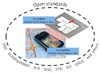
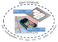
In order to make spatial standards interoperable with communication standards, such as, to integrate LBS into Internet, Web and wireless, OGC coordinates its activities with several organizations including OMA, IETF, W3C, OASIS, ISO, Parlay. Parlay is a consortium that develops open APIs based on their Open Systems Architecture (OSA) for mobile networks that provides functionality for authentication, authorization, and access to network services. APIs for OSA/Parlay enable service implementations within existing fixed and mobile telecommunications networks. This architecture/framework complements the GeoMobility Server, described here.

The GeoMobility server
The GeoMobility server provides the basic functionalities on which location-based applications are built (the OpenLS Core Services). It provides subscribers with various location-based application services and content. By using open interfaces to access network location information, this server allows applications to access a set of core services known as the OpenLS Core Services. To summarize, the GeoMobility server provides:
  • The Core Services and their OpenLS interfaces along with the OpenLS Information Model, consisting of Abstract Data Types (ADTs).
  • A set of applications build upon the Core Services and accessing them through OpenLS interfaces.
  • Content such as map data, points of interest, routes, and so on used by the Core Services; this content can also be hosted on other servers and accessed through the Internet.
  • Various supporting functions for personalization, context management, billing, and logging.
Best practices for LBS privacy
There is however lack of established user privacy standards. In 2010 CTIA Wireless Association published “CTIA’s Best Practices and Guidelines for Location Based Services” but the document is not legally valid. The guidelines emphasize user notice and consent since it is the LBS user whose privacy is at risk if location information is misused or disclosed without authorization. Per the guidelines, LBS providers must inform mobile users on how their location data will be used, disclosed and protected for each user to decide whether or not to use the LBS service or authorize disclosure. More information on the CTIA’s “Best Practices and Guidelines for Location-Based Services” is available at http://www.ctia.org/business_resources/wic/index.cfm/AID/11300.
source: Subhankar Dhar and Upkar Varshney “Challenges and Business Models for Mobile Location-based Services and Advertising” Communications of the acm, May 2011, vol. 54, no. 5, CTIA’s Best Practices and Guidelines for Location Based Services, OGC
Read on
Search