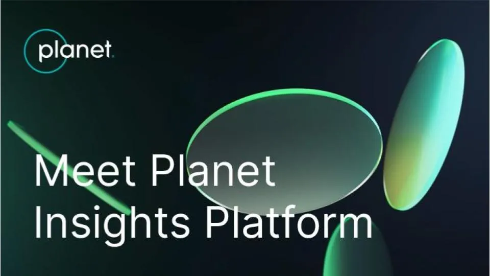
Introducing Planet Insights Platform: Easier, Faster, and More Cost-Effective Insights

At Planet, we recently unveiled our new all-in-one platform for multidimensional Earth insights: Planet Insights Platform. We celebrated by inviting the global Planet community to a virtual event to explore how Earth data, analytics, and powerful tools come together in the platform to monitor and understand change.
At the event, Planet co-founder and CEO, Will Marshall, shared, “You can think of Planet Insights Platform as your central hub for a vast array of data and tools that can provide new capabilities, create new insights, and build innovative products. [It] is the all-in-one place where you can achieve multidimensional Earth insights.”
You can watch a recording of the event, which includes presentations and demos from Planet experts. Or, keep reading — this article provides an overview of Planet Insights Platform and how to get started.
What to Expect From the Planet Insights Platform: Easier, Faster, and More Cost-Effective Insights
During the virtual event, Troy Toman, Senior Vice President of Product and Software Engineering at Planet, shared, “We’ve unified our core offerings into a powerful set of APIs and tools that provide access to multiple data sets and powerful analytics. This breaks down the conventional barriers to leveraging the power of Earth observation data while laying the foundation for future cutting-edge capabilities that make it easier for our partners to build solutions and our customers to get the answers they need.”
Today, the platform brings together new capabilities that dramatically improve customers’ capacity to analyze and orchestrate large volumes of Earth data, reduce upfront development and maintenance costs, and focus on differentiation. These updates include:
- A unified account experience across Planet and Sentinel Hub: By linking the two platforms, users will now be able to access cloud hosting and imagery analysis tools from Sentinel Hub through a single login.
- Enhanced Analysis-Ready PlanetScope data: Analysis-Ready PlanetScope uses proprietary AI to create harmonized, cloud-masked, and spatially consistent daily stacks of images, which enable time-series analysis and machine learning applications.
- Updated global Road and Building Change Detection: Our Road & Building Change Detection AI-based models point to where development is taking place across country-wide areas, on a weekly basis. This can help users clearly understand how and where the places they care most about are evolving.
- New and improved Planetary Variables: Field Boundaries trace the boundaries of agricultural parcels, giving insights into different crop types and growth throughout the season. Additionally, Crop Biomass Planetary Variable now integrates Planet’s daily, global PlanetScope data, offering a cloud-free, analysis-ready data product for monitoring agricultural fields.
- Time series and statistical analysis: Within the Planet Insights Platform, users can efficiently translate imagery into formats best suited for advanced data science and machine learning models.
With Planet Insights, users can build insights and solutions, make decisions, and act faster. Planet customer Valentin Louis, of the UK Rural Payments Agency, shared, “We needed fast and quick access to satellite data that helped reduce the time spent on downloading and pre-processing. That’s where Planet Insights Platform comes in. It helped us quickly distribute data and insights across our agency by integrating seamlessly in our current software ecosystem.” You can hear even more from Valentin in this spotlight video.
Monitor. Identify. Analyze: A Platform for All Users
We believe that what truly sets Planet Insights Platform apart is its accessibility and ease of use. Whether you are new to Planet or an advanced user, our goal is that you can easily access all of our products and derive meaningful insights from the data.
A few highlights:
- Data archive: Planet Insights Platform has a 7+ year archive of near-daily data. This dataset can help users understand unforeseen events or establish baselines of activity and is a fundamental part of our unique broad area management offering.
- Access for universities and social impact organizations: Education and Research users can access the Planet Insights Platform for free! First, apply to our Basic Education & Research Program. Once you have an account, you can learn how to get started with Planet Insights Platform.
- Easy navigation for previous users of Sentinel Hub: Planet Insights carries over a similar user experience as EO Browser in Sentinel Hub – the login is now unified. By consolidating the datasets and tools into one Platform, customers no longer have to spend time managing multiple systems.
Whether you are new to Planet or an advanced user, our goal is that you will be able to navigate the platform easily and derive meaningful insights from the data. We provide you with a wide range of enterprise support and services, including training and online resources to maximize the value of the platform.
Get Started With Planet Insights
If you’re new to Planet, you can learn more about the Planet Insights Platform by watching the virtual event on-demand or by exploring the Planet Insights Platform homepage. When you’re ready, reach out to begin your journey with Planet.
Already a Planet customer? Get started with Planet Insights Platform or join the Sentinel Hub forum on Planet Community to connect, ask questions, view product announcements, and learn more.
Author: Madeline Dahm
Author bio: With a background in science writing, Madeline creates multimedia content to showcase the value of Planet data for a range of applications and use cases.
Did you like this article? Read more and subscribe to our monthly newsletter!


#Featured


Next article
Google Maps and OpenStreetMap: The coexistence of two unequal siblings

In 2015, Aleks Buczkowski gave an overview of OpenStreetMap vs. Google Maps on this blog – and he suggested trying OpenStreetMap (OSM). Now, almost 10 years later, I think it would be a good idea to look more closely at the differences between them. This will help us understand why both can coexist and neither can or will replace the other – at least that is my guess for the next years.
As of 2024, if you were to ask a random person in many Western parts of the world for directions, they would most likely use Google Maps on their smartphone to assist you. In comparison to Google Maps, OSM can be seen as a niche phenomenon in the geospatial space. However, today OSM is used in more applications than ever before.
Although in a wider sense, both Google Maps and OSM can be described as platforms and the end use may be similar for some users, Google Maps differs from OSM.
In this article, I will:
1) Compare Google Maps with OSM in three areas: background and origin, socio-technical configuration, and data usage.
2) Explore the relationship between Google Maps and OSM, explaining why they both coexist.
Background and Origin
Both OSM and Google Maps share a similar ideology and origin. OSM was founded in 2004 embedded in the time of Web 2.0. It was created in response to the dissatisfaction with access to state-owned maps. Google Maps, however, is part of the company Google which, as a survivor of the dot-com bubble, became a quickly rising star in the technology sector in the early 2000s.
Both OSM and Google share techno-enthusiasm beginnings that originated in the 1990s and early 2000s. This belief in the emancipatory potential of the information society and new technologies was referred to as Californian ideology by Barbrook and Cameron (Barbrook & Cameron, 1996) as it was prototypically developed in California during that time.
OSM mostly relies on volunteers to contribute to the project. While Google Maps has offered and continues to offer a limited opportunity for volunteer participation, its origins lie in Google’s acquisition of several geospatial companies in 2004 to help create a map for location searches on Google Search.
Before this acquisition, Google had no activities in the geospatial field (Kilday, 2018). The acquired companies provided the necessary expertise to process geospatial data, as well as data from administrative agencies. Later, more data was acquired and Google Maps began collecting data in-house.
In 2005, Google launched its mapping product, which quickly became successful and expanded both spatially and functionally. Google particularly benefited from integrating Google Maps on smartphones.
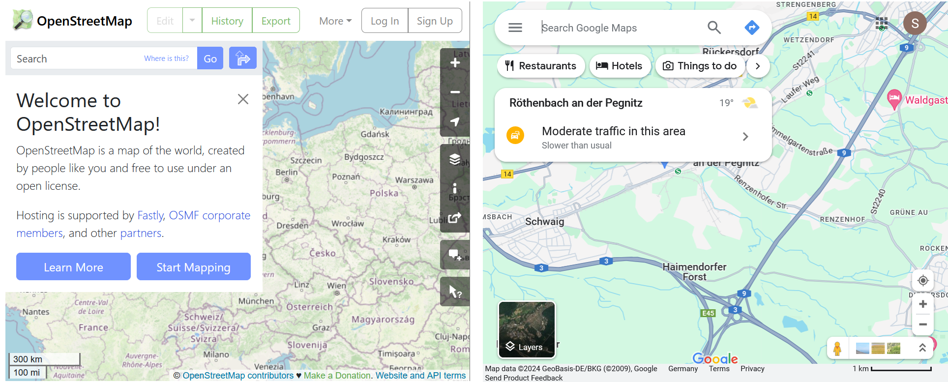
OSM and Google Maps Website 2024
Socio-technical Configuration
OSM is first and foremost a mapping community, then second a geospatial database, and, third, something that can be turned into a map. However, creating the actual map is “outsourced” to the user: the user can do as they please as long as they follow the few guidelines and attribute the data to the license.
In contrast, Google Maps is a map product that is part of the Google universe. The project offers several services: While OSM can compete with Google Maps as a geographic database, it falls short in areas such as search, reviews, and aerial/satellite imagery (Beddow, 2022). However, OSM is also not designed to provide these services as their self-conception is rather based on being a mapping community.
Data Usage
OSM geospatial data is openly accessible, but there is not one API through which OSM data can be accessed. That is why individuals as well as commercial companies that want to use OSM data have to either process OSM themselves or build pipelines to process OSM data so that they are fit for their use. Recent examples of that are the Daylight Map Distribution or Mapbox data. The user has the freedom to decide how to utilize the data, whether it be for further processing, displaying in various styles, or using only certain parts. As long as the user complies with the license, any of these options are permissible.
In contrast, Google provides several APIs for easily accessing Google Maps data. Initially, there was no API for Google Maps, and the data was freely available for use, resulting in the creation of so-called “mash-ups” (Ahlert, 2022). Currently, Google charges a fee for extensive use of the API, creating a structural dependency for numerous businesses of varying sizes that require access to Google Maps data (McQuire, 2019).
We can see that there are certain similarities between OSM and the tech-capitalist Google Maps platform. The term tech-capitalism (or technocapitalism) refers to changes in capitalism associated with the emerging power of new technology corporations. Like platforms that are closely formed by this tech-capitalism, OSM also includes similar elements such as a digital infrastructure (Plantin & Powell, 2016). OSM is also based on an online platform that enables a group of people, the community, to collaborate together via online interfaces.
Similar to social media platforms or neighborhood support platforms (Michel & Schröder-Bergen, 2022), OSM also includes local affective dimensions such as the ground truth ethos or the focus on localness. But unlike the tech-capitalist platforms, which already have this in their name, the project is decidedly anti-commercial and this aspiration can also be felt among many participants. Thus, the commercial idea is nowhere to be found in OSM. OSM is based around a non-profit foundation while tech-capitalist platforms as part of companies only function in the long term if they generate a profit.
However, certain techno-solutionist attitudes of active members are similar: both tech-capitalist platform members and core members of OSM tend to be technologically optimistic, i.e. they assume that objective knowledge can be produced with technology and data analysis. This can be found in both the ecosystem of OSM and the service platform Google Maps. For OSM, the underlying premise is that the technology and practice of collaborative mapping can empower individuals and communities to shape their spatial environment. For Google Maps, the platform’s extensive accessibility and convenience can be leveraged by billions of users worldwide.
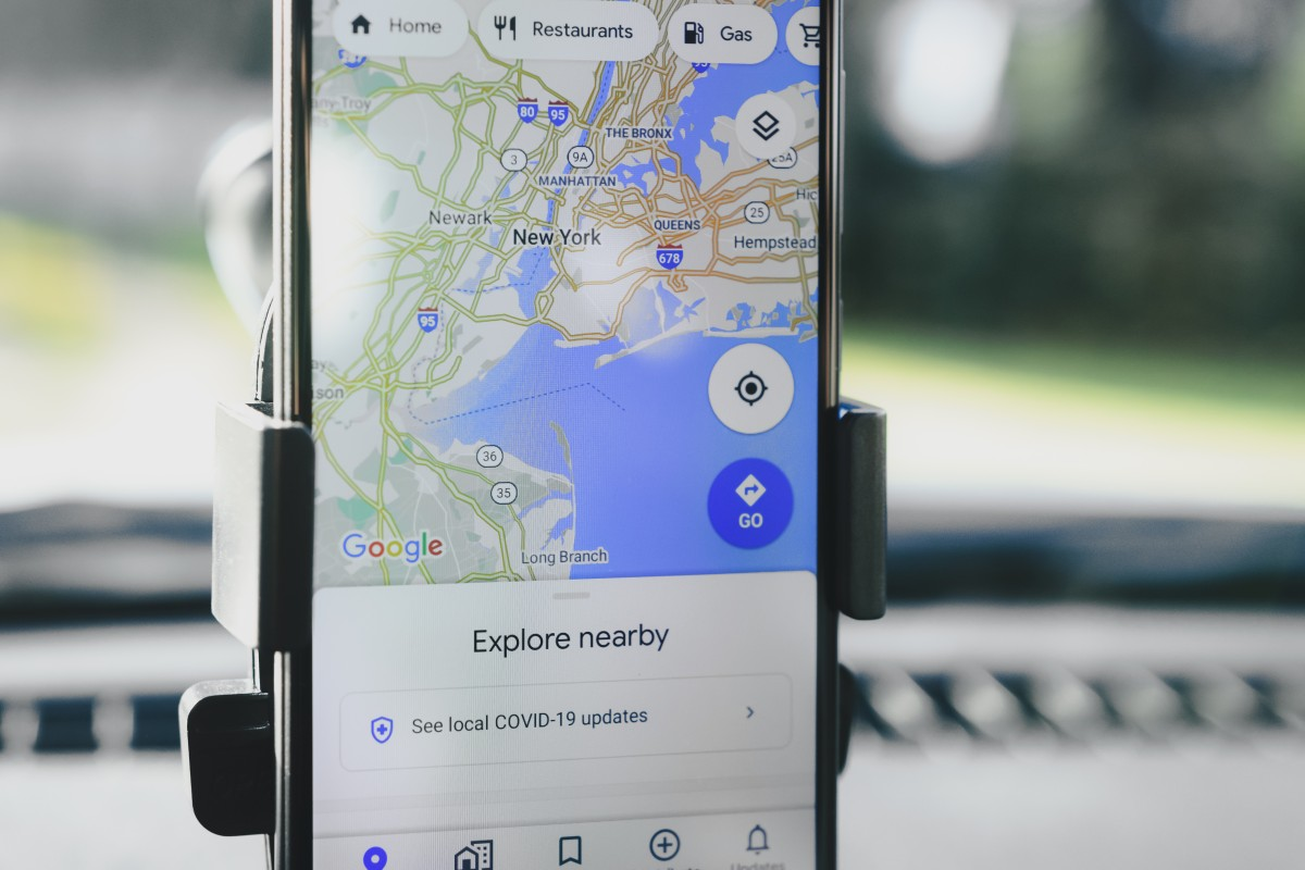
Google Maps for Consumer Navigation and Exploration (CC0 Public Domain)
Both OSM and Google Maps are of significant importance to individuals, organizations and commercial actors in a variety of fields, including navigation, analysis and business operations. OSM places a strong emphasis on openness and community collaboration, offering a wide range of use cases for geospatial analysis, transportation, public services, and humanitarian mapping. In contrast, Google Maps provides a convenient platform for consumer navigation and travel planning, as well as integration with other Google services such as for local businesses and delivery services.

OSM Mapping Party after the 2010 Earthquake in Haiti (Todd Huffman from Phoenix, AZ, CC BY 2.0, via Wikimedia Commons)
OSM Mapping Party after the 2010 Earthquake in Haiti (Todd Huffman from Phoenix, AZ, CC BY 2.0, via Wikimedia Commons)
In summary, Google Maps is more accessible and therefore more widely used. Since Google Maps is not primarily participatory, but rather a product of a platform company, there is less control over the content. As part of a profit-oriented company, Google Maps follows a different logic to a community project such as OSM (Whitehead & Collier, 2023).
However, because Alphabet, Google’s parent company, does not provide separate revenue figures for Google Maps, it can only be estimated whether Alphabet is making money with Google Maps. Assessments of Google Maps’ financial performance vary. While Morgan Stanley’s financial advisors consider it an “under-monetized asset” (Nowak 2017), Skift, a travel industry news site, suggests that Alphabet is likely to be “making considerable money” from it (Schaal, 2019).
OSM provides an alternative source of geospatial data and can compete with Google Maps in terms of data quality in many parts of the world. This is recognized by many companies that choose not to pay for access to Google’s API.
Google Maps and OSM do not interact directly, but from OSM’s perspective, there may be indirect challenges for OSM. Google Maps is the top dog that everyone knows about. The more Google Maps is used, the more “niche” OSM may become and the more difficult it may be to recruit new members. This problem may grow as more players enter the geospatial space, such as the Overture Maps Foundation, initiated by major technology and logistics companies.
However, both Google Maps and OSM have brought the ubiquity of digital map data into the 21st century: Google Maps as an everyday super-platform application and OSM as a counter-movement to government and economic data collection by a community contributing to a digital commons. Both exemplify the transformation of the use of digital geospatial data in our daily lives. And because of their different use cases and goals, both have a raison d’être.
Did you like this post? Read more and subscribe to our monthly newsletter!

