#Ideas

Interactive map of London from… XVI century

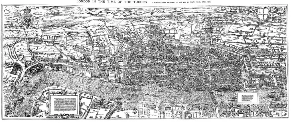
Civitas_Londinium_or_The_Agas_Map_of_London

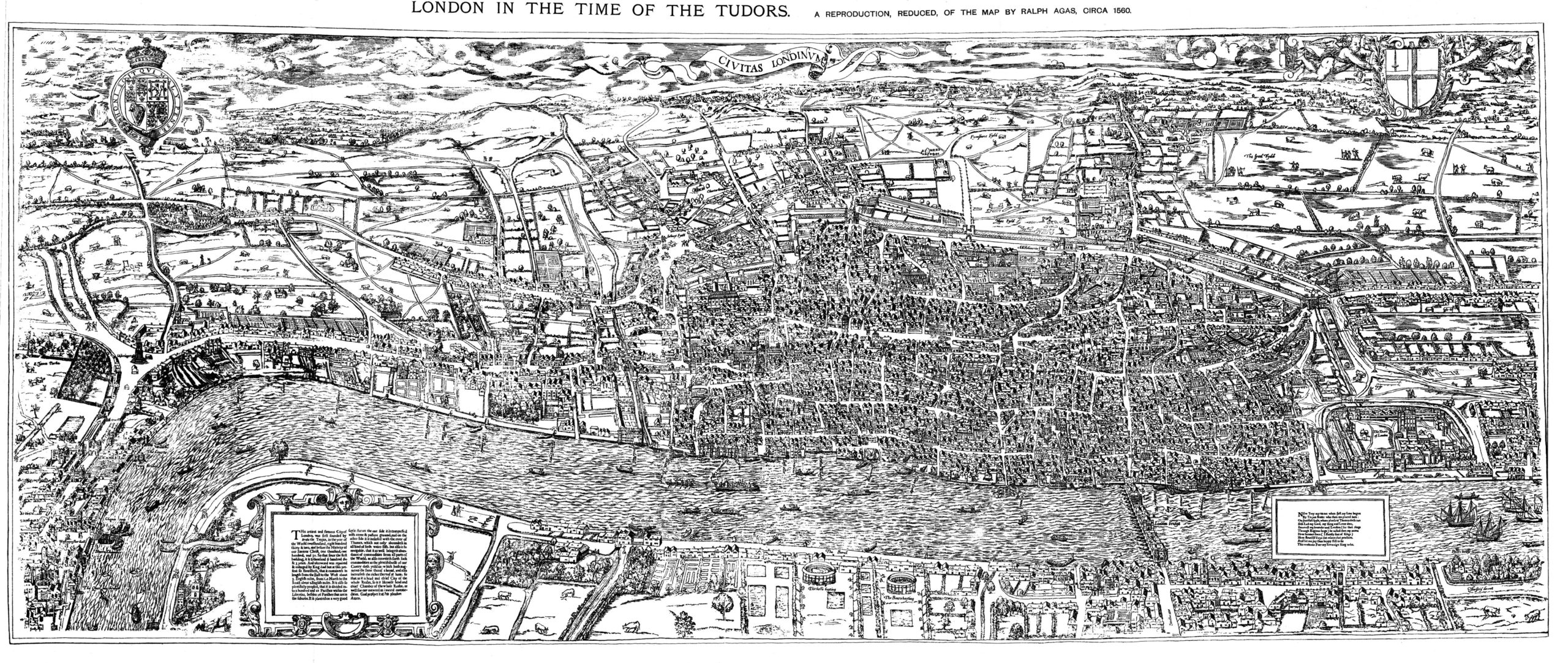
Old maps are awesome. They bring us back to times where cartographers were not engineers but artists. Each map from middle ages is a work of art. One of the best know English map maker from medieval times is Ralph Agas 1540 – 1629 a land surveyor with a mathematical bent of mind.

In the mid XVI century he created a famous birds eye view map of London often refereed to as “Agas” map which shows a detailed picture of the city with monuments, institutions, businesses, marketplaces, and urban planning fixtures. The level of detail of this piece is incredible.

Agas Map of London - Geoawesomeness

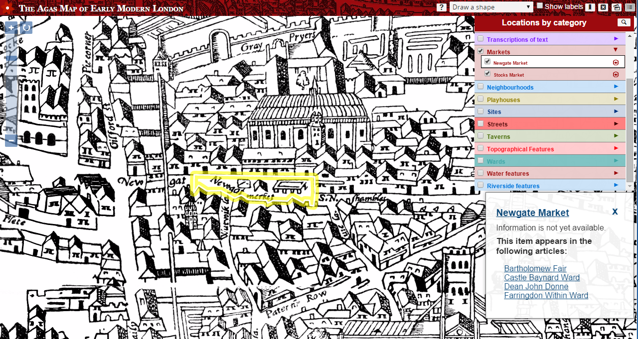
An English professor at the University of Victoria – Janelle Jenstad who is researching the spatial history of London, decided to bring the map to the XXI century with cool interactive layers. She overlayed it with references to people, places, topics and terms to provide a virtual visit of Shakespeare-era London. So if you click on the Newgot market square the map will give you an idea of what it is and how it was used, back when Shakespeare was around.

Really Geoawesome project! Just play with it!

DID YOU LIKE THE POST?
SUBSCRIBE TO OUR WEEKLY NEWSLETTER

[wysija_form id=”1″]

Say thanks for this article (0)
The community is supported by:
Become a sponsor
#Ideas
#Business #Ideas
Urban Digital Twins in China: A Smart Gadget or a Decision Support Tool?
Nianhua Liu 03.28.2024
AWESOME 4
#Fun #Ideas #People
‘You Are #Geoawesome’ Original Series: A Step-by-Step Guide
Sebastian Walczak 10.9.2024
AWESOME 0
#Environment #Fun #Ideas #Satellites #Science
Using Principal Component Analysis (PCA) in Satellite Imagery: A Concise Guide with QGIS Application
Sebastian Walczak & Nikita Marwaha Kraetzig 09.11.2024
AWESOME 1
Next article
#Business #Featured

Nokia wants to sell its mapping division HERE

HERE - Geoawesomeness

One year after selling its mobile phone division to Microsoft, Bloomberg Business reports that Nokia is planning to sell its mapping department HERE. The article claims that the Finnish company wants to sell HERE to focus on its wireless-networking business. This is supposed to improve Nokia’s debt and boost its rating from junk status.

Nokia bought HERE’s predecessor Navteq for $8.1 billion in 2007. Bloomberg reports that today HERE is valued at about $2.1 billion according to Nokia’s own financial reports. There is one comment when looking at that difference. It wasn’t the best investment ever. Over the last couple of months we’ve seen a lot of marketing activity around HERE. They’ve been present in press, released new, free Android and iOS apps, developed indoor mapping features… Now we see why. To make that brand more attractive for potential buyers.

Gossips says that Uber and private equity firms are among those who have been approached by Nokia with the offer. On the other hand there are a couple of big brands with a financial resources to acquire HERE, including Google, Apple and Microsoft on the top of the list. Google doesn’t need HERE’s mapping data as it has built its own spatial database over the years. Apple has a long-term contract with TomTom migrating to a new data provider would create a huge mess which Apple surely wants to avoid. Microsoft might seem like the obvious potential buyer, as it already bought a big chunk of Nokia’s business but previous reports claimed Nokia also wanted Microsoft to buy the HERE division as part of the original Nokia deal, but the Redmondians declined.

Big change in the industry is happening on our eyes! We will update you as soon as we learn something new.

Read on
Search