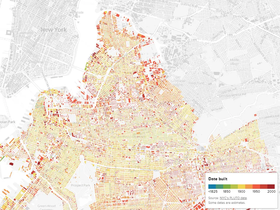

Thomas Rhiel – Brooklyn lover and the founding editor of BKLYNR created this amazing map of Brooklyn’s real-estate which links the history with present. He plotted 320,000 buildings and shaded each of them according to its year of construction. The result is a snapshot of Brooklyn’s evolution. It reveals how certain neighbourhoods developed over the years while leaving some of them unchanged for decades. While browsing the map I’ve noticed a lot of buildings which are 100 or more years old. I’m wondering what is the average age of buildings in Brooklyn compared to other districts in NY…
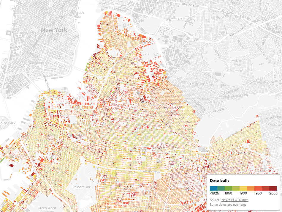
source: BKLYNR

#Ideas


Next article

 Mapping business is not easy. Not easy to efficiently update spatial data, not easy to monetize, not easy to create something new, not easy to be better than others… Navteq and then Nokia was definitely the world leading spatial data provider. Few year’s back they had only one global competitor – Tele Atlas (acquired by TomTom).
Now the ecosystem is a little bit more complex as Google did what it does great – made users seamlessly addicted to their mapping solutions (addicted to quality and great user experience). Two years ago Google brought its maps to connected cars industry partnering with BMW among others. 2-3 years back this kind of solutions were reserved only for the most expensive vehicles. Today they are available as extra feature almost in every mid-range car and Nokia decided to enter this sector with their new solution called HERE Auto.
What is it?
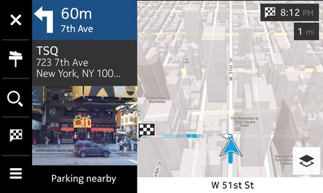
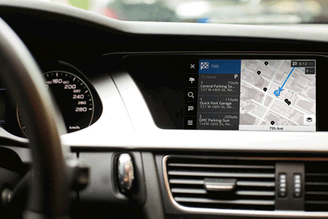
Essentially HERE Auto is a cloud-enhanced in-car navigation and infotainment platform, as well as a companion app for smartphones. You can think about it as an embedded in-dash navigation system which offers you many cool location-based features like offline 3D and street-level satellite maps (once you download the data) and many online services including real-time traffic, weather, parking spots, fuel prices and much more.
Cool or not cool?
Imagine you’re checking route to your meeting point on your smartphone and once you’re in a car it automatically displays the directions on your in-dash navi. It will synchronize your favourite places with/from your other devices. It will tell you that you should get gas right now because where you go the prices will be higher. You will know if any of your friends is around as it can be connected to Foursquare and Facebook. Moreover Nokia also plans to offer a software development kit, letting developers create new apps for the platform. So it’s definitely cool. Is it better than Google’s? We will know something more after the Frankfurt Motor Show (IAA) on September 10th where HERE Auto will be officially presented. In light of yesterday’s information that Microsoft bought device department of Nokia we can conclude that Nokia will invest a lot in their mapping solutions. We are waiting for the new revolution.

