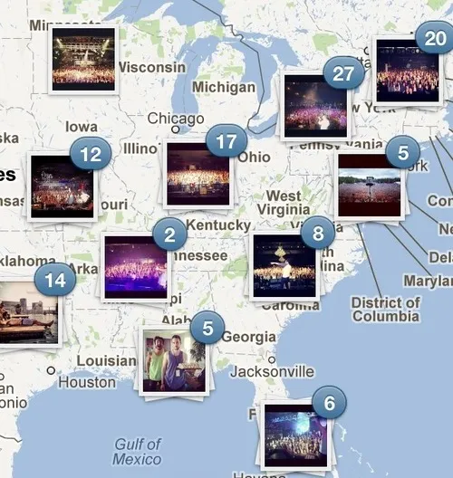
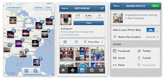
 Instagram – the world’s fastest-growing photo-sharing app has finally started to be serious about geolocation. Untill now the service has been known mostly from the huge acquisition by Facebook for $1 billion and great digital filters to make you smartphone pics look like SLR. The latest version of the App has been updated with a new location-based feature called Photo Map. It’s exactly what it sounds like: when you turn it on, and you can lay out all your geo-tagged photos on a map (Google Map).
The first time you press it, you’ll be prompted to choose which of your photos will be mapped. After you’ve deselected the ones that reveal any top-secret locations, the rest will show up on a world map, organized into stacks by location.From then on, all your photos will automatically be added, and Instagram friends can browse your pictures by location as well as time or tag.
What I like about it is a smart way of organizing images in location stacks. What is the most important question how will Facebook integrate it with its interface. I think it’s gonna be something really cool.
Check out the Video:
source: Instagram Blog, Technoblog NBCNEWS


