How We Responded to Covid-19 Pandemic by Mapping Ugandan Border Entry Towns (by MapUganda)
This post has been cross-posted from HOT News.
Timely provision of medical and non-medical supplies is critical for COVID-19 response, and the need to remember the undesirable demands to protect oneself from the disease has prompted the reinvention of risk communication with targeted messaging like the “Tonsemberera (Do not come close to me) campaign.” All over the world, the outbreak prompted the application of tools, such as digital and geospatial technology, for efficient responses, to enable the quick identification and isolation of infected individuals or families while also ensuring the efficient supply of daily needs such as food, especially among those that were gravely affected by the pandemic.
OpenStreetMap is one such platform that enables building tools and obtaining demographics without needing complex techniques. With the identification of buildings, access roads, and amenities, responders gain easy access to information, and so the planning and delivery of support services become more efficient. Unfortunately, the most affected areas in Uganda were the border districts that only existed as blank spots on OpenStreetMap. Map Uganda, together with Geo YouthMapppers, came forward through the HOT Microgrant program to support the availability of data for the planning and actions of government and field responders, such as the Ugandan Red Cross. The parties embarked on mapping buildings, roads, and identifiable amenities for porous border entry points to help create detailed maps to support and retool the Ugandan Red Cross Society and Ministry of Health surveillance efforts against the spread of the pandemic.
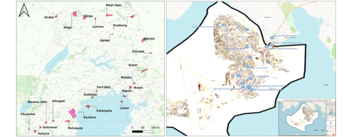
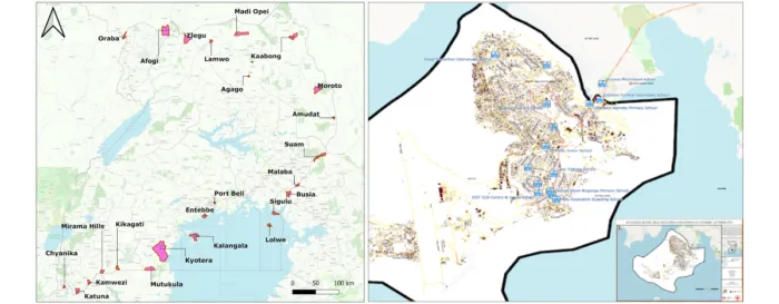
In spite of the lockdown of the airport in March and the strict monitoring and testing at official borders entry points, COVID-19 transmission still found its way into the country through the porous border points, carried by people entering from the neighboring countries of Kenya, Congo, and Tanzania. With support from a Rapid Response Microgrant, students and community members dedicated a piece of their time every day to contribute to the remote mapping of 27 border towns.
Data Collected
A series of trainings and work sessions using different tools, such as JOSM, ID Editor, Tasking Manager, Quantum GIS, Umap platform, were used to remotely prepare the data and information for the communities at the frontline of the awareness and risk communications against the pandemic.
- More than 250,000 buildings were added to the map
- Over 7000km of roads were collected
- More than 400km of waterways were also mapped in these all the border points.
- 27 Digital and paper maps were created.
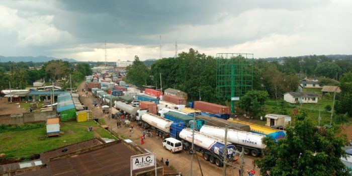
Cargo trucks lining up at the Malaba Border Point on the border of Uganda and Kenya as truck drivers wait to be tested for Covid-19 before they enter Uganda.
Insights from the mapped border towns
Among all the 27 border towns, Kyotera and Busia had the highest number of buildings. The access roads are primarily distributed across Kyotera, Elegu, Busia, Mutukula, and Moyo border towns, with Kyotera having the highest number of access roads. This attributes to the dense population of the town and puts its population at risk of an outbreak if there is a community infection within the area.
For further insights, please see these resources:


