#Business #Science

What is GIS: A Beginner’s Guide

As you are here I’m guessing that the term GIS has popped up at work. Maybe your organization has decided to start using GIS to make better sense of their data, or you were looking into ways to map your data, and that search led you to the term “GIS”.

If like me, the first thing you did when you heard this term was head over to Wikipedia, you will have been confronted with lots of complex jargon and even some scary looking algorithms:

Formula for calculating aspect in GIS, Wikipedia

Now, before you get disheartened or fall asleep, I have some good news for you!

GIS isn’t that complicated, what’s more it can even be fun. Once you’ve finished this short book not only will you understand what GIS is all about, but you will have the background knowledge and vocabulary required to discuss GIS and its associated tools with confidence.

You will even learn the basics of operating a GIS, preparing map data and publishing interactive web maps.

What is GIS?

GIS stands for “Geographic Information System”. GIS is a very broad term, and trying to get a consistent definition can be tricky. Ask ten different GIS users and you will likely get ten different answers.

It could be argued (and the propeller heads often do) that any digital data that contains location based information is in fact a GIS.

This location information in the GIS industry is called “spatial data” and it could be an address, coordinates containing latitude and longitude or complex three dimensional geometry.

But you’re not here to get into semantics, or bogged down in jargon, I’m guessing you are here because you want to know what the majority of people mean when they say GIS, and more importantly how it can be of value to you and your organization.

What does a GIS do?

The truth is that it can do a lot of things, but here’s the short answer: A GIS allows you to visualize your data as a map.

Maps + Data = GIS

What’s more, GIS systems aren’t static. They allow us to ask complex questions—or “queries” as they are called in GIS speak—anytime we like. A GIS system can answer these questions instantly by modifying colors, shapes or highlighting locations on the map.

We’re visual creatures that possess an innate ability to visualize patterns. Patterns that might take us hours to identify in a spreadsheet can often be identified in an instant when displayed in a more visually engaging format like a graph, chart, or in this case a map.

There are many innovative ways that your data can be displayed on a map. It could be plotting markers, color coding locations based on an a data value or using heat maps to identify clusters and patterns in your data, the possibilities and potential insights are literally endless.

Data can be visualized in endless ways

What’s more, GIS systems aren’t static. They allow us to ask complex questions—or “queries” as they are called in GIS speak—anytime we like. A GIS system can answer these questions instantly by modifying colors, shapes or highlighting locations on the map

Do I need a GIS?

The truth is that GIS is merely a tool, it’s just a means to an end. Most people don’t need a GIS, what they really need is the answer to a question. A GIS simply provides us with a more efficient mechanism of obtaining that answer.

So the question to ask yourself is this; will the benefits of being able to visualize my data on a map and quickly answer questions that are location specific, provide me with a return on the time taken to get up to speed on GIS?

I’ll give you a clue: if data is a core part of your business then the answer starts with “y”, ends in “s” and contains an “e” in the middle.

By the time you’ve finished this book — it’s pretty short, so shouldn’t take you long — I’m confident that you will be excited about the possibilities that GIS holds for your business.

Location is a powerful element of your data that, until now, you have likely been neglecting. You obviously know the what and when, and you probably know the how. But do you really understand the where?

I’ll guarantee there are patterns in your data that have been right under your nose this whole time, but you just haven’t been able to see them. A GIS system will shine a bright light on those patterns and make them clear for all to see.

How Much Does GIS Cost?

So I can hear you thinking:

“That all sounds great, but be straight with me—am I going to need to sell a kidney?”

I can’t say that it’s never happened, but you’ll be pleased to know that most of us that benefit from GIS still possess two functioning kidneys!

There are some great free and open source tools available, lots of affordable desktop and web tools (Mango, nudge nudge, wink wink) and also some very expensive solutions at the top that service very niche use cases.

Later in the book we will be taking a more indepth look at the various open source and paid GIS software solutions, both on the desktop and the web.

In most cases the main cost of GIS will be in time rather than software licensing. Which brings us neatly onto the next question.

Can I do GIS for myself?

If you listen to the consultants, then a long winded buzzword-filled answer will eventually arrive at a negative. But isn’t that always the case with consultants?

The truth is that you can do it yourself using freely available tools and some self-study.

And I know, because that’s the way I learned GIS.

I’m a software engineer by trade, and managed to make it well into my twenties completely oblivious to the mysterious world of GIS.

Then one day I’m in a meeting with a client. They mention to me that they would like move their GIS system online and enquired whether or not I could do it.

Like every young and overly keen consultant, I nodded away as if knew what he was talking about and assured him that I could deliver a superb online IGS, hang-on, or was it GIS?

After the meeting I combed the internet and began to realise what I had got myself into. This GIS stuff looked pretty tricky to say the least—jargon galore, and very complicated looking tools.

Luckily I persevered and managed to learn just enough to make it to the next meeting and maintain a very thin veneer of understanding and confidence.

That was ten years ago. Since then I’ve been a partner in a GIS consultancy company and more recently founded Mango, a web tool that makes it easy for non-coders to create and share GIS web applications.

I’m effectively a GIS immigrant, I didn’t learn it in college — I stumbled across it completely by mistake. I think this gives me a unique perspective, and I’m confident that you too can quickly learn enough GIS to provide tangible value to your work.

And I can assure you of this: GIS is a great skill to have under your belt. It’s always looks good on a CV, because it’s something that most companies know they should be doing more of but haven’t had the personnel to get the ball rolling.

How long does GIS take to learn?

Now I’m not going to pretend that GIS is simple, it can in some instances be extremely complex, but like most things it follows the 80/20 rule: you only really need to learn 20% of what’s possible in order to enjoy 80% of the benefits.

If you tried to learn every aspect of GIS it could take a lifetime, a far better approach is to get a good idea of what’s possible and then zero in on the parts that will be of benefit to you and your business.

That’s where this book comes in, this book isn’t going to teach you to become a GIS expert. My objective is to give you an introduction to what’s possible and get you acquainted with some common use cases, tools and terminology.

This will be the foundation you need to zero in the parts that will benefit you the most.

For example, a common GIS use case is business analysis. In this case you will be most interested in how to transform tabular data — like spreadsheets — into a map-ready format, and then build visualizations that highlight sales trends or sales territories.

What you don’t need to understand is how to process LIDAR data or orthorectify an aerial photograph. Don’t worry if you don’t understand what those things mean, truth be told, I don’t really understand them either ?.

You see, as with all technical professions there are some professionals that like to make it all sound much more complicated than it really is. But don’t let them put you off, most of these things that sound so complex can be learned in an afternoon.

Say thanks for this article (1)
The community is supported by:
Become a sponsor
#Business
#Business #Fun #Ideas #People
History of GIS | Top 6 Figures in GIS and Geospatial
Nikita Marwaha Kraetzig 08.12.2024
AWESOME 2
#Business #Featured
Global Top 100 Geospatial Companies – 2024 Edition
Avatar for Muthukumar Kumar
Muthukumar Kumar 01.31.2024
AWESOME 10
#Business #Events #Featured
Gain Insights from Spectral, SAR, and LiDAR Thoughts Leaders at Geo Sessions 2024
Avatar for NV5 Geospatial
NV5 Geospatial 09.30.2024
AWESOME 4
Next article
#People

CARTO Locations was one of the best Location Intelligence events ever

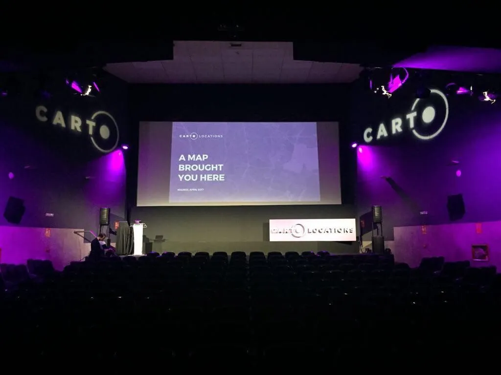
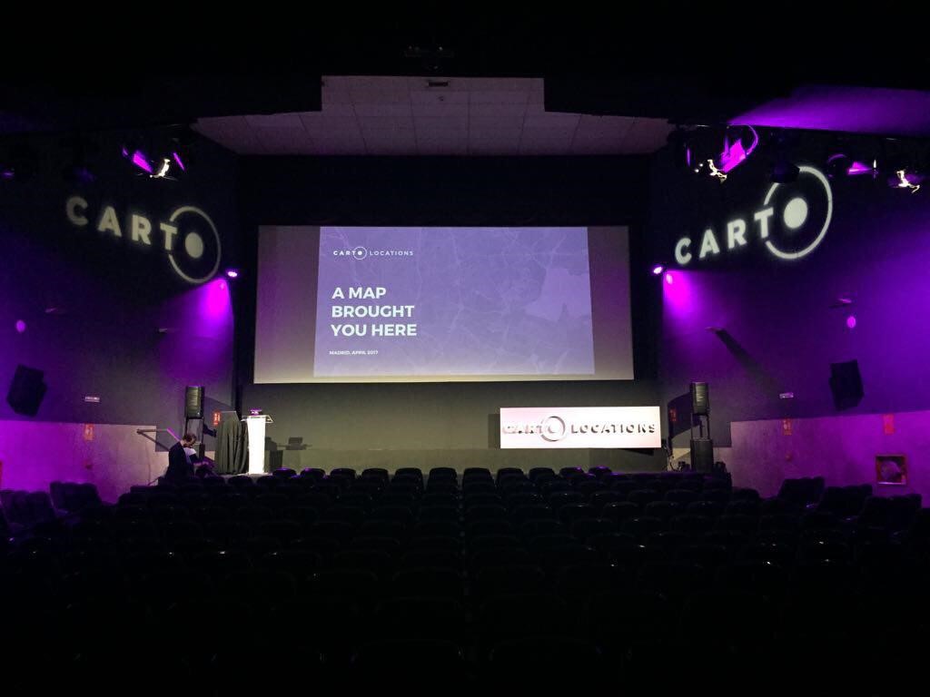
CARTO Locations is a new location intelligence event organized by CARTO, a provider of Location Intelligence software. The first edition of this event took place from April 26-27 at CARTO´s headquarters in the Palacio de la Prensa in Madrid, Spain. With over 300 visitors, some coming from as far as Japan, the event was well-visited. The two-day program offered several speakers and panel leaders from the fields of analytics, data visualization, geospatial analysis, and data science. CARTO staff was present to discuss different components and new releases of the CARTO platform in a series of keynotes and technical sessions, while CARTO partners discussed how CARTO’s platform and location data extends their business and services.

The following article provides a selection of keynotes and technical sessions of the event.

Keynotes

CARTO

The event´s opening keynote was delivered by CARTO CEO Javier de la Torre, who discussed the term location intelligence, which is the process of deriving meaningful insight from geospatial data relationships to solve a particular problem. CARTO´s LI platform is now used by more than 1200 individual customers worldwide to derive and visualize these insights.

New data sources, analytics and audiences are driving a new location intelligence revolution. With “new analysis”, he referred to CARTO Builder, a web-based drag-and-drop analysis tool for business users and analysts to discover and predict key insights from location data. CARTO’s second big product offering is Engine, a one-stop shop of geospatial tools, services and APIs for the rapid development of location applications.  Companies such as Waze, Tile, Airbnb and Uber are all examples of companies that make use of location intelligence, by combining location data with analysis. An example of how CARTO’s technology is reaching new audiences is the Bloomberg Terminal, a software system for monitoring and analyzing real-time financial market data and place trades that now comes with integrated CARTO location intelligence technology.

Telefonica

A number of keynotes were given by CARTO partners that discussed the importance of location data and how it adds value to their products and services. The first one being from Telefonica’s Chief Data Officer Chema Alonso, who made a statement that was repeated many times during the event: companies that make decisions based on location-based data are ahead of companies that don´t. To support this statement, he first showed how consumers use location data for routing, finding a parking space or restaurant information on Google. Second, he showed how companies build user profiles based on where they are, when and how they behave. For the Mobile World Congress in 2017, Telefonica aggregated this data for studying commuter patterns studies around Madrid. In Malaga, Telefonica uses IoT infrastructure to make the city greener and smarter, while the local government uses CARTO technology to monitor information created by sensor technology around the city.

BBVA

Elena Alfaro is Global Head of Data & Open Innovation at BBVA, a bank that is active in both Spain and Mexico. Her keynote provided an interesting view on how BBVA uses big, geolocated financial data from its customers to study and map their behavior: location technology makes it possible to see where in a city or area they make payments. She showed how CARTO’s platform was used to map these payments, as well as to analyze a network of shared customers moving throughout the city and redraw existing boundaries among areas (zip codes). On a larger scale, the same process was executed for large tourist areas in Spain during the summer months, showing where BBVA customers make payments when on holiday.

BBVA’s business customers also benefit from big, geolocated financial data through customized apps that provide insights to business owners as how to improve their business strategy based on information of the area where this business is located. Finally, she showcased BBVA API Market, an online API catalog targeted towards companies, small businesses and developers interested in building value-added services based on financial APIs.

HERE

For CARTO users wishing to use authorized location data instead of OpenStreetMap’s free data, HERE provides location data as a premium service. Leon van der Pas, who is Senior Vice President IoT Business Group at HERE, discussed how HERE is reinventing itself once again in a quickly changing geospatial market. In his keynote titled “A Perfect Storm: Data, Digitization and Disruption”, he explained how location data underpins HERE’s open location platform and how location data provides new insights and possibilities for all industries, not just automotive. He continued with an overview of new location intelligence technologies that require HERE’s location-based data in the future. He expects the drone market to professionalize more, as current technology is insufficient to realize its full potential. A concept that originated in the car industry, the so-called Reality Index that provides a real-time car navigation map, can also contribute to entire cities and its inhabitants and this is where technology providers, mapping companies and the automotive industry are working towards in the coming time.

Presentations on CARTO’s Location Intelligence platform

The first real technical session, “Connecting the Dots”, was delivered by Javi Santana, who is CARTO´s Chief Technology Officer. He showed how location data has changed over the years and that using location data today means handling large volumes of real-time data. One way CARTO can handle such data is through Torque.js, which renders big, time series data in the client. In addition to Torque.js, CARTO works with regular location data from databases such as Oracle, MySQL and PostgreSQL, Big Data platforms (Redshift, Hive). Nowadays, it’s common to use multiple data sources to produce one map: a 21st-century version of John Snow´s cholera maps of the 19th century would involve a combination of location data from public sources, telecommunications, social networks and demographic data. A recent customer story showed how spatial analysis can be used for understanding and predicting the Zika virus in Brazil.

A key product overview of the CARTO platform was provided by Javier Alvarez, who is UI developer at CARTO. This session provided insight to how CARTO Engine and Builder work together, as well as the future of both. While Builder has been created thanks to Engine APIs, Builder also helps to shape Engine by determining the difficulties in developing or expanding APIs, and provides feedback allowing the company to develop simple APIs for solving complex problems. To be released soon is an Analysis UI Framework to run complex geospatial analysis at scale.

Stuart Lyn, Head of Research and Data at CARTO, explained that spatial analysis is different than other types of analysis as data doesn´t stop at boundaries and relationships change from place to place. His presentation focused on geo algorithms and advanced Analytics. CARTO offers spatial analytics tools such as calculation of point clusters found in GIS software and data science software. There´s also a Python module for existing data science workflows called CARTOFrames. A use case that was mentioned many times during the event is the study of movements, and related applications such as optimization of infrastructure, inference (uncovering underlying patterns and relationships in location data) and prediction using spatial and temporal data patterns.

The second conference day opened with a presentation called “Location (without all the hype)” by Sergio Álvarez Leiva, who is CARTO’s Chief Product Officer. While most of his presentation was about early mapping examples, the last part discussed a number of upcoming CARTO product features. Of particular interest were advanced SQL analysis workflows, more and better collaboration tools, a smart vector rendering engine, a new version of Engine, more and better visual collaboration tools, a Pandas interface for integrating CARTO into data science workflows and 3rd-party data streams through the Data Observatory.

This Data Observatory was also the subject of the next presentation, delivered by Stuart Lynn and Javier Noguerol. This data observatory provides out-of-the-box location data for more than twelve countries, as well as access to a catalog of analyzed data methods, and the opportunity to build LI apps on top of fast APIs. This means that available data from the web that might not be easily searchable can also be found through the data observatory through well-formed and named tables and searchable through a list of data provided by CARTO. The data observatory is also a context-providing API that powers spatial analysis.

The past and future of CARTO’s Mobile SDK was discussed by Jaak Laaneste, who is Head of Mobile at CARTO. Since 2009, CARTO used Nutiteq´s mobile maps SDK, offering offline maps, mobile GIS and 3D globes and cities. It was possible to use your own server and GIS backend with the SDK, but some customers wanted a full solution. In 2016, CARTO acquired Nutiteq and released the 4.0.0 version of its own mobile SDK in December of that same year. This SDK offers offline features, is not locked to a specific base map source, has been integrated with the CARTO platform and offers GIS features such editing vector data. An impressive integration roadmap mentions two new updates later this year of the mobile SDK, integration with CARTO´s current and upcoming APIs, such as the new Engine APIs.

The remainder of the program offered presentations on location intelligence and satellite imagery analytics, CARTO´s partner program, Google Cloud and maps, among others. The event concluded with a discussion on the future of CARTO and Location Intelligence, including a Q&A session with CEO Javier de la Torre, Sergio Álvarez Leiva, Javi Santana and Ian Walsh.

Read on
Search