With globalization, population growth, climate change, and increasing demands for resources, today’s designers of the built environment are challenged with serious and complex issues when planning cities and spaces. There is an inherit responsibility to design with nature, providing the most suitable ways to suppress weakness, subdue threats, enhance opportunities and foster the strengths of the site through great designs. Imagine using site data to help craft smarter designs that meet program objectives and overall goals.
GeoDesign is a new and innovative way of designing the built environment, fusing both nature and geography with design. Not just another technology to add on to an already crowded field of design programs, GeoDesign meshes design with value-based information to help designers, planners and stakeholders make better-informed decisions.
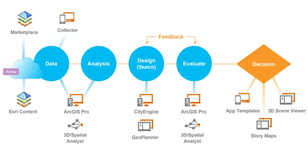
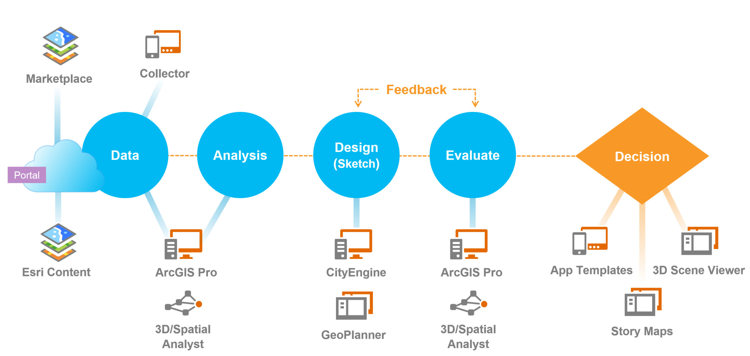
GeoDesign technology offers a set of robust tools that supports rapid evaluation of design alternatives against the impacts of those designs. Esri Inc, the global mapping and GIS company (established in 1969), has developed a set of tools, which combined together form the GeoDesign Solutions Platform. The technology is a powerful extension to GIS that incorporates 2D and 3D creative site analysis, sketching and diagramming, 3D modeling, BIM for urban design and other critical aspects as an integral part of the design process. Think of GeoDesign as a design extension from GIS, powerfully leveraging site data to produce real smart plans, and turning data into understandable datascapes.
Esri’s GeoDesign Solutions Platform combines sketching and modeling tools with the power of geo-data to integrate information, offering a seamless work flow that provides the designer with the tools needed to make smart design decisions.
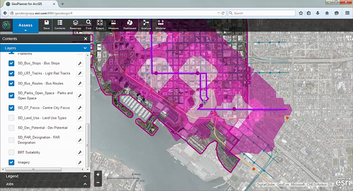
In the GeoDesign process, Esri’s GeoPlanner for ArcGIS (web-based application) enables users to create, analyze, and report on planning alternatives and scenarios through an easy to use interface. By combining web-based analytics, sketching tools and dashboards, designers and planners can visualize design impacts in real time. Using performance indicators applied to multiple scenarios, the designer can select a wise option that is supported by data. Site suitability can be assessed by combining factors such as slope, aspect, population, and distance to water to understand risks in the planning area. Compare and evaluate development scenarios using dashboards and get real time feedback.
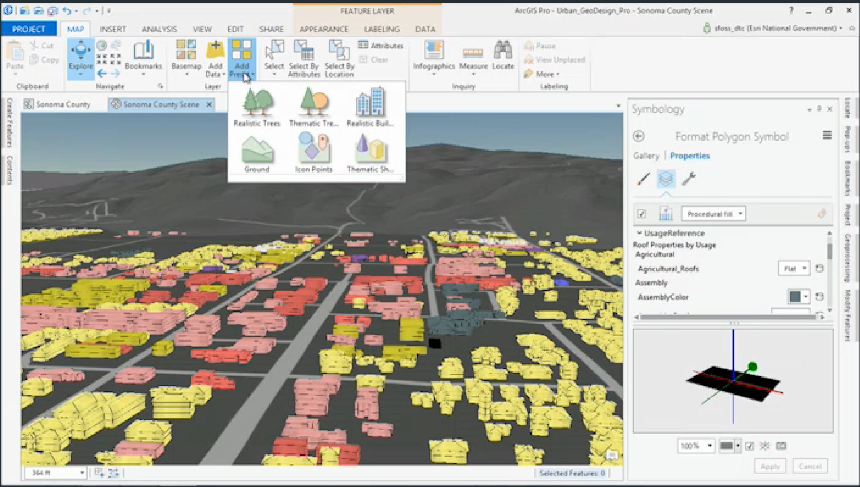
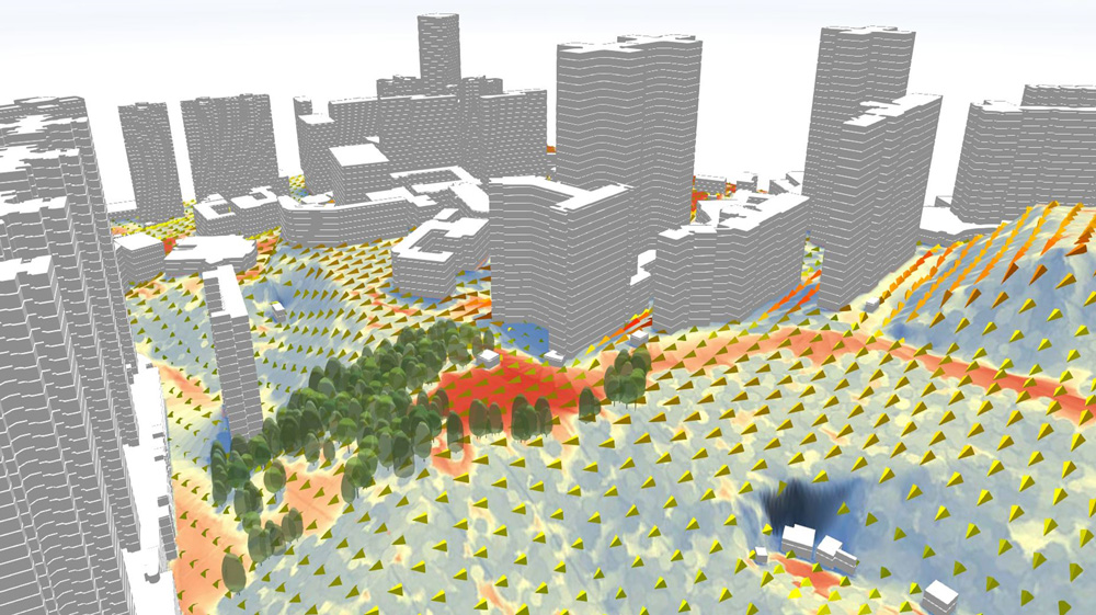
Once the analysis has been done, designers can then import their work onto ArcGIS Pro, where they can perform further analysis on shadows, wind speed, flooding, site water issues, solar radiation, glare and viewshed, all in 3D and within the context of the surrounding built environment. ArcGISPro has a ribbon interface (similar to other 3D modeling and CAD programs) that is easy to use. Populate the landscape with various tree species with the click of a button, or quickly draw and extrude realistic buildings, all in 3D. Because urban plans are attached to data, all changes to the design will reflect changing impacts on the site.
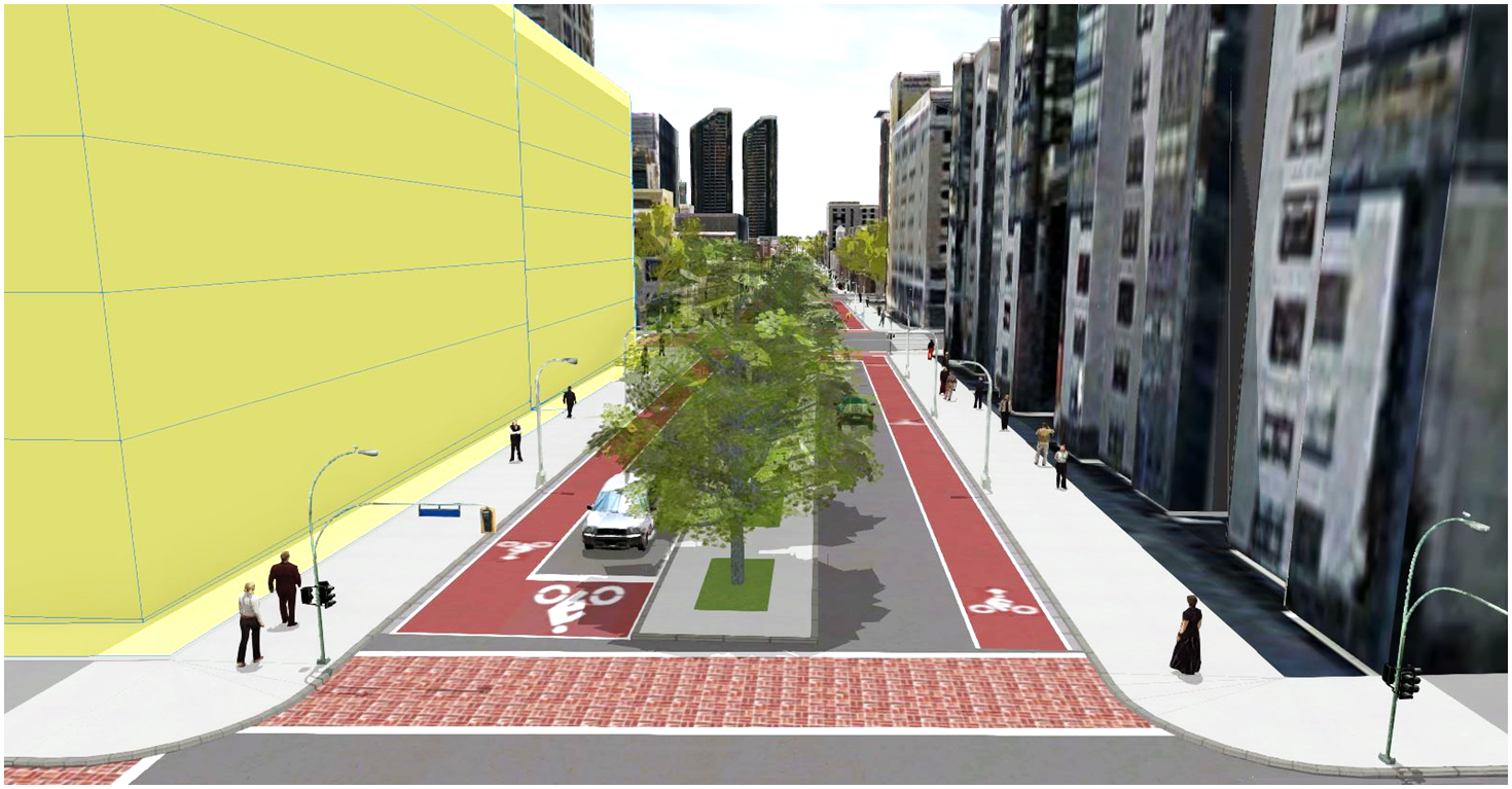
At this stage the project can easily be imported into CityEngine to create smart urban developments that respect zoning laws, reflect the site analysis and show future possibilities. CityEngine allows the user to stipulate, visualize, analyze, and store zoning regulations in 3D. This allows the designer to get instant feedback reporting, making it simple to compare planning proposals and analyze designs. CityEngine can be used to model plan recommendations, using its form-based zoning code as inputs for parametric modeling. The resulting 3D masterplans can help with public engagement during stakeholder meetings, and allow the public to understand and see the new shape of the city.
At a recent GeoDesign Summit at Esri’s headquarters in Redlands, professionals and academics showcased their projects using the Esri GeoDesign Platform: GeoPlanner, ArcGIS Pro, and CityEngine. These powerful tools have become part of a strategic design approach to help them overcome design challenges. It was exciting to see how these professionals have used this new technology to create smart designs to combat complex problems, shaping resilient cities and landscapes supported by evidence-based feedback. Kongjian Yu, Professor and Dean, College of Architecture and Landscape Architecture, Peking University and President and Principal Designer Turenscape, speaks about the power of GeoDesign and the need to use the GeoDesign technology to understand complex issues and create new design solutions. Professor Yu’s company has been a world leader in using GIS technology and landscape architecture to understand and integrate water systems, biological systems and cultural heritage. With these tools he has helped to plan the location of new cities in China, cities that will not put a strain on the natural ecology of the site. Turenscape has used GeoDesign to plan and implement the restoration of watersheds in highly polluted cities, thus providing storm water management, wildlife habitat, and areas of natural beauty for the citizens. Kongjian Yu believes GeoDesign is not just a reasonable way of designing, but also more compellingly, a matter of survival. GeoDesign is the solution to complex problems.
Please refer to this link for further information:
Esri’s Geodesign Platform and link to Gartner Report.
TED TALK on GeoDesign by Jack Dangermond, President and Founder of Esri
Demo Overview of Geodesign Platform: GeoPlanner, ArcGIS Pro, CityEngine
Opening Remarks from the 2015 Geodesign Summit.
Lecture by Carl Steinitz, Professor of Landscape Architecture and Planning, Emeritus, Harvard’s GSD
Special thanks to research assistant Adele Pierre.


