#Business #Ideas

Get ready to see more local ads on your Waze app

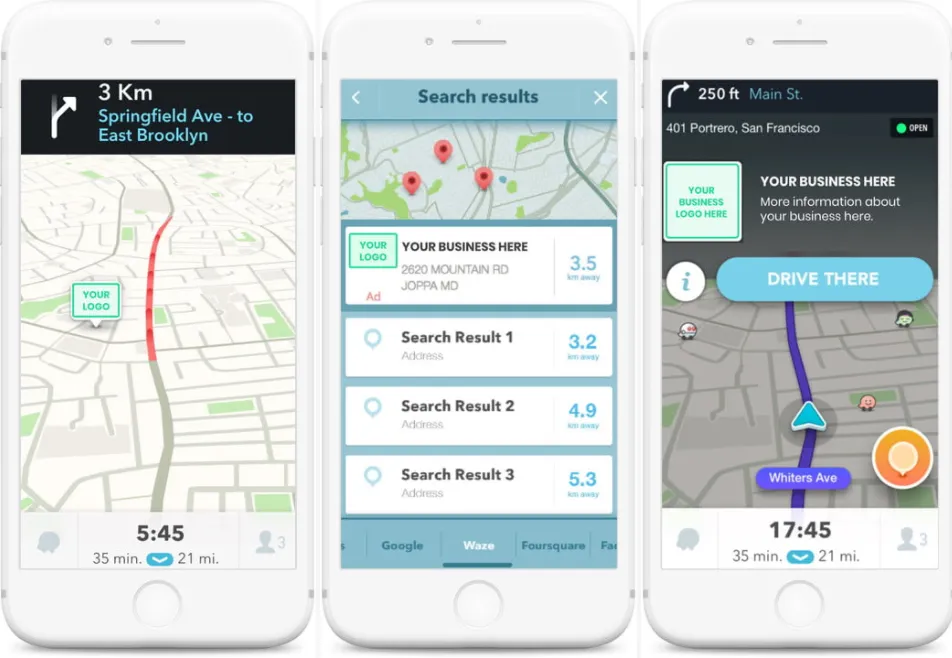
You must have chanced upon branded pins from big brands like McDonald’s or Adidas on Waze already, but get ready to see your neighborhood salon pop up on your favorite navigation app. After a year of experimentation, Google-owned Waze has officially rolled out an advertising platform aimed at small and midsized businesses – Waze Local.

The pricing starts at as little as $2 per day and will allow advertisers to show a branded pin to the commuters driving near their store’s location. Even if the branded pin fails to persuade a driver to stop and visit the store, the least it will do is build brand awareness.

The other ad formats Waze Local is offering include:

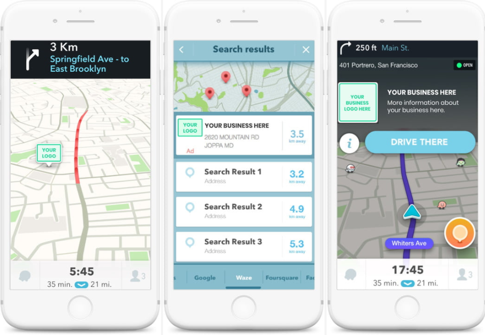
  • Promoted Search: The advertiser’s location will be promoted to the top of search results and include the business’ brand logo.
  • Zero-Speed Takeover: A digital billboard will pop-up when drivers are at a complete stop. This type of ad will take up half of your phone screen and can be availed only by those advertisers who opt for a premium plan.
Waze says it has more than 100 million active users and every dollar spent on the Waze Local platforms gets the advertiser’s message to 384 drivers. During its beta tests in 2017, more than 3 million users visited the stores of Waze Local advertisers – leading to an in-store traffic increase of 20.4%.

Now, if you’re worried about being bombarded with advertisements on your next Waze trip, the company has assured that it will not compromise the user experience with ad clutter. At any time, you will not be shown more than three branded pins.

Geomarketing is only going to get bigger and better in 2018, and Waze looks fully prepared to make the most of this opportunity. According to reports, Waze Local APIs are in the pipeline, as is advertising based on voice activation. Exciting times ahead!

Say thanks for this article (0)
The community is supported by:
Become a sponsor
#Business
#Business #Contributing Writers #Fun #People
History of GIS | ESRI – A Pioneer in GIS Technology
Sebastian Walczak & Nikita Marwaha Kraetzig 07.26.2024
AWESOME 2
#Business #Ideas
Urban Digital Twins in China: A Smart Gadget or a Decision Support Tool?
Nianhua Liu 03.28.2024
AWESOME 4
#Business #GeoDev
3 Pathways For Integrating Planet Data Into Your GIS Workflow
Avatar for Sponsored Article
Sponsored Article 08.12.2024
AWESOME 1
Next article
#Environment

How climate change is forcing sea animals to change their natural behavior

With climate changing making the oceans around Australia warmer further south, many sea animals are also changing their characteristic movements and feeding habits to move within those warmer waters, a decade-long study providing a panoramic view of the underwater world has found.

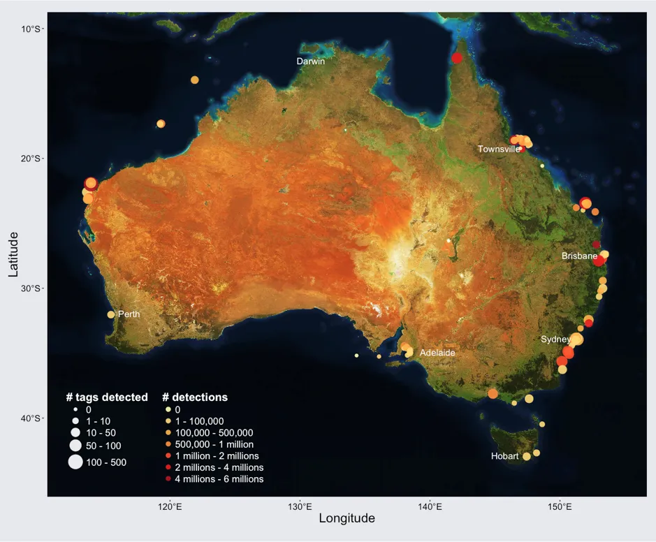
In 2007, scientists at Australia’s Integrated Marine Observing System (IMOS) deployed 3,777 sound-emitting devices on 117 sea animals, including great white sharks, crocodiles, sea turtles, fish, and dugongs. For the last 10 years, they have been tracking the movements of these marine species via 1,891 receiving stations, collecting over 49.6 million quality-controlled acoustic detections till date.

This data has given researchers a wealth of information about how far the animals typically move, what are their preferred habitats, and how their movements have altered over time. The study, for example, brought to fore interesting patterns like the annual migration patterns of grey reef sharks.

The insights from the dataset will also help the scientists to predict how the behavior of aquatic creatures may change as climate change intensifies and leads to warmer waters, oxygen depletion, and ocean acidification. “For example, in the case of bull sharks – a species we tracked that is known to be potentially dangerous – research has shown that they move within warmer waters,” explains Prof. Rob Harcourt, who heads the Animal Tracking Facility at IMOS.

Left/a): Cumulative number of tags registered and detections uploaded on the IMOS web application. Right/b): Inventory of the number of animals tracked for each of the 117 species.

Collaborative effort

The typical range of an acoustic receiver is between 60-950 m depending on local geography, bathymetry, and environmental conditions – which means a large-scale study, spanning thousands of kilometers cannot be undertaken with acoustic tagging.

To overcome this problem, IMOS collaborated with Atlantic Cooperative Telemetry, California Fish Tracking Consortium, Florida Acoustic Cooperative Telemetry, and South Africa’s Acoustic Tracking Array Platform and deployed broad-scale, integrated receiving stations.

As Prof. Harcourt sums up, “The data is available through the online Australian Ocean Data Network Portal, making it a very valuable resource for comparing the behavior of marine animals today and in the future.  We are also going to add the data to public marine species location databases to improve existing biodiversity records and enhance existing geographical distribution maps for Australian sea species.”

Read on
Search