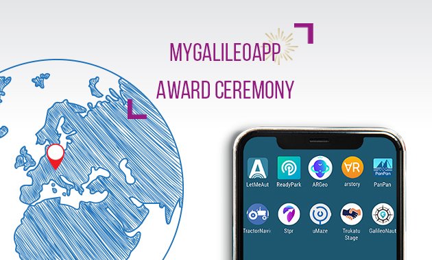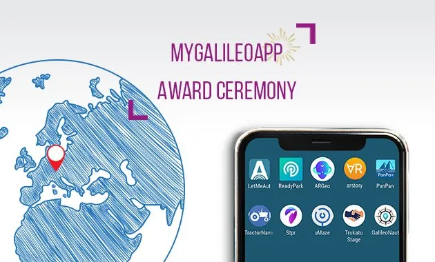
Almost a year ago, the European GNSS Agency (GSA) announced an exciting competition in which contenders had to design, develop, test, and commercially launch a mobile app focused on the utilization of Galileo, the European Global Navigation Satellite System (GNSS). Today, the 10 finalists of this competition are gathered in Prague to learn who will win #MyGalileoApp contest’s top prize of €100.000 (100k Euro).
As we wait for the results, we caught up with the Top 10 to get an insight into the vision behind their innovative apps…
ARGEO
Concept: Leveraging geolocation, augmented reality, and blockchain, this app allows users to discover content such as prizes and coupons geolocated around the streets of a city.
Q. Do you think companies are yet to tap into the full potential of augmented reality when it comes to marketing?
I believe that augmented reality in the next future will be one of the most disruptive technologies in every sector. It will give to the companies the possibility to deeply change their marketing approach and really engage the customers by making them live immersive brand experience. This technology is opening new marketing opportunities, new markets, and new channels. Thanks to the possibility to connect, through this technology, the digital to the traditional channel, cutting and at the same time boosting the relationship between product and physical store, for instance thanks to the geolocation, retail companies, which need today to find a way to survive to the e-commerce, can engage the customer by offering a different purchase experience. Companies that will be able to understand and tap the full potential of this technology will surely take advantage of it in terms of customer engagement, brand awareness, and sales.
Q. What role does blockchain play in this project?
Since the companies will put on ARGEO contents with a real market value, like free products, prizes or shopping cards identified by a unique redeeming code, the role of the Blockchain in this project is to guarantee the maximum safety for every transaction inside the app, since the content is released when it is redeemed by the cashier. In the next future, blockchain will the basis for the launch of ARGY, a token the users can catch and save in order to take part in premium campaigns and other special benefits. ARGY will be the basis for our membership system.
arstory
Concept: This augmented reality ecosystem allows users to leave ‘digital traces’ at real locations and share them with friends and followers.
Q. What kind of ‘digital traces’ are we talking about? Messages? Virtual collectibles?
‘Digital traces’ is a collective term for all the content we want to leave behind in digital everyday life. These can be photos, blog posts, or works of art. The term also refers to digital content that is stored in one place for a specific purpose. This can mean, for example, excitingly visualized additional information at historical sites, but also personal reactions to them.
Q. Are there any plans to connect the app with existing social networks or does a user have to get followers from scratch?
We do not yet have a clear position on this. Basically, it should be possible to share content from arstory into other social networks. How strong the integration should be, we don’t know yet, because we have to balance between our attitude to data protection and user-friendliness. To attract users, however, we are not dependent on other networks, since arstory does not necessarily have to be used as a social network. In contrast to classic social networks, arstory works even if you are the only user of the platform.
Q. What was the inspiration behind this idea?
Mark Frey and Erwin Völkening got to know each other at ETH Zürich, where they exchanged ideas and pitches for possible start-ups. In the exhausting learning phase of the second semester, Erwin spent more time thinking about how to make learning more efficient and presented Mark with the digital implementation of the loci method (a mnemonic technique that links learning content with places) that would deposit content on augmented reality tours through the real world. Mark then developed the idea further with Erwin and expanded the scope of the project. After long discussions and many discarded concepts, the idea for arstory was born.
GALILEONAUT
Concept: Acting as a link between the harbor master’s office of a marina and sailors, this app assigns a docking place to a boat entering the port without requiring any assistance from the harbor master’s office.
Q. Why sailing? How much time does it traditionally take for a boat to secure a docking place at a marina?
I am not personally a sailor. But a member of our team, Serge, is. He is at the initiative of the topic of GALILEONAUT. Waiting time to receive a docking place could be long, depending on the availability of the person in charge at the master’s harbor office and of the number of simultaneous requests. As an example, during the summer, this waiting time can be longer than one hour.
Q. In how many ports/countries do you plan to launch the app? How many sailors do you expect your app to benefit on a daily basis when it is at its full capacity?
Today, we work with Port Leucate, a French Mediterranean port, as a proof of concept of GALILEONAUT. But our business scaling strategy is not to sell our app directly to ports or marinas, which would be long and not very efficient, but to offer it to existing solutions already connecting sailors and ports (but not proposing guidance inside ports!). In this way, our solution could be used by thousands of sailors all around the world (Europe, North Africa, the Caribbean, etc.).
PanPan – Possible Assistance Needed
Concept: This backup safety solution is intended to send a distress signal during potentially dangerous activities when users may not be able to do it themselves.
Q. What was the motivation behind this idea?
Since both of us have had careers in emergency services, we have first-hand experience in what it means to search for a missing person and how minutes can make a difference between life and death. Now we want to use our skills as software developers to increase the chances of people being found in time if the worst happens.
Q. Your project description says: “The App will come into action when you are not able to send a distress signal yourself.” Will the app send an auto signal if the user doesn’t indicate the finish of an activity in the estimated time? Who all will the message go to?
Your assumptions are correct. When starting an activity you set an expected duration and select contacts from your phonebook. When the expected return time has passed, the App will notify the user asking if they are alright. If there is no reaction for more than 10 minutes, the alarm will be sent out to the selected contacts automatically (including last known locations). Think of it as a countdown you set it when starting and cancel it on return. If it is not actively canceled, the alarm will be triggered. Additionally, the alarm can also be triggered manually by the user if he is still able to.
Ready Park
Concept: This app enables users to exchange parking spots with other users in real-time.
Q. Which are the cities/neighborhood where you expect the app to find early users?
During the proof-of-concept phase (i.e. since phase 1 of #MyGalileoApp challenge) ReadyPark has already succeeded in mobilizing more than 500 users in the southeast French region especially in the city center of Nice and Marseille (2nd and 5th biggest french cities) where parking is a very painful experience. Now we expect to find early users in other cities with :
- Fast-growing population
- High C2C services adoption level
- Expensive off-street parking spots
- Decrease of on-street parking spots
Most of the big and medium cities in Europe (at least) meets these criteria. In such cities, looking for parking represents 30% of traffic. To spread the sharing spirit of ReadyPark in the near future, we will focus our communication on the main European big cities.
Q. What is your personal experience of parking pains?
We live in the southeast French region, more specifically in Nice (we also used to live in other big cities like Paris, Marseille, Athens) where parking is an everyday pain. In those cities, it can take you more than 30 minutes to 1 hour to find an on-street parking spot. Moreover, in Nice and Marseille, parking is such an issue that people are used to the triple parking line; it is a crazy situation, really painful and unbearable.
Q. Do you anticipate any conflict with users who do not use the app? There are chances a non-user may be eying the same spot as an app user…
You are right, it may happen and we anticipated it! As parking is a real-time issue, if an on-street spot is available, it may be quickly taken. A key factor in ReadyPark is that it rewards the users giving their spot (the “giver”) if they wait for the user nearby, selected by ReadyPark, who is going to take the spot (the “taker”). The Taker is selected by ReadyPark on different criteria such as proximity to the giver, car size compatibility, and sharing level in ReadyPark.
To facilitate the exchange and avoid that a non-user takes the spot, ReadyPark informs both users on the brand, size, and color of the other vehicle. Moreover, the giver is rewarded only if he exchanges with the selected taker. ReayPark detects automatically if it is the case ! So, the giver is motivated to leave his spot only if the taker vehicle is approaching. Like in Uber, the giver can follow the taker route and see when and from where, he is coming.
Furthermore, Readypark indicates the estimated route time for the taker to arrive; so, if someone else arrives before the estimated time, the giver doesn’t leave his spot if he wants to be rewarded and doesn’t show that he is going to leave if he wants to avoid any conflict. There is a very small probability that a non-user arrives approximately at the same time and with a similar car to that of the taker.
STPR (Wander)
Concept: With an aim to provide high-level education and storytelling value to its users, this game combines a virtual environment with game-related physical experiences in the real world.
Q. How does the game work? Does the user actually have to go to specific locations in real life?
Wander app is not so much a game, as a new way of traveling with an element of a scavenger hunt. It provides users with a path that wanders through unique, worthy and photo-friendly sites within a city. Removing the need to search endlessly on google maps or trip advisor to easily find a great place to eat or have a coffee.
Each tour is punctuated with a series of tasks that require the player to take actions in real life, like reaching a specific location or investigating their surroundings. Completing those quests will reward the user not only with coins and experience but with a truly engaging narrative. We want to bring the story of the city to visitors, and leave them wanting to learn more, not just a superficial and often confusing or stressful tourist experience.
Q. What previous experience do you hold in gaming? Where did the inspiration for this game come from?
Have you ever felt overwhelmed with options and places to see during your trip? Because this problem was bothering us virtually every time the people in our team traveled. I was especially weary of googling the next place to go and constantly scrolling TripAdvisor to locate the best spots to see.
When I first came to Poznań for my studies, my initial sense of overwhelming loss at what to do next was what sparked this idea of a curated travel app with elements of AR. I wanted to have my own private city guide right in my pocket. A guide that would tell me, based on my interests, where I should go, eat, and take some photos. I wanted to learn about the true story of the city, but not have to go through every single museum, blog post, and guidebook to get that information.
And so with our team, we started developing this idea into Wander. We are part of a world-recognized software and eCommerce agency. We perform R&D work behind the scenes so that our clients always have access to cutting-edge tech like machine learning, augmented reality or robotics. We believe our experience crafting a strong user experience will carry over here and bring a delightful and smooth app for travelers everywhere.
Tractor Navigator
Concept: This app provides guidance for farmers driving tractors, enabling them to visualize their current position and trajectory in an open field.
Q. What is the accuracy of localization that this app provides?
The accuracy is around 1m when you are in optimal conditions: dual-frequency GNSS receiver in smartphone (like Xiaomi mi 8), open sky environment (generally true in the field) and lots satellites in range. We are also working on improving accuracy further (<1m) by offering the possibility to apply RTK/DGPS correction in realtime from nearby NTRIP station.
Q. Generally, one would expect that a farmer can tell a plowed or tilled area from undisturbed one even by sight… So, how did you come with the idea of creating an app for farm navigation?
Yes, of course, if you are plowing the app it is not necessary. The use cases of this app are for fertilizing, seeding grassland, or winter crops for which it is not easy to tell where you already worked by sight. One of the team members has a small farm, he was wondering if it was possible to have this simple guiding help with only his smartphone without having to invest in a more advanced guiding system with an external antenna and dedicated software.
Trukatu
Concept: This mobile C2C platform connects people who want to rent or lease items with owners who have items to rent out.
Q. How does the in-built insurance mechanism work and how does that safeguard users against fraud?
Trukatu will establish partnerships with insurance companies. The insurance will cover potential damage caused to the products by the renter, as well as instances of theft. We establish a process of ID Verification so that the identity of the renter and lender is known to us. Potential fraud, such as the refusal of payment, is prevented as Trukatu collects the payment from the renter immediately once the rental deal has been made through the app. However, the money will only be paid out to the product owner once he has handed over the item. The renter then needs to confirm having received the item and the product’s functionality. Only then, the payment will be forwarded to the lender.
Q. Since ‘meet’ is an essential part of the process, what security steps does the app follow to make sure an antisocial element is not able to exploit this functionality?
Firstly, the personal data of the renter and lender are not shared with each other. A chat functionality inside the app allows both sides to communicate so that personal information such as phone number and email address does not have to be exchanged.
In the app, it is possible to share ones’ location with the other person to make the meeting process easier. However, this is not mandatory. At the same time, the sharing of location supported by Galileo can be used to make it easier to meet at very public places. Both sides can, for instance, agree to meet in the waiting hall of the main train station and exchange the item in that location without having to reveal the home addresses or other private meeting points.
In the future, we plan to include parcels self-drop stations as possible exchange locations in the app. Then, renter and lender will not have to meet anymore in person if they exchange medium-sized or small items. Instead, they can use the existing infrastructure to pass on the item to each other and remain entirely private if they wish to do so.
uMaze
Concept: Using the accuracy of Galileo to develop local cartography, this app creates a small-scale virtual maze in specific outdoor areas wherein users can play.
Q. Is there any minimum area requirement to launch and play the game? Are there various difficulty levels?
Yes, there are three levels of difficulty:
- Easy
- Medium (Galileo accuracy recommended)
- Hard (very high accuracy only)
The difficulty setting controls how wide the passages in the maze are. With easy (10 meters), the GNSS position doesn’t have to be extremely accurate, whereas with medium (5m) and hard (2m), any drift or inaccuracy in the position signal is a problem. The minimum area required to create a maze is in the function of the shape of the area (e.g. square) and the difficulty level.
Based on those criteria, currently uMaze requires:
- Easy requires approx. 800m² minimum
- Medium requires approx. 200m² minimum
- Hard requires approx. 25m²
We are promoting uMaze with a minimum of 25m². That requires a hard difficulty setting, though, and there won’t be much of walls in the maze, if any.
Q. Do maze creators get any pre-defined maze designs or templates?
The mazes are generated by uMaze randomly. The role of the creator is to define the “physical” constrains of such a maze. In other words, the creator maps with uMaze:
- Indicates the perimeter of the maze
- If there are any obstacles inside the perimeter (e.g. trees, water, rocks, bushes, human-made objects)
- Specify the entrance(s) to the maze.
- Decides the level of difficulty
Finally, uMaze generates a maze within those constraints.
LetMeAut
Concept: This app aims to support people with autism by giving instructions for outdoor daily-life movements.
Q. What made you choose the subject of autism?
One of the members of the team has been observing this disorder closely in the past years, coming in contact with autistic people and their families, and understanding their struggle thanks to the help of professionals. It became clear that spatial navigation was one of the difficult tasks for people of the spectrum, given the high amount of information that has to be processed with it. Therefore, when this competition came up, we couldn’t think of a better match.
Q. How different is LetMeAut from the other apps available today to assist people with autism? What role do you see localization playing in helping people on the spectrum?
What makes LetMeAut different from other ASD related apps, is exactly what it focuses on. Just a quick search on the stores will provide you with several good apps aiming at improving social, learning and speaking skills, at organizing the daily schedule, at helping these people to go through static tasks.
Nonetheless, none of them is intended to help autistic people move around, while, on the other side, there are plenty of apps trying to do it for the neurotypical people. Localization has an important role also for autistic people, because moving around alone is one of the major expressions of autonomy, and increasing autonomy is one of the ingredients to increase the quality of life.
Stay tuned to Geoawesomeness for the results!

 Featured Job: Fullstack Developer at Mapz
![]() CartoVista: GIS and Cartography Manager
CartoVista: GIS and Cartography Manager![]() Hasso-Plattner-Institut: Ph.D. & PostDoc Position
Hasso-Plattner-Institut: Ph.D. & PostDoc Position![]() Vizzuaity: Scientist
Vizzuaity: Scientist![]() University of Houston: Assistant or Associate Professor – Geosensing Systems Engineering
University of Houston: Assistant or Associate Professor – Geosensing Systems Engineering![]() Natural Capital Project: Software Engineer
Natural Capital Project: Software Engineer![]() BASF: Internship Remote Sensing / Satellite Products
BASF: Internship Remote Sensing / Satellite Products![]() Descartes Labs: Software Engineer – Platform
Descartes Labs: Software Engineer – Platform![]() Premise: Junior Geospatial Data Scientist
Premise: Junior Geospatial Data Scientist![]() Orbica: Geospatial Developer
Orbica: Geospatial Developer![]() TEKSystems: Business Intelligence Analyst
TEKSystems: Business Intelligence Analyst


