
It’s Here! The 1st edition of the Geoawesome “Geospatial for Good” Report is Ready for Download.
Earlier this year, we asked for your help in showcasing the positive impact of geospatial technology on the world. Today, we are thrilled to announce that the “Geospatial for Good” report is now available for everyone to download!
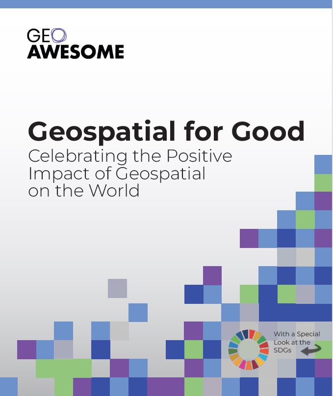
This community-driven report highlights the incredible work being done across the globe, using geospatial data and tools to address the UN’s Sustainable Development Goals. Inside, you’ll find real-world case studies and project spotlights that demonstrate how our community is making a tangible difference in areas like climate action, public health, and sustainable development.
We are incredibly proud of what we have created together, but this is just the beginning. We invite you to download the report, share it with your networks, and let us know what you think. Your feedback is invaluable as we continue to tell the story of how geospatial technology is changing the world for the better.
Download the full report here and join the conversation. We look forward to hearing from you!
Acknowledgements
The report was authored with the active participation and support of several members of the community including Rhiannan Price, Bill Greer, Kiri Carini, Rohini Swaminathan, Sebastian Walczak, Isabella Merschdorf & Muthukumar Kumar. Geoawesome extends our sincere gratitude to Seamus Geraty for his invaluable assistance throughout the editing, design, and publication phases.
For questions, comments and suggestions, please contact muthu@geoawesome.com


#Fun


Next article
In today’s world, 3D data is no longer a niche element in geospatial science – it’s becoming the necessary resource of urban analysis, environmental modeling, and AR visualization. But with this explosion of data comes a question: How do we organize, stream, and analyze 3D datasets efficiently? Here, 3D tiles come on stage!
Google Earth, Google Maps, and the Google Tile API
When talking about 3D tiles, it’s impossible not to mention Google Earth. Google has been a pioneer in large-scale 3D terrain and city visualization, creating some of the most detailed photorealistic 3D models available.
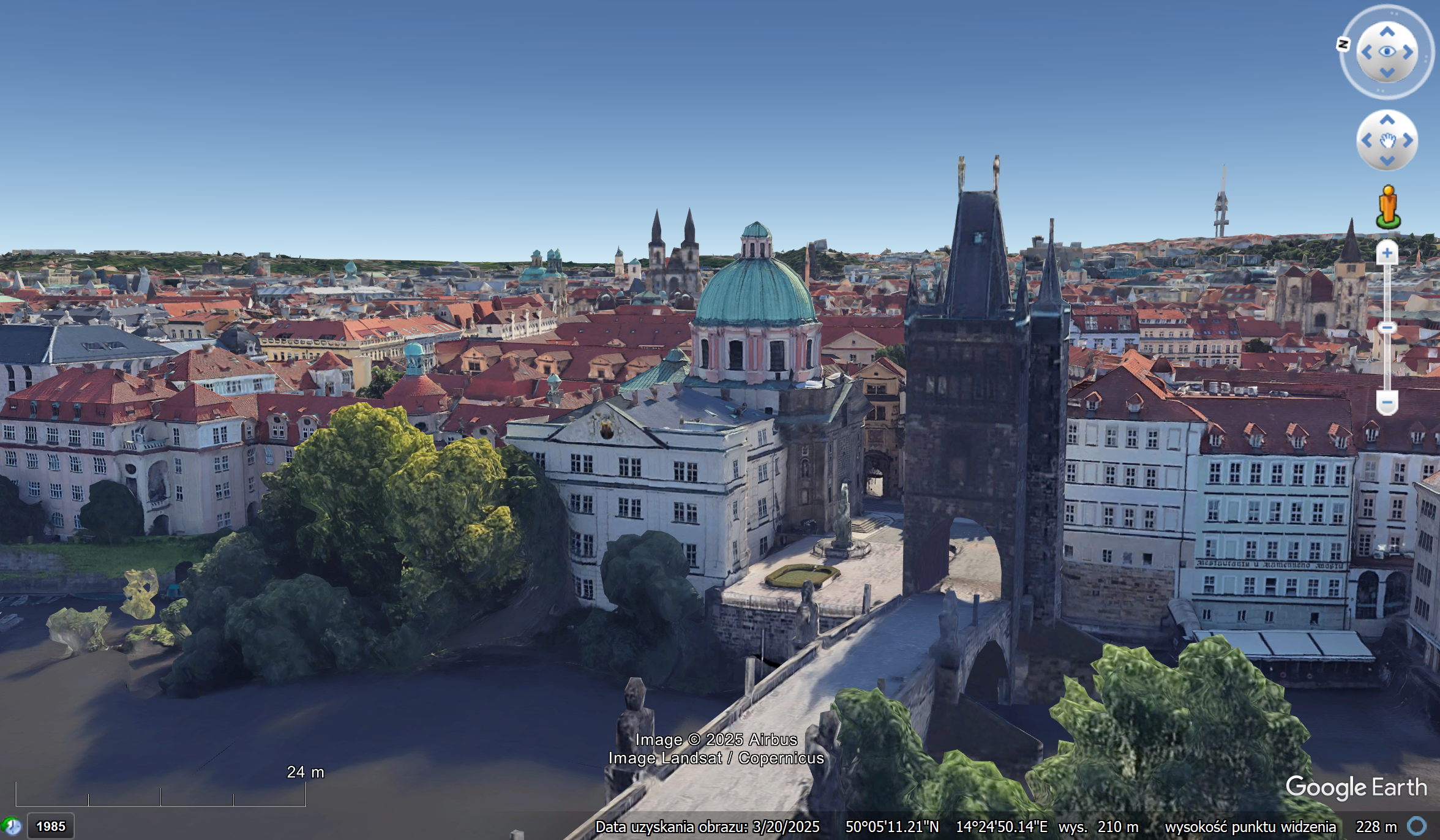
In 2023, Google opened part of this ecosystem through the Google Tiles API, which enables developers to access vector and raster tiles for custom applications. While the API is primarily focused on 2D/2.5D data today, its architecture lays the groundwork for integrating 3D tiles into broader mapping and AR experiences.
OGC and the Standardization of 3D Tiles
To prevent a fragmented 3D ecosystem, the Open Geospatial Consortium (OGC) developed an open specification for 3D tiles. The following is a list of relevant points: The OGC 3D Tiles Standard is a set of guidelines that define how to create, manage, and consume 3D tiles. It provides an overview of the methodologies for the structured storage and streaming of 3D geospatial data at scale. This approach ensures seamless interoperability among tools, datasets, and platforms, a necessity as more industries adopt 3D workflows.
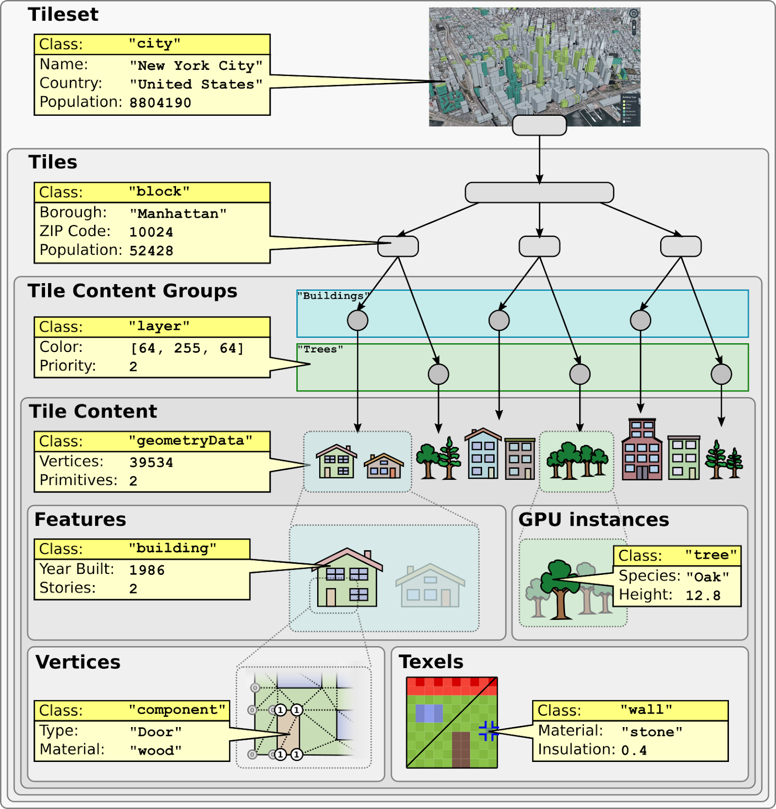
Cesium: The Engine Powering 3D Tiles
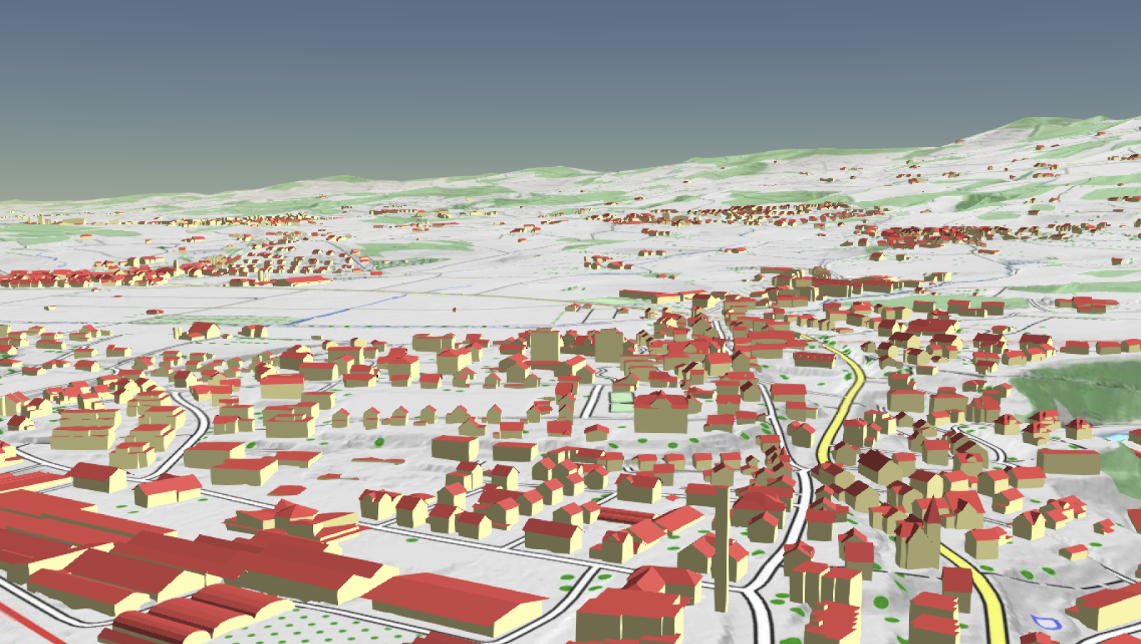
If 3D tiles are the data, Cesium is the engine that strengthens their potential. Originally developed to handle massive 3D geospatial datasets for aerospace applications, Cesium became the reference implementation for 3D Tiles and remains a leading platform for streaming and visualizing them. Many of today’s digital twin platforms, city-scale models, and online 3D maps are built on top of Cesium’s open-source engine and Cesium Ion services.
Peter Rabley even highlighted the transformative power of 3D tiles in a Geoawesome Problem Solved episode, noting how they allow cities and organizations to move from static maps to dynamic, interactive 3D environments.
Visualizing and Using 3D Tiles
The beauty of 3D tiles is that they are not limited to one type of data or one platform. Photogrammetry meshes, LiDAR point clouds, BIM/CAD models, and vector data can all coexist in a single 3D tiling structure.
Visualization tools include:
- CesiumJS / Cesium Ion: Web-based streaming of city-scale 3D models.
- Google Earth Engine (future potential): Combining 3D tiles with Earth observation.
- Panoramic video generation: Tools are emerging that can render cinematic fly-throughs or 360° panoramas of 3D-tiled cities.
- Urban digital twins: Municipalities use 3D tiles to run simulations for energy efficiency, flooding, and transportation planning.
Why 3D Tiles Matter
Urban planning, AR navigation, and digital twin projects are growing. 3D tiles will be the foundation for 3D geospatial data. This data can be scaled up or down and works well with other systems. The message is clear:
Geospatial analysis is going to be all about 3D, and 3D tiles are going to be a great part of it.
Read More
- 3D Tiles Demo
- 3D Tiles in QGIS – How to load and use 3D Tiles in QGIS?
- Cesium Photogrammetry Example – Real-world photogrammetric tileset in Cesium Ion.
Read more and subscribe to our monthly newsletter!

