


Welcome to our third GeoawesomeQuiz! Have you already tested your knowledge on quiz 1 & 2? This week the Quiz is even more challenging. Have fun!
[mlw_quizmaster quiz=3]


#Fun


Next article
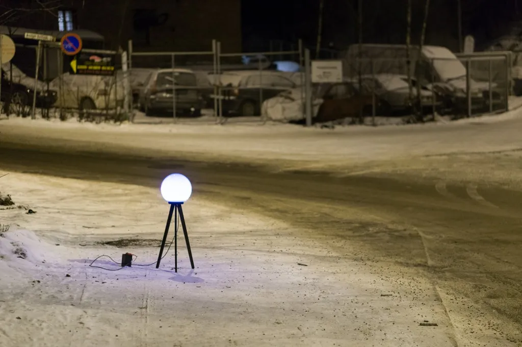
Recently we came across an interesting artistic projected called Satellite Lamp. The artist Timo Arnall placed around Oslo, Norway 50 GPS equipped lamps which change brightness according to the accuracy of received GPS signals. Than he photographed them as time-lapse films in order to start to build a picture of how these signals behave in actual urban spaces.
The project investigates what Timo describes as “one of the most important, yet completely normalized, modern infrastructures.” And in fact that’s true. How many of your mortal, spatially unaware friends understand GNSS technology? They seamlessly use it everyday but they don’t really understand how it works.
Everyday city life is being shaped by the technologies and devices in our pockets, creating new social and spatial practices. These products are made possible by vast technical infrastructures and complex systems that we rarely see and that we often know very little about. GPS is a good example of how these systems are often invisible, often obscure or go unseen, and are becoming increasingly mundane.
The main outcome of the project is the video:
Totally Geoawesome!

