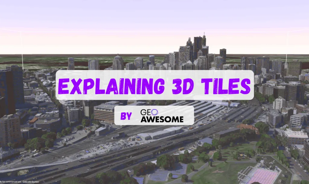

In today’s world, 3D data is no longer a niche element in geospatial science – it’s becoming the necessary resource of urban analysis, environmental modeling, and AR visualization. But with this explosion of data comes a question: How do we organize, stream, and analyze 3D datasets efficiently? Here, 3D tiles come on stage!
Google Earth, Google Maps, and the Google Tile API
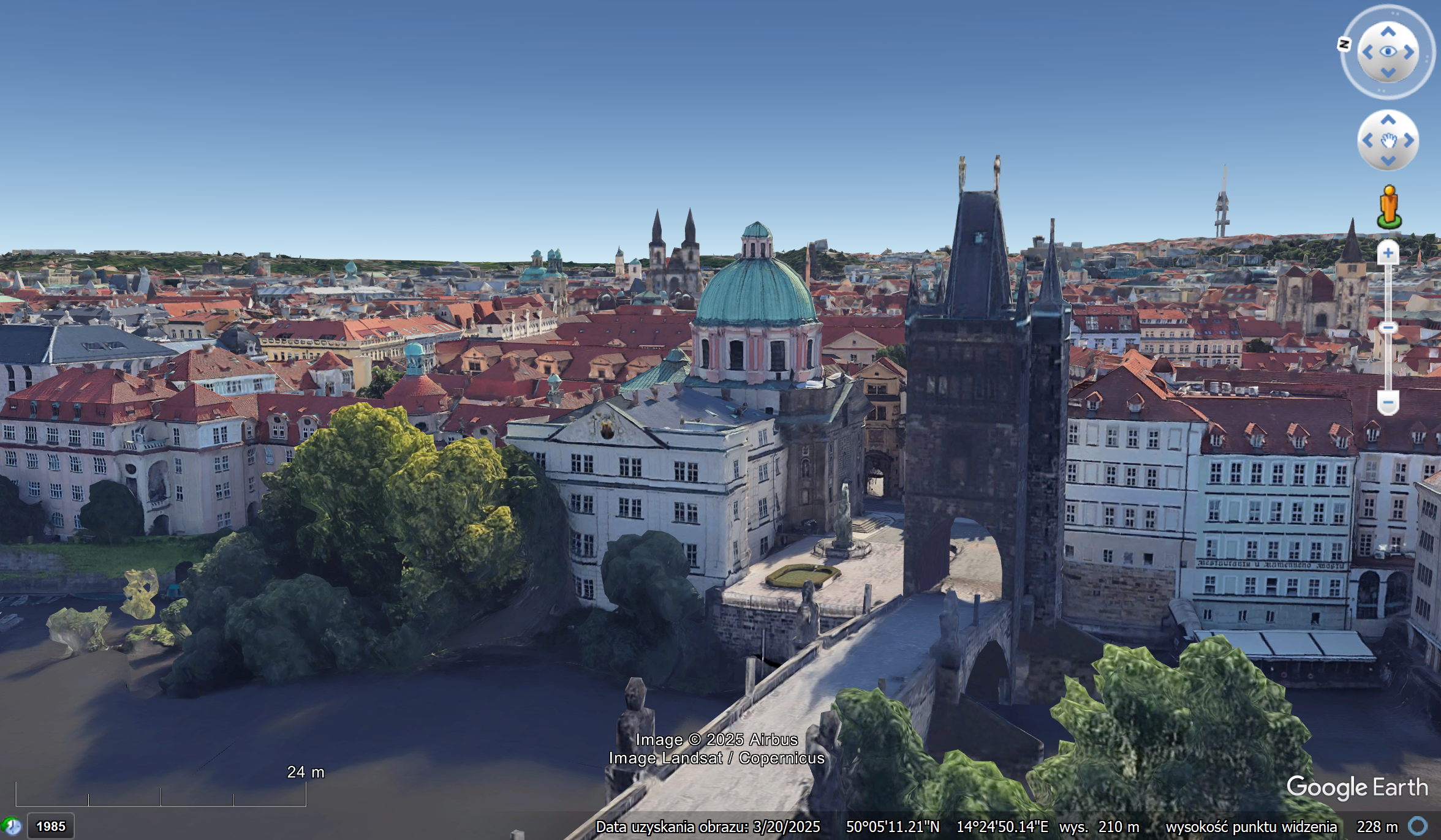
When talking about 3D tiles, it’s impossible not to mention Google Earth. Google has been a pioneer in large-scale 3D terrain and city visualization, creating some of the most detailed photorealistic 3D models available.
In 2023, Google opened part of this ecosystem through the Google Tiles API, which enables developers to access vector and raster tiles for custom applications. While the API is primarily focused on 2D/2.5D data today, its architecture lays the groundwork for integrating 3D tiles into broader mapping and AR experiences.
OGC and the Standardization of 3D Tiles
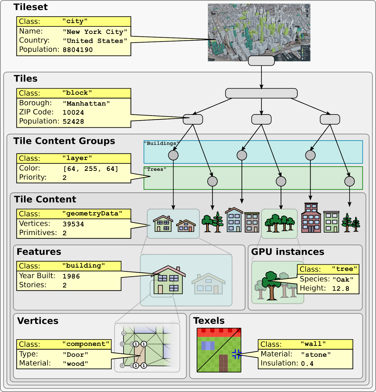
To prevent a fragmented 3D ecosystem, the Open Geospatial Consortium (OGC) developed an open specification for 3D tiles. The following is a list of relevant points: The OGC 3D Tiles Standard is a set of guidelines that define how to create, manage, and consume 3D tiles. It provides an overview of the methodologies for the structured storage and streaming of 3D geospatial data at scale. This approach ensures seamless interoperability among tools, datasets, and platforms, a necessity as more industries adopt 3D workflows.
Cesium: The Engine Powering 3D Tiles
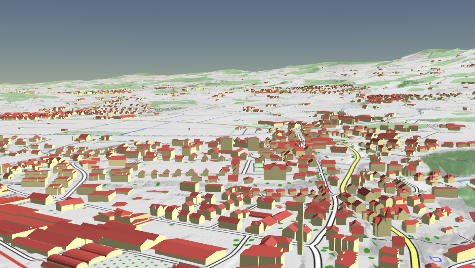
If 3D tiles are the data, Cesium is the engine that strengthens their potential. Originally developed to handle massive 3D geospatial datasets for aerospace applications, Cesium became the reference implementation for 3D Tiles and remains a leading platform for streaming and visualizing them. Many of today’s digital twin platforms, city-scale models, and online 3D maps are built on top of Cesium’s open-source engine and Cesium Ion services.
Peter Rabley even highlighted the transformative power of 3D tiles in a Geoawesome Problem Solved episode, noting how they allow cities and organizations to move from static maps to dynamic, interactive 3D environments.
Visualizing and Using 3D Tiles
The beauty of 3D tiles is that they are not limited to one type of data or one platform. Photogrammetry meshes, LiDAR point clouds, BIM/CAD models, and vector data can all coexist in a single 3D tiling structure.
Visualization tools include:
- CesiumJS / Cesium Ion: Web-based streaming of city-scale 3D models.
- Google Earth Engine (future potential): Combining 3D tiles with Earth observation.
- Panoramic video generation: Tools are emerging that can render cinematic fly-throughs or 360° panoramas of 3D-tiled cities.
- Urban digital twins: Municipalities use 3D tiles to run simulations for energy efficiency, flooding, and transportation planning.
Why 3D Tiles Matter
Urban planning, AR navigation, and digital twin projects are growing. 3D tiles will be the foundation for 3D geospatial data. This data can be scaled up or down and works well with other systems. The message is clear:
Geospatial analysis is going to be all about 3D, and 3D tiles are going to be a great part of it.
Read More
- 3D Tiles Demo
- 3D Tiles in QGIS – How to load and use 3D Tiles in QGIS?
- Cesium Photogrammetry Example – Real-world photogrammetric tileset in Cesium Ion.
Read more and subscribe to our monthly newsletter!

#GeoDev


Next article
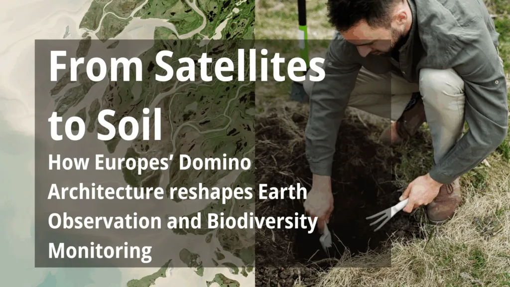

In a muddy riverbend in southwest England, researchers wade through a newly restored wetland, measuring how a meandering stream has begun to reclaim its ancient course. Hundreds of kilometres above, a satellite silently passes overhead, capturing images that may help determine whether the effort is working. This is no one-off science experiment — it’s part of a quiet revolution unfolding across Europe: a convergence of ecology, Earth observation, and environmental economics that could reshape how we fund and protect the natural world.
Three public-funded initiatives — Domino-E, BIO-CAPITAL, and Klimagärten³ — are working at the intersection of satellites and soil, building a new foundation for valuing biodiversity. Together, they hint at a future where ecosystem restoration is not just a moral imperative, but a measurable, monitorable, and even tradable asset.
Satellites, Smarter and More Strategic
At the technological frontier is Domino-E, a European project developing the next generation of ground segment infrastructure for Earth observation. While relatively unknown outside the EO community, its impact could be foundational.
Domino-E’s ambition is to make satellite observation more responsive, decentralised, and user-driven — not only for defence or disaster response, but for long-term climate and biodiversity monitoring. Its key innovations include:
- The Coverage Service, which identifies gaps in satellite data coverage — enabling researchers to target overlooked but ecologically critical areas, such as small wetlands or fragmented green patches in cities.
- The Smart Catalogue and Request Management System (SCRMS), which automates and prioritises tasking requests to available sensors — including commercial high-res constellations.
- The Visual Analytics Service (VAS), which simplifies access and interpretation of satellite data through user-friendly interfaces and AI-based analysis tools.
These services lower technical and financial barriers to accessing satellite data — and make it feasible to integrate EO into biodiversity projects at a much larger scale. While the infrastructure is still in development, projects like BIO-CAPITAL and Klimagärten³ are already preparing for what this shift could mean. In the near future, satellite-derived biodiversity indicators could be automatically generated and delivered — not just to scientists and agencies, but to landowners, schools, and municipal governments.
Turning Biodiversity Into a Balance Sheet
That’s exactly what BIO-CAPITAL is piloting across diverse landscapes in the UK, France, Italy, Slovenia, Romania, and Austria. The project brings together ecologists, remote sensing experts, and policymakers to tackle a deceptively simple question: Can biodiversity gains be measured accurately enough to generate financial value?
In southwest England, riverbeds are being rewilded, wetlands restored, and tree corridors reconnected. But without long-term data, these efforts struggle to secure sustained funding: “If you can’t measure uplift in biodiversity, it’s hard to argue for long-term investment — or protection.
High-resolution EO data — combined with field validation — allows for consistent biodiversity monitoring over time. This is especially crucial in the context of Biodiversity Net Gain (BNG) policies, which require developers to not just offset damage to ecosystems, but show a net ecological benefit. In this framework, a destroyed meadow might be compensated by restoring a wetland elsewhere — but only if the improvement can be verified.
BIO-CAPITAL is testing how EO data can provide that verification. If successful, it would turn restored habitats into certified environmental assets — with quantifiable, traceable value. Domino-E’s infrastructure could be the engine that makes such monitoring affordable and scalable across Europe.
Measuring Biodiversity One Garden at a Time
The Klimagärten³ project in Austria brings this logic to the micro-scale — focusing on urban and peri-urban green spaces like school gardens, public parks, and community plots. The goal: assess their potential as carbon sinks and biodiversity hotspots.
While satellite data at this scale is still limited, Klimagärten³ is laying the groundwork. Local partners are experimenting with soil sampling, in-situ sensors, and EO-informed modelling to estimate how much CO₂ is stored in the vegetation and soil of everyday green spaces: If we want cities and citizens to take carbon farming seriously, we need to provide tools that are credible, affordable, and user-friendly.
Domino-E’s services could one day fill this gap. Automated tasking, simplified interfaces, and machine-learning-enhanced analysis may soon allow municipalities and citizen groups to access EO-based indicators without relying on costly consultants. While EO data is not yet reliable enough for single-garden analysis, the trajectory is clear — and Klimagärten³ is watching it closely.
Restoration as a System, Not a Slogan
Taken together, these three projects suggest a new European paradigm: one where ecological recovery is quantifiable, verifiable, and ultimately bankable. As the EU pushes forward with the Nature Restoration Law and the Green Deal, the need for credible monitoring systems will only grow.
Domino-E provides the infrastructure. BIO-CAPITAL demonstrates the financial and regulatory integration. Klimagärten³ ensures the approach reaches even the smallest patches of green.
The implications extend beyond environmental policy. In a warming world, restoration must scale — and that means creating a system where protecting nature becomes a rational economic choice, not just an ethical one. That future may not be far off. In fact, from satellites to soil, it’s already starting to take shape.

