The New Elevation Product From Airbus is Set to Offer DEM with 0.5m Resolution
The geospatial community has been buoyed by continual improvements in the quality of satellite data which allows users to look at the world from a completely different perspective. The accelerated innovation has opened the doors for very high-resolution data that unlocks a whole new range of new applications. A great example is the new Pléiades Neo data from Airbus that we’ve covered previously here on the blog.
This type of high-resolution satellite imagery allows us to not only have a 2D view of the entire globe, but it also allows us to piece together multiple images to create sophisticated 3D models using the principles of photogrammetry.
Introducing DEM Airbus
Airbus’ Elevation Portfolio offers a large range of Elevation products from global off-the-shelf to local and on demand availability.
The so called WorldDEMTM, elevation models are based on Airbus radar satellites, TerraSAR-X and TanDEM-X. The WorldDEM products are fully functional off-the-shelf datasets covering the entire surface of the Earth, from pole-to-pole, in different resolutions up to 5m posting with WorldDEM Neo.
The on-demand Elevation products are created to use the wide range of Airbus satellite optical systems including Pléiades and Pléiades Neo. Therefore these products are at a much higher resolution and they are only purchased as and when needed – to take advantage of the most updated data possible. Up until now the on-demand Elevation data had three products based on Pleiades 50cm imagery– Elevation1 & 4 (with 1m and 4m resolution) and a 3D textured Model (3D mesh model with realistic fascades).
However, the company has now developed an exciting new 50cm resolution elevation product from Pléiades Neo which is set to transform the state of the industry once again.
Launching Elevation 0.5
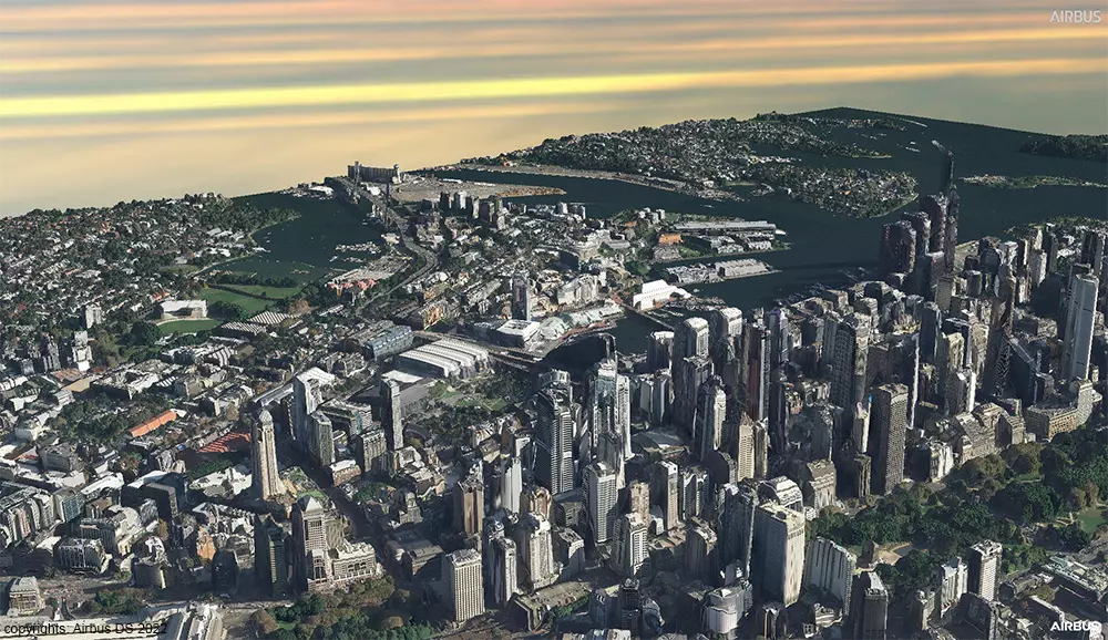
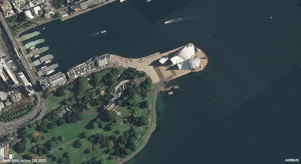
Thanks to the launch of new Pléiades Neo 30cm optical satellites, Airbus is now in a position to offer 50cm resolution elevation models to users. This is the result of extensive R&D work that pushed the resolution and accuracy to an industry-leading standard that is unmatched by any other satellite data provider.
Comprehensive testing allowed the team to calibrate and validate the final resolution to 50cm and the relative accuracy to a level of 1m. The absolute accuracy is between 3m and 5m – thanks to a worldwide Airbus own reference database – but this can be further improved when a customer provides Airbus with additional ground control points, which may take it even under the 1m resolution threshold.
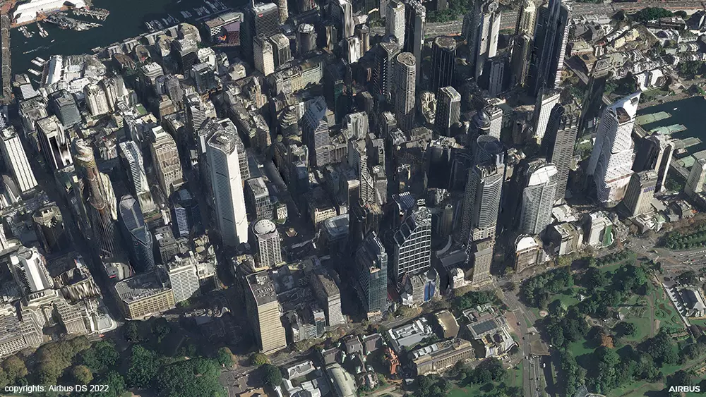
It’s worth noting though, that accuracy is not the be-all and end-all. In addition to this, the new 50cm elevation product offers exceptional 3D photorealistic quality. Objects such as trees and buildings are represented in a way that the industry simply hasn’t seen before – thanks to the leverage created on Airbus’ proprietary photogrammetric production process and algorithms.
After some tests run by early adopters, Airbus is ready to release Elevation 0.5 model to the market very soon.
How Does It Work?
Creating a digital elevation model of this kind requires multiple high-resolution satellite images that can then be combined using the principles of photogrammetry. It starts with measuring the conjugate points in your images which are then associated with ground control points to achieve the matching that you need. Then photogrammetry helps to solve for the 3D geo-referencing which can then create the model and visualization that you’re after.
To understand how Airbus’ production process works specifically, we spoke to the Head of Imagery Production at Airbus: Jean-Charles Pruvost. He explains that the process starts by defining the area of interest. Once this is determined, Airbus will check the topography and environment in that specific area so that the parameters can be correctly configured for the tasking team.
After this has been completed, the tasking team will take the necessary stereo or tri stereo images – typically being limited to 10-15 degrees if you’re looking at dense urban areas.
The duration of this part of the process – the editing step – is directly related to the size of the area of interest. A single Pléiades Neo image has up to a 14 km width, which is already huge, but it is possible to combine several images to cover very large areas!
Airbus engineers will then adjust the images to reduce noise and ensure that the resulting 3D models are fair representations compared to the specification provided. Some of the samples that we’ve seen of these are simply astonishing. You can zoom in to roofs, buildings, and street furniture – to see a level of detail that is mind blowing.
copyrights: Airbus DS 2022
Applications and Use Cases
There is a range of exciting use cases that become possible with this level of resolution. While the focus of these models tends to be on digital terrain modelling and 3D visualizations, there are natural extensions, for instance, for the gaming and the defence industries. Some of these applications include:
- High precision weapon targeting and mission preparation in the military context.
- 3D stickers can be placed around airports and bases to handle low-altitude flights and other such considerations.
- Digital Twin visualizations to simulate plants, mining areas, and other Smart City concepts.
- Nuanced public visualizations to enhance wireless network projects, public transport implementations, and more.
- Analysis of solar energy potential on rooftops.
- Creating climate zone maps of urban areas, including urban heat islands and land use maps.
- Replacing the need for drone or aerial data in the mining industry.
- Monitoring the power grid or other similar assets over large areas.
- Improving farm management.
- Progress monitoring for the construction sector.
The applications here are vast and varied and as Jean-Charles Pruvost says: “It looks like a real game changer for the industry.” But as with many new technological breakthroughs, we’ll only truly understand the impact once users can experiment and push the boundaries of what is possible.
Conclusion
Elevation 0.5 represents an inflexion point for the satellite data industry, bringing a level of accuracy and photorealism that we have never seen before. It remains to be seen how this new technology will be utilized – but what is clear is that it opens doors to analyses and modelling capabilities that can transform the way we think about our world.
There is yet to be determined how pricing and product specifications will play out in the marketplace, but for those select clients who are currently in talks with Airbus – we look forward to seeing what is possible with a resolution of under one meter.
Did you like the article? Read more and subscribe to our monthly newsletter!


