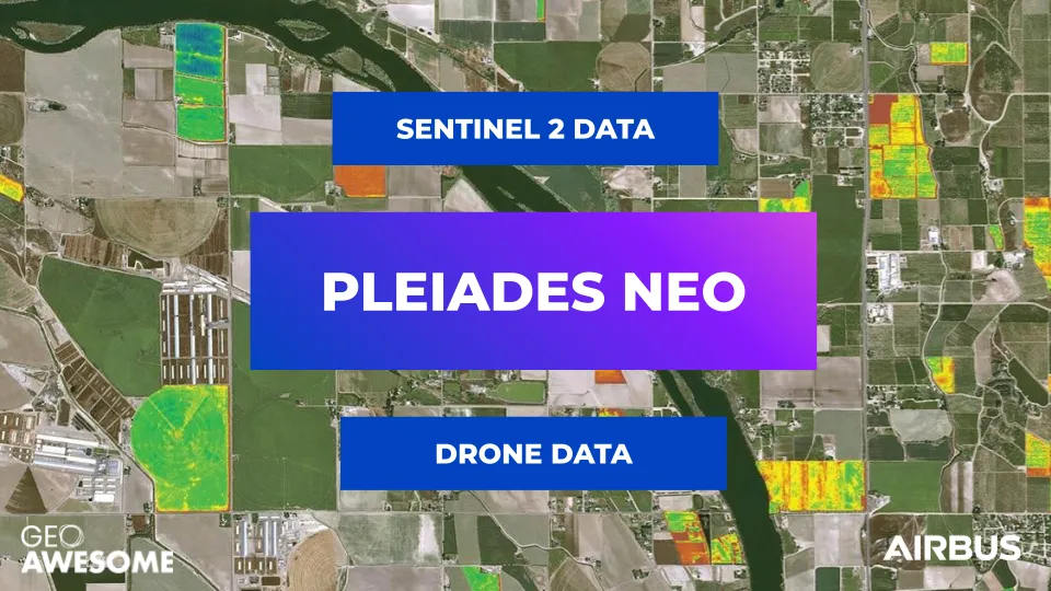
The new 30cm Pléiades Neo constellation offers, the precision agriculture sector, data that bridges the gap between drones and open-source satellite imagery
Precision agriculture has been one of the big buzzwords in the world of agri-tech. It is also one of the most important applications for imagery data from both satellites and drones, which are a critical component of the precision agriculture process. Multispectral imagery data can be combined with other data (such as crop type, terrain models, soil type etc.), to calculate so-called ‘prescription maps’. Farmers use these maps to analyse the situation on the ground to make informed land management decisions. To trigger specific actions such as variable-rate spraying, the maps can be uploaded to automated farming equipment.
Typically, prescription maps are based on satellite data, which can be complemented with drone or airborne data for individual fields where cloud coverage makes satellite data unusable—particularly relevant at the peak of the growing season, when the time window to make the right decision may be as short as 1–2 weeks.
The new Pléiades Neo constellation from Airbus is filling the gap between satellite data from open-source constellations such as Sentinel 2 and drone data.
Temporal and spatial resolution
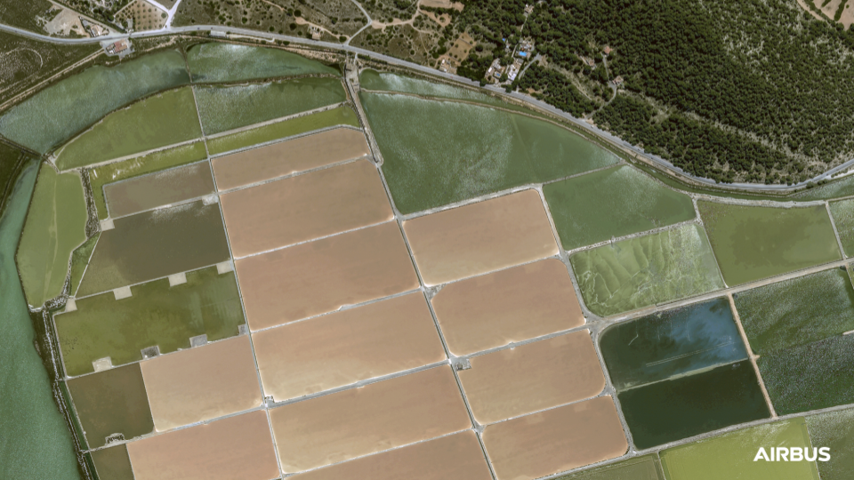
Pléiades Neo offers 30cm native resolution and after launching the complete constellation later this year, it will be able to revisit any location around the world several times a day.
Large crops, (cereals, rapeseed, corn etc.), are mostly monitored by satellites such as Sentinel, which offers a much lower resolution compared to Pléiades Neo, but a larger swath. This covers more fields over a given location in a single pass.
Pléiades Neo, despite offering a smaller swath compared to Sentinel, with four satellites in orbit, Pléiades Neo satellites can cover large areas within a single day and at much higher resolution. The level of detail obtained may be a little excessive for current precision agriculture equipment, but what it does do is provide very valuable information when it comes to monitoring crop growth to prevent potential diseases – 30cm resolution imagery enables you to see a much clearer picture, meaning early detection is possible.
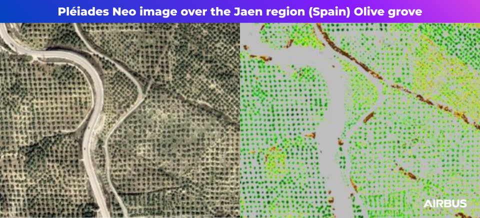
This high-resolution data also plays an important role for specific use cases, such as high-value crops like vineyards and olive orchards for example. Across Europe, such plantations are now facing increasing challenges of drought, so farmers need to use water resources in a far more efficient way. 30cm resolution is important in specifically identifying the condition of each separate tree in order to make an informed decision about how to treat it.
Another use case is in crop trials performed by technical institutes in the context of research and development activities. Such institutes have objectives to continuously improve systems of crop management, to develop advanced decision-making criteria and to benchmark new cultivation methods. Every year, they perform numerous tests in frameworks of micro-plots planted in open fields.
One more instance where higher resolution is useful is in locations where fields are narrower than 10m, which there are many of, particularly in central Europe. When the field is 5-7m wide (and, as an example, 2km long) the error rate for a 10m pixel size is significant.
Spectral resolution
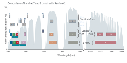
In precision agriculture, spatial resolution is very often less important than spectral resolution. Spectral bands allow us to see and measure things not visible to the human eye. The most popular measure coming out of various spectral bands is ‘normalised difference vegetation index’ (NDVI), which is based on red, plus the infrared bands – easy to measure for the majority of satellite or drone multispectral sensors. But in practice, NDVI is just scratching the surface of the possibilities that come with adding additional spectral bands, such as the new Pléiades Neo ‘Red Edge’ band, or visible, near-infrared and shortwave infrared in Sentinel 2, among others.
NDVI will not work well with developed crops. To create a full model of the canopy reflectance, you need to use different indices, such as Leaf Area Index, ‘normalised difference red-edge index’ (NDRI), or ‘modified soil-adjusted vegetation index’ (MSAVI), depending on crop type, growth stage and the purpose of the analysis. Using the Red-Edge band from Pléiades Neo satellites, allows better chlorophyll content measurement and as a therefore a more precise estimation of the Leaf Area index values on crops, at plain development. Indeed, the Red-Edge band helps to pinpoint subtle stress in crops in advance compared to traditional indices, as it corresponds to the region of electromagnetic spectrum where the reflectance of green vegetation changes rapidly.
The role of spectral bands goes beyond vegetation indices. Spectral bands are of no interest to farmers of course, but they do care about the quality of agronomic information derived from that data. Satellite sensors need to pass through the atmosphere and then adjusted for the atmospheric distortions. Therefore having a set of bands helps to characterise vegetation as well as enabling the best and most accurate data correction. This is why the ‘Deep Blue’ band is very important in helping Pléiades Neo obtain the most accurate data: it significantly aids the atmospheric corrections.
Satellite vs. drone data
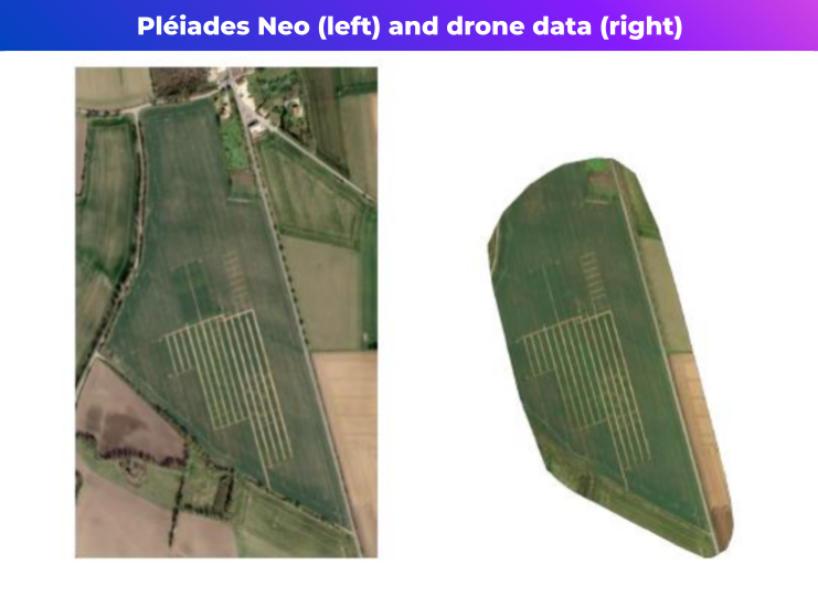
In fact, the accuracy and reliability of the data related to radiometric corrections is the biggest challenge for drone sensors. Satellite data typically uses a large number of bands, with a very stable sensor and radiometry procedure for regular calibration, providing trusted results. By contrast, the calibration of a multispectral drone sensor is not an easy task.
To obtain reliable drone data, the sensor calibration has to be in line with the specific weather and light conditions (e.g., cloud coverage and time of day). If calibration is made for clear skies, a single cloud passing by will influence the result. There are techniques to manage this, but it adds a certain level of uncertainty and has a significant impact on the prescription map produced from of this drone data.
Conclusions
Pléiades Neo offers a unique combination of both spectral bands and high spatial resolution, smartly completing lower resolution satellite constellations, such as Sentinel, ensuring precision and timeliness of the information. Moreover, it can substitute drones or aerial data, especially over larger areas, as it is much more economically viable. With its very high spatial resolution, excellent spectral parameters and more frequent revisits increasing the chances of cloud-free data, it is an excellent asset.
Did you like the article? Read more and subscribe to our monthly newsletter!


