NOAA’s Satellite Woes: Mitigating Gaps in Weather Prediction

Weather throughout the world is increasingly getting bizarre and unpredictable. Fluctuating Temperatures and Tornadoes are the order of the day and the only relief and peace of mind one has in times like these – Weather Prediction Satellites.
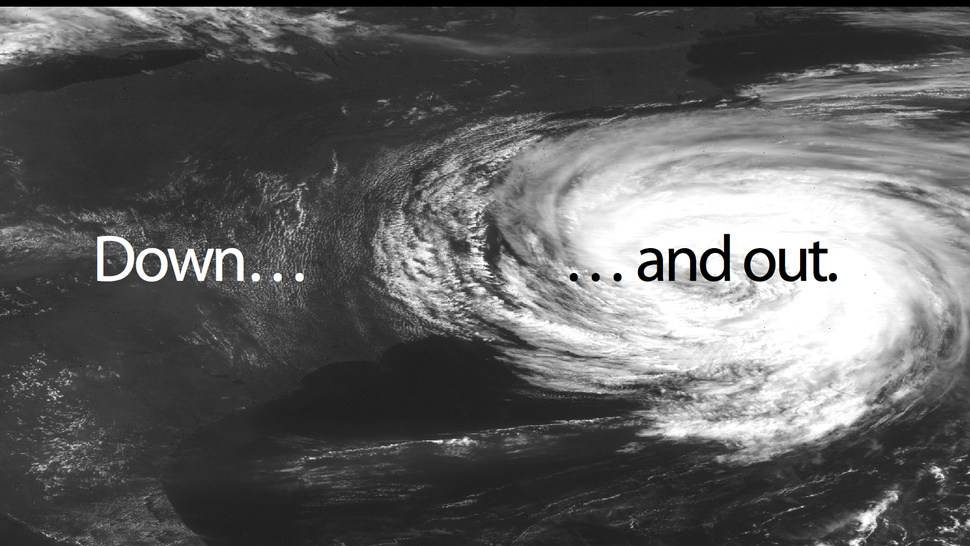
Image from NOAA's satellite under Creative Commons license

Imagine not having the ability to predict extreme weather conditions, atleast few hours before!
Image from NOAA’s satellite under Creative Commons license

One of the most scientifically advanced weather prediction organizations in the world, NOAA claims “NOAA’s weather programs touch the lives of every American. Every day, decisions are made based on NOAA weather information – from the mundane “should I pack an umbrella today?” to the most critical and potentially life-saving.”

United States relies on geostationary and polar orbiting satellites to help provide a global weather perspective day and night, 24×7, 365 days a year. A system that is crucial to weather forecasters, climatologists and an army of amateur weather forecasters besides the government agencies.

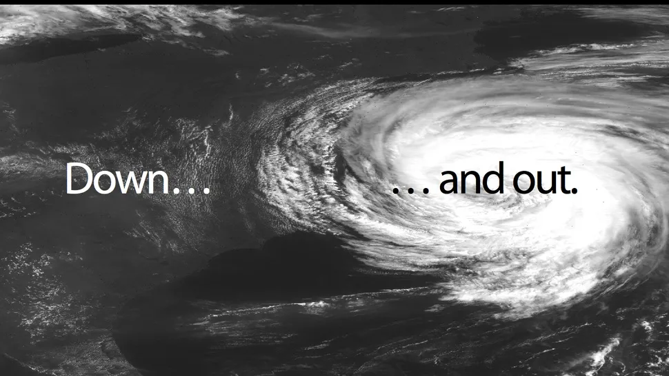
Now, it looks like all this could be in a spot of bother. NOAA has acknowledged ” there is a substantial risk of a gap in polar satellite data in the afternoon orbit, between the time that the current polar satellite is expected to reach the end of its life and the time when the next satellite is expected to be in orbit and operational. This gap could span from 17 to 53 months or more, depending on how long the current satellite lasts and any delays in launching or operating the new one. There is also a risk of a gap in the early morning orbit if the Department of Defense’s next satellites do not work as intended. “

A potential gap of 17 to 53 months?? NOAA has to be really worried! I hope they are. A satellite data gap can result in less accurate and delayed weather forecasts and warnings.

At a time when weather around the world has been unpredictable to say the least, this does not make things more comfortable. However I must add that this information is intended as a worse case scenario if the current polar orbiting satellites do not work. Hopefully things wont go out of hand.

All said, US has already placed this issue in the High Risk Report for 2013


Did you like this post about NOAA’s satellite? Read more and subscribe to our monthly newsletter!

Say thanks for this article (0)
The community is supported by:
Become a sponsor
#
#Featured #Ground stations #Satellites
Ground Stations Explained: How Does Satellite Data Travel from Space to Earth?
Nikita Marwaha Kraetzig 02.29.2024
AWESOME 9
#Business #Geospatial analytics #Other
Making Geospatial More Approachable Through Clear Documentation: Meet UP42’s Documentation Lead, Daria Lutchenko
Nikita Marwaha Kraetzig 09.27.2024
AWESOME 5
#Business #Environment #Featured #Shipping #Transportation
Achieving Ambitious Climate Goals How Can Marine Geospatial Data Protect Our Oceans While Supporting the Shipping Industry
Nikita Marwaha Kraetzig 11.14.2024
AWESOME 1
Next article

NASA’s Solstice Mission: First topographic images of Saturn’s Moon “Titan”

Titan, Saturn’s largest moon with a radius of about 2600 kilometers is bigger than Planet Mercury and is one of the most Earth-like and interesting “worlds” in the solar system. Titan is special as it’s the only moon in the solar system known to have clouds, surface liquids and a “mysterious” thick atmosphere. Titan’s atmosphere is mostly nitrogen, like Earth’s, but the difference –  methane on Titan acts the way water vapor does on Earth, forming clouds and falling as rain and carving the surface with rivers. “Methane Rainfall”! Now that’s something. Scientists believe that the methane present in the lakes and rivers in Saturn’s Moon could offer answers about the origin of life.

Image credit: NASA/JPL-Caltech/ASI/JHUAPL/Cornell/Weizmann

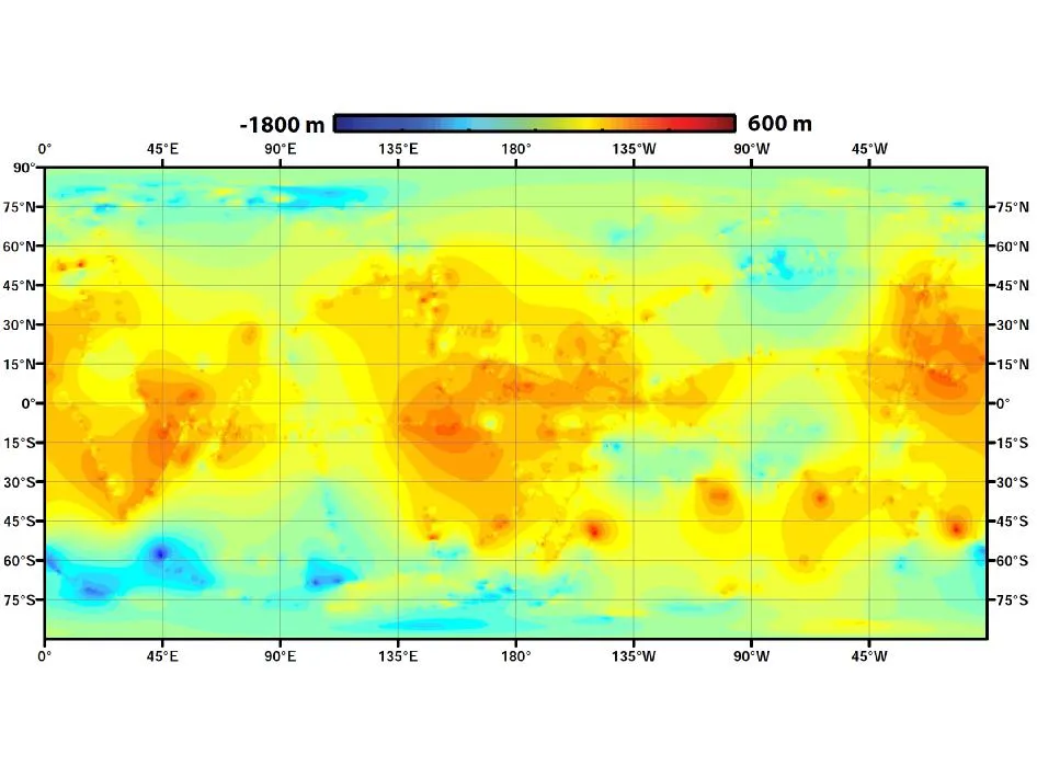
First GLOBAL TOPOGRAPHIC map of Titan
Image credit: NASA/JPL-Caltech/ASI/JHUAPL/Cornell/Weizmann

All this makes this mission to the Saturn’s Moon, all the more AWESOME!

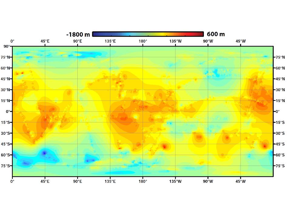
Using data from NASA’s Cassini mission, researchers have now created the first global topographic map of Titan. The significance of the map is self-evident considering that Titan is one of the most Earth-like “celestial object” in the solar system.

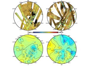
These polar maps show the first global, topographic mapping of Saturn’s moon Titan, using data from NASA's Cassini mission. Image credit: NASA/JPL-Caltech/ASI/JHUAPL/Cornell/Weizmann

These polar maps show the first global, topographic mapping of Saturn’s moon, using data from NASA’s Cassini mission.
Image credit: NASA/JPL-Caltech/ASI/JHUAPL/Cornell/Weizmann


NASA adds

The map team used a mathematical process called splining – effectively using smooth curved surfaces to “join” the areas between grids of existing topography profiles obtained by Cassini’s radar instrument. The estimations fit with current knowledge of the moon – that its polar regions are “lower” than areas around the equator, for example. But connecting those points allows scientists to add new layers to their studies of Titan’s surface, especially those modeling how and where Titan’s rivers flow, and the seasonal distribution of its methane rainfall.”

Titan has so much interesting activity – like flowing liquids and moving sand dunes – but to understand these processes it’s useful to know how the terrain slopes,” Ralph Lorenz, a member of the Cassini radar team based at the Johns Hopkins University Applied Physics Laboratory, Laurel, Md., who led the map-design team. “It’s especially helpful to those studying hydrology and modeling Titan’s climate and weather, who need to know whether there is high ground or low ground driving their models.”

Exciting times indeed!

To know more about Moon of Saturn. Visit NASA’s page


Did you like this post? Read more and subscribe to our monthly newsletter!

Read on
Search