

Crowdsourcing has been a huge deal in the recent past. Be in trying to map the disaster affected region in Phillipines or searching for the missing MH plane, it is a great way to involve the common public for a greater cause.
Now it is NASA’s turn to ask the public’s help. As many of you have known or heard, the International Space Station (ISS) has been taking incredible pictures of our planet. What you might not know is that we almost have 1.3 million pictures of Earth, with one thrid taken during night. Cities at Night is a crowd sourcing project strated by Complutense University of Madrid. Part of the bigger project is Lost at Night. This project is about localizing cities from ISS with the help of internet users.
Help us to georeference the position of cities which appear in the ISS images.
Once nocturnal images are identified, the biggest task is to know where they are ! Now it is upto us to make good use of these images!
Have couple of hours to spare? Get started here!
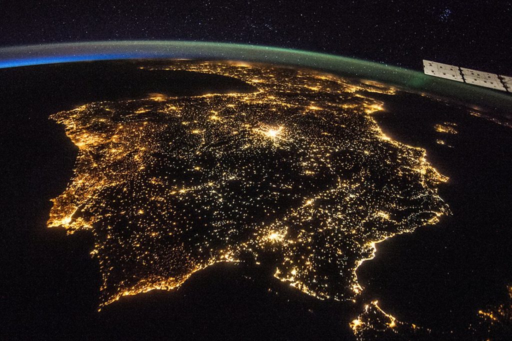
Image of NASA: Spain and Portugal
For more information: Please read NASA’s featured article here
Did you like this post about initiative of NASA? Read more and subscribe to our monthly newsletter!


#
Next article
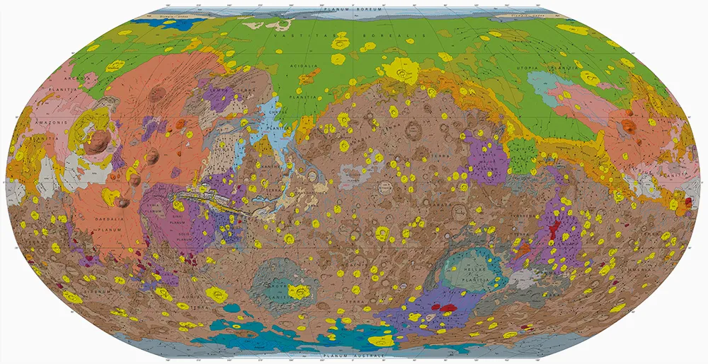
Here you go! USGS has released their latest, most beautiful geologic maps of Mars, thanks to 16 years of continous data collection! Though this planet doesn’t quite look habitable, it is the only other planet that falls within sun’s habitable zone. Humans have been studying the red planet for centuries. US missions to Mars starting from Mariner and Viking to the recent ones such as Mars Express have shed a lot of light on the geologic composition.

New Martian Global Geologic Map
You can download the original map here.
Map description:
“This global geologic map, which records the distribution of geologic units and landforms on the planet’s surface through time, is based on unprecedented variety, quality, and quantity of remotely sensed data acquired since the Viking Orbiters. These data have provided morphologic, topographic, spectral, thermophysical, radar sounding, and other observations for integration, analysis, and interpretation in support of geologic mapping. In particular, the precise topographic mapping now available has enabled consistent morphologic portrayal of the surface for global mapping (whereas previously used visual-range image bases were less effective, because they combined morphologic and albedo information and, locally, atmospheric haze). Also, thermal infrared image bases used for this map tended to be less affected by atmospheric haze and thus are reliable for analysis of surface morphology and texture at even higher resolution than the topographic products.”
Findings from the new map will enable scientists and researchers to identify future landing sites.
Did you like this post? Read more and subscribe to our monthly newsletter!

