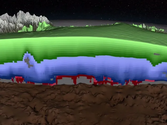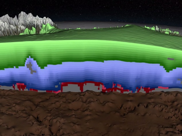
NASA created detailed 3D map of Greenland’s ice sheet
Deep ice sheets close to North and South Poles are a natural storage of historical records of climate changes over last thousands years. Using ice-penetrating radar data, NASA scientists have built the comprehensive map of layers deep inside the ice of Greenland.
Greenland’s ice sheet is the second largest mass of ice on Earth, containing enough water to raise ocean levels by about 20 feet (6 m). This new map, prepared on the basis of radar scans collected by Operation IceBridge, gives scientists data to determine the age of large swaths of Greenland’s ice as well as to monitor its melting which dramatically accelerated over the past two decades.
The radar works by sending signals into the ice and recording the strength and return time of reflected signals. From those signals, scientists can detect the ice surface, sub-ice bedrock and layers within the ice. Scientists are especially interested in knowing more about ice from the Eemian period (115,000 to 130,000 years ago) that was roughly as warm as today. Based on historical knowledge we could try to predict the future climate changes.
Truly Geoawesome!
Did you like this post? Read more and subscribe to our monthly newsletter!


