DroneDeploy is one of the best drone mapping software provider
DroneDeploy is a drone software start-up funded in 2013 by three college friends from South Africa – Mike Winn (CEO), Jono Millin (CPO) and Nicholas Pilkington (CTO). They were working on a project related to using UAVs to fight poaching, and they’ve realized that there were plenty of drones on the market but a lack of data processing software that would enable non-technical people to use drones as a survey-grade tool.
They’ve started to build their own cloud-based software, and today they are one of the leading platforms that enables creating cartometric orthophotomaps, 3D point cloud models and data analytics from any drone.
Competing software platforms include PrecisionHawk’s PrecisionMapper platform, which has historically been positioned to the enterprise user for advanced geospatial analysis, but recently launched a free version for the professional surveyor that includes 2D and 3D maps as well as algorithms that are compatible with visual data such as volumetrics and visual NDVI. Pix4D is another competitor, although, at a higher price point, that has been a market leader to date for aerial mapping and analysis.
End-to-end software solution
Unlike competitors that often provide drone hardware and software on the top of it, DroneDeploy is strongly focused on the software-side, and it aims high. The company wants to be a cloud-based operating system (OS) that could be used for any drone hardware.
The App
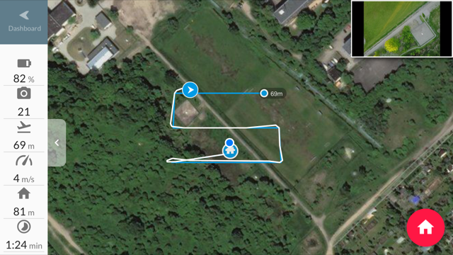
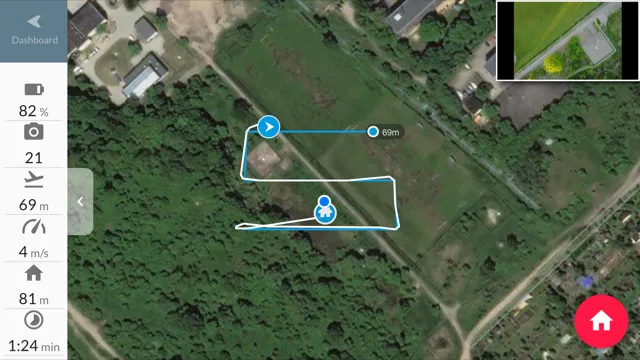
The DroneDeploy offering starts with a free app available for Android and iOS that let users create photogrammetric flight plans for UAVs, and if you own a DJI, it will automatically take off, land and give users a live first-person view of the drone in flight as it captures images.
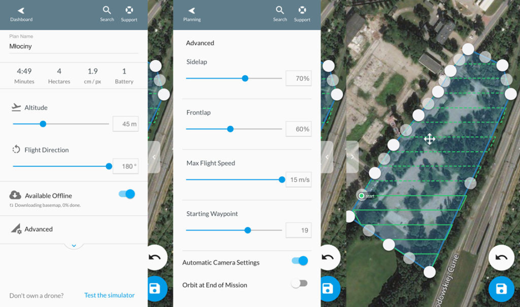
The app is easy to use, but it gives advanced users some customization options. For instance, you can set up side and front overlaps. For most scenarios, the default settings should be good enough, but in some cases like dense vegetation or long corridor mapping you should modify it. You can also change your flight directions which is important if you need to capture complex structures.
It is important to keep the app always updated. During my first survey with DJI Mavic Pro, my drone started to fly away without any control, and I had to turn off the app and switch to DJI Go app to bring it back manually. When I updated the app, everything worked like a charm.
The web platform
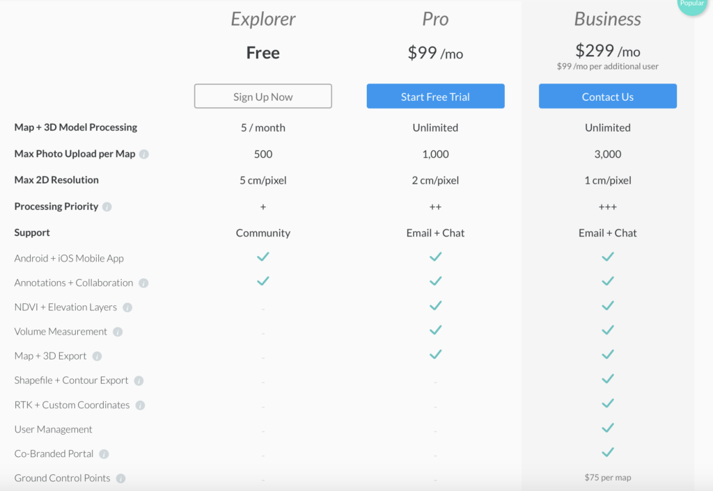
Once you capture the images in the field, you can go DroneDeploy website to do the processing. The company offers 3 packages:
The basic package is available for free but it’s a bit limited, so if you wish to use your drone for casual survey jobs once for a while you might want to check out this app that offers full functionality for free for up to 60 projects a year. For more advanced and professional users DroneDeploy offer is very attractive.
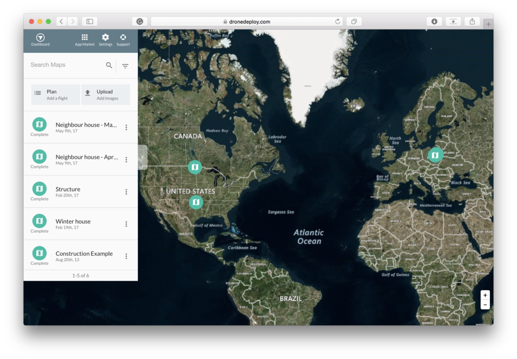
The web app has the same interface as the mobile version. You can browse all the flight plans created on your phone, you can also create a plan on the computer then upload them to your drone via a mobile app.
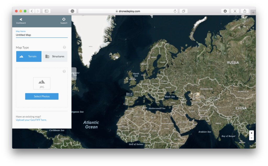
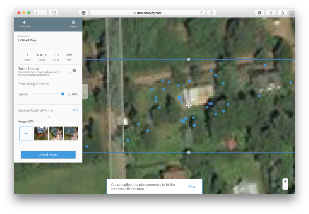
But the main feature of the web version of the app is the possibility to upload the data captured in the field for processing. The first step is selection what kind of photogrammetric product you’ve captured. The ‘terrain’ type will let you create a regular orthophotomap and a Digital Elevation Model. The ‘structures’ option will is best for 3D point cloud or mesh of buildings. The app lets you also upload existing maps in GeoTIFF format.
Now it’s time to upload your images. Depending on the size of your project and the speed your internet connection it might take a couple of minutes to a couple of hours and additional few hours to generate the photogrammetric products.
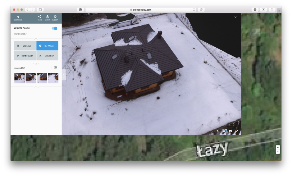
While the regular orthophotomaps and DEMs are no different than in other software, the option to generate 3D structure models gives amazing results. Take a look:
The app allows you to embed created 3D models on your website:
Overall
DroneDeploy’s aim to be one of the top operating systems for drones seems to be achieved. Their offer is really impressive, especially when it comes to 3D modeling.
The company is growing fast and their products are getting better and better each month. We love what these guys achieved over the past couple of years. We will keep you up to date with all the latest news about DroneDeploy. Stay tuned.


