Descartes Labs raises $20 million to advance geospatial analytics platform

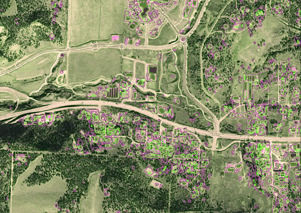
An example of actionable intelligence made possible by Descartes Labs: Building detection identifies habitable structures near pipelines in the Western United States
New Mexico-based Descartes Labs, a startup that promises to solve the geospatial industry’s big data problem, has raised a cool $20 million in bridge round of financing. This fresh capital brings the geospatial analytics firm’s total fundraising to almost $60 million.
Here’s a quick refresher on what Descartes Labs – which describes itself as a ‘data refinery’ – does. The platform provides quick access to the complete catalog of satellite imagery from Landsat, Sentinel, and Airbus OneAtlas, among other sources. They also take care of issues like enriching the images with metadata or tackling the differences in image registering or tiling, so you do not have to waste any time in mundane tasks. And then, using machine learning and artificial intelligence technologies, the company builds algorithms that unravel hidden patterns from these mammoth datasets.
Users can also upload their own data to the platform to create unique products and get ahead of business challenges with predictive analytics.
To give you an example of Descartes Labs’ current work, the company is helping governments in the Middle East and North Africa to monitor food security by identifying agricultural fields in archived and current satellite imagery. Its algorithms are also detecting wildfires and anticipating their spread to help deliver early warnings as easily as weather alerts.
Recently, Descartes Labs started providing solutions for mapping methane – the greenhouse gas on steroids – to get a clear picture of what is contributing to climate change. And with this new infusion of capital, the company wants to accelerate its mission ‘to build a digital twin of the planet’ and launch some exciting new products in 2020.
“We’re building a digital twin of planet Earth using a pipeline of data from a diverse collection of satellites, at scale, to provide instant access to analysis-ready images of the entire world via a searchable, on-demand interface. We’re continuously updating it with massive volumes of new information from historical and current satellite data, sensors, and data from our customers, to generate actionable intelligence,” the company explains in a blog post.
Now read: The perfect storm called artificial intelligence and geospatial big data


