
Chennai, my beloved hometown is under water and is experiencing the wettest monsoon in over 100 years! The city on the coast of Bay of Bengal has received over 50 cm of rain in less than 24 hours and things are only predicted to get worse as more rains are forecast.
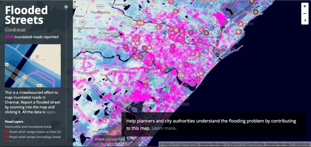
Arun and his team @Mapbox, have built a crowd-sourced tool for reporting the flooded parts of the city and so far over 4000 roads have been reported as inundated. If you are in Madras at the moment, consider using this map to identify flooded areas and also upload geotagged pictures of the flooding using the United Nations entity app – UN-ASSIGN.
 The army and navy have been called in and the local people have opened their homes for everyone to find shelter. Its heart-warming to see the outpouring of help and assistance, my city has been offering each other on Whatsapp and #ChennaiFloodHelp on Twitter. Thanks everyone! Stay safe and take care!


#Insights


Next article
Today we’ve got for you another YouTube quiz by fellow GeoGeek Guido Goudswaard. This time your challenge with be to identify 10 European countries based on a map. It might not be easy but it’s awesome:)
DID YOU LIKE THE QUIZ? SUBSCRIBE TO OUR WEEKLY NEWSLETTER
[wysija_form id=”1″]

