![]() SmarterBetterCities is a fast growing 3D web startup, with offices in Zurich and Redlands. They create captivating 3D visualizations that is both light-weight and informative. A technology company that is being led by an Architect CEO, We interviewed Antje Kunze to learn more about their products, her vision for the company and whether design takes precedence over computer science or not 😉
SmarterBetterCities is a fast growing 3D web startup, with offices in Zurich and Redlands. They create captivating 3D visualizations that is both light-weight and informative. A technology company that is being led by an Architect CEO, We interviewed Antje Kunze to learn more about their products, her vision for the company and whether design takes precedence over computer science or not 😉
Tell us about your startup journey! How did you all start? From being a research scientist at ETH Zurich to being the CEO of a geoawesome startup, how’s the journey been for you personally?
It was a really exciting transition. At ETH Zurich we worked at the Chair of Information Architecture and had almost unlimited resources to create tools that would facilitate the design of sustainable urban futures. Suddenly businesses and cities came to our lab to buy solutions from us. This is when we understood that we need to make our knowledge available as scalable products and services in order to really have a positive impact on society. Personally, being a CEO of a geoawesome startup is like being newly in love. There are days that you fly high with the butterflies and there will be also days that you feel blue and tender. Fortunately, most of all times we are on the sunny side.
The idea of Smart Cities has been in the public sphere for a while now and with name like SmarterBetterCities for your company, I’m sure it is the primary focus of your startup, what are the different products that you are working on? How is it going to help realize the idea of Smart Cities?
 The majority of the people worldwide are living in cities. But these cities are not like London, New York, Shanghai, Mumbai or Tokio. We are talking about that the majority of towns are the ones with populations between 10’000 to 100’000 people. They all need to master their futures and need to be more resilient against economic and ecologic crises. These towns do not have the deep pockets of mega cities but they still need answers. That is the real challenge that we are trying to tackle with our products. No town should be left behind for smart city development. Our products are scalable cloud products with the support of Esri desktop applications. Just take our SmartZoning App as an example. Users can be urban planners or real estate firms. The tool enables you to learn about the maximum load permitted by law and based on your urban structures. You can use that information to avoid bad planning, to encourage on site energy production and to find the best investment opportunities. California will be soon regulating the amount of lawn areas in new developments. Our tools have features like that built in so that designers can focus on great design and create sustainable plans right from the start.
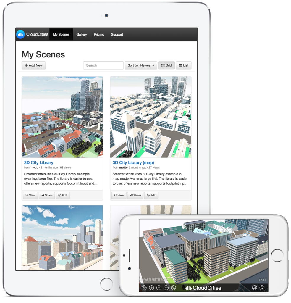
Your main primary product is CloudCities, a lightweight 3D content sharing engine. We explored the 3D map of the Harvard Campus and it was really responsive and clean. Does Architecture and Computer Science, go hand in hand at SmarterBetterCities? Who usually gets the upper hand?
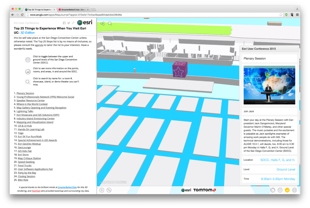
It is an exciting symbiosis. So to say both sides alway have a win. Just look at our recent public release of CloudCities. Or at the new 3D map of the San Diego Convention Center for the Esri User Conference. Most of our team members have a professional background in both worlds of technology and design. Or they do have a private interest beside their profession that they can live up in SmarterBetterCities. I think that this is quite unique and sets us apart from others.
Is it already possible to visualize real-time data with CloudCities and to integrate sensor information?
Good question! We think that it is actually quite important to provide easy access to life sensor data. Big progress was made the past 3 years. And we did successful technology demonstrators together with IBM, Esri and other companies in Zurich, Delft, Paris and in Birmingham. However, we are still observing the landscape. What we are currently missing are widely accepted standards and protocols that get a wide adoption across the industry and thus would have a high impact. Technologies like WeMo and Nest point into the right direction. From a business point of view I would say let’s see what the Prosumer market will bring within the next 12 months and we will react.
SmarterBetterCities utilizes Esri technology and is part of the Esri startup program. How has that experience been?
That’s a two fold question. On one hand Esri’s technology like CityEngine and ArcGIS Pro for 3D city modeling is quite unique and unbeaten. I think that nobody else in the industry offers such an open and integrative platform. On the other hand the Esri startup program gives us an accelerated access to this platform, its vast social network and marketing channels. This saves us a lot of development resources. And as we grow also our needs for the Esri platform will grow as well. Already today CloudCities is tightly integrated with ArcGIS Online.
Is the program and your close partnership with Esri, one of the reasons you decided to have one of your offices in Redlands, the HQ of Esri?
Yes, that is of course one important part of the equation. Esri and we have a quite close history. In Zurich we started our first office literally next door to the Esri 3D R&D Center. We helped each other in our 3D product development. The majority of our customers are US based and a high fraction is from government sectors. Esri is highly experienced working with those accounts and we have a close exchange. But also Southern California is moving forward in the smart city market. Redlands is a good location to serve Los Angeles, San Diego and everything inland. Besides Redlands has a great university with a focus on GIS and business development. Salary ranges and operation costs are highly competitive if you compare it to San Francisco or even Santa Monica. Honestly, Redlands is a really nice Californian town with some history and an active community. I really like it here. The oranges are a plus for sure.
Honestly, Redlands is a really nice Californian town with some history and an active community. I really like it here. The oranges are a plus for sure.
You’ve already worked with the City of Zurich, Oregon State, Harvard University and others. Is working with Governments and big organizations a challenge for a startup?
We really had quite positive experiences when working together with public institutions, education sector and large scale enterprises. However, two things can make it really hard. It take quite a bit of time to get a project going from actually winning a bid. And for foreign companies US procurement requirement can be a challenge. So it really helps to have a good customer mix across all sectors.
What’s the most exciting project you are currently working on? Any Indoor maps, HoloLens projects that we’ll get to see soon 🙂
 Here we need to differentiate between software development and our custom products for enterprise level customers. Two project had be really outstanding. The work together with Harvard was amazing. And we are really happy that we have created with them an open 3D campus model that is open to be extended for 3D indoor maps and scenario planning. The latest project is the 3D model of the San Diego Convention Center. We learnt a lot from this. The challenge was to combine the world of CAD and GIS in this project. In the future we want to automate the authoring processes as much as possible. And on the software side we are working on many new exciting CloudCities features that will be coming up in the next months. I can only tell that there will be new indoor apps, fresh 3D city content, support for importing and exporting various 2D and 3D CAD and GIS formats, web-based 3D city design and support for online 3D printing and rendering.
What’s your take on Open Source libraries? Going forward, do you have plans for Open Source projects?
Open Source is great when you have mass momentum. See the Firefox project as a great example. In GIS the web 3D market is still a niche product. There I think Open Source does not really work, yet. As an academic for example you can afford to setup a sophisticated framework and publish it under a open source license. But nobody besides you as the author or some clever PhD students will be ever capable to use it. This is definitely not scalable, quite expensive and out of reach for the mass market. We at SmarterBetterCities are looking to create scalable solutions, which are instantly available, being configured by the users in a few moments, running in the cloud with no maintenance costs and that are relatively open by providing an API.
Open Source is great when you have mass momentum. See the Firefox project as a great example. In GIS the web 3D market is still a niche product.
As the CEO, what’s your goal for the next years for SmarterBetterCities? More products? More integration and file formats? What’s your vision?
Now I have to pitch. We have set ourselves serious goals. We want that the earth will become a smarter and a better place. Cities are at the center where we can have maximum impact. I see that CloudCities will become the major web service for planning and managing smart cities. To make that happen we started now with a 3D sharing service that helps people to understand urban developments and that engages feedback. The next step will be to make smart 3D accessible for every town. This includes simplified online access to 3D maps of the built environment and 3D city sketching tools that will be completely web-based. Along with that we will extend our collection of 3D Cities Libraries with resource efficiency analysis and infrastructure modeling. Since months we are working on fiscal impact analysis tools and on tools for designing more resilient urban spaces. Data integration is a key. It is unbelievable that we still have an enormous gap between the GIS and the CAD worlds. We will close this gap or at least built bridges to make the lives of our users much easier. I cannot wait for it any longer to make that happen.
As a successful geo-entrepreneur, what is your advice for geogeeks who want to start their own company?
Just do it. Make it simple, make it with passion and make it work. Your clients and your partners will love it and business will come.
Any final thoughts that you would like to share with the Geoawesomeness readers?
 Yes, I would like to share three things. First, we talked a lot about CloudCities. I think you should all have a look at the 3D interior map of the San Diego Convention Center that we did for the Esri User Conference. Second, if I raised you interest in 3D web maps we offer a lot of free open data based 3D city maps at CloudCities. And finally, we are at the Esri User Conference starting from Saturday until next Thursday. We would be glad if you could come by and join us at our booth or at our CloudCities user meeting on Tuesday. See you all in San Diego!
Contact Details
Interested in learning more about SmarterBetterCities? You can contact Antje via email: kunze@smarterbettercities.com. One more thing, If 3D is your thing and you are super interested in everything GIS, then have a look at their 3D specialist opening.


