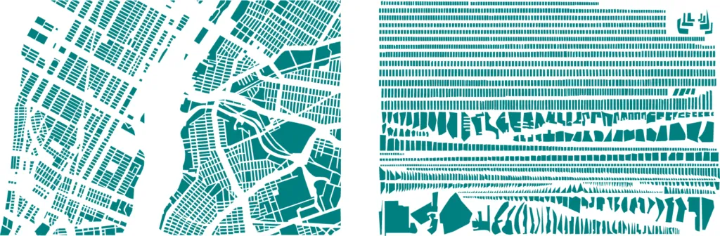

French artist Armelle Caron had a really cool and clever idea: take a map of a city, deconstruct it, classify it by size and shape, and finally arrange it again in rows. The results look very intriguing but what’s most important they clearly show some characteristics of the city. Check in on your own:
NEW YORK

ISTANBUL

PARIS

source: Armelle Caron website


#Ideas


Next article

 Amazon recently launched out the beta version of Amazon Map API for its mobile app SDK. This gives developers an alternative to Google Map API. This is definitely gonna be another blow to Google Map API as another technological and internet giant leaves Google Maps.
Amazon Map API is not yet as robust as Google Map API but so far it is able to offer the two core features which are very paramount to developers:
- Interactive Maps: One can embed a Map View in an app for customers to pan, zoom and fling around the world. You also have the option to display a user’s current location, switch between standard maps and satellite view, and more.
- Custom Overlays: You can display the locations of businesses, landmarks and other points of interest with your own customized markers and pins.

