#Featured
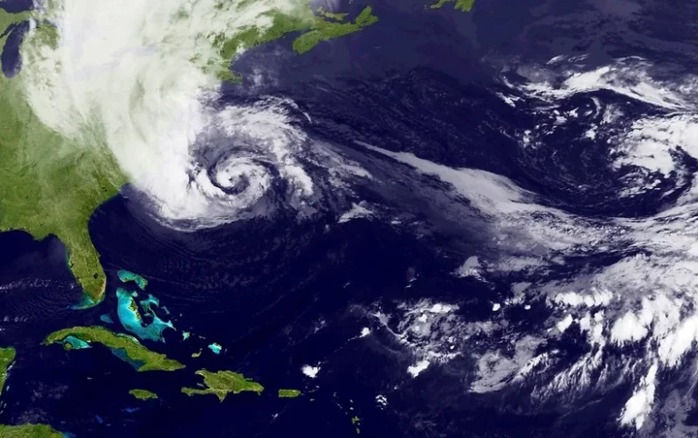
Satellite Weather Forecasting in the Age of AI and Climate Change
Discover how satellites power modern weather forecasting — from polar and geostationary missions to AI-driven models. Learn how space-based data improves storm tracking, early warnings, and climate resilience in an era of extreme weather.

Discover how satellites power modern weather forecasting — from polar and geostationary missions to AI-driven models. Learn how space-based data improves storm tracking, early warnings, and climate resilience in an era of extreme weather.
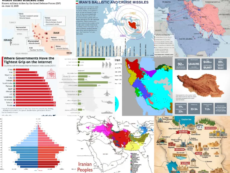
Top 20 Maps and Charts That Explain Iran and the Road to the 2026 Conflict
Explore the key maps and charts that explain Iran—from geography and demographics to sanctions, the nuclear program, and regional alliances—culminating in the 2026 Iran conflict.
Explore the key maps and charts that explain Iran—from geography and demographics to sanctions, the nuclear program, and regional alliances—culminating in the 2026 Iran conflict.


Search