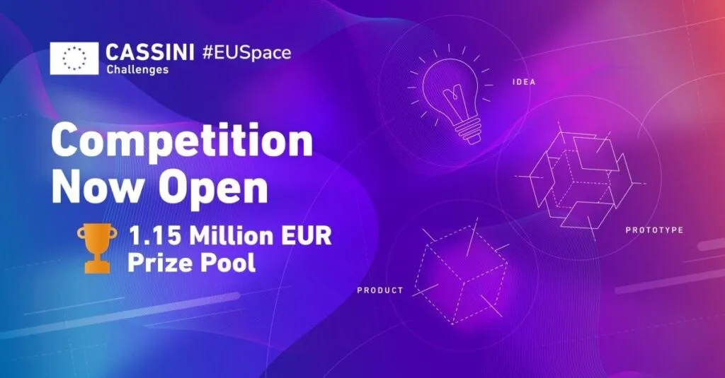

The CASSINI Challenges 2024: Make it with Space!
The CASSINI Challenges, a core element within the European Commission’s flagship CASSINI innovation initiative, is a yearly competition implemented by the European Union Agency for the Space Programme (EUSPA). It invites European entrepreneurs to showcase how their ideas, prototypes, and products employ EU Space Programme data and technologies to address critical challenges on Earth.
The competition welcomes participants at all stages of their careers, from those in the early ideation phase contemplating novel uses of technology through to seasoned entrepreneurs with proven technologies, existing customers, and commercial traction. Offering up over 1 million EUR in prizes across the three tracks, the competition serves as a key support mechanism for European innovators.
The Objective
The objective of the CASSINI Challenges is to promote the use of space data and technology as a potential remedy for commercial, social, and environmental challenges on Earth. The prize is designed to foster the development of innovative solutions, recognizing both technological excellence and commercial achievements. By leveraging EU Space resources, including satellite navigation, Earth observation, satellite communication, and space surveillance and tracking, participants are contributing to the advancement of the European Space industry. This helps enhance its global competitiveness while demonstrating the vast potential of space technology across diverse industries. Ultimately, this drive will spur economic growth, technological leadership, and the strategic positioning of Europe in the global space arena.
The 2024 Edition
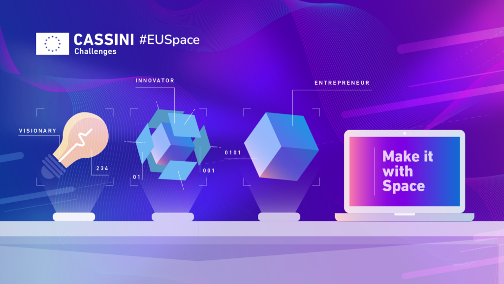
The 2024 CASSINI Challenges are divided into three tracks (Idea, Prototype, and Product) to cater to innovators at different stages of development. The Product Track, still open for submissions, focuses on market-ready products and solutions (Technology Readiness Level 8 or 9). Applicants must demonstrate commercial traction and provide evidence of customer demand, alongside a clear value proposition. EUR 100,000 for the top 7 products. Your product should leverage EU Space technology, including, but not limited to satellite navigation, Earth observation, secure SATCOM, or space surveillance and tracking.
Don’t Miss Out!
The Product Track deadline is still open until March 24th, 2025.
If you are developing a product using EU Space technology, this is your time to shine and compete for €100k!
Submit your solutions today: Click here to complete your entry
For more information on the competition, please visit: CASSINI Challenges homepage
Good Luck!
Note: This is a sponsored article and has published by the Geoawesome Team to provide valuable insights to our readers and the geospatial community. It has been reviewed to ensure it meets our editorial standards for quality and relevance. In case you have any questions or comments, please reach us at info@geoawesome.com


#Ideas


Next article


Recently, I was helping a friend with a super cool project where his team needed high-resolution satellite imagery and an elevation model. Knowing a thing or two about remote sensing, I offered to assist. The experience was long and painful; I drafted and re-wrote a post that walked through the entire process but decided not to post all the gory details.
The project centers around a detailed ground-based scan of a UNESCO Heritage site. The goal is to allow users to virtually visit and tour the site from a museum thousands of miles away. To provide a rich and immersive experience, we needed to simulate the surrounding landscape and enter the need for satellite data.
Over four years ago, Joe Morrison, a “controversial industry figure,” wrote a post about how The Commercial Satellite Imagery Business Model is Broken. He has made good progress at Umbra, enabling anyone to task a Synthetic Aperture Radar (SAR) satellite via the SkyFi app. This assumes the user understands what SAR is, knows how to use SAR, understands how “tasking” works, knows about the SkyFi app, and is willing to part with about $1,000.
Unfortunately, that’s not what I needed; let the games begin.

A good place to start is a well-known portal that is free, open, easy to use, and provides a robust inventory of all the data and sources available for any location.
(This does not exist.)
In a satellite buyer utopia, one could draw a circle on a map and easily understand every time a sensor observed that area of the world. The user could preview the data, read the relevant metadata, and receive instructions on how to access it. This includes optical, radar, multispectral, hyperspectral, low and high resolution, elevation models, open data, and licensable data.
This is no different from any other buying experience, like when you type in a desired product in Google Shopping or Amazon. For some reason, in the satellite / remote sensing / geospatial industry, we like to make things difficult, slow, and frustrating. In my quest to find data sources, I visited over 15 different platforms, each with its own unique: website, login requirements, buying experience, pricing, and access to a limited amount of data.
USGS Earth Explorer, Copernicus Sentinel, Maxar, Airbus, Planet, Satellogic, Blacksky, UP42, SkyFi, SkyWatch, Opentopography, Intermap, Apollo Mapping, Landinfo, AWS
Frustratingly, most of these ended up with “CONTACT SALES.” Even more frustratingly, most of the sales departments did not contact me. (Is there another industry in the world where the buyer is willing to spend thousands of dollars and gets ghosted? Seriously, if there is, please let me know)


Some apps, like SkyFi and SkyWatch, were intuitive, easy to use, and transparent with pricing. They have both made great progress, and I applaud them for working on simplifying this process. There were a couple of reasons why, ultimately, I couldn’t use their platforms: 1) I needed very high-resolution data in a remote area of the world, and those images simply didn’t exist on the apps. And 2) I needed a digital elevation model (DEM) to bundle with the image.
(Note: SkyWatch has recently added Maxar imagery, which is good progress, but I wouldn’t have bought it due to its high pricing and restrictive licensing. I also needed elevation data.)
As an aside, many buyers like me have gone through this same process and provided a wealth of feedback (and frustration). I’m not unique. And to give credit, many fine folks at many different companies are working tirelessly on this problem. Frustratingly, there is something like a 100:1 differential in investing to build satellites compared to investing in delivery platforms, i.e., the technology that actually allows end users to consume data. (In 2023, private investment in satellites was ~$2B versus ~$20M in delivery platforms.)
Fortunately, I knew a guy: Brock at Apollo Mapping. Brock and his team were super responsive and helpful, and their portal, ImageHunter, has a lot of data sources, including both imagery and 3D DEMs. We ended up licensing Airbus Pleiades imagery and WorldDEM Neo from Apollo as it had the desired resolution and was much more affordable than Maxar.
It took me about two months to procure the data from start to finish, and I’ve been in this industry for about twenty years. Can you imagine going through this if you’re unfamiliar with all the acronyms, sources, providers, terminology, and insane licensing?
If you’ve never read an EULA for a satellite image, here are some common restrictions. If legal stuff is boring to you, skip to the Sheldon GIF.
- Usage Restrictions – Many licenses specify whether the imagery can be used for commercial, research, or government purposes. In many cases, imagery is licensed for internal use only, meaning it cannot be shared or resold. (Satellite companies love this because it allows them to sell the same image ‘n’ many times)
- Redistribution and Sharing – Most providers prohibit or strictly control imagery redistribution, sublicensing, or public sharing. If redistribution is allowed, it often requires additional fees or agreements. This includes basic usages such as making it viewable online.
- Time-Based Restrictions – Some licenses limit how long the imagery can be used before requiring renewal or removal from storage.
- Geographic and Sector Restrictions – Certain areas or industries (such as defense or intelligence) may be restricted due to national security concerns or export control laws.
- Resolution and Modification Limits – Some licenses restrict users from modifying or enhancing the imagery in ways that could violate intellectual property rights.
- Attribution Requirements – Users may be required to credit the satellite imagery provider when using the images in publications, reports, or analyses.
- Export Controls and National Security Laws – Regulations like the U.S. International Traffic in Arms Regulations (ITAR) and Export Administration Regulations (EAR) may restrict the distribution of high-resolution satellite imagery to certain countries or entities.
- Analytical Derivatives – Some agreements specify whether users can create and share derivative products based on the imagery, such as maps, models, or analytical reports. In other words, the provider wants to control the type of analysis on the image.
Indeed, one doesn’t actually purchase a satellite image; they purchase a license to use a satellite image in a very restrictive manner.
Satellite providers even restrict the user’s ability to compare data sources and quality and impose restrictions on making direct comparisons with other providers:
- Benchmarking Prohibitions – Some providers explicitly forbid users from conducting or publishing performance comparisons (e.g., resolution, accuracy, spectral quality) between their imagery and that of competitors.
- Quality Assessments & Reverse Engineering – Licenses may restrict users from analyzing or reverse-engineering the imagery to evaluate its performance in a way that could be used to compare providers.
- Public Disclosure Restrictions – Even if comparisons are allowed internally, publishing or sharing results publicly (e.g., in reports, marketing materials, or scientific papers) may require prior approval from the provider.
- Derivative Work Limitations – Some providers restrict the creation of derivative works that could be used to highlight differences in quality, coverage, or accuracy between competing imagery sources.

The CEO of Uber is infatuated with improving the experience and has notably said, “Uber sucks.” He puts himself in the consumer’s and driver’s shoes to figure out ways of improving. Uber’s CEO Says He’ll Always Find a Reason to Say His Company Sucks | WIRED
I would LOVE to see this from the leadership teams of satellite companies:
- Find reasons why your company sucks. (your end users are willing to help)
- Stop bragging about your specs; we don’t care.
- Anyone who wants a leadership position at a satellite company should first be required to go find and buy a license. Give them a few thousand dollars and a laptop.
- FIX licensing. Just because it’s been done like that since the 90s doesn’t mean it needs to continue.
- Umbra is excluded from the above statement.

Umbra has wisely realized the advantages of open licensing far outweigh the potential “risk”. Open data receives more usage, more sharing of data and analysis, more adoption, happier customers, and ultimately grows the market.
In 2008, the USGS Landsat program adopted an open license and usage and adoption flourished. Today, the value of that dataset is estimated at over $25B in annual economic value: Landsat’s Economic Value increases to $25.6 Billion in 2023 | U.S. Geological Survey
Here is the worst part of the story, something I feel sick about. We didn’t use the data … At the end of this all, it just didn’t meet the project’s needs. Had we been able to test the data beforehand, we could’ve avoided this. Another problem in this buying journey is the lack of sample data. Sure, it does exist, but we were looking at cities like Cleveland for the sample, with the site being completely different. Satellite providers *will not* provide samples of the client’s exact location for testing purposes. There are exceptions, of course, like if we had $1M to spend. However, they believe they are “losing money” if they have to make custom samples for projects of this size.
Where do we go from here:
- We need to build a better solution than these monolithic siloed platforms. It sucks as a consumer. We need an Amazon.com for geospatial data.
- Existing EULAs should be incinerated. If an Open License isn’t feasible right now, the market would be OK with a simple, human readable, standardized commercial license that permits users to USE data.
- All satellite companies should adopt and deploy STAC.
-
Last, I’d love to find a satellite provider who would like to partner with me, not just take my money. Allow me to experiment with data. Don’t squeeze me on licensing. Treat me like a customer.
Note: The article was originally published on Kevin’s Substack and has been republished here with the permission of the author.

