

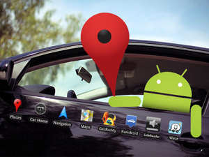
 So you know you are not allowed to talk or text without your hands on the wheel while driving. But in case you thought that checking Google Maps was acceptable, a Californian judge has made it clear that isn’t the case. The last month ruling by the California Appeals Court says handling a cell phone while driving, even if “solely for its map application,” is as illegal in the Golden State as holding the phone to your ear while talking. But what about using touch screen navi devices which are becoming a standard in almost every new car? It seems that for now gesture and voice control is the future.
source: CNET


#Insights


Next article

 Esri has completely fallen in love with Geofeedia, a wonderful location-based social media foraging tool. This synergy will lead to the integration of Geofeedia tool within the ArcGIS platform.
With this innovation, emergency managers, public safety professionals could easily and accurately integrate, monitor, analyse and visualise live web data from social media from within the ArcGIS platform.
According to the CEO of Geofeedia, Phil Harris “Esri is an industry leader and provides the ideal enterprise platform to visualize and analyze real-time social media feeds from Geofeedia,” He also noted that “Location-based social media data layers from Geofeedia combined with Esri’s technology and vast repository of other layers give public safety officials the best combination of real-time intelligence for response efforts.”
Real-time data and feeds from Twitter, Instagram, Youtube, Picassa, Flickr, kaptur and so on can pulled from Geofeedia as layers and integrated within other layers in ArcGIS such as imagery, street networks, topography and community base maps.
The social data can be mashed up with other information such as public safety assets, city infrastructure, utility networks, hazardous materials, demographic data, and more. Additional dynamic data including weather, automated vehicle location, GPS, and traffic video camera feeds can be combined with social and map data. People can perform historical social media analysis to identify trends and patterns .
Professionals in government, national security, healthcare, and insurance could now extend the ArcGIS platform by adding intelligence about social conversations. This includes social media sentiment, location, population profile, and temporal and spatial trend analysis.
This is really going to be an interesting synergy.
Source : cnbc.com

