Will Apple go Indoors? : A question that has been doing the rounds ever since Apple Inc acquired an indoor GPS/GNSS positioning company – WiFiSlam. Now it looks like Apple is surely on its path to indoor marketing, navigation and possibly even more.
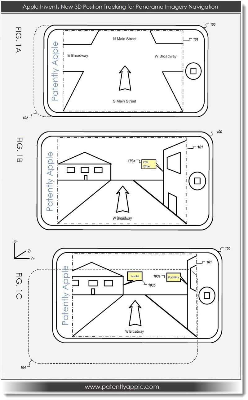
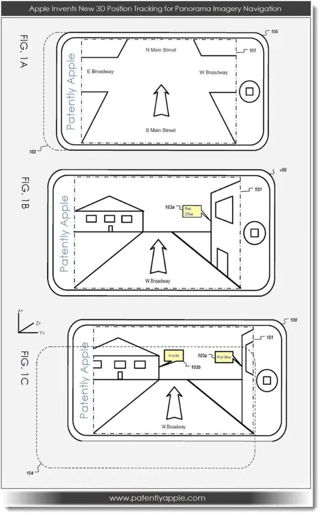
WiFiSlam’s acquisition allows Apple to pinpoint the smartphone user’s location in real time to 2.5 meters accuracy using WiFi signals alone. Now a patent filed by Apple “3D Position Tracking for Panoramic Imagery Navigation” was published and approved by the US Patent and Trademark Office.
The patent is basically about getting detailed street-views to Apple’s Map application which has been under fire for its location bugs. In addition the patent is about making the Street-view experience “richer” and “simpler”.
Apple’s patent application descriptions has been reported to be “Stingy” and I agree completely. Basically Apple’s idea or what I made out of it is with this latest tech patent Apple’s users can now enter an indoor panorama of a structure using forward and backward translations. Current street-view navigation is perhaps not user friendly considering the functionality of turning street corners and the like can be greatly enhanced and made simpler. Precisely Apple’s intent I guess. Once inside the building using this translation action, users can even purchase items using further actions. Taking Indoor Positioning to the next step!
PatentlyApple states “In some implementations, forward and backward translation enables the user to enter an indoor panorama of a structure (e.g., a commercial venue), ” like a store for making a purchase. Although Apple has recently taken a bruising over their Map application’s turn-by-turn navigation inaccuracies, it’s crystal clear that they’re charging ahead with determination to bring newly advanced services to Maps in the future”
Soon, we would be “playing” with the Street-View. Using the Street-View is perhaps going to end up like playing the motion sensor based Racing games!
Apple is surely going Indoor!!!
Source: PatentlyApple


