#Business

Apple expands Maps Flyover coverage with 20 new cities

Flyovers

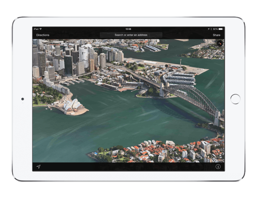
Apple Maps are getting better. No one can argue with that. Couple of months ago Apple finally introduced public transit to Maps. It is also working on its own Street View using Apple mapping vans. Already 34 of them are driving across US and Europe and the number of vehicles is growing fast.

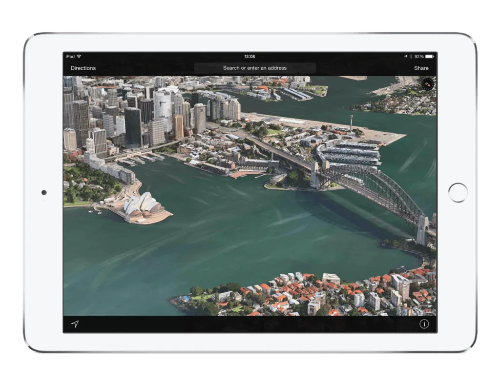
But that’s not all. Last week Apple has extended its Map Flyover coverage with 20 new locations.

  • Aarhus, Denmark
  • Bobbio, Italy
  • Budapest, Hungary
  • Cádiz, Spain
  • Chenonceaux, France
  • Dijon, France
  • Ensenada, Mexico
  • Gothenburg, Sweden
  • Graz, Austria
  • Loreto, Mexico
  • Malmö, Sweden
  • Mayagüez, Puerto Rico
  • Millau, France
  • Nice, France
  • Omaha Beach
  • Rapid City, SD
  • Rotterdam, Netherlands
  • Sapporo, Japan
  • Strasbourg, France
  • Turin, Italy

The Flyover technology comes back to 2011 when Apple acquired C3 Technologies – a Swedish Company specialized 3D modelling based on combined in aerial imagery and Lidar scanning. Flyovers resemble 3D buildings in Google Earth but the production process is done semi-automatically and its based on actual images and shapes rather than sketching, which makes it look more realistic.

I strongly believe that with new Apple mapping vehicles the company is working on the combination of areal data with street level data to make a detailed 3D model of the world. We should see the effects in 1–2 years. I can’t wait to experience it.

Here is a full list of all available Flyover cities as of August 19th, 2015:

Australia, New Zealand:
  • Auckland
  • Canberra
  • Christchurch
  • Dunedin
  • Nelson
  • Perth
  • Sydney
  • Melbourne
  • Wellington

Canada:

  • Calgary
  • Montreal
  • Surrey
  • Toronto
  • Vancouver

Denmark, Finland, Sweden:

  • Aarhus
  • Copenhagen
  • Gothenburg
  • Helsingborg
  • Helsinki
  • Linköping
  • Malmö
  • Odense
  • Stockholm
  • Roskilde
  • Visby

France, Monaco:

  • Bordeaux
  • Chambord
  • Chenonxeaux
  • Côte d’Azur (including Marseille, Nice)
  • Dijon
  • Le Mans
  • Lyon
  • Paris
  • Perpignan
  • Millau
  • Monaco
  • Mont Saint-Michel
  • Montpellier
  • Nimes
  • Reims
  • Rennes
  • Saint Etienne
  • Saint-Tropez
  • Strasbourg

Germany, Austria

  • Berlin
  • Graz
  • Cologne
  • Hamburg
  • Karlsruhe
  • Kiel
  • Linz
  • Munich

Ireland:

  • Cork
  • Cliffs of Moher
  • Dublin

Italy:

  • Ancona
  • Bari
  • Bobbio
  • Rome
  • Milan
  • Turin
  • Paestum
  • Perugia
  • Venice

Japan:

  • Sapporo
  • Tokyo

Hungary, Czech Republic:

  • Brno
  • Budapest

Mexico:

  • Chichen Itza
  • Culiacán
  • Ensenada
  • Guadalajara
  • Teotihuacán

The Netherlands:

  • Rotterdam

Portugal:

  • Braga

Spain:

  • Alicante
  • Almería
  • Badajoz
  • Barcelona
  • Cáceres
  • Cádiz
  • Cordoba
  • Jerez de la Frontera
  • Huelva
  • Madrid
  • Sevilla
  • Valencia

South Africa:

  • Cape Town
  • Durban

United Kingdom:

  • Belfast
  • Birmingham
  • Edinburgh
  • Glasgow
  • Kingston upon Hull
  • Leeds
  • Liverpool
  • London
  • Manchester
  • Wolverhampton

United States:

  • Aguadilla, Puerto Rico
  • Albany, NY
  • Arecibo, Puerto Rico
  • Arches National Park
  • Arlington, MA
  • Arlington, TX
  • Atlanta, GA
  • Austin, TX
  • Bakersfield,CA
  • Baltimore, MD
  • Baton Rouge, LA
  • Beverly Hills, CA
  • Boise, ID
  • Boston, MA
  • Buffalo, NY
  • Century City, CA
  • Chicago, IL
  • Cleveland, OH
  • Cupertino, CA
  • Dallas, TX
  • Denver, CO
  • Fort Worth, TX
  • Green Bay, WI
  • Honolulu, HI
  • Hoover Dam, AZ
  • Houston, TX
  • Indianapolis, IN
  • Las Vegas, NV
  • Long Beach, CA
  • Los Angeles, CA
  • Memphis, TN
  • Miami, FL
  • Milwaukee, WI
  • Minneapolis, MN
  • Modesto, CA
  • Mayagüez, PR
  • Mount Rushmore, SD
  • Nashville, TN
  • New Orleans, LA
  • New York, NY
  • Oakland, CA
  • Philadelphia, PA
  • Phoenix, AZ
  • Ponce, Puerto Rico
  • Portland, ME
  • Portland, OR
  • Providence, RI
  • Rapid City
  • Sacramento, CA
  • Saint Paul, MN
  • Salem, OR
  • San Antonio, TX
  • San Diego, CA
  • San Francisco, CA
  • San Jose, CA
  • San Juan, PR
  • Santa Monica, CA
  • Seattle, WA
  • Stanford University, CA
  • Stockton, CA
  • Tacoma, WA
  • Tulsa, OK
  • Zion National Park, Utah
Say thanks for this article (0)
The community is supported by:
Become a sponsor
#Business
#Business #Environment #Featured
Unlocking the Future: Key Trends in Geospatial Technology for 2025
Aleks Buczkowski 12.25.2024
AWESOME 8
#Business
Geo Addressing Decoded Part 1: Why Does Geo Addressing Matter?
Aleks Buczkowski 04.16.2024
AWESOME 6
#Business #Events #Featured
Gain Insights from Spectral, SAR, and LiDAR Thoughts Leaders at Geo Sessions 2024
Avatar for NV5 Geospatial
NV5 Geospatial 09.30.2024
AWESOME 4
Next article
#Business #Ideas #Science

Google Street View Cars To Map Air Pollution Using Aclima Sensors

Aclima-Google-Air_PollutionAir pollution is a serious issue in most cities across the world, a recent study from China is testament to how serious the issue is. In spite of all the awareness, it is still difficult to get access to air pollution data in the same way we can google for weather data.

Quite a lot can change if we had access to air pollution data in such an easy fashion. For starters, you can avoid commuting at a particular time if you realize the air pollution is too high in the route that you take. The city planners can figure out where they need to increase traffic restrictions and perhaps improve public transportation. The possibilities are endless and with such data easily available, if might even become an election issue (I certainly hope so).

Google Street View Cars To Map Air Pollution

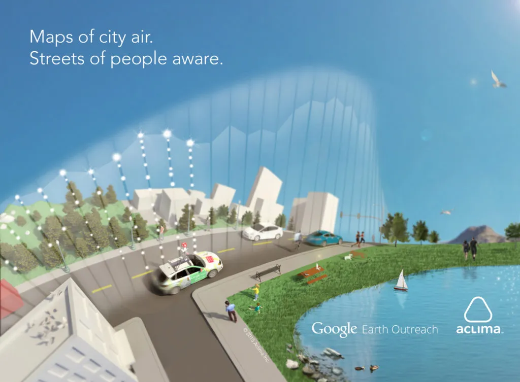
As part of the Google Earth’s Outreach program, Aclima, California-based startup that works on Environment monitoring sensors, has been working with Google to equip the Google street view cars with their sensors to map air pollution. After 750 hours and 150 million data points, they are done mapping Denver and if you like to look at the insights from their project, here’s the link.
aclima

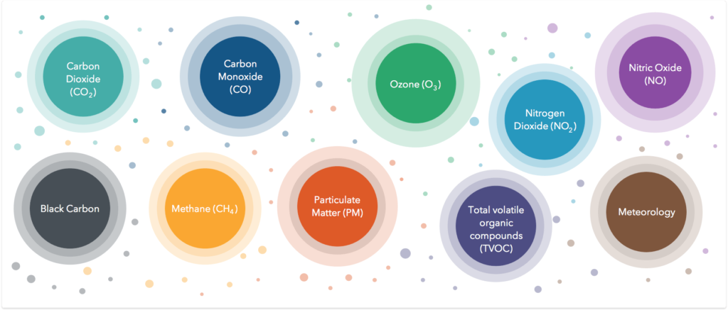
What the Aclima sensor onboard the Google car can sense

Imagine what we can do if we had access to Air pollution data the same way we had access to weather information!

How the Google car equipped with the air pollution sensor was driven around Denver

It’s a really interesting project and with Google involved in it, it has already captured the attention of a lot of people and hopefully when it debuts on Google Earth, even more people will start taking air pollution seriously. The only issue with such an approach is that the data is never going to be up-to-date! Unless of course, Google plans to drive around every single day of the year (which would be ironic, considering we would be mapping air pollution with cars). That’s where IoT sensors like AirBeam are going to helpful. There is a need for such data and the Aclima-Google partnership is definitely going to be a great help in getting more attention to the issue.

Can Wearable Tech Help Monitor Air Quality?

Wearable Tech has come a long way in the last 2-3 years and now we even have wearables for monitoring the environment. Organization like HabitatMap have been working on wearable air quality monitors for a while now (Related: Internet of Things, Maps & Environmental Monitoring). They are not the only ones, startups like Chemisense, TZOA Wearables are also working on this. Wearable tech together with Crowd Sourcing can really help bridge the data gap that exists today and help increase awareness when it comes to protecting yourself from pollution in general. (Related: With Wearable Devices That Monitor Air Quality, Scientists Can Crowdsource Pollution Maps).
Read on
Search