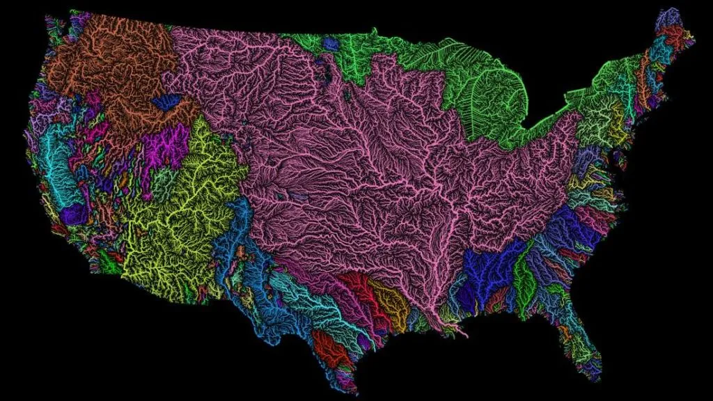

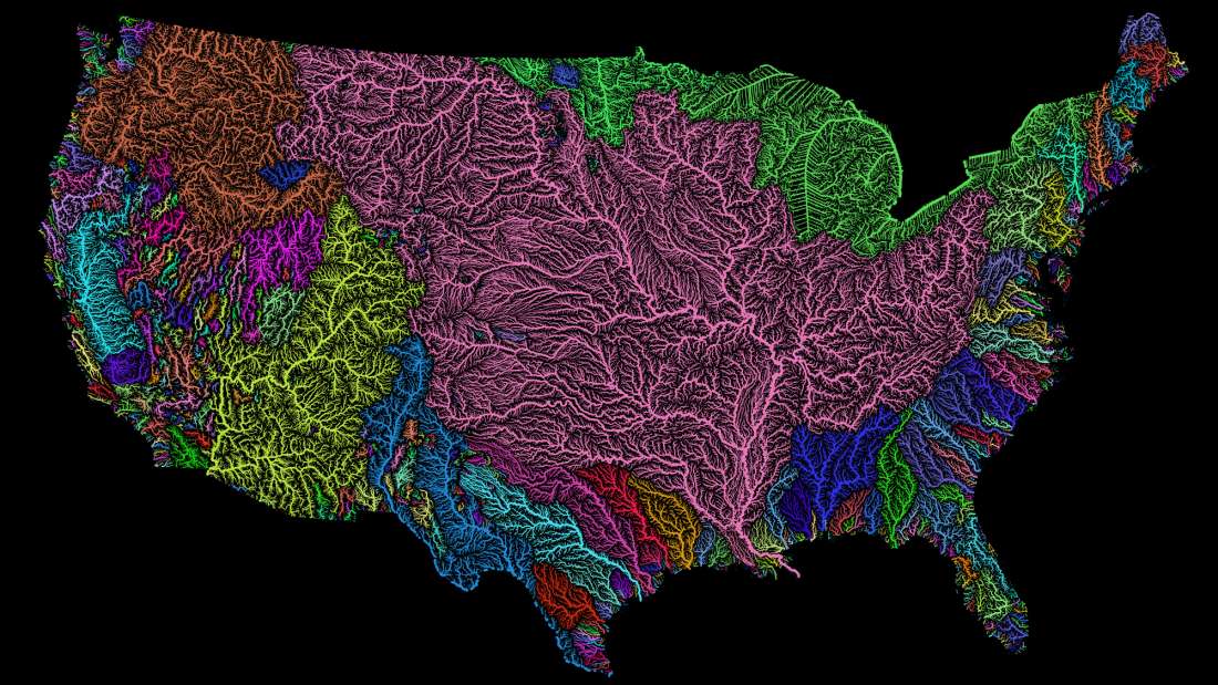
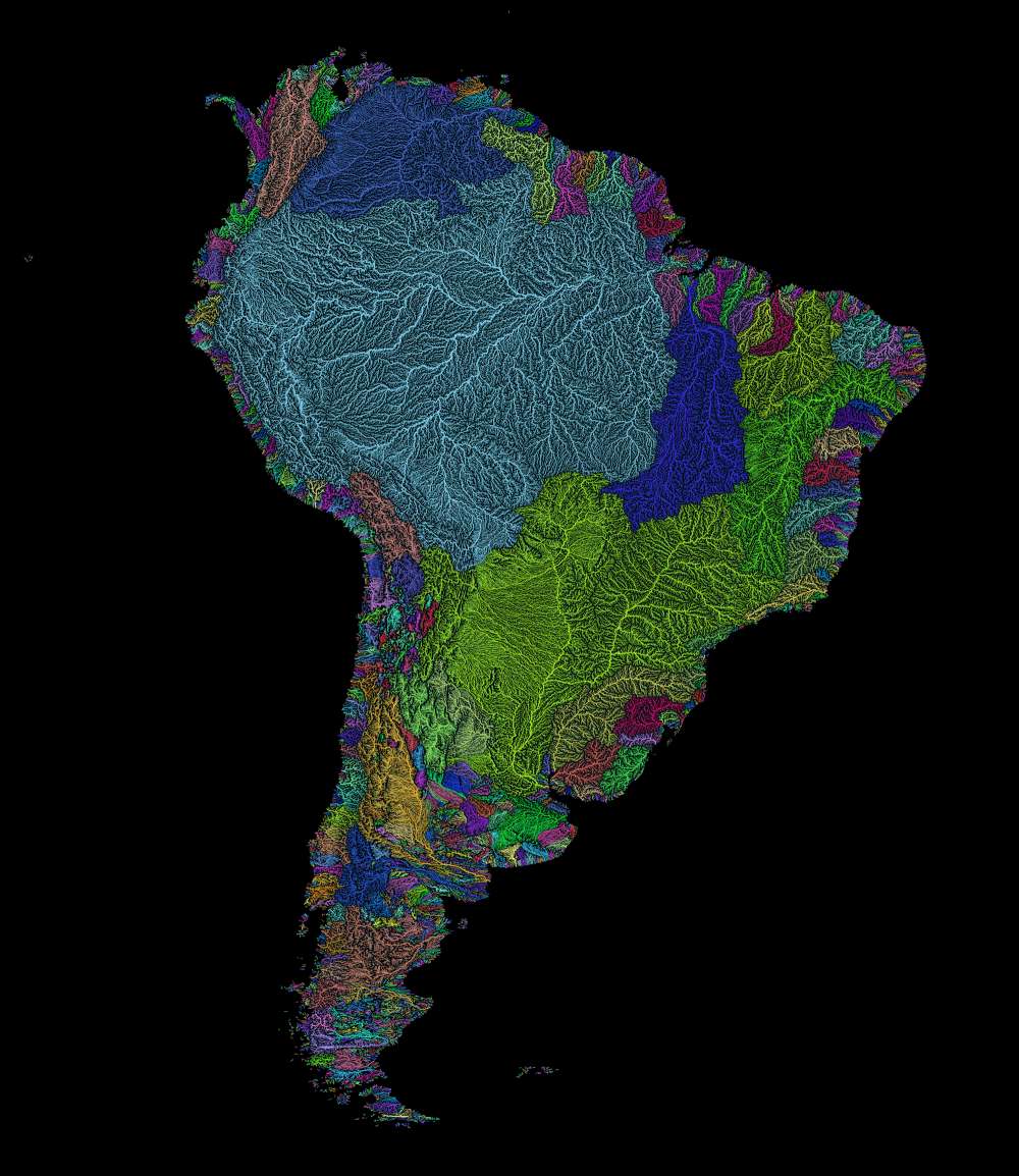
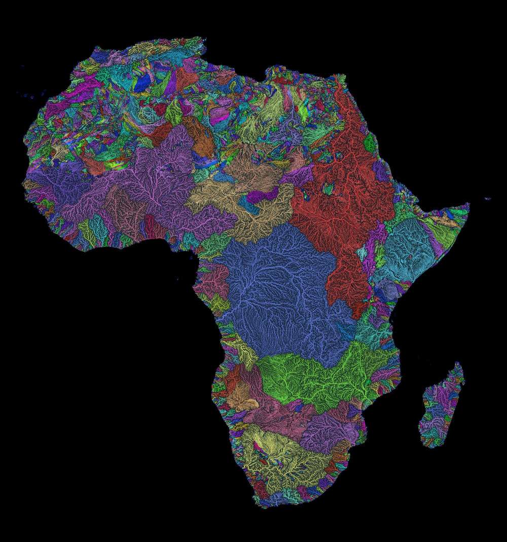
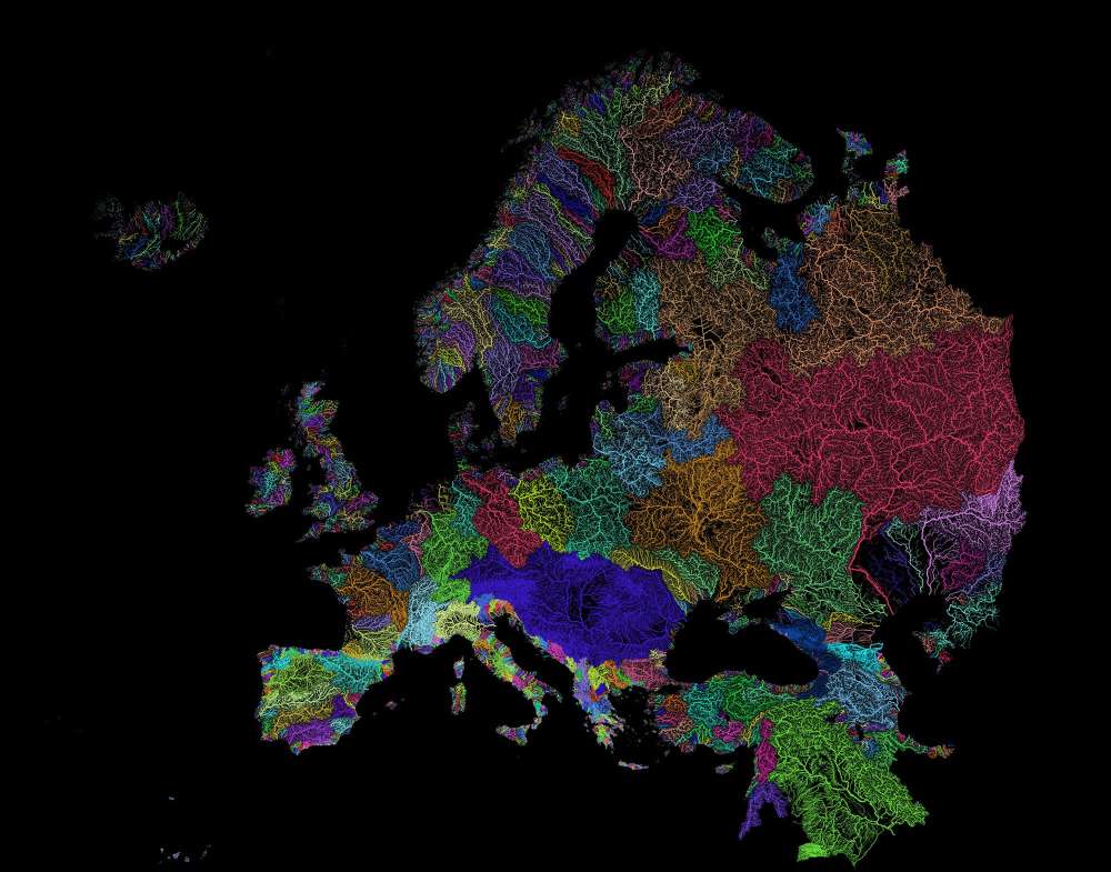
Do you remember awesome population density map we’ve shared a couple of weeks ago? The same designer Róbert Szűcs created another map that focuses on the world’s river basins. His maps received an amazing attention in the US and there is a simple reason for that… They are beautiful.
Róbert is an amazing guy from Hungary who works on GIS projects to earn some money and then he goes to different parts of the world and works as a voluntary GIS analyst. Right now he left UK and works in Indonesia.
His inspiration comes from a simple topics like the population density or river sheds where the maps are traditionally quite boring. Róbert looked at these data from a different angle and he saw its beauty and potential. His projects are made with open sourced tools including QGIS and GIMP, as well as open data. For the sake of this project he gathered river data from EEA, WWF and USGS. The effect is truly stunning.
High resolution prints of the maps are available for purchase on Etsy where Róbert states that he has “a lifelong passion for beautiful maps”. And have absolutely no doubt that it’s truth.


#Ideas

Next article

In case you missed the #GeoChat on Open Source and Hybrid GIS last month, we got you covered! Here are the highlights of what was a truly entertaining #GeoChat.
Shall we get started?
Andy Dearing, the CEO of Boundlessgeo who was the invited guest on #GeoChat kicked it off in style! 10 extra points for doing your homework, Andy 😉
Getting all my #hashtags all cued up for #GeoChat…learn from the best: https://t.co/cGZGhQhAu4
— Andrew Dearing (@adearing) October 27, 2016
Open Source & Governments
great question – yes. Gov is encouraged to look at #opensource #gis first – reduce lic. fees, interoperability #geochat
— Andrew Dearing (@adearing) October 27, 2016
Interested in programming?
@qgis plugins can be written in #python or C++ – can bld your own workflows / processes; #geoserver is in Java #geochat
— Andrew Dearing (@adearing) October 27, 2016
Open Source in the BI market?
we would like to see Microstrategy and others integrate w/ @opengeospatial standards;we do heavy #GIS, BI tools do BI #geochat
— Andrew Dearing (@adearing) October 27, 2016
How good is Open Source GIS?
@QGIS has gained significant adoption. Customers realize 80% of what they do in ArcMap is avail. in @qgis #geochat
— Andrew Dearing (@adearing) October 27, 2016
Okay, what’s the 20% that’s still missing?
Fair ? – we haven't, but the @QGIS comm. does a great job; one article I like is this one: https://t.co/DX0wQIcgYk #geochat
— Andrew Dearing (@adearing) October 27, 2016
If you were to begin transition to a Hybrid GIS solution, where would you start?
Suggest you read @GeoCalamito blog post: https://t.co/VDPvMoyhns you can start at the db and go up, or vice-versa #geochat
— Andrew Dearing (@adearing) October 27, 2016
And the most important question that everyone wanted to ask 😉
Is Boundlessgeo working on Self-Driving cars?
we would have guessed a hybrid 😉 #GeoChat
— Geoawesomeness (@geoawesomeness) October 27, 2016

